Showing posts with label thrust faults. Show all posts

Saturday, January 11, 2025

Shear Luck Near Sunderdunga River

As I settled down for lunch by the Sunderdunga riverside during my recent Kumaon trek, I noticed a polished boulder nearby. It had a striking appearance dominated by a large crystal of feldspar set in a much finer grained material. This finer matrix had a pronounced streaky fabric, as if made up of very fine layers. Upon closer examination, these layers or foliation was due to the planar arrangement of minerals like amphiboles, mica, quartz, and feldspar. The larger eye catching feldspar grain in the center of the boulder seems a little flattened along one axis and elongated along the orthogonal, giving it a crude sigmoid shape.

I had chanced upon a rock caught up in a shear zone. These are fault zones where movement of the crust causes intense rock deformation. The type of deformation I observed typically occurs at a deeper level where high temperatures make rocks soft and ductile. Rocks caught up in fault zones at shallower levels undergo brittle deformation. They have a broken appearance, made up of sharp edged fragments set in a crushed finer matrix. The rock is fractured, and these cracks get filled with minerals like calcite and quartz. 

This typical brittle like deformation was absent in this rock. There was no sign of any fracturing and breakage of the rock. Instead, the finer grained minerals seemed to flow around the larger feldspar crystal. Grain size reduction occurs by plastic rearrangement of atomic layers and recrystallization of softer minerals during deformation. The stronger resistant minerals which remain as large crystals are called porphyroclasts. Since rocks are sliding past, there is a rotational component to deformation also. Larger grains often show signs of being rotated, while finer groundmass wraps around.

The end stage of such ductile deformation are rocks known as mylonites. These have a flinty or glassy appearance due to the extreme grain size reduction.

I suspect this particular rock has not quite reached the mylonite stage. Let us call it a protomylonite. It does show a clear contrast between the finer matrix made up of stretched and elongated minerals and a large porphyroclast.  

The asymmetry of the porphyroclast gives geologists an idea of the sense of motion along faults. The annotated photo below shows the relative sense of shear or motion.  

Hundreds of such measurements have been made in the Greater Himalaya. When measured in-situ,  the direction of relative motion is 'top to the south', indicating the general direction of movement of Himalaya thrust faults.  Deformation is not uniformly distributed throughout the Greater Himalaya but appears restricted to narrow zones. These zones of intense shearing containing deformed rocks including mylonites have allowed the recognition of  major thrust fault zones such as the Main Central Thrust which emplaces the Greater Himalaya slab on top of the Lesser Himalaya.

There are minor shear zones too. I think this rock was eroded from one such shear zone in the Sunderdunga valley. 

Coming back to the brittle versus ductile deformation regimes. Almost all the deformation you observe in the Greater Himalaya took place in the ductile regime. Here are a few examples from the Greater Himalaya of ductile deformation seen in schists and gneisess. These are my observations from various treks in the Kumaon. 


A cross section of the Himalaya is presented here to showcase the metamorphic gradients along the Greater Himalaya slab (green). For this reading, you can ignore the rest of the Himalaya orogen shown in the figure. Temperature gradient increases towards the core of the slab with kyanite (k) and sillimanite (sill) as the prime high grade metamorphism indicators. This example is from the Nepal Himalaya, but the arrangement of the different Himalaya divisions is identical in adjacent Kumaon. 

 Source: Mike Searle et.al. Tectonophysics 2017

Notice the localization of mylonites along the Main Central Thrust zone. Metamorphism of rocks above around 600 degree centigrade during the Eocene (~35 million years ago) and in the Miocene (~25-16 million years ago) has resulted in the ubiquity of ductile deformation observed in the Greater Himalaya. In hotter pockets in the core, metamorphic rocks partially melted and the resulting granitic magma was injected along penetrative weak planes, forming dikes, sills, and small plutons.

Channeled between two great fault zones, the Main Central Thrust at the base and the South Tibetan Detachment as roof, this hot mushy crustal material was then tectonically extruded to shallower levels, its ductile fabrics frozen and preserved as the rocks cooled. Subsequent tectonism has superimposed brittle deformation on the Greater Himalaya ductile structures. 

Finally, another beautiful example of a gneiss showing ductile shearing.  Fish shaped white feldspar are set in a biotite mica and quartz matrix which flows around the porphyroclasts. Can you guess the sense of relative motion?

Observing features that you have seen only in a textbook - that is the great joy of going out in the field.

Monday, May 20, 2024

Remotely India: Chittagong Tripura Fold Belt

Remotely India #13

Did you know that the easternmost part of the Bengal delta is being compressed into folded hill ranges? These go by the name Chittagong Tripura Fold Belt (CTFB), also referred to by geologists as the Outer Indo Burman (Myanmar) Ranges.

Take a look at the annotated satellite image below. The CTFB appears as a series of north south oriented ridges and valleys, extending from northern Tripura to south of Cox Bazaar in Bangladesh. 


Structurally they are made up of strata folded into anticlines (upwarps) and synclines (downwarps). To the east, they are separated from the inner Indo Burman (Myanmar) Ranges (IBR) by the north south trending Kaladan Fault. The Chittagong Coastal Fault marks the westernmost boundary of this fold belt, although the sedimentary pile below the sea bed of the Bay of Bengal to the west is also deforming. The 'deformation front' of this terrain is therefore further to the west of the Coastal Fault. 

As you might have guessed, these fold belts are a result of the Indian tectonic plate converging with Asia. But the nature of tectonic plate interaction is different from the plate collision that formed the Himalaya. In the case of the Himalaya, the continental crust of the Indian plate has collided with the continental crust of the Asia plate. The lower part of the Indian continental crust has slid under Tibet while thick slices of the Indian upper crust have been thrust up by faults to form the different geologic units of the Himalaya. 

Tracing the mountain arc southwards from its bend around Arunachal Pradesh, a different type of tectonic plate interaction is unfolding. In the Himalaya collision zone the more buoyant continental crust is sliding at a shallow angle underneath Tibet, a process known as underplating. In contrast, the Indian tectonic plate along this eastern convergence zone is made up of denser oceanic crust. As a result, along the zone of contact with Asia, this dense plate is subducting or taking a deep dive at a steeper angle into the mantle. 

Another difference apparent from the surface structure is the presence of both vertical and sideways movement of crustal blocks. This occurs because the Indian plate is pressing into Asia at an angle. Oblique convergence results in thrust faulting wherein rocks are moved up along east sloping fault planes. Collision at an angle also causes blocks to slide past each other along strike slip faults.  

The IBR is an older mountain chain formed by the subduction of the Tethyan oceanic crust underneath the Asia plate and the smaller Myanmar plate. This process, initiated in the Late Cretaceous around 100 million  years ago, eventually led to the formation of a complex fold belt by mid Miocene times (15-20 million years ago). 

This fold belt is made up of deep sea sediments and fragments of the Tethyan oceanic plate. These rocks were subjected to very high pressures during mountain building. Sheared and fractured rock units occur in a melange made up of dismembered blocks of varied rock types juxtaposed by faults. Heat and high pressure acting on rocks rich in aluminum, calcium, iron, titanium, and magnesium has resulted in the formation of deposits of exquisite gemstones such as jade, rubies, sapphires, spinel, and peridote. The IBR is studded with precious stones!

By Miocene (~20 million  years ago) the IBR had emerged above sea level as elevated ranges and had started eroding. Sediments shed from these hills were deposited in delta and shallow marine environments of the Bengal Basin to the west. During continued subduction of the Indian plate, between 2-4 million  years ago, this thin skin of the crust made up of about 5 km of sediment was scraped off, faulted, and crumpled up to form the CTFB. Geologists call these scraped off wedges of sediments that form along subduction zones as 'áccretionary prisms'. 

Further to the south, the Andaman Islands is also an accretionary prism formed along the plate junction between India and Asia.

The deformation of the CFTB diminishes from the east to the west. There are two distinct structural domains of this belt. To the east is a more tightly folded belt known as the Eastern Highly Compressed Fold Thrust Zone. Towards the west, is the more open Western Fold Thrust Zone. The emergent part of this fold belt is bounded to the west by the Chittagong Coastal Fault. However, geophysical studies show that the strata below the Bay of Bengal sea bed is also being warped and can be considered part of a westward growing CTFB.

The annotated satellite image below is a close up of the CTFB and the IBR. The black line is the Kaladan Fault separating the two, but even without my annotation, the two terrains have a distinctly different appearance. The older IBR have been more deeply dissected by streams. They have an etched faceted texture. To the west, the younger ranges of the CTFB have a more uniform even texture. 


Finally, I just wanted to put up a structural cross section of the CTFB. The folded and faulted nature of the sedimentary strata is apparent, as is the difference between the more tightly folded eastern zone compared with the more open western domain. Source: Md. Sakawat Hossian et.al. 2022: Lithosphere.

Scientists study terrains like the Chittagong Tripura Fold Belt to understand the mechanical response of the crust to different types of tectonic plate interactions. There is an economic incentive too. The IBR with its precious stone deposits has long been a target of exploration. In the CTFB natural gas seepage has been observed at many places. Geologists are interested in understanding the subsurface structure to target search for hydrocarbon accumulations.

As always, exploring Indian geology from satellite imagery is fun and a great learning experience for me. Stay tuned for more such stories!

Monday, December 27, 2021

Cyanobacteria And Mountain Building In The Paleoproterozoic

By 2.3 billion years ago, cyanobacteria employing oxygenic photosynthesis began proliferating in the world's oceans. This resulted, several hundreds of millions of years later, in triggering the formation of fold mountain belts in places where tectonic plates converge and collide. 

This big idea linking geological processes and biological evolution is explored in an interesting paper by John Parnell and Conner Brolly published in Communications Earth and Environment.  

Source: Examining the tectono-stratigraphic architecture, structural geometry, and kinematic evolution of the Himalayan fold-thrust belt, Kumaun, northwest India- S Mandal et.al. 2019.

Consider how fold mountain grow using this example from the Lesser Himalaya. The different colored layers are rocks formed on the northern margin of the Indian plate. They range from 1.8 billion years to around 50 million years in age. As the Indian continent collided with Asia around 50 million years ago, this pile of metamorphic and sedimentary rocks was squeezed by compressional forces. They were folded and broken up by thrust faults into a series of panels or sheets. Deformation of the Indian plate spread from north to south. As you gaze from the top to the bottom of the graphic you will notice that folding and faulting first began at the zone of collision (extreme right of the graphic). Over time the locus of deformation migrated further and further away from the site of continental contact. New faults grew and moved sheets of rocks southwards, stacking them and building mountains by thickening the crust.

Now look at the more detailed cross section below from Mandal's paper. The fold and thrust architecture of Lesser Himalaya is clearly revealed. The thin pink lines are the thrust faults and they have partitioned the rock pile into a series of panels (A-G), causing 'stratigraphic repetition' across the mountain belt. Internally, each panel has the same sequence of layers. I am ignoring some of the complexities of the formation of the Greater Himalaya for the sake of brevity.

Parnell and Brolly argue that the increased biomass in oceans starting 2.3 billion years ago produced organic rich sediment, which transformed on burial into carbonaceous shale and graphite bearing metamorphic rocks. The rates at which tectonic plates move meant that basins that filled up with such sediments began arriving at collisional zones some 200 million years since their initiation. 

Carbon rich and graphite bearing layers reduce friction along faults making the contractional deformation I outlined in the Himalaya example easier. The widespread mountain building activity observed in the geological record from 2 to 1. 8 billion years ago was helped along by faults preferentially splitting the rock pile along weaker graphite rich layers with the carbonaceous material acting as a lubricant, allowing easier movement and stacking of the faulted blocks. The nice graphic below compiles instances of mountain building that took place during that time frame from across the globe.  

Source: Increased biomass and carbon burial 2 billion years ago triggered mountain building- Parnell and Brolly 2021.

The authors give several examples of Paleoproterozoic orogenic belts in which major fault zones are associated with graphite rich layers. They also point out that the atomic arrangement of carbon in graphite that has been disturbed by faulting is different from the background graphite in sediment. Many fault zones in their examples contain this 'disordered' graphite bolstering their case that graphite was mobilized during fault movement.

This connection between carbon rich sediment and faulting appears as a recurring theme in geologic history. Another example comes from the Cretaceous when there was abundant deposition of organic rich sediment during times of globally high sea levels and oxygen depleted ocean depths. The resulting black shales subsequently provided the weak zones for faults to split and move crustal sheets during the building of the Rockies, the Andes and other mountain ranges spread widely across continents.

While it makes sense that carbonaceous material will reduce frictional resistance and enhance fault movement, one must be careful not to overemphasize the causal link between carbon rich sediment and mountain building. After building a case for the close association of carbonaceous sediments and major faults, the authors write, "Given the link between organic matter and deformation evident in younger rocks, the scene was set for collisional orogenesis at ~2 Ga (Fig. 1) by the exceptional accumulation of organic carbon during the mid-Palaeoproterozoic.

I would think that 'the scene was set for collisional orogenesis at ~2 Ga' not because of the presence of carbon rich sediment, but because by that time a global plate tectonic regime was operating and plate forces were maneuvering continents in directions that resulted in them converging at multiple places. The pulse of mountain building during that time period occurred because several continents crashed into each other. 

That the presence of carbonaceous sediment may aid faulting but is not a necessary condition for thrust fault regimes to develop in convergent settings is supported by looking at what occurred earlier in geologic history before the exceptional bloom in cyanobacterial growth and carbon burial. Yatin Zong and colleagues in a recent paper published in Nature Communications describe the formation of the Central Orogenic Belt of Northern China which formed by the collision of a chain of oceanic volcanoes with the North China continent in Neoarchean times (2.8-2.5 billion years ago). They demonstrate the development of fold and thrust structures and large distance movement along thrust faults that occurred in this convergent plate setting along the North China continental margin between 2.6 and 2.5 billion years ago. Here, thrust faulting detached sheets of the crust made up of lava erupted from oceanic volcanoes and also sediments deposited in adjacent basins and moved them hundreds of kilometers.  The fault surface was lubricated by copious amounts of the shiny mineral mica. 

This is several hundred million years before the exceptional accumulation of carbonaceous sediment in Paleoproterozoic times. It appears that the lithosphere deforms in a mechanically consistent style under the horizontal compressive forces prevalent in plate tectonic settings, with hydrated oceanic crust, water saturated clays, micas, and carbon being alternative candidates for reducing friction.

How did the outer shell of the earth behave before plate tectonics? Early earth was a much hotter place. Warm rocks are weak. Plate motion is driven by a pull force that is imparted as a tectonic plate subducts or sinks underneath another tectonic plate. So, for plate tectonics to evolve, the lithosphere or the outer shell of the earth has to become strong enough not to disintegrate as it is being pulled by its subducting leading edge. Such conditions, geologists think, likely became more and more common as the earth cooled sufficiently by about 3 billion years ago. 

Before this time tectonics played out as gravity driven vertical movements of the crust . This inference is based on the structures observed in many Archean age terrains which show large granitic bodies encircled by steeply tilted and metamorphosed volcanic and sedimentary rocks. On a hotter earth, buoyant granitic magmas rose and intruded the near-surface volcanic and sedimentary layers pushing them aside and thermally transforming them into low grade metamorphic rocks.

This ensemble of metamorphosed volcanic and sedimentary rocks are called greenstones. The typical structure is a granitic dome encircled by vertically oriented layers of greenstone having a flattened or schistose fabric formed due to the parallel orientation of platy minerals like micas and chlorite. The satellite image below shows one of the classic examples of this 'dome and keel' structure from the Archean age terrain of Pilbara from northwest Australia. Grey green narrow schist belts are wedged between light colored oblate shaped granitic domes.  The Pilbara terrain ranges in age from 3. 5 billion to 2. 9 billion years.

The Indian continental crust has its share of these Archean granite-greenstone associations. Some prominent ones are in Karnataka, exposed near Dharwar, Shimoga and Kolar. Most of these belts are older than 3 billion years in age.

Contrast this structural style with that of a classic fold belt from younger Proterozoic times. These are the famous Nallamala ranges in south India formed by horizontal compressive forces.

The earth changed considerably between 3 and 2 billion years ago. Chemical differentiation of magmas separated heavier elements from the lighter ones, forming continents made up of lighter buoyant granitic rocks and oceanic depressions floored by denser basalt lava. The growing mechanical strength of its outer shell formed coherent slabs or plates ultimately resulting in the more familiar plate tectonic cycles of super-continent formation and breakups. 

Another striking change appeared on the surface by 2 billion years; the formation of high topography. In the Archean, growth of new crust by constant injections of magma kept the outer shell warm and weak, unable to support the weight of tall mountains.  As the earth cooled the lithosphere gained strength and became rigid. High mountains built by tectonic thickening of the crust at continent collision zones could now stand on a strong foundation.

Folds, faults, crushed rocks, and mountain belts. All these dramatic contortions of the crust readily invite us to probe the physical evolution of the lithosphere as an explanation for the geological dynamism of our planet. Parnell and Brolly in their paper remind us that unique biological events have played a role too in shaping earth's physical features, even those as immense as the Himalaya.  

*******************

Wishing readers a very Happy and Safe New Year!

Tuesday, October 13, 2020

Himalaya: Critical Wedge

 A while ago a friend commented that she had learned in school geography class that Himalayan faults are the youngest. Now, earthquakes in Bhuj, Gujarat, and Latur,Maharashtra, in recent times tell us that there is active faulting going on elsewhere in India too. But I could understand what she was trying to say, that the Himalaya is a growing mountain chain with active faulting. 

I think a lot of non-geology folks appreciate this point. What is not that well known is that within the Himalaya the locus of active faulting has shifted southwards over geologic time. The Himalaya is the northern margin of the Indian continental crust which has been broken up into blocks or litho-tectonic units and stacked by major faults. From north to south these faults are, South Tibetan Detachment, Main Central Thrust, Main Boundary Thrust, and Main Frontal Thrust. There are plenty of minor faults between these major breaks. 

As the Indian continent collided and underthrust Asia, slices of its crust were pushed up in the following order; The Tethyan Himalaya along the South Tibetan Detachment (45-35 million years ago), the Greater Himalaya along the Main Central Thrust (24-15 million years ago), the Lesser Himalaya by the Main Boundary Thrust (and many subsidiary faults, 11-5 million years ago), and the Siwaliks by the Main Frontal Thrust (and some subsidiary faults, 1 million years ago to recent). All these faults merge at depth with a north dipping (sloping) master fault known as the Main Himalaya Thrust along which the India plate is underthrusting or sliding underneath Tibet. The Himalaya is deformed Indian crust riding atop the MHT.

Why did faulting activity migrate southwards in this growing orogenic (fold and thrust) mountain belt? Geologists give a mechanical explanation of this style of mountain growth using the Critical Wedge Model. 

It will be worth pausing this post to watch a video made by Middlebury Plate Tectonics on Critical Wedge Theory. Email subscribers who cannot see the embedded video may watch it at this link- Critical Wedge Theory- Himalaya.


To summarize, the Himalaya may be abstracted as a wedge of crust which is thicker in the north and thinner towards south. The ratio of normal stress to shear stress controls whether a fault can slip. As crust thickens beyond a threshold value of the ratio, increased normal stress can pin down and lock a fault. Subsequently, the locus of active fault slip migrates towards the region with a more favorable stress ratio, which in the case of the evolving Himalaya orogen has been progressively southwards.

This is a very informative video but I know of many geologists who would protest. Their objection will not be that the Critical Wedge model is wrong but that it doesn't explain all of the Himalaya. They argue that the upper structural levels of the Greater Himalaya were extruded by a different mechanism. The growth of compressional mountain belts involves crustal thickening due to folding and thrusting. The Critical Wedge model explains this as taking place by the brittle breakage of slices of underthrusting crust along faults and their continuous accretion to a growing wedge. Rocks of the Greater Himalaya though show signs of ductile deformation. High grade gneisses were partially melted to form migmatites. Pods, lenses and sheets of granite magma was injected along fractures and planar rock fabric (schistosity).

The picture above shows leucogranite sills (white layers) intruding high grade gneisses near the village of Naagling in the Kumaon Himalaya, Uttarakhand. This partial melting and magma injection was contemporaneous with the extrusion of rock from deeper to shallower levels of the crust. 

All this took place beginning about 24 million years ago. Geologists have termed the movement of this hot mushy ductile rock mass as 'channel flow', literally to mean a channel of semi-solid rock that is being squeezed upwards like toothpaste from its container. In this case, the container were two bounding fault systems, the South Tibetan Detachment as the roof, and the Main Central Thrust as the floor. Supporters of channel flow say that the pervasive ductile deformation observed in the Greater Himalaya doesn't support the Critical Wedge mechanism of orogen growth. Instead, they propose that 'channel flow' was a unique phase in Himalaya development, restricted to the Miocene when deeply buried hot crust was being extruded. Over time  shallower levels of the crust were incorporated into the growing orogen where colder temperatures permitted brittle breakage of the crust and critical wedge growth. The Lesser Himalaya and the Siwalik ranges can be more satisfactorily explained by this mechanism of southwards fold and thrust propogation. 

'Critical Wedge' and 'Channel Flow' are statements on how crust with contrasting mechanical properties responds to compressional forces of tectonic origin and/or surface directed pressure gradients generated due to removal of overburden by erosion.

One final point. The video mentions 'out of sequence' thrusting referring to rejuvenation of extinct fault zones in the rear of the wedge. In case of the Himalaya this means renewed faulting in locales much to the north of the Main Frontal Thrust. This out of sequence thrusting manifest by low level earthquakes is taking place near and just southwards of the Main Central Thrust zone and seems to be driven by enhanced erosion stripping away rock, thereby reducing crustal thickness and normal stress.

Interestingly, I came across a paper by Paramjit Singh and colleagues which has used Apatite Fission Track (AFT) to reveal a pattern to this exhumation. Fisson Tracks is a kind of radiation damage in uranium bearing crystals. It is an ongoing process, but the tracks get preserved only below a critical temperature. The density of tracks is correlated to the time since the rock cooled below the healing temperature. In mineral apatite, fission tracks records the time when the rock cooled below 120 deg C. A young AFT date means that the rock was at around 4 km depth at a more recent time and has been exhumed to the surface much rapidly than a rock recording an older AFT date.

AFT dates taken along a north south profile in the Kumaon-Gharwal Himalaya from the Vaikrita Thrust to the Berinag Thrust  show a southward younging of dates, indicating sequential uplift and exhumation from north to south since Pliocene times (<5 million years ago). The 'out of sequence' faulting regime seems to be a second cycle of an 'in-sequence' pattern developing in the footwall (structurally underneath) of the Main Central Thrust zone. Similiar studies done by this team of scientists across nearby transects in the same climatic zone in the High Himalaya show that rocks are following different exhumation patterns. Contrary to what the video depicted, that does not sound like a climate controlled phenomenon. Rather variations in local tectonics may be dictating this style of exhumation. 

Himalaya never cease to be a mystery and a wonder.

Tuesday, November 19, 2019

Kumaon Lesser Himalaya- Lessons In Mountain Building

Mountain belts like the Himalaya and the Alps formed when continental crust was squeezed, deformed and uplifted during the collision of two continental plates. The Himalaya, which is the deformed edge of the Indian continental plate is made up of different terrains. The Tethyan Himalaya is the northernmost terrain whose northern edge meets the Asian continental plate. The Greater Himalaya and the Lesser Himalaya are the two terrains successively to the south of the Tethyan Himalaya.

The Tethyan Himalaya are made up of rocks of Cambrian to Eocene in age  (542 -50 million years old) and have suffered the least burial and metamorphism. The Greater Himalaya are rocks which were buried as deep as 20-25 kilometers, suffering the highest degree of metamorphism and even partial melting. They range in age from the Neoproterozoic to the Ordovician (1000 -450 million years old). The Lesser Himalaya rocks were subjected to an intermediate level of burial and metamorphism. They span the Paleoproterozoic to Neoproterozoic in age (1840 -800 million years old).

The Siwalik ranges that occur to the south of the Lesser Himalaya are made up of sediments that were derived from the erosion of the rising Greater and Lesser Himalaya. They range in age from about 12 million to 0.5 million years.

So, exactly what happens when the crust gets caught up in such a continent-continent collision?

A recent paper by Subhadip Mandal and colleagues in Lithosphere explains the structural architecture and mechanisms of crustal deformation of the Kumaon fold and thrust belt. They propose a resolution of some long standing problems in Kumaon geology, namely the interrelationships between the different fault systems and exposed terrains.

See the map which shows part of the Kumaon and Gharwal Himalaya. Before India Asia collision, the crust between the two orange lines would have been ~575 kilometers wider! ....Squeeeze!


How did the crust get 'shortened' during India- Asia collision? In the schematic that I have drawn below, shortening of a particular length of crust takes place by folding it or by breaking it up into blocks and stacking them. The Himalaya have formed by a combination of such folding and thrust stacking.


Off course, the Himalaya is not one big fold, nor is it a stack of blocks forming a tower like the way I've drawn it. Rather, think of inclined books on a shelf. The books are inclined towards the right, or north. There are 4 books. From right to left they are the Tethyan Himalaya, Greater Himalaya, Lesser Himalaya and the Siwaliks. 

A shelf with books inclined to the right will grow by shelving from left to right. The Himalaya have grown in exactly the opposite manner. 

Imagine four books lying flat forming a chain on a bookshelf.  The rightmost book (Tethyan Himalaya) made contact with Asia and was thrust up. Then the book to its left was thrust up (Greater Himalaya), then the Lesser Himalaya and finally the Siwaliks. Deformation moved from right to left, or in the real world, from north to south.

But enough of abstraction! In the real world.. A  has been crumpled up to form B.  A in the figure below is the original disposition of rock units of the Indian plate. B shows those units as they are today,  folded and faulted after the collisional process. The Greater Himalaya is the topmost pink layer. The Lesser Himalaya layers are shown in green, blue and orange. The Siwalik ranges are fawn colored. The Tethyan Himalaya not shown in this figure. 


Source: Subhadip Mandal et.al. 2019

The structure looks like a mangled disordered heap of strata. But there is an order to this apparent chaos. As in our book analogy, these units were deformed in a sequence. The cross sections below shows the sequence of deformation and how the structural architecture evolved.


Source: Subhadip Mandal et.al. 2019

The collision of the Indian and Asian plates has been timed to around 55-50 million years ago. The first significant topography formed with the uplift of the Tethyan Himalaya between 45-35 million years ago.  The rocks that became the Greater Himalaya were buried the deepest during continental collision. They were uplifted between 23-16 million years ago. This crustal block was moved along a giant fault system known as the Main Central Thrust. In the two figures above you can see the Greater Himalaya as the pink layer overlying the Lesser Himalaya.

The Lesser Himalaya rocks which show imprints of a shallower buried state were lifted up between 16 - 4 million years ago. This rise of the rocks of  the Lesser Himalaya took place in two broad phases. In the first phase, the oldest rocks of the Lesser Himalaya were thrust up along another big fault system known as the Ramgarh-Munsiyari Thrust. In the figure, these oldest Lesser Himalaya rocks are the thick green layers immediately below the pink Greater Himalaya. Subsequently, more and more of the younger Lesser Himalaya strata got caught up in the deforming pile of rocks. Slices of the younger Lesser Himalaya were moved along thrust faults and stacked in a southerly growing fold and thrust belt.   

Initially, the Greater Himalaya and the oldest Lesser Himalaya were placed atop the younger Lesser Himalaya along very low angle faults in a manner similar to the stacked blocks I showed in the beginning of the post.  Later, the growth of the younger Lesser Himalaya lifted, tilted at steeper angles, and folded the overlying Greater Himalaya and the older Lesser Himalaya thrust sheets in a series of broad domes (anticlines) and troughs (synclines).  

The Greater Himalaya and the oldest Lesser Himalaya domes were more susceptible to erosion. As a result, these domes were removed over time, leaving behind synclinal remnants known as klippen. Isolated outcrops of Greater Himalaya and the oldest Lesser Himalaya rocks sit atop younger Lesser Himalaya at many places along the Lesser Himalaya belt. For example, the town of Almora in Uttarakhand is on a klippen of Greater Himalaya rocks. Further to the east the small town of Askot is on a klippen of the oldest Lesser Himalaya.
 
And finally, sediments which were being deposited in a southerly moat in front of the rising Greater and Lesser Himalaya rose to become the Siwaliks beginning around 1-0.5 million years ago. 

Mandal and colleagues work clarifies to a great extent the structure of Kumaon Himalaya and the mechanism of how fold and thrust mountain belts are constructed. I have simplified the story here. The paper has more nuanced details of the methods and techniques used to reconstruct a long and complicated process.

When you travel next across the Kumaon region, think of inclined books (thrust sheets) and their sequential uplift.


Tuesday, September 11, 2018

Before The Himalaya: Story Of A Late Cretaceous Subduction Zone


My article on the geology of the upper catchment of the Brahmaputra River in southern Tibet has been published in The Wire Sciences. This region is technically called a suture zone. It contains the remnants of the Tethys Ocean floor made up of basaltic oceanic crust and overlying deep sea sediments. These rocks were deformed and uplifted during the India Asia collision.

I focus on a paper on the Jiachala Formation by Hanpu Fu and colleagues published in a recent issue of Science China Earth Sciences. They use a technique known as detrital zircon geochronology to resolve a long standing problem about the age of that sedimentary deposit. In my article I explain how this technique works. I also elaborate on the broader story these deposits tell us about plate tectonics and the beginnings of the Himalaya.

An excerpt:

In the Cretaceous Period, the Indian plate, which had been moving northwards since the breakup of Gondwanaland, was approaching the Asian continent. The southern edge of the Asian continent was lighter continental crust, whereas the leading part of the Indian plate was denser oceanic crust. As a result, in the zone where the the two plates converged, the denser Indian plate slid below the Asian plate, forming a subduction zone.

As the Indian lithosphere sunk deeper into the mantle, it heated up and released water trapped in sediments and hydrated oceanic crust. This water penetrated the overlying Asian plate, lowering the melting point of its rocks and triggering magma generation. This buoyant magma rose through the Asian continental crust. Some of it reached the surface, resulting in extensive volcanism. The rest solidified in the subsurface, forming giant bodies of granite known as batholiths.

Such terrains have the grandiose name of magmatic arcs. The town of Leh and the surrounding settlements in the Indian region of Ladakh are situated partly on a magmatic arc.

Two sedimentary basins since developed south of this arc. Immediately adjacent to the magmatic arc was the forearc basin. A deeper depression, known as the trench, formed further away on the Indian oceanic lithosphere, at the junction where the Indian plate had slid under the Asian plate. Both were receiving sediments derived from the erosion of the Asian continent.

During subduction, slices of the Indian plate were scraped off and thrust to the surface. Such fault-bounded piles of sediment and oceanic crust are called accretionary wedges, and they, along with a chain of oceanic volcanoes  that formed to the west in the region between Ladakh and Kohistan, would have been the first island ranges formed in the Tethys Ocean between India and Asia.


 Read the complete article here.

Saturday, April 21, 2018

Everest Summit Limestone

Most people I talk to about geology are aware that the Himalaya formed by the buckling and uplift of crust caught up in the India-Asia collision. But, I do see eyebrows raised when I tell them that the summits of some of the highest peaks are made up of marine sedimentary rocks.

The summit of Mount Everest is a fossil bearing limestone of Ordovician age. These deposits are part of a thick pile of sediments of Cambrian to Eocene age which accumulated on the continental shelf of India. They suffered only shallow burial (up to ~10  km) preceding and during continental collision. They are known formally as the Tethyan Sedimentary Sequence.

What happened to these sediments as they got caught up in Himalayan mountain building? A recent study published in Lithosphere has teased out the deformation and metamorphic history of this limestone.

Polyphase deformation, dynamic metamorphism, and metasomatism of Mount Everest’s summit limestone, east central Himalaya, Nepal/Tibet - Travis L. Corthouts, David R. Lageson, and Colin A. Shaw

These scientists trained Nepalese Sherpa climbers to recover samples from the Everest summit. The location of the samples and the basic geological divisions of the summit is seen in the annotated photograph posted below


 Source: Travis L. Corthouts, David R. Lageson, and Colin A. Shaw 2018

The Everest region is made up of high grade metamorphic rocks of the Greater Himalayan Sequence. They are rocks of the Indian continental shelf of Late Proterozoic (~1000 million years old) to Ordovician (450 million years old) age which were buried to greater depths (up to 20-25 km) during continental collision. These rocks are intruded by leucogranite ( a light colored granite) dikes and sills.

Towards the upper levels, the grade of metamorphism decreases gradationally to upper greenschist facies. The contact between the two metamorphic grades is a shear zone termed the Lhotse Shear Zone. The greenschist faces rocks are termed the Everest Series.  On top of the Everest Series is the 'Yellow Band'. This is a coarse grained marble and calc-schist. The summit limestones (Qomolangma Formation) rests on this Yellow Band. The boundary between them is a fault zone known as the Qomolangma detachment. This fault zone is a strand of the South Tibetan Detachment (STD) that puts the Tethyan Sedimentary Sequence (TSS) on top of the Greater Himalaya Sequence throughout the extent of the Himalaya.

A schematic cross section depicting this stratigraphy is shown below.


Source: Travis L. Corthouts, David R. Lageson, and Colin A. Shaw 2018

Researchers used three types of analysis to figure out the geologic history of the limestone.

a) Microfabric analysis of the samples gave the geologists clues to the deformation and stress regime experienced by the summit limestone. The limestones have been converted into a mylonite. This means that increased temperatures and pressures from faulting resulted in a new textural arrangement in which the original calcite grains of the limestone were recrystallized and deformed. New calcite crystals grew flattened and stretched along one direction, resulting in a foliated (layered) streaky appearance to the rock. This texture forms during ductile deformation in a compressive stress regime. Geologists found that near the vicinity of the Qomolangma fault, a set of dilational fractures indicating extensional forces cut across these ductile deformation textures. This indicates that the summit limestone was subjected to tensile forces and normal faulting at a later stage.

b) Titanium content of quartz and biotite from samples close to the South Summit (EV6) indicated the temperature of metamorphism. This is so because the amount of Ti incorporated in to growing crystals of quartz and biotite increases with increase in temperature of crystallization. Results indicated that the limestones at the base of the Qomolangma Formation experienced temperatures as high as 500 deg C. 

c) The age of metamorphism was estimated by dating muscovite crystals using Ar40/Ar39 technique. Muscovite crystals grew in response to the increased temperature and pressure the limestone was subjected to during Himalayan orogeny. Dates show that there were two phases of mineral growth. The first at 28 million years ago, and a younger phase at about 18 million years ago, indicating separate events of movement and heating along the Qomolangma fault zone.

The leucogranite sills and dikes, which intrude the underlying Greater Himalaya Sequence, also merit a mention. They formed by the partial melting of the crust during Himalaya orogeny.  As this magma intruded and solidified inside the Greater Himalaya Sequence, they expelled fluids with volatile elements which permeated into the overlying limestone. This caused metasomatism and crystallization of secondary minerals in the limestone. Boron, potassium, titanium and H2O were introduced into the limestone and were incorporated into minerals like muscovite, biotite and quartz. This activity is dated to about 28 million years ago based on the age of secondary muscovite in the lower parts of the summit limestone.

The sequence of geologic events is summarized in the graphic below:


Source: Travis L. Corthouts, David R. Lageson, and Colin A. Shaw 2018

And an excerpt of the conclusions from the paper-

The different fabrics and metamorphic temperatures observed between the upper and lower parts of the Qomolangma Formation are the result of distinct events that influenced the summit limestone at different times throughout Himalayan orogenesis. Fabrics seen in summit samples are the result of Eohimalayan deformation and low-grade metamorphism associated with initial thrust faulting, folding, and crustal thickening of the Tethyan Sedimentary Sequence in the Eocene. In contrast, the fabrics and elevated temperatures preserved in South Summit samples are the result of events that occurred in the late Oligocene and early Miocene, including metasomatism associated with Neohimalayan metamorphism and normal faulting on the South Tibetan detachment. This means that several significant tectonic events in Himalayan orogenesis are preserved in the Qomolangma Formation, a succession of deformed Ordovician limestone that now comprises the top of Mount Everest.

Open Access.

Thursday, June 1, 2017

The Serpents Of Nagling- Granite Intrusions Into Greater Himalayan Sequence Metamorphics

Over chai, elders told us about large serpents invading their village. A curse, they said. Only the correct prayers and purification rituals saved them, forcing the serpents to retreat deep into the forest. Some serpents remain trapped in the rock faces near the village, which was renamed Nagling (Nag means cobra..or more generically serpent).

The picture below are the entombed serpents of Nagling (trekkers for scale).


Geologists recognize them to be granite dykes (intrusions cutting across host rock layering) and sills (intrusions parallel to host rock layering) intruding the high grade metamorphic rocks of the Greater Himalayan Sequence (GHS).

The GHS is a block of the Indian crust bounded between the Main Central Thrust (MCT) at the base and the South Tibetan Detachment System (STDS) at the top. It represents mid crustal material which was metamorphosed and then was extruded and exhumed during Himalayan orogeny between 25 million years ago to about 16 million years ago. These dates vary somewhat along the strike of the Himalaya. Thrusting along the MCT took place earlier in the western Himalaya. Eastern regions like the Sikkim Himalaya record younger dates for the movement of the MCT.

The grade of metamorphic varies within the GHS. The figure below is a schematic section of the Greater Himalayan Sequence. It is from a study on the nature of the MCT by Michael Searle and colleagues from the Nepal Himalaya and is a very useful guide to think about the internal structure of the GHS.


 Source: Searle et. al. 2008

From the base of the MCT the grade of metamorphism increases towards higher structural levels. This is recognized as an "inverted metamorphic gradient", since minerals that are formed at higher and higher temperatures and pressures are occurring at structurally higher and by implication apparently shallower levels of the crust. The inverted gradient is recognized by the successive appearance of  biotite, garnet, sillimanite and finally kyanite. The sillimanite-kyanite zone transitions into the zone of partial melting and granite intrusives. This is the zone where the crust experienced conditions that lead to the formation of in situ melts and their mobilization and intrusion into surrounding rock. Above this zone the grade of metamorphism reduces towards the STDS. In the figure, the granite intrusion zone is directly overlain by the STDS and the Tethyan sequence. However, there is variation in this theme across the Himalaya. In the Kumaon region where I was, the "melt zone" is overlain by a sequence of lower metamorphic grade phyllite rocks.

What caused this melting and production of granitic magma? Many geologist point to the STDS. They suggest that this zone of extentional faulting stretched and thinned the crust, resulting in " decompression-related anatexis". This means that when extentional faulting along the STDS and exhumation reduced the overburden on deeply buried hot rocks, the release in pressure resulted in the lowering of rock melting point. This led to a partial melting of the crust (anatexis). Other geologists disagree with this explanation. They point out that since decompression has a minor effect on melting the likely source rock compositions you would require unreasonably large amounts of denudation along the STDS.  Rather, they suggest that crustal thickening by the continued convergence of India with Asia elevated temperatures in the middle levels of the crust to a range where partial melting began. These melts then moved along weak planes and intruded the surrounding GHS above the sillimanite and kyanite grade gneisses. The main pulses of this magma generation took place between 24 million years and 19 million years ago.

Geologists estimate the temperatures of this melt zone to be around 650 deg C to 750 deg C, corresponding to a  burial depth of about 20-25 km. Yes, the GHS represents crust that has traveled from that depth to the Himalayan heights it now commands by a combination of thrust faulting and erosional unroofing i.e. the stripping away of shallower levels of the crust!

During one of my previous treks in the Kumaon region I had walked across the GHS from the base of the MCT to the sillimanite zone in the Goriganga valley from the town of Munsiari to village Paton. This time, one valley to the east,  we began our trek at village Nagling in the zone of  partially melting. All around us were rock faces intruded by sill complexes and dykes. The picture below shows multiple sills of granite cross cut by dykes.


High up from Nagling village towards Nagling Glacier I saw this granite dyke complex (outlined by red dotted lines ) cutting across metamorphic banding (black lines).


And in the stream near Nagling Glacier I came across this rounded stream boulder showing granite cross-cutting banded migmatitic gneiss.


We traveled north and  reached Duktu. Earlier, somewhere near the village of Baaling, we had crossed the zone of partial melting and were in the uppermost levels of the GHS made up of phyllite grade metamorphic rocks. The phyllites are not intruded by granite.

However, granite was present at Dugtu too, but only in the Dhauliganga river bed. This river emerges from the Panchachuli Glacier. The Panchachuli ranges which fall lower in the GHS are made up of high grade gneiss intruded by granite.

As a result, the Dhauliganga river bed near Duktu village is choked with boulders of granite and migmatite rocks.


This is a very distinctive  biotite-tourmaline granite. The picture below shows blocks of granite with tabular black tourmaline.


Here is a picture of me looking intently at a block of GHS made up of a granite intruding in to a gneiss.


And another close up of light colored granite intruding dark grey banded gneiss and encircling and enclosing rafts of the metamorphic host rock (red arrows).


And finally, from the sheer rock faces near Nagling Glacier, one of my favorite examples of the granite intrusions. A near vertical dyke (red broken outline) cut and displaced by a fault (yellow broken lines). Metamorphic banding shown in black lines.


... Pleistocene-Holocene glacial deposits of the Panchachuli Glacier area.. coming up next!

Thursday, May 25, 2017

Chasing The South Tibetan Detachment- Panchachuli Glacier Area Kumaon Himalaya

This is a geology travelogue of my recent trek to the Panchachuli Glacier. This is the famous Darma Valley trek in the Dhauliganga river valley of the Kumaon Himalaya. For years, the trek began at village Sobla, about an hours drive north of Dharchula. From Sobla, it is a two to three day hike to Dugtu, which is the base village to approach the Panchachuli Glacier. However, when we went there in the first week of May 2017, a serviceable road had reached village Nagling. This cut two days of our walk. We began our trek at Nagling. It was a days walk to Dugtu. There I got a chance to look at the geology and especially search for an important fault zone I had been wanting to see. I begin this post with some geology background and then write about my observations during our walks around Dugtu.

The South Tibetan Detachment System (STDS) is an important fault zone in the Himalaya, bringing in to structural contact the Tethyan Sedimentary Sequence (TSS) with the underlying metamorphic rocks of the Greater Himalayan Sequence (GHS). It is a northerly dipping extensional or normal fault. This means that the Tethyan sediments which make up the hanging wall of the fault have moved down relative to the footwall made up of the Greater Himalayan Sequence. As the name suggests the STDS is most prominently developed in the southerly Tibet plateau like physiographic province of the Himalaya, north of the great Himalayan summits.

What is the history of the TSS and the STDS? As is the case with Peninsular India,  the northern extent of the Indian plate would have been made up of Archean granite and granite-gneiss terrains representing the earliest stable crust and greenstone belts (metamorphosed and deformed volcano-sedimentary rocks). On this Archean-lowermost Proterozoic foundation were deposited successions of sedimentary packages, some intruded by igneous rocks. These range in age from the Mesoproterozoic to the Eocene.  The Archean and lowermost Proterozoic rocks are not exposed anywhere in the Himalaya. The Lesser Himalaya Sequence and the Greater Himalaya Sequence are slices of crust containing the Mesoproterozoic to Phanerozoic successions which have been metamorphosed to varying degrees during Himalayan orogeny. The Tethyan Sedimentary Sequence represents late Neoproterozoic to Eocene successions which largely escaped metamorphism during Himalayan orogeny.

In the early Cenozoic, when the Indian plate impinged into Asia this Neoproterozoic to Eocene sedimentary "cover" was folded, faulted and scraped off to form an early "Tethyan" mountain range. As collision continued and as lower tiers of the Indian crust subducted under Asia, thrust faults moved slices of deeply buried and metamorphosed crust upwards. These slices are the Greater Himalayan Sequence. They are bounded by the Main Central Thrust at its base and by the STDS at the top. Concurrent with the movement of the Main Central Thrust, fault zones developed at the base of   the Tethyan sedimentary cover, perhaps along the same planes of breakages that had earlier uplifted the Tethyan ranges. This fault zone evolved into the STDS.

There are different hypothesis on how important the STDS is to the evolution of the Himalayan orogen. One school of thought suggests that the extention and thinning of the crust along the detachment zone accelerated the exhumation of the deeply buried GHS and brought these deeper levels of the crust in to structural contact with the Tethyan cover sequence. Alternative scenarios argue that thrust faulting played a more prominent role in the southward propagation and exhumation of the GHS with the STDS playing only a minor role in the exhumation of the footwall GHS.

Whichever scenario is correct, there is no doubt that the South Tibetan Detachment is a major structural boundary separating two distinct lithologic terrains.

The outcrops around me during my trek where all metamorphic rocks of the Greater Himalayan Sequence. I had hypothesized that the South Tibetan Detachment and Tethyan rocks if they indeed were present in the area would be making up the summits of the ranges around Dugtu and in the Tidang area.

After days of observation I was proved right about that. I used three types of indicators to infer the  presence of Tethyan sedimentary rocks high up on the summits and to recognize the fault boundary between them and the underlying Greater Himalayan Sequence metamorphic rocks.

1) Structural discordance between the Greater Himalayan Sequence and the Tethyan Sedimentary Sequence. This could be clearly seen near the summits of the ranges north and east of Dugtu.

2) Boulders of sedimentary rocks like conglomerate and planar and cross bedded sandstones in the streams draining these ranges.

3) Dilation fractures in both the phyllite grade metamorphic rocks of the Greater Himalayan Sequence and in sandstones of the Tethyan Sedimentary Sequence. This indicated the presence of an extensional stress regime. The South Tibetan Detachment is a zone of normal faulting. The crust has been broken and pulled apart by tensional forces. These stresses were felt over a broad zone and impacted the footwall and hanging wall rocks.

As I am writing up these three criteria I have to admit that my thinking about these lines of evidence was not at all clear when I started the trek. Rather, my ideas and understanding of the local geology evolved haphazardly over the days as I walked the valley and started noticing structural orientations, stream rubble and fracture patterns.

We began our trek at Nagling village. Our destination was the village of Dugtu (Lat 30.2486, Long 80.5460). We walked northwards. As Himalayan thrust sheets dip north, we were going structurally higher and higher up the Greater Himalayan Sequence. At, and ahead of Nagling, we were in a zone of partial melting and granite intrusions. High grade gneiss and migmatites were intruded by dykes and sills of granite. I'll be posting about this section separately. This high grade gneiss zone was overlain by a sequence of phyllite grade metamorphic rocks. These phyllites show tight isoclinal and recumbent folding. The internal structure of the Greater Himalayan Sequence is interesting. There is an increase in metamorphic grade from the base to the higher levels and then a decrease towards the very top.

Above the phyllite grade rocks separated by the STDS are the Tethyan sediments. I figured I would have traveled north enough, i.e. structurally high enough along the GHS to cross the phyllite zone and into the overlying Tethyans. I had an expectation that at the very least I would notice them capping some of the ranges I was going to encounter between the villages of Dugtu and northward towards Sipu.

Here is an interactive map of the area I trekked, which you can use to follow the text and check on the locations of the samples.


Day1 - The northerly walk takes a left turn as we enter the Panchachuli Glacier valley. The river Dhauliganga is a west to east flowing river in this valley near Dugtu village. We entered the village of Dugtu in pouring rain. Every mountain range was covered in clouds, and in any case the rain was heavy enough to keep us indoors for the evening.

Day 2- More rain! It happened during my last trek in the Munsiari valley too. We go stuck there for two days due to heavy rain and snow. As it happened, the rain stopped by afternoon and we could go for a short walk to the twin village of Dantu across the Dhauliganga river. The river bed was chocked with boulders of a distinct biotite-tourmaline bearing granite (Picture to the right). Both Dugtu and Dantu villages are located in phyllite grade rocks. This conspicuous granite does not intrude these rocks. Its source lies in the Panchachuli ranges, lower in the GHS. The Panchachuli Glacier has gouged it from the Panchachuli ranges and transported the debris to this valley. All the summits were still covered by clouds and I was resigned to wait it out for any further observations of the geology.

Day 3- Perfect weather. It was bright and sunny. But I hardly did any geology this day. We took a spectacular 5 kilometer walk westwards to the Panchachuli glacier.  The terrain was covered by forest, shrubs and grass and higher up by ice. We walked along the lateral moraines of glaciers past. The Panchachuli glacier was much bigger during the Pleistocene ice ages and glacial deposits are piled up high in the valley. I'll be posting on these deposits too. If only I had just glanced to the east of Dugtu and looked carefully at the ice snow covered ranges!!

Day 4- Great weather again! We took a northerly course towards the village of Tidang. Our original plan was to walk up further north to the village of Sipu. However,  the ITBP (Indo-Tibetan Border Police) were restricting movements of civilians in that area and we got a nod to go only to Tidang on a day trip. This is fantastic terrain. We passed through pine forests and then into a landscape of open woodlands and scrublands. We were now in the Lassar Yankti valley. The picture below shows a north facing view of the Lassar Yankti valley.


 This river joins the Dhauliganga near the village of Dugtu. There were enormous mountain ranges on both sides of the valley. Here below is a view of the mountain ranges on the right bank of the Lassar Yankti near the village of Dakad.  The north dipping rock faces in the foreground are Greater Himalayan Sequence phyllites. I had a feeling that if there were Tethyan sediments here they would be making up the summits of the range in the background.   I was keeping my eyes peeled for anything interesting.


And soon I began noticing that phyllite grade rock fragments scattered along scree slopes showed dilation fractures (Pic to the left). These fractures occur when the crust is being subjected to tensile forces. I now strongly suspected that these upper structural levels of the GHS were close enough to the STDS to have experienced extensional stresses. The picture show a phyllite grade rock with foliation displaced along a fault (black line) and showing dilation fractures (above) and another phyllite with parallel sets of dilational fractures (below). The fractures have been filled or healed with secondary quartz.

We passed the village of Dakad (Lat 30.2756, Long 80.5291). A few hundred meters ahead I had the first of the big "aa-haa" moments of the trek. A large boulder of sandstone showing planar and cross bedding lay just a few meters aside of the trail. It must have been transported there either during a rock fall or by glaciers from high up on the ranges on the right bank of the Lassar Yankti. A few minutes ahead we came across a stream draining these ranges and joining the Lassar Yankti. In that stream near the bridge connecting to village Tidang I saw a conglomerate boulder (Lat 30.2822,  Long 80.5262). Sedimentary rocks of the TSS were definitely present high up in that range. Here is a picture of the cross bedded sandstone (above) and the conglomerate (below).


Looking up towards the ranges, I could not identify a lithologic or structural boundary, but the presence of dilation fractures and sedimentary debris pointed to the presence of the STDS and the TSS high in those ranges.

Day 5- The weather Gods were kind again. We trekked westwards from Dugtu along the left bank of the Dhauliganga river towards the terminal moraine of the Panchachuli glacier. The rock walls on the left bank of the river were phyllite grade rocks. Again, I found dilation fractures in them. And in a small stream draining those ranges... another conglomerate (Pic to the right) ! (Lat 30.2471, Long 80.5181). I looked up to the summits carefully. Perhaps my viewing angle was just right or perhaps my mind was now better prepared but... there it was... a clear structural discordance between steep northwesterly-dipping rocks and the overlying more gently northeasterly-dipping rocks. I was looking at the South Tibetan Detachment Fault that had placed Tethyan sediments over the Greater Himalayan Sequence (picture below; join the tips of the arrows to trace the detachment fault).


I then looked through the valley straight towards the ranges to the east of Dugtu. Again, that same structural discordance was clearly visible in the snow capped summits. The picture below (photo credit: Swati Pednekar )  shows this eastern range, the detachment fault (join the tips of the arrows to trace the fault) and the lithologic units.


Day 6- A trek to villages of Goe, Philam and Bon. We walked north from Duktu, crossed the Lassar Yankti river a little ahead of Dantu village and entered village Goe (Lat 30.2602, Long 80.5411) and then walked southwards. That morning I had confidently predicted that we would find sedimentary rock with dilation fractures on this trail. These villages are at the base of the ranges shown in the picture above. Although not diagnostic, there was another strong hint that these ranges had sedimentary rocks at the summits. The summit rocks have weathered into a blocky square edged pattern typical of jointed sandstones and quartzites.

And I was right! Sandstones along with low grade phyllite rocks (from the lower levels of the mountain) were being used to build walls and pavements in all the three villages. Picture on the left (above) shows a cross bedded sandstone block making up part of a wall in village Goe. And a cross bedded sandstone slab (left, below) is being used as a pavement stone for a village trail between Goe and Philam. Further south ahead of village Bon, a large stream draining these mountains contained boulders of bedded sandstones. And at a small bridge at the bottom of the valley  (Lat 30.2370, Long 80.5450) I came across a sandstone block (picture below) with slickensides (black arrows) and dilation fractures (red arrows). Slickensides are striations on rock surfaces formed by frictional movement of rocks along a fault. This was a strong indicator that these sandstones were sourced from an extentional fault zone high up near the summit.


We continued walking southwards, into lower levels of the GHS. Soon, we were back in the Nagling area, in the zone of partial melting and granite intrusions.

This ended our trek in the Panchachuli Glacier area. To date, it was the most satisfying trek I had done in the Himalaya. Although the STDS was high up and I could not actually walk across it, I had hypothesized, made observations and validated my expectations of the presence of the detachment faults and Tethyan sedimentary rocks. This would be a good field exercise for students! And I am hoping this post will be used by trekkers wanting to explore and understand the geology of this area.
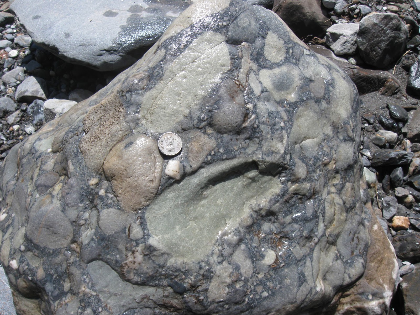
Day 7- We trekked to the Nagling Glacier which has carved a perfect U shaped valley. Certainly one of the most beautiful sites I have been to.


... more geology posts on glacial deposits and granite intrusions... coming soon.. !