Showing posts with label my book shelf. Show all posts

Wednesday, February 26, 2025

Oil Hunters Of India

At Independence in 1947, India had just a few operational oil wells situated in the northeastern region of the country. Most of the subcontinent's sedimentary basins remained unexplored for their hydrocarbon potential. The Oil Hunter: Journey of a Geologist for India's Oil Exploration by Dr. Shreekrishna Deshpande is a personal recollection of the immense effort undertaken by Indian geologists to re imagine these basins as hydrocarbon source and reservoir rocks. It is the story of the development of India's oil industry told with unconcealed pride.

Russia, France, and the U.S. offered personnel and technical help along the way, but the lion's share of the credit goes to geologists of the Oil and Natural Gas Corporation for their perseverance and resilience in the face of immense challenges.

Dr. Deshpande joined the ONGC in its early days in 1961 and describes vividly his field experience in remote locales all across the country, from scorching Kutch, to steep Himalaya terrain, to facing personal danger during an insurgency in Assam. There were inevitable career challenges along the way due to changing institutional structure and unrealistic political expectations. Their impact on company work culture and productivity is described in honest and direct language.

One of my favorite passages comes towards the end of the book where he explains the divergence between geologists and management in their basic understanding of exploration and discovery.

"Subsurface discoveries of oil reserves cannot be projected with certainty. The inputs to the discoveries are always deterministic, but the result is never so, and there is a strong factor of probability. Exploration efforts are to reduce the risk factor and increase the probability of discovery. Methods for direct detection of  hydrocarbons from the surface, are  yet to be evolved. This contrasts with any other industry, where the output is more predictable and proportionate to the input. 

.... As a simplistic approach the management decides the cost of discovery of one tonne of oil by dividing the amount of discovered oil by the expenditure met. It is expected by them that similar expenditure should proportionately result in additional discoveries.

When a sedimentary basin turns old and mature, the addition to the existing stock of subsurface oil becomes increasingly difficult. Non-geoscientists then blame geologists for such uncertainty. Only the high profitability in the oil industry is visible; its probabilistic nature and the risks involved are not so obvious. The stochastic nature of oil discoveries is not appreciated by non-explorationists". 

My one complaint about this book is that there is very little geology in it! Dr. Deshpande describes the geology work he and others undertook in very broad strokes. I felt that a few examples of how specific types of geologic data is useful for petroleum exploration would be illuminating for the non specialist reader. 

Let me give an example. Early in his career he is sent to Osmania University, Hyderabad, to analyze some sedimentary rock samples using Differential Thermal Analysis. He simply mentions that the results were used by ONGC in their exploration efforts, but how so? DTA is a way to understand whether the sedimentary rock was baked during burial to temperatures that are conducive for hydrocarbon formation. 

Another example, and one that involves his specialization, could have been a brief passage describing his work on limestones. What is a carbonate sedimentologist looking for in these rocks? The main reservoir of Mumbai High, India's biggest oilfield, are Miocene age limestone beds which were deposited repeatedly during phases of oscillating sea level. Among other things, exploration geologists want to know how open spaces or porosity in these rocks has evolved over time and whether its occurrence can be predicted throughout the sedimentary section. There was a geological detective story waiting to be told there. 

But these are mere quibbles. Overall, this is a very readable account of the productive and remarkable career of a pioneer exploration geologist of India.  Popular accounts of Indian geology and industry are rare. Recently, Himalaya geology expert Dr. Om N. Bhargava released his memoir, Travails and Ecstasy of a Geologist Addicted to the Himalaya, on his experiences of working in the Himalaya. Indian earth scientists are beginning to share the good work they have done with a more general audience, bringing a much needed familiarity with a lesser appreciated but critical field of study. 

Wednesday, October 2, 2024

The Garden Of Ediacara

I came across this lovely evocative passage in Nick Lane's book Transformer: The Deep Chemistry of Life and Death.

"You are not completely spineless. You have a notochord: a flexible rod made of cartilage, which in your descendant, millions of generations hence, will develop into a proper backbone. For now, you flex your rod like an eel to undulate through the water, never quite fast enough. Better to stay submerged in the soft mud at the bottom, with only your head visible, while you filter out grains of food from the swell. You have a wormlike head, with a small bulging of nerves that will one day become your brain. Your eyes aren't much use, but at least you can make out the looming of a monster, and swiftly bury your head again. Oh, times have changed. Not long ago, the world was full of gently filter feeders, swaying their fronds softly in unison, never harming a soul. Not that you remember, except in some hazy instinctive yearning for the garden of Ediacara. But now there are vast armour-plated war machines, bristling with claws and spikes and rows upon rows of crystalline eye facets fixing you from every dimension. You are a tender morsel, barely a couple of inches long, protein-rich muscle strapped to a crispy rod; a tasty snack for Anomalocaris. Better pull in your head again, just in case- being a little bit spineless might help you survive in this fearsome new world, outnumbered a thousand to one by spiny monsters".

The passage describes the early Cambrian world (540-510 million years ago) which saw the rapid diversification of the animal biosphere. The ancestors of vertebrates had worm like bodies, and Anomalocaris, an early arthropod, was top predator. Much before, the garden of Ediacara was a very different place. Complex multicellular life appears in the fossil record from about 570 million years ago in the Ediacaran Period. These creatures were sessile (fixed to the sea floor) filter feeders with body shapes resembling large leaves and fronds. Evidence of mobile animals manifests by 550 million years ago. Their tracks, trails, and burrows are preserved in soft sediment.

The graphic shows this  'Edicaran biota', a term that includes a diverse and unrelated groups of organisms. Three distinct phases, termed Avalon, White Sea, and Nama,  showing different community assemblages and increasing ecologic specialization are recognizable through the Ediacaran Period. Notice that mobile bilateral creatures first appear in the White Sea (B) assemblage. 

 Source: Rebecca Eden, Andrea Manica, Emily G. Mitchell: Plos Biology 2022.

Later in the chapter Nick Lane elaborates on how many of these Ediacaran filter feeders, simpler creatures without specialized tissues for different functions,  could not cope with the anoxic sulpur rich environments and died out. Sponges notably did survive. Mobile animals though had evolved a rudimentary circulatory system and molecules like myoglobin and haemoglobin, capable of storing oxygen and removing carbon dioxide. When oxygen levels increased in the Cambrian their descendants had metabolic machinery to take advantage of this high-octane environment. The radiation of animals utterly transformed our world. 

I highly recommend this book. It has a fair bit of chemistry in it. Nick Lane explains much of it using easier to follow diagrams instead of the dreaded chemical equations of our college years. He is a firm advocate of the metabolism first (as against a RNA/genes first) view of the origin of life and provides elegant explanations of energy flow and the evolution of metabolic pathways that build organic molecules to form biomass and breaks them up to power respiration. Disease and ageing is the inevitable consequence of the eventual degradation of these metabolic reactions. 

At the heart of all this is the Kreb's cycle, a series of reactions which burn sugars in oxygen to generate energy for cellular functions. But the surprise is that much of life can get by with only a partial Kreb's cycle. In many microbes, it is not a cycle at all, but a short linear path. Not at all what our biochemistry book taught us and a lesson for creationists who insist that systems like the Kreb's Cycle are irreducible complex, a sign of intelligent design, which could not have evolved through incremental steps.

Nick Lane- Transformer: The Deep Chemistry of Life and Death.

Tuesday, January 16, 2024

Deep Pacific Upside Down Waterfall

This passage from Helen Czerski's Blue Machine: How The Ocean Shapes Our World gives us a glimpse of the wondrous undersea universe we are just beginning to explore.

"We see upside-down waterfalls, she says. I don't understand what she means at first, and it takes me a few seconds to process the video as Deb keep talking. In those vertical chimneys, the walls crack and hydrothermal fluids come leaking out and  you get something that looks like half a toadstool growing out of a tree in an old growth forest. And suddenly I see it. This is a gigantic hydrothermal chimney looming out of the darkness, and hot water is indeed leaking out of its side. But because hot water is less dense than cold water, the hot water keeps flowing rapidly upwards. When it first hits cold water, its clearly dumped some minerals and made a ledge that sticks out- that's the toadstool shape that Deb is referring to. The water flowing upwards has had to flow outwards underneath the ledge before it can carry on upwards. But the ledge has developed a hollow on its underside like an upside-down bowl, so there is a pool of hot water there, held in the hollow as if it were filling up the inside of an umbrella. The boundary between hot and cold water shimmers like a mirror. And then the hot water is spilling out of its hollow and continuing upwards into the gloom. It really is an upside down waterfall".

Helen Czerski is watching this footage captured by a remotely operated vehicle exploring the area around the Juan de  Fuca Ridge, an undersea mountain chain a few hundred kilometers west of Seattle. Here, the Pacific and the Juan de Fuca tectonic plates diverge. Scientists are closely monitoring this ridge for seismic and volcanic activity, using a network of sensors  called the Regional Cabled Array. Deb Kelly is the Director of this project. Hydrothermal chimneys are sulfide and carbonate mineral deposits that form when hot mineral saturated sea water emerges through cracks in the ocean crust. The are common near mid oceanic ridges where the interaction of sea water and rock heated up by magma generates vigorous hydrothermal systems.

I'm only a quarter into this book and am enjoying every page of it. Highly recommended!

Tuesday, December 19, 2023

Books: Transformer , Blue Machine

 These two books came highly recommended via friends and social media.


I had really enjoyed his earlier book, The Vital Question. It was an exploration of energy constraints on the evolution of complex life on earth and perhaps elsewhere in the universe. Transformers takes a deeper look at the chemical processes underlying cellular function and their commonalities and differences across the spectrum of life.


Growing up as a hard rock geologist, I received very little training in how the ocean functioned. And to be honest, I have not updated myself on this immensely important topic in earth sciences. Blue Machine is my chance to learn more about how oceans shape our world. Looking forward to this one!


Tuesday, May 24, 2022

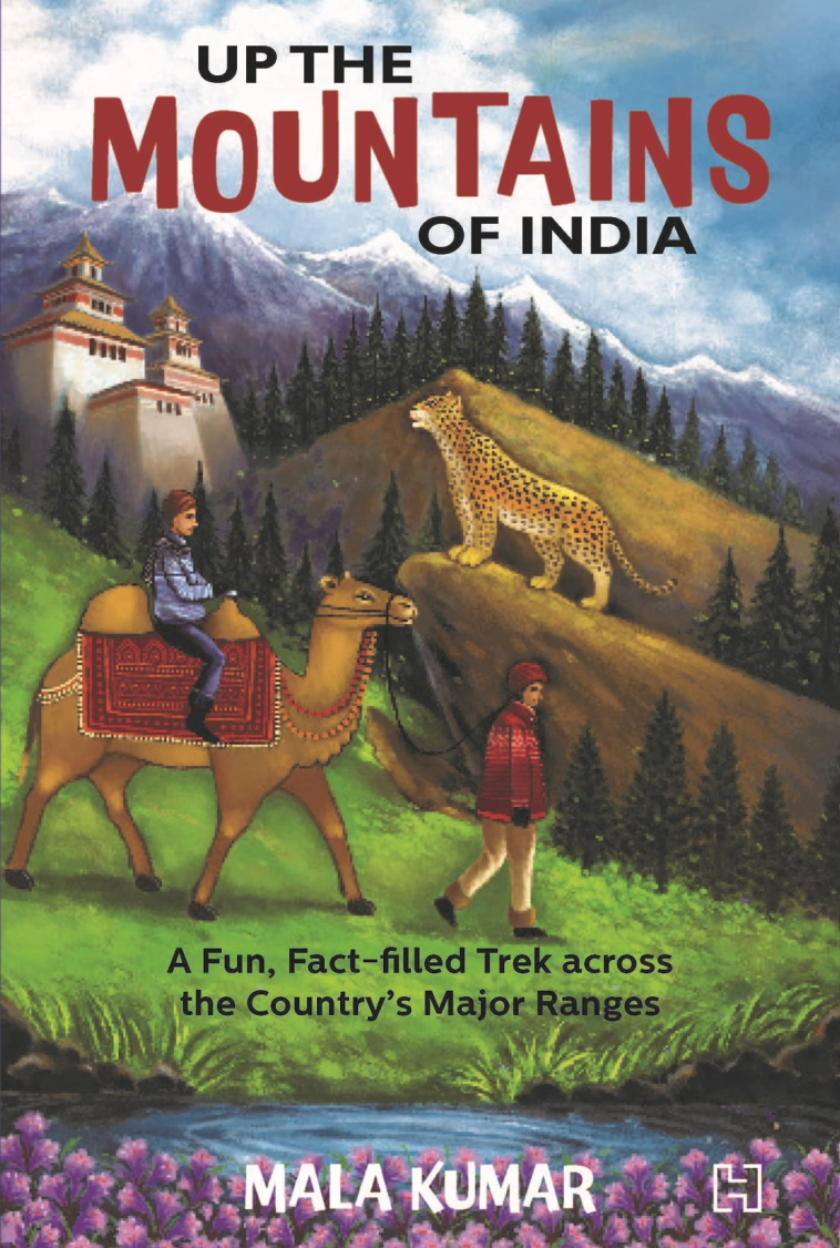
Book: Up The Mountains Of India

Finally it arrived! The author Mala Kumar connected with me a couple of years ago. She was writing a book on the mountains of India aimed primarily at young readers and wanted a geologist to help with fact checking some of the contents. We have had quite a few email exchanges since then, and my curiosity about this book has been growing even since. Mala has written over 40 books for children and this one is sure to enthrall them. But why just children? Anyone interested in India's varied physiography, geology, and wildlife, should read this book. 

I loved the way Mala has used everyday analogies to describe complex geology. One of my favorite examples is using a stuck piano key to explain about fault block mountains. The stuck key is a horst or a block that has moved up relative to the adjacent depressed keys which are called grabens. India's mountains are geological varied. The Himalaya, the Satpura, and the Western Ghats, for example, have formed by very different processes. Mala has used clear language and everyday familiar examples to simplify explanations of their origins. 

But this book is much more than about geology. Forests, wildlife, and human communities living in these rugged provinces really are the heart of the book. There are evocative descriptions of the animal and plant life of the different mountains ranges. Tibetan gazelles and mysterious snow leopards of the Himalaya, hoolock gibbons of the northeastern hills, majestic tigers of the Satpura and the Aravalli, and the bewildering varieties of frogs and reptiles of the Western Ghats, make us proud of our magnificent wildlife. There are lovely photographs scattered through the book. I could not stop gazing at the clouded leopard sitting elegantly on a branch deep in forests of the Mizo Hills. 

People too have lived in these mountains and forests since times immemorial. Their lives and life practices are being threatened as more mountain and forest land is gobbled up for dams, mines and expanding townships. In the northern Aravallis, villagers fought for years to save the sacred grove of Mangar Bani. In the Nallamali hills of Andhra Pradesh, members of the Chenchu tribe along with other organizations protested uranium mining that would have transgressed on the Amrabad Tiger Reserve. The book tells many stories from across the country, from the Aravallis, to the Eastern Ghats, to the Himalaya, of people struggling to conserve forests and water sources. 

Sketches and insets provide a welcome addition to the text. There are fun stories about the people of the mountains, about their crafts, about intrepid explorers, along with short quizzes, crammed in the insets that make the mountains come alive. 

Mountain ranges form the most important watersheds of our big rivers. Today, rampant development of mountain slopes coupled with climate change are becoming big threats to our water security. Mala Kumar's urgent call for conservation and sustainable development emerges again and again throughout the book and she has chosen her audience well. Whom better to inculcate a love and awareness for nature than in our children. These young citizens will be living in an increasingly challenging world and the hope of changing it for the better lies in a deeper understanding of how nature works. 

Go out for a trek in the mountains. Keep a lookout for that bright bluetail, and that curious langur who is peering at you half hidden from behind the thick leaves. Pick up pebbles from the stream bed and ask yourself about its geological secrets. Take a mountain train to the scented Nilgiri heights.  If you are hesitating, this book is an ideal place to begin.

Up the Mountains of India: A Fun, Fact-Filled Trek across the Country's Major Ranges - Mala Kumar. 


Thursday, November 25, 2021

Reverend William Buckland's Pie Crust


I came across this delightful passage in Elsa Panciroli's book, Beasts Before Us: The Untold Story of Mammal Origins and Evolution.

Naturalists exploring southern Scotland in the early nineteenth century came across some intriguing looking footprints impressed in red sandstone in a quarry at Corncockle Muir. The geologist Reverend Henry Duncan described these footprints and send some casts to the Reverend William Buckland who was making a name for himself in the emerging field of geology. The thinking was that these tracks were most likely made by crocodiles and turtles. Reverend Buckland came up with a clever way to test this idea. 

From Elsa Panciroli's book-

'Ist I made a crocodile walk over soft pye-crust [sic]' he wrote in a letter to Duncan, 'and took impressions of his feet...[second] I made tortoises, of three distinct species, travel over pye-crust, and wet sand and soft-clay...' Buckland's wife supplied the pie-crust and Buckland supplied the tortoises. Where the crocodiles came from is unclear, but as Buckland had a penchant for eating them he probably also had access to  live ones. The results : the marks matched the tortoises. He concluded, 'though I cannot identify them with any of the living species.... the form of the footsteps of a modern tortoise corresponds sufficiently well.... so I conceive your wild tortoises of the red sandstone age would move with more activity and speed... than my dull torpid prisoners.'

It was understood much later that these footprints in sand from Permian times (299 -252 million years ago) were made by early Therapsids from which arose the mammalian lineage. 

I am really enjoying this book! 

Sunday, October 31, 2021

Books: Volcanoes, Mammals, Himalayas

 New arrivals on my book shelf.

Fire and Ice: Volcanoes of the Solar System. Earth has them. So does the Moon and Mars. While eruptions on these three is molten silicate magma, there is plenty of variety in the rest of the Solar System. Io has sulphur rich emissions which drape the surface with a coating of  sulphur. Pluto has eruptions of nitrogen, methane, and ammonia that solidifies to form icy rock. Tidal forces unleased by Saturn on its moon Enceladus ruptures the moon's surface and triggers eruptions of fluids that fall back as snow and also contribute to the formation of Saturn's rings. Volcanologist Natalie Starkey delves into our current understanding of volcanoes of the Solar System and what we can learn from them about planetary evolution. Fascinating topic!


Beasts Before Us: The Untold Story of Mammal Evolution and Origins. Untold because most authors begin where the Dinosaurs end. The starting point is  usually at 66 million years ago, when a meteorite changed the world in an instant, reorganizing and vacating ecosystems into which mammalian lineages radiated. The story told by Elsa Panciroli goes way back, when Synapsids, the branch that led to mammals diverged from the common ancestor of mammals and reptiles. Repeat three times before going to sleep every night. Mammals did not evolve from Reptiles. These two groups shared a common ancestor in the Carboniferous about 300 million years ago. More and more fossils  are revealing that these early mammalian lineages were quite diverse, and not mere stunted underlings to the more popularly known Dinosaurs. For a lucid audio discussion of this book, listen to Elsa Panciroli on Paleocast Podcast- Beasts Before Us. 

 
 Himalaya: A Human History. My friend Emmanuel Theophilus is sure to like this one. I am thoroughly enjoying it. I didn't know much about ancient Tibet and Nepal, and what a rich history these two regions have! Ed Douglas tells these stories with panache and verve. And with a light touch. Lost empires,  ancient trade routes, master craftsman, art, architecture, spiritual masters, crafty power brokers, bloody military campaigns, missionaries, adventurers, botanists, colonialism, and recent geopolitics.  It really is an enthralling narrative of the epic history of this mighty mountainous region. I'll use the word 'remote' more carefully hence in my conversations about the Himalaya. This one is for you Theo!  

Wednesday, July 28, 2021

Darwin: Caught Between Catastrophism And Gradualism

This past Saturday was Guru Purnima and I thought I would share a short post on two of Charles Darwin's mentors who had a big influence on him particularly in the early days of his scientific career. Adam Sedgwick and Charles Lyell were both geologists whom Darwin looked to for advice and inspiration. Although Darwin had a rather broad training in natural history, he initially considered himself a geologist. 

Just before embarking on his voyage aboard the H.M.S.Beagle in 1831, Darwin had spent some time doing fieldwork in Wales with Sedgwick. Over a couple of weeks Darwin became proficient in identifying rock types, describing outcrops, and mapping and interpreting the regional geology. He first met Charles Lyell after he returned from his voyage in 1836, although he had been regularly corresponding with Lyell about geology. 

Adrian Desmond and James Moore's biography Darwin: The Life of a Tormented Evolutionist has a lovely description of Darwin's early encounters with geology as he began his travels aboard the Beagle with the shadow of Sedgwick and Lyell following him around. 

The Beagle has reached St. Jago in the Cape Verde Islands, about 300 miles off the African coast. There Darwin saw a fossil bed, rich in shells and corals, about 30 feet above sea-level. 

An extract from Desmond and Moore's book: 

" Sedgwick in North Wales had inducted him into Cambridge-style geology- a science of violent crustal movements,wrenching strata, and mountain thrusts. But how had this seashell band arrived at this height above the ocean? Lyell's Principle's of Geology could help here, even though Henslow had said to beware. Lyell pictured a world constantly and slowly changing, with the past no more violent than the present - so that today's climates,volcanic activity, and earth movements balance one another, land rises in one area as it falls in another, not cataclysmically, as Sedgwick thought, but gradually".

 Darwin studied the fossil band and reasoned that the sea itself could not have fallen over the lifetime of St Jago islands (he was wrong in this assumption, but at that time the causal link between short term climate change and sea-level fluctuations was just not appreciated). The fossil layer did not exhibit any signs of a violent geological change. He decided a gradual uplift of the volcanic island was a better explanation for the stranded fossil bed.

Darwin became and remained a gradualist throughout his lifetime. Gradualism was one of the central ideas of his theory of evolution. That biological change too proceeds slowly was something he had imbibed from Lyell's thinking about geological processes. 

His geological observations about South America were well received by his two heroes. Lyell introduced him to Britain's science elite and Darwin quickly received invitations to join various Geological Societies. He was ready to embark on a serious geology career, but a nagging question about the nature of life eventually took him on a different path. 

His work on transmutation began consuming him as he wholeheartedly devoted his research energies to solve the 'mystery of all mysteries'; how do new species originate and change?  Even after he drifted away from any serious geological work, Darwin remained a close friend with both his mentors. But neither ever embraced his theories of evolution. Sedgwick and Lyell, rooted in Anglican tradition, could not shake of their religious convictions and accept a naturalist explanation for life that Darwin had proposed. 

 Sedgwick was particularly severe in his criticism. He wrote on reading The Origin of Species (quoted from Desmond and Moore's book):

.." Parts of it I admired greatly, parts I laughed at till my sides were almost sore, other parts I read with absolute sorrow because I think them utterly false and grievously mischievous. You have deserted... the true method of induction,and started in machinery as wild, I think, as Bishop Wilkins's locomotive that was to sail with us to the moon".

Sedgwick and Lyell's cold shouldering of his theory caused Darwin immense pain. He had always felt at home with the geology community of Britain whom he thought of as more of a gentlemanly fraternity than the cantankerous zoologists. Desmond and Moore describe how physically sick  Darwin felt after a futile conversation with Lyell about his ideas on transmutation. Shivers, shakes, fever, vomiting became routine maladies throughout his later life, manifestations of the inner turmoil of working on an extremely unpopular theory.  But the dogged and outstanding scientist that he was,  he could not and did not let his mentor's rejection persuade him to stop his work or change his thinking. Patiently and 'gradually'  he put the pieces together and built a body of work that changed the world forever. 

***********************************

On a personal note, a warm welcome to new email subscribers who signed up after I switched to MailChimp. Do press reply and drop in a line to say hello. Thank you again for your interest.

Thursday, July 15, 2021

Fire Initiated The Anthropocene

James C. Scott in his book Against The Grain: A Deep History of the Earliest States makes the case for the transformational impact of fire on our environment.

" Hominids' use of fire is historically deep and pervasive. Evidence for human fires is at least 400,000 years old, long before our species appeared on the scene. Thanks to hominids, much of the world's flora and fauna consist of fire adapted species (pyrophytes) that have been encourage by burning. The effects of anthropogenic fire are so massive that they might be judged, in an evenhanded account of the human impact on the natural world, to overwhelm crop and livestock domestication. Why human fire as landscape architect doesn't register as it ought to in our historical accounts is perhaps that its effects were spread over hundreds of millennia and were accomplished by "precivilized" peoples also known as "savages". In our age of dynamite and bulldozers, it was a very slow-motion sort of environmental landscaping. But is aggregate effects were momentous."

The impact of human activity on the earth's outer skin has been so considerable that atmospheric chemist Paul Crutzen proposed that we are now living in a new geologic epoch, which he called the Anthropocene. This has sparked a vigorous debate on whether a new division of our time scale is justified, and if it is, on where to place its beginning. James C. Scott make a distinction between what he terms the "thick" Anthropocene, contrasting with the idea of a  "thin" Anthropocene. 

A "thick" Anthropocene is manifest by a sudden appearance of a worldwide signal of human activity. Examples of this could be the advent of the Industrial Revolution, or even more catastrophically, the nuclear age in the 1940's which left global radioactive markers.  The "thick" Anthropocene appears to fit more closely geologic convention which demands that the beginning of a new geologic time unit need be recorded by a widespread and more or less synchronous preservation of biological and chemical changes. 

Scott calls fire, agriculture, and domestication as part of the complex that comprises a "thin" Anthropocene. These inventions changed the world patchily and slowly. Its signals appear here and there, not encoded in one geologic layer, but in many, smeared over the past few hundred thousand years. 

The term "more or less synchronous" I used to describe a new geologic boundary is relative to where in the geologic past the observer is. More recent changes are resolvable to a finer degree either as a matter of historical record or by methods like counting tree rings and annual/decadal growth layers in stalactites, cross calibrated by either carbon dating or some other radiometric dating method. The error bar increases as one goes further back in time. Take the great mass extinctions of the past. There will be a sediment layer to which a geologist can point to and state that this marks the boundary between say the Ordovician and the Silurian or the Permian and the Triassic. But that sediment layer certainly wasn't deposited instantaneously. It likely represents a few thousand years of elapsed time. If you were an observer who spent a few years in the Late Ordovician 443.8 million years ago, the situation would have been more akin to Scott's "thin" Anthropocene, with small changes occurring at different times in different places. You would have been unlikely to have anticipated the profound cumulative shift that would eventually accumulate.

Most mass extinctions which form the basis of the big divisions of geologic time unfolded over thousands of years, but their material record is collapsed into a few feet of sediment. We perceive these geologic turnovers as 'sudden' because the preceding and succeeding periods of relative stability lasted tens of  millions of years and the time the 'boundary layer' spans is unresolvable using our current dating methods.

The exception to this is that fateful day 66.03 million years ago, when a large meteorite struck what is now the Yucatan Peninsula. By the time the dust had settled (literally) in a few weeks, the world had irrevocably changed. The Cretaceous-Paleogene boundary layer is in an absolute time sense a truly instantaneous deposit. We interpret it as instantaneous, not by radiometric dating, but by using our understanding of the physical sedimentation processes that would have been triggered by the impact.

The lesson we can draw from the transformational events from deep geological time is not about the debates over the timing of Anthropocene but on its effect. Like those distant ecologic disruptions, we too have set off biological, chemical and physical processes on a different trajectory than they were several thousands of years ago. The Anthropocene will leave a permanent mark on the many future worlds to come.

Monday, May 24, 2021

Books: Earliest Societies, Early Medieval India

 You didn't think I would stop at just three books, did you? More were delivered few days back.

1) Was the transition from a hunter gatherer lifestyle to agriculture a prerequisite for the formation of complex societies? James C.Scott explores this link between sedentism, domestication and state formation. The Sumerian Ur city state that formed around 3800 B.C is one example of this. New archaeological discoveries are hinting at complex societies of antiquity greater that the agriculture linked complexes that came up in the fertile crescent.  Sites like Gobekli Tepe in Turkey may make us reexamine our assumptions regarding the causes and timing of the formation of early states. Besides this book, I will recommend this essay by Samo Burja - Why Civilization is older than we thought. 


2) In the past year, I read four fine books on Indian history covering the time span from the 1000's to about the 1750's. India in the Persianate Age 1000-1765 and A Social History of the Deccan, 1300-1761: Eight Indian Lives, both by Richard M. Eaton. The Emergence of the Delhi Sultanate by Sunil Kumar who sadly passed away recently. And the fourth was The Mughal State 1526-1750. This is a collection of essays collated by Muzaffar Alam and Sanjay Subrahmanyam with a long introductory critical essay on Mughal historiography by the two editors. I thought it was time for me to explore the few centuries preceding the arrival of Central Asian Turkic invaders. The Making of Early Medieval India and The Early Medieval in South India look like good introductions to this time period. 


Tuesday, May 18, 2021

Books: Animal Minds, India Language History, India Governance

 New on my book shelf:


1) This came highly recommended from science Twitter. Peter Godfrey-Smith has surveyed a wide section of the animal kingdom and writes about the evolution of sensory experiences in different species. Sponges, corals, worms and octopus all manipulate the environments in specific ways. Disparate evolutionary pathways to be sure, but they all inform us about the origins of our mental capacities. 


2) I had a brief introduction to this book over a chickoo milkshake when the author M. Rajshekhar had visited Pune couple of years ago. He has spent several years traveling across India, surveying both big cities and the rural regions. His Ear to the Ground project resulted in scores of articles on India's everyday economy and the general failure of governance in this country. Its good to see some of his work distilled into this book.


3) Live History India has a really good interview with Peggy Mohan about her new book on India's language history. This is always a fascinating topic, as it tells us so much about population history, their origins, migrations, and intermingling. There is a section on Marathi too, and I'm looking forward to learning about that.

Friday, September 11, 2020

Bihar: Where Many Rivers Meet

I came across this passage in Vipul Singh's interesting book, Speaking Rivers: Environmental History of A Mid-Ganga Flood Country, 1540-1885. 


 "In consequence of the frequent changes which take place in the channels of the principal rivers that intersect the territories immediately to the presidency of Fort William and the shifting of the sands which lie in the beds of those rivers chars or small islands are often thrown up by alluvion in the midst of the stream, or near one of the banks and large portions of land are carried away by an encroachment of the river on one side, whilst accession of land are at the same time, or in subsequent years gained by dereliction of the water on the opposite side;... the lands gained from the rivers or sea by the means above mentioned are a frequent source of contention and affray,and although the law and customs in the country have established rules applicable to such cases these rules not being generally known, The Courts of Justice have sometimes found it difficult to determine the rights of litigant parties claiming chars or other land gained in the manner above described". 

It is a section of the preamble of The Bengal Alluvion and Diluvion Regulation of 1825 which the East India Company passed to assure a regular income from Diara lands. 

Diara land are ephemeral parcels of land that accrete to river banks or emerge in the middle of the river channel by sediment deposition. They can disappear in a decade or so as a major flood cuts away the river bank or erodes an island, only for newer land to appear elsewhere along this meandering fluid riverine landscape.

The satellite imagery covering the region between Patna in the west to Munger in the east forms the heart of this mid -Ganga floodplain.

Diara lands were traditionally farmed by landless peasants for the few months of the year that they were above water and then abandoned during monsoon inundation. There was no concept of ownership of these lands. The East India Company in its quest to maximize land revenue decided to regulate ownership of the Diara. It didn't always work in practice. Zamindars were reluctant to report the ground situation accurately and maps became outdated as topography and landscapes shifted quickly. Diara lands remained and still are a source of dispute.

Fascinating is the struggle outlined in the book of two long lasting empires with this river system. Before the Mughals, the Afghan ruler Sher Shah Suri occupied this region and had adapted to the capricious environment to his advantage. The Mughals though faced a different problem. Their power center was far to the west in Delhi and Agra. Carrying grains and goods from Bihar to Agra-Delhi using pack animals wasn't possible, since the expenses of feeding these animals would have left very little surplus. Being children of the Eurasian steppe, they preferred the horse and land transport, and that meant that they were unable or unwilling to develop a river navigation network on a commercial scale. The direction of river flow also worked against them. Sailing goods-laden boats upstream was challenging, especially as Vipul Singh points out, the Ganga upstream of Varanasi becomes difficult to negotiate. As a result the Mughals could never exploit or control this region fully. 

The British though found the river to their liking. The Grant of Dewani of Bengal, which the East India Company won in 1765, extended to the mid Ganga floodplains. The Company's main port lay downstream in Calcutta and their major markets across the seas in China and Europe. Using their expertise in navigation they soon set up a thriving trade in saltpetre, calico, opium and silk. Slowly, they also began imposing a linear topography on these curving meandering rivers. The building of embankments, canals, and barrages was thought necessary to control the inundation that could lead to a loss of a cropping season. The various Regulations and Acts meant to ensure a permanent and uninterrupted stream of revenue ended up changing the people's interaction with the river. 

These land regulations, beginning with the Permanent Settlement of 1793, entrenched the power of hereditary Zamindars who became Company rent collecting agents. It became especially hard for the landless to eke out a living as they saw even the ephemeral parcels of Diara which they had been farming now being allocated to the nearest Zamindar and his tenants. Large scale flood control projects carried out by Zamindars and encouraged by Company revenue officers began reshaping the ecology of the floodplains with embankments preventing floods in one region but exacerbating them on the opposite side or in downstream areas. Embankments also prevented smaller local streams from draining into the larger rivers, resulting in the water-logging of fields. Praveen Singh in The colonial state, zamindars and the politics of flood control in north Bihar (1850-1945), details how a web of social and economic interests spurred on this construction spree despite warnings from irrigation engineers about the detrimental effects of embankments.

Vipul Singh also emphasizes the linkage between physical processes and cultural evolution.  A unique Bihari regional identity emerged based on the homogeneous ecology, similar agrarian practices and a shared reverence for the Ganga. 

The Ganga of the plains is a turbid river. It transports several hundred million tons of sediment to the Delta. In this section of Bihar, it is joined by the Sone from the south and the Ghaghara, the Gandak and the Kosi from the north. The Kosi and the Gandak are especially sediment rich, carrying a suspended sediment load of 80 million tons per year and 43 million tons per year respectively. All this sediment is what makes this region special. A significant fraction of it gets deposited every year in the river channel and its floodplains. Over time, the Ganga and its tributaries have built vast alluvial deposits, through which the river finds its way, often getting choked on its own sediment, and then breaking free by cutting a new path for itself. This abundance of water and sediment has formed a complex fluvial ecosystem of meandering channels, river islands, abandoned courses, oxbox lakes, ponds, and wetlands. The organic rich silt deposited across floodplains by the rivers during monsoon inundation nourishes multiple crops. Life's daily rhythms became embedded in this ecology and its inhabitants evolved farming practices adapted to the changing tune of the environment.

There was linguistic pride too, not in one common 'Bihari' language, but in the various dialects spoken 'eh /e paar' and 'oh o paar'; this side of the Ganga and on the other side. Bhojpuri was the dialect of the Champaner area north of the Ganga, while to its east on the north side was spoken Maithili. In the Patna region on the south side was Magahi and towards the east near about Munger was Angika. These vernaculars with their common folk tales, poetry, and myths about deities, changing seasons, local plants and animals, and the Ganga, knitted the region together, away from the pull of the Delhi-Agra-Awadhi influence which lay to the west and the Bengali cultural sphere towards the east.

Magh ke garmi, Jeth ke jar
Pahila pani bhar gail tar,
Ghag kahen ham hoban jogi,
Kuan ka pani dhoihen dhobi
.

[Heat in Magh (January-February), cold in Jeth (May-June),and the tanks filled with the first fall of rain, are the signs of drought. Ghagh says that I will become a beggar, and the washer-men will wash with well-water.]  

This is a gem of a book. Highly recommended reading! 

Sunday, September 6, 2020

Hutton On Erratics

 "There would then have been immense valleys of ice sliding down in all directions towards the lower country, and carrying large blocks of granite to a great distance, where they would be variously deposited, and many of them remain an object of admiration to after ages, conjecturing from whence, or how they came. Such are the great blocks of granite which now repose upon the hills of Saleve".

... James Hutton : Theory of the Earth (1795). 

This passage is quoted in Jamie Woodward's book The Ice Age: A Very Short Introduction, and it is one of the earliest attempts to explain 'erratic boulders'. These are boulders sitting on a surface made up of a different rock type than the boulder, indicating that the boulders have been transported from a far away terrain. The great blocks of granite observed by Hutton were scattered on a limestone landscape that was part of the Jura mountains on the border between France and Switzerland.  Just how these boulders got to their present location was the subject of a lively debate in the late 1700's and the 1800's. Hutton suggested they were brought there by glaciers. Other naturalists, taking inspiring from Scripture, proposed that they were transported by Noah's flood. 

Erratics implied that glaciers must have been much larger in the past. Hutton never developed his thinking about glaciers into a full explanation. That would take several more decades of debate. Erratics found in Alpine regions and on the European and North American temperate plains became part of a growing body of evidence for past climate change.

Closer to home, the picture below shows an 'erratic' made up of a high grade metamorphic rock and sourced from the mountains seen in the background. The location is Darma Valley, Kumaon Himalaya.


Sunday, August 23, 2020

Books: Speaking Rivers, The Ice Age

 Ordered and received!

Prof. Vipul Singh is with the Dept. of History, University of Delhi, and he writes in the acknowledgments section that environmental history as a formal subject of study in history departments had a late start in India. The focus of the book is the flat lands of Bihar with its annual floods and shifting river channels and how Mughal and later British land use policies transformed the people's relationship with the river system. Looks like a very meaty book with plenty of Notes, Maps and a long Reference section. Will be sharing interesting snippets as I read along.


As one blurb says... "Perfect to pop into your pocket for spare moments".  A fine introduction by Jamie Woodward. The recognition that the earth has passed through several glacial and interglacial phases is really a triumph of field geology. Thick sedimentary deposits in Europe and N. America were recognized as being left behind by advancing ice sheets. The stellar role played by geologists in the mid-late 1800's and their debates grounded within the prevailing schools of catastrophism versus uniformitarianism is highlighted. And there are good succinct sections on the many modern theoretical advances in climate science and the techniques that geologists and climate scientists bring to bear upon understanding the mode and tempo of climate change.


Happy Reading.

Monday, March 30, 2020

An Outing With William Smith

I have started reading Roger Osbourne's The Floating Egg: Episodes in the Making of Geology.

It tells stories set mostly in the 1800's from the Yorkshire region of England of people involved in exploring landscapes, discovering fossils, and slowly constructing a systematic science of geology. The story of James Hutton's insight that the earth was really old based on his observation of the juxtaposition of two sets of strata at Siccar Point on the east coast of Scotland is well known. From that he deduced that the lower set of strata were deposited first, then tilted and eroded, upon which the upper set of strata were deposited. This meant that a vast amount of time separated these events.

In the late 1790's England, the need to transport coal from mines to industry led to a surge in canal building, as transport by barges was cheaper. William Smith was one surveyor in much demand. He began observing consistent patterns of rock and fossil associations through his explorations and realized that he could use these patterns to predict the presence or absence of certain rock types or fossils deep underground, even if the complete association of rocks was not exposed at the surface. Smith went on to make the first detailed geologic map of Britain, a tale best read in Simon Winchester's The Map That Changed The World.

Roger Osbourne imagines a conversation William Smith has with a fellow traveler, a Mr. Palmer of Somerset Canal Company, while on survey near the city of York. Mr Palmer is the narrator.

They climb a high tower which affords a view of the surrounding countryside. William Smith's eyes light up when he sees a line of hills in a distance.

'You are a coal mining man, Mr. Palmer, and for that you have my respect. Now if you were to go to those chalk hills and dig for coal, you would never find it. Never'

Though I had believed I understood Smith's explanations,this seemed a truly fantastic inference.

'But how can you know that Mr. Smith?  Those hills are more that twenty miles away'

'Think on it Mr. Palmer, think on it. You would need to dig through chalk,which is perhaps 500 feet thick, then through shale, limestones and red sand before you even got to the coal measures. You would be miles under the earth'.  He laughed at the thought of it.

'Can this be true?' I asked.

He turned to me, his face and eyes set strangely with a conviction that I had never seen on any man.

'Not "Can it be true?" Mr Palmer. It must be true. These are the laws of nature. They have no variance. What I seek is a philosophy which will embrace the whole earth. It cannot allow any exception'. 

The year is 1794. William Smith was optimizing mineral exploration strategy based on his new found understanding that the package of coal overlain by red sand, overlain by limestone then shale and then chalk will occur unvarying in this region.

A thousand such observations followed by countless inferences ultimately coalesced in to a rigorous science of geological mapping.

This is a lovely book.

Monday, September 16, 2019

Darwin: Citizen Science

After his return to England in 1836 from a five year round the world trip aboard the Beagle, Darwin did not travel again for any extended fieldwork. His home became his study and his laboratory, but he was no lonely isolated genius. His ideas stemmed from data that streamed in from all over the world.

From Darwin: The Life of a Tormented Evolutionist

Down House had become the hub of a correspondence network across the Empire, its tentacles touching every little England. The sack of mail brought gems daily to aid his sexual selection. Botanists from Ceylon to Calcutta sent reports on monkey manes and bearded Indians; mining engineers from Malacca to Nicaragua told of indigenous customs; tile manufacturers in Gibraltar attended to merino lambs; wine exporters in Portugal followed the local tailless dogs; Laplanders measured reindeer horns; New Zealanders heroically tackled the Maori's sense of beauty; and missionaries and magistrates from Queensland to Victoria ceased converting and incarcerating to observe aboriginal ways- with an old Beagle shipmate Philip King helping out. This is what Darwin excelled at: collecting and collating, tracking down facts, verifying,extending his old notebook speculations to embrace the globe.

Darwin had many India connections. His botanist friend Joseph Hooker who had traveled to India in the 1840's had been one source of information on indigenous plants, animals, and people. From 1855 or so, Edward Blyth, curator of the museum of the Royal Asiatic Society in Calcutta became his chief contact. He struck up a lively correspondence with Darwin. Details about monkey manes and bearded Indians would have come from him.

"his large and varied stories of knowledge, I should value more than that of almost anyone" he wrote of Blyth.

Vikram Doctor has written an insightful essay on Edward Blyth's life. It sketches the sharp contrast between the financially comfortable life Darwin lived in England against the hardscrabble existence of Blyth, who managed to stay on for 21 years in India on a salary of Rs 250 a month, supplementing it with a trade in exotic birds and animals.

A love for natural history drove Blyth on and Darwin benefited from that immensely.

Tuesday, September 10, 2019

Books: Timefulness And A New History Of Life

More books arrived in my mailbox.


I have been looking for an updated sweeping history of life survey. Peter Ward and Joe Kirschvink have written just that book, covering topics from the origin of life to mammalian evolution. I'm in the middle of the section on the origin of life, along which I am re-reading the relevant section from Nick Lane's superb book The Vital Question. Flipping ahead, I can see that the authors have developed broad narratives of how ecosystems changed, framed within the themes of catastrophic events and changes in levels of oxygen, carbon dioxide and hydrogen sulphide (very early in the history of life).

After enjoying her first book, Reading the Rocks, I had to order Timefulness, a long essay on the need to be aware of the multiple time scales on which geologic processes operate. Marcia Bjornerud stresses that inculcating time-literacy is vital for a sensible societal response to our epoch of rapid planetary change.

I'll be sharing excerpts from time to time.

Saturday, August 17, 2019

Darwin: Victorian Menage A Trois

In 1864, a few years after the publication of the Origin of Species, Darwin, fighting a bout of illness took up some botanical work on Lythrum, a genus of flowering plants known as loosestrifes. He had been breeding them on and off for many years. His interest was in their sexuality as they gave him a deeper understanding on the evolution of sterility and reproductive isolation. His theory of population divergence and the origin of new species depended upon the evolution of traits that prevented individuals and populations from mating with each other.

Lythrum was known for its triple sexuality. There were three kinds of flowers. The female stigma could be tall, medium or short-styled. Each was accompanied by two sets of male stamens.  If the female was tall, the males were short or medium sized.

Darwin realized through his breeding experiments that greater the difference in height between these sexual organs, the greater the frequency of sterility. Mating between the unequal sized sexes in the same plant produced sterile seeds.  This was evolution preventing inbreeding and favoring cross pollination.

Adrian Desmond and James Moore in their biography, Darwin: The Life of a Tormented Evolutionist, write about Darwin's mischievous side:

" Talk about illegitimacy might have shocked the ladies guilds, at least coming from Erasmus Darwin's grandson. (Grandfather's own bastardizing experiments were still supplying tittle-tattle. At this moment Darwin suspected the widow of a botanical friend, Francis Boott, to be an illegitimate granddaughter of old Erasmus). But Darwin was stolid, methodical, reducing the love of the plants to cold, clinical calculation. Sterile seeds counts somehow fitted an unromantic, data-crunching age. Not for him Erasmus's flowery personifications, as styles and stamens bent to embrace in a kiss:

Two knights before thy fragrant altar bend,
Adored Mellissa! and two squires attend.

Still, he could tease. Solicited by a Mrs Becker for something edifying for her ladies' literary society, he posted 'On the Sexual Relations of the Three Forms of Lythrum salicaria'. Goodness knows how many red faces left after hearing that 'nature has ordained a most complex marriage-arrangement, namely a triple union between three hermaphrodites,- each hermaphrodite being in its female organ quite distinct from the other two hermaphrodites and partially distinct in its male organs, and each furnished with two sets of males' ".

There is no doubt that Darwin was an outstanding thinker. But he also was a hands on guy. His thinking was not vacuous or overly speculative.  He was a tinkerer and putterer.  He produced data. By cross breeding plants. By dissecting barnacles. By co-opting pigeon breeders and noting down the variation in the size and shapes of different breeds. Documenting tiny differences between individuals within groups was crucial to his case that complex structures could evolve by incremental changes over generations.

From life's little details he built the grandest theory of all.

Thursday, December 13, 2018

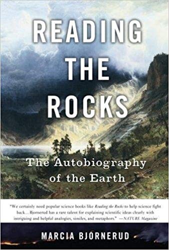
Books: Colliding Continents And Reading The Rocks

These two beauties came by mail!

Readers know that I have been traveling and writing about the Himalaya the past few years. I had gone to Delhi in 2010 to attend a wedding and casually asked my cousin whether he could recommend a trip to the Himalaya. After the wedding I ended up in Mukteshwar, Uttarakhand for a short stay. I was hooked and have been going regularly since. I realized that I knew almost nothing about Himalaya geology. My Masters course in Pune had barely touched the surface. There were no Himalaya geology experts among the faculty and that showed in the minimal attention it was given in the syllabus. After all these years,  I decided to use my trekking trips to observe the local geology and teach myself about the geological architecture of the Himalaya.  I have been reading from the research literature too. After 6 years of trekking, field observations and reading I can say that I do have a broad understanding of the lithology and structure of the Uttarakhand Himalaya. Mike Searle's book, based on his 30 years of field and lab work in the High Himalaya and Tibet, covering almost the entire mountain chain from the western extremity in Pakistan to Bhutan and the Indo-Myanmar ranges in the east, is going to add enormously to my understanding of the details of the geological processes in operation at the zone of collision between India and Asia and how they formed this enormous mountain belt.

Marcia Bjornerud's book comes highly recommended from my Twitter friends and colleagues. It tells the story of the earth by delving in to and elucidating the basic geological processes in operation on the surface and in the interior of the planet. I have been actively pursuing geology outreach for over a decade now, through my blog mainly, but more recently by taking people out in the field and conversing with them about the rocks we see around us and their place in the geologic history of the earth. I have been trying hard to improve my ability to explain basic concepts in an easy to understand language. I have a feeling this fine book will help me refine that skill.

I will be posting my thoughts and some excerpts from these two books from time to time.

Wednesday, August 30, 2017

Mapping: In Praise Of The Triangle

Jerry Brotton in his book A History Of The World In 12 Maps writes about France's National Map Project. Begun around the 1670's upon the establishment of the Academie de Sciences and the Paris Observatory and headed by the astronomer Cassini I, it first attempted to create an accurate geodetic survey of France using the latest surveying instruments. At the heart of the survey was the calculation of distances and directions using the method of triangulation. Latitude was calculated using a quadrant that measured the altitude of celestial bodies. Then, using a measuring stick, a baseline of a known length was established. A third point on the landscape was sighted. The angles between the three control points were measured. Using trigonometric tables the lengths of the remaining two sides of the triangle could be calculated.

I liked this passage:

In 1744 the survey was finally completed. Its geometers had completed an extraordinary 800 principal triangles and nineteen base lines. Cassini III had always envisaged printing regional maps as they were produced, and by 1744 the map was published in eighteen sheets. Its new map of France, on an approximately small scale of 1: 1,800,000, shows the country represented as a network of triangles, with virtually no expression of the land's physical contours,and with large areas such as the Pyrenees, the Jura and the Alps left blank. It was a geometrical skeleton,a series of points,lines and triangles following coasts, valleys and plains in connecting key locations from which observations were carried out. Over it all lay the triangle, the new immutable symbol of rational, verifiable scientific method. On Cassini III's map the triangle almost takes on its own physical reality, a sign of the triumph of the immutable laws of geometry and mathematics over the vast, messy chaos of the terrestrial world. The Babylonians and the Greeks had revered the circle, the Chinese celebrated the square, the French now showed that it was the application of the triangle that would ultimately conquer the earth.

Cassini III was the grandson of Giovanni Domenico Cassini (Cassini I). The directorship of the Paris Observatory remained in the Cassini family over four generations.

This surveying method was quickly adopted and adapted by others. The Ordnance Survey began mapping the British Isles using this method in the late 1700's.  William Lambton took the Ordnance Survey's acquired expertise and began the Great Trigonometrical Survey of India in the year 1800, a feat that took nearly 50 years to complete. John Keay's book The Great Arc details that mammoth effort.