Showing posts with label mineralogy. Show all posts

Monday, December 15, 2025

Harappan Technology, Homo Floresiensis, Foraminifera

Some exciting readings for you- 

1)  Manufacture of synthetic stone in the Bronze Age Harappan Civilization.

Stone beads were important in Harappan culture and trade. They were made out of agate, an amorphous or cryptocrystalline form of silica. The Kutch region was the primary source of these agates. Stone and bead processing Harappan age workshops abound in this region. The tradition continues today. Some of the best ornamental agate is still being sourced from Kutch. The agates precipitate as secondary silica in cavities of the Deccan Basalts and associated silica rich lava.

To perforate these agates, the Harappans needed tools such as drill bits which were harder than the agate. For this, they manufactured a synthetic stone, now called Ernestite, by high temperature sintering of sand and laterite raw materials. Reaction temperature needed to fuse these materials into a cohesive rock would have reached 1100 deg C! Mesozoic sandstone, found all over Kutch, provided the sand, and the laterite came from iron rich weathered layers capping the Deccan Basalt.

A terrific study by M.K. Mahala and coworkers that details the provenance and fabrication of this interesting artificial stone has just been published in Nature Heritage Science. There is a lot of mineralogy and geochemistry described in the paper, but the conclusions are clearly laid out for all to understand.

2) Climate change and the decline of the Hobbit.

Why are small isolated populations of animals vulnerable to extinction?

Inbreeding, small geographic range, limited access to resources, reliance on one or few food sources, a chance catastrophic event, all may be factors making them susceptible to extirpation.

A case in point is the Hobbit or Homo floresiensis, the diminutive hominin discovered on Flores Island, Indonesia, in 2003. The archaeologic record shows it lived on the island for at least one million years. Homo floresiensis is thought to be a descendant from an early Homo species which dispersed from Africa 2 million years ago. The other famous inhabitant of the island that coexisted with the Hobbit and was its main food source is the dwarf elephant Stegodon.

A careful analysis by Michael Gagan and coworkers, published in Nature Communications Earth and Environment, using geochemistry of calcite from cave deposits show how climate change and decrease in water availability may have increased competition for resources and made life challenging for the inhabitants.

Summer rainfall began declining around 76,000 years ago with record low rainfall between 61,000 to 55,000 years ago. Both the Hobbit and Stegodon fossils become rarer during this interval and disappear by 50,000 years ago. Modern humans entered Flores Island around 46,000 years ago, and whether the Hobbit interacted with them on Flores Island is uncertain. 

3) The history of the ocean, as told by tiny beautiful fossils

The tiny fossils are planktonic foraminifera living suspended in the upper sunlit portion of the ocean. Their shells are made of calcium carbonate. They occur in huge numbers and have short lives. Their shells drop down and carpet the ocean floor, making them valuable archives for understanding evolution. Scientists make use of them for studying climate change too. Certain changes in the chemical composition of their shell are a function of water temperature. Tim Vernimmen has written a short piece on how foraminifera inform us about past environmental crisis and ocean conditions.

Thursday, July 31, 2025

How Old Is Himalaya Topography?

 Is this true?

The answer is no. To be fair, aside from the click bait, the article itself does not make any such claim. It covers a new study on some igneous rocks from Arunachal Pradesh that formed during an earlier pre-Himalaya stage of the India Asia plate convergence. 

By mid late Cretaceous times, between 100 to 66 million years ago, the dense ocean lithosphere that was the front edge of the Indian plate was sinking underneath the Ladakh terrain, a splinter of Asian continental plate disconnected from the mainland. The subduction of the Indian plate triggered extensive melting in the deep subsurface, building over time a magmatic arc. The schematic below shows the plate tectonic scenario. 

This arc has been well studied in the Kohistan and Ladakh areas. The new work found that a body of granitic rock known as the Lohit pluton is also an eastern extension of the Kohistan Ladakh arc complex. 

Eventually, the oceanic crust of the Indian plate was consumed and the Indian continental crust collided with the Ladakh terrain, which by this time had sutured with the Asian mainland. Himalayan mountain building begins from this point on, roughly sometime after 50 million years ago. 

How do geologists know when topography began to form in the Himalayan region? Various dating methods tell us when a particular rock or mineral crystallized or cooled below a particular temperature. But how do we date the formation of topography? Sedimentary geology, my field of specialization, has played a big role in giving us insights into the tectonic and topographic evolution of the Himalaya. I'll summarize how the story of the formation of the different Himalaya ranges came to be written by these geologists. 

Due to inherited geologic history and subsequent conditions during continental collision, the entire region between Ladakh and the Himalaya front can be subdivided into six geologic terrains running along the length of the mountain arc. These are, from north to south,  the Gangdese magmatic arc, the Indus-Tsangpo suture zone, the Tethys Himalaya, the Greater Himalaya, the Lesser Himalaya, and the sub Himalaya (Siwalik). Each is made up of distinctive rock associations. 

The earliest topography began to from in the north, at the zone of contact between the two continental plates. Over time, there was a step wise progression of southwards topography formation. As each of the geologic terrains rose up, newly developed stream networks started eroding the rocks and delivered distinctive sediment mixtures to two types of sedimentary basins which had developed adjacent to the mountains. The Indus and Bengal basins at the two extremities of the Himalaya received sediments from the Indus and the Yarlung-Tsangpo/Brahmaputra. A second type of basin, known as a foreland basin formed to the south of the orogen. This moat like depression which runs parallel to the Himalaya, and is fed by streams running transverse to the ranges, also became an archive of material removed from the mountains. 

By carefully identifying the sedimentary grain types deposited in these basins and how their proportions change through the oldest to the youngest layers, geologists have been able to piece together the evolution of new topography and geologic provenance through time. 

I am presenting this reconstruction through a series of time slices which show topography formation in each of the geologic terrains and the resulting stream networks transporting the derived sediment from source to sink. The representation only shows the central foreland basin from Himachal Pradesh to Nepal. I have not shown the sedimentary history of the western and eastern basins. The trends at the Himalaya extremities are similar with some difference due to variations in the dominant geology of the contributing catchments. 

I have also not covered a short phase of basin formation in the Indus Tsangpo suture zone between 30 to 20 million years ago. This basin received sediments from both the Gangdese Arc and the Indian plate and was then uplifted to form the Indus Group ranges which include the famous Kailash mountain. For more details of this episode of Himalaya mountain building do refer to my post - Is Mount Kailash the Oldest Mountain in the Himalaya?

In the diagrams, the legend "foreland sandstone diagnostic grains" refers to the arrival of a suite of distinct grain types in the foreland basin. This signals the uplift and erosion of new rock types in the growing mountain range. Earlier formed ranges will in most cases continue to contribute sand, but it is the first appearance of a new grain type in successive strata that is the indicator of tectonic and topographic changes. 

The inspiration for these diagrams is from P.G. DeCelles and coworkers paper on the timing of the India Asia collision, published in the May 2014 issue of Tectonics.

A) Initial Continental Collision- 58-54 million years ago: What was the timing of the collision?


As long as Indian oceanic lithosphere was subducting under Asia, a deep trench and forearc basin separated the two continents. Sediments eroded from Asia were trapped in these depressions and could not travel on to the Indian continent. This situation changed on continental impact. By then the intervening basins were shallower, the Tethyan Ocean had started retreating and rivers originating on the Asian tectonic plate could now flow across the zone of collision and deposit sediments on the Indian continent. These Asia derived delta sediments rich in volcanic rock fragments eroded from the Gangdese Arc began to be deposited on the Indian continental shelf between 58-54  million years ago. TH, GH, and LH are the future Tethys Himalaya, Greater Himalaya, and Lesser Himalaya.

B) Proto Himalaya Stage- 45-30 million years ago. 

Preceding and during collision, slices of the Indian oceanic plate were thrust up and sandwiched between the two continental plates. Igneous rocks of this "suture zone" are made up of magnesium rich silicate minerals (olivine, pyroxene) and magnesium aluminum oxides (spinel). Only a remnant arm of the Tethys persists, but rivers can now flow across the Indian continent and deliver sediments to the foreland basin. This basin is located roughly over what is now the southern Lesser Himalaya and the Siwalik ranges. Gangdese Arc and suture zone derived sediments first appear in the foreland by 45 million years ago.

C) Early Himalaya Stage- 35-20 million years ago. 

A pulse of low grade metamorphic rock fragments start appearing in the early Oligocene to Miocene age foreland basin sediments. These are derived from the newly forming Tethyan fold and thrust belt. Volcanic rock fragments are now absent in the central foreland, suggesting that the growing Tethyan ranges are a barrier to rivers originating in the Gangdese Arc. The Indus and the Yarlung Tsangpo, initiated in the furrow of the suture zone and flowing parallel to the northern ranges before cutting across the rising mountain chain, continue to transport arc derived sediment to the basins at the western and eastern extremities. 

D) Main Himalaya Stage- From 20 million years ago.

Three pulses of mountain building are recognized during the Main Himalaya Stage. The early phase from 20 -11 million years ago records the uplift of the Greater Himalaya which are made up of high grade metamorphic rocks containing minerals like mica, feldspar, and garnet. Deformation continued southwards between 11-5 million years ago resulting in the formation of the Lesser Himalaya ranges. These shed low grade metamorphic and dolostone (magnesium calcium carbonate) detritus. 

Eventually the foreland basin got caught up in the progressing orogeny. New faults propagated southwards. Slices of the oldest foreland basin deposits were broken and accreted to the mountain front. These freshly exhumed rocks became the major source of sediments feeding the youngest depositional phase in the foreland. Pliocene-Pleistocene  (5 -0.5 million years ago) layers of the Siwalik hills are made up of rock fragments cannibalized from Eocene and Oligocene foreland strata. 

How is the age of the foreland basin sediments determined? The entire exercise of unraveling the topographic history of the Himalaya depends on that! 

These sediments have been dated using a variety of methods. Fossils provide age ranges for packages of sediment. Magnetic signals preserved in iron rich mineral grains are measured and pegged to an absolute date by comparing the magnetic pattern to a global magnetic chronology. Techniques such as fission track dating of zirconium silicate sand (zircon) tells geologists when that zircon in its source was being uplifted and cooled thus giving a fair idea of the time of its erosion, transport, and deposition as a sedimentary particle. 

Gathering all this age information on the sediments, the timing of the arrival of distinctive rock fragments and minerals in the foreland agrees well with the exhumation history of their provenance as deduced from bedrock geochronology. 

The growth of mountain chains is a long and complex process. The word "collision" may invoke ideas of near instant crustal response, but deformation and surface uplift moves rather slowly across strong and rigid plates. Surface and deep crustal process are linked. For example, the formation of the Tethyan fold and thrust belt resulted in crustal thickening and the deep burial and metamorphism of rocks that eventually became the Greater Himalaya. There was a long time lag between the initiation of collision and the main Himalaya pulse of uplift. The rise of  the Greater Himalaya took place a good 35 million years after the India Asia impact. 

Foreland basins give us valuable insights into the relationship between sedimentation and tectonics, but they too need careful evaluation. They are not static entities. Compare the proto Himalaya stage with the main Himalaya stage and you will notice that as mountain building moved southwards the location of the foreland shifted too in response to the migrating load of the thickened crust. This process continues to this day. If the region of the Siwalik hills was the foreland a few million years ago, today it is the Ganga alluvial plains. 

Orogeny and drainage impact the sedimentation patterns in the foreland. Different rivers breaking through along the mountain front may not be bringing uniform sediment mixtures at the same time. Hinterland differences in geology of the catchment results in variable sand composition along the length of the foreland. Take the example of river Ravi. It drains mostly the Lesser Himalaya and hence its brings with it low grade metamorphic sand grains. On the other hand, the Sutlej flows through a significant portion of the Greater Himalaya. High grade metamorphic grains make up a large proportion of its sand. 

Further, chemical reactions taking place in the subsurface may dissolve some types of minerals. This may create an apparent trend in sand composition through time, which may not accurately reflect the actual history of the provenance. 

Researchers need to be cognizant of these issues when they construct their answers. 

Understanding the timing of Himalaya uplift provides valuable insights into the geodynamic forces at play during continental collisions. But the interest in this question goes beyond geology. Climate scientists want to know more about the linkage between Himalaya evolution and the advent and shifts in the Asian monsoon. And the value of studying the Himalaya spills into many other areas. Orogeny exposed enormous volumes of fresh rock to chemical weathering, mobilizing nutrients and organic carbon which would then be sequestered in fluvial and marine environments. These elemental cycling and budgets are keenly studied by surface systems specialists. 

Visit the picturesque Kangra region in Himachal Pradesh. Climb the thick sandstone layers leading up to the historic Kangra fort. Go to nearby Jwalamukhi, where natural gas emanating from the deep keeps alight an eternal flame. Ascend the hills towards the famous town of Dharamshala. You will be traveling through the Miocene foreland basin. Sedimentary petrologists for decades have worked on these and other sites along the Himalaya frontal ranges amassing data on sandstone composition. Even as million dollar instrumentation keep revealing new facets of the earth, their main tool has remained the humble petrologic microscope mounted with a grain counting stage. From this labor of love has emerged the story of how and when the Himalaya came to be.

Sunday, June 30, 2024

Field Photo: Unusual Himalaya Metamorphic Rock

My friend Emmanuel Theophilus, who spends a lot of time wandering in the high Kumaon Himalaya, sent me this photo of a feldspar rich gneiss.,

He observed this loose boulder near the small settlement of Bugdiyar in the Goriganga valley, north of Munsiyari town. Bugdiyar is located in the Greater Himalaya. This is a high grade metamorphic rock terrain. As you walk along the many trails that lead to places like Nandadevi Base Camp and Milam Glacier,  you can observe mica and amphibole rich schist with gleaming garnets, quartz and feldspar rich gneiss, migmatite gneiss (partially melted gneiss), and leucogranite (quartz and feldspar rich magma) intruding this high grade ensemble. 

This traverse takes you into the core of the Himalaya orogen, where high temperature and pressure during mountain building that took place 35 to 15 million years ago transformed the sedimentary protolith into metamorphic rocks. 

This particular gneiss rock has an extraordinary texture. I have never before seen such large feldspar (white crystals) in a metamorphic rock. Judging by the pebbles and other rocks strewn by the side, these are inches long feldspar grains. 

I want to introduce two terms used to describe texture in metamorphic rocks; porphyroblastic and porphyroclastic. Both these terms describe rocks with very large crystals surrounded by fine grained minerals. These are rocks with two distinct crystal size classes. 

Porphyroblastic texture forms when one mineral grows more quickly than other minerals during metamorphism. Large crystals of the rapidly growing mineral are set in a finer crystalline matrix. Both the large and small sized minerals have recrystallized, but at different rates.  

In contrast, porphyroclastic texture forms when there is a size reduction of some minerals , leaving one unaffected mineral larger than the rest. This situation occurs most commonly in fault zones where softer minerals may get crushed more easily leaving the resistant mineral as a large porphyroclast. These types of rocks have a broken appearance. The softer minerals become aligned to give the rock a prominent streaky banded texture. The more competent mineral may also develop an elongated shape.

Which of the above is the rock Theo found? My guess is that it is a porphyroblastic gneiss. Take a closer look at the beautiful large grains. They seem to be the result of growth during metamorphism, in the process engulfing small pockets of mica in their interiors. The rock lacks the streakiness and the often broken, bent, and stretched large grains characteristic of a porphyroclastic texture.

However, there is a subtle sign of deformation too. Have a look at this close up. 

The black arrows point to rugby ball shaped feldspar grains. They have a long axis and a short axis and appear to be stretched in one direction. Also notice the grey cracks running along the longer axis of many of these crystals and continuing into the rock. These are paper thin zones where force or stress was localized. The change in shape (strain) in the feldspar grains follows these very narrow zones of deformation. 

All of the above is my reasoned speculation on the origin of this texture. The next step is to meet up with Theo near Bugdiyar and walk along the Goriganga in search of the outcrop.

The Goriganga near Bugdiyar. It is spectacular out there!

Thursday, October 26, 2023

Photomicrograph: Mineral Filled Vesicle

I came across this stunning image of a mineral filled vesicle on the September 2023 cover of Geology. The rock sample was collected from the Louisville Seamount Chain in SW Pacific Ocean.

 Source: Elmar Albers et.al. 2023- Timing of carbon uptake by oceanic crust determined by rock reactivity.

Vesicles in igneous rocks are spherical holes formed by expanding gas bubbles. As lava erupts, dissolved gases bubble out. Lava solidifies fairly rapidly on exposure either to air or water. The bubble shape is retained as a small cavity. It gets filled with minerals when magmatic fluids and mineral saturated seawater or groundwater circulate and react with the rock. 

The basalt rock in this study is about 50-74 million years old. The calcite in the vesicle precipitated within 8 million years of eruption. Alteration of undersea basalt is a CO2 sink. Basalt reacts with seawater, trapping carbon in carbonate minerals. The calcium required for formation of carbonate minerals is provided by the alteration of minerals like plagioclase. The study is trying to estimate how long such carbonation reactions continue. Carbonated oceanic crust eventually sinks into the mantle at subduction zones sequestering carbon from the surface for hundreds of millions of years.

This particular vesicle is filled with carbonate (calcite) and clay. Notice the beautiful banding suggestive of pulses of mineral formation. Among the brown and white layers are white bands of faceted saw tooth calcite. And the upper part of the vesicle is filled with large irregular shaped crystals. Surrounding the vesicle is the 'groundmass', made up of tiny crystals of plagioclase feldspar, iron oxide, and volcanic glass. There is no scale in the picture, but my guess is that the vesicle is a few hundred microns across.

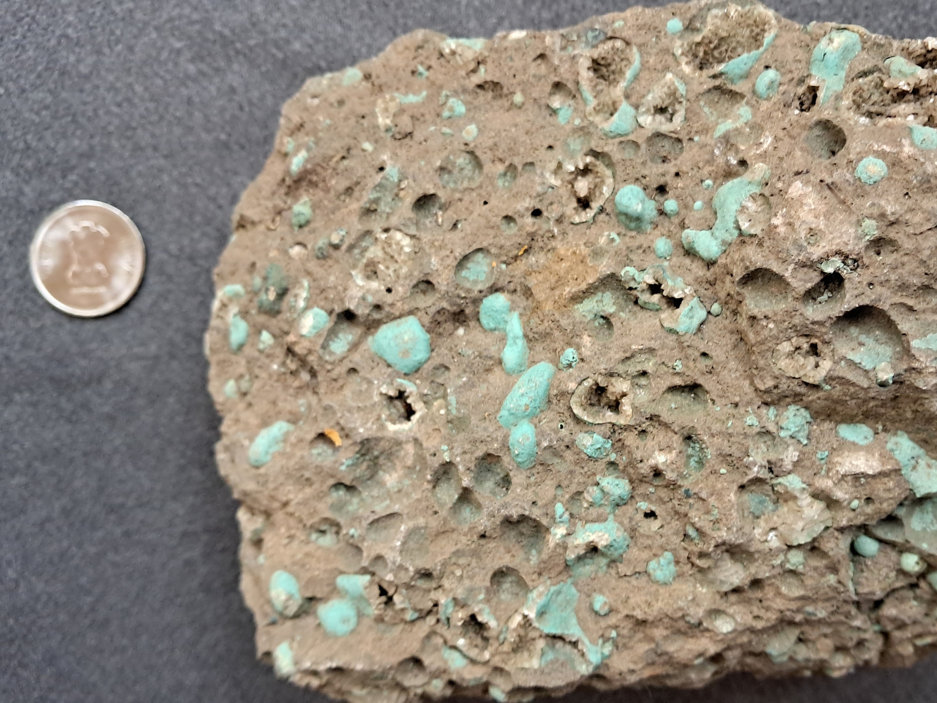
In a hand sample a vesicular basalt will look like the example below. This is from the Deccan Traps near Pune. 

The vesicles here are much larger than the first example. Many are empty. Some vesicles have a lining of tiny crystals. Carbonation of terrestrial basalts also constitutes a carbon sink.  Combating global warming and achieving net zero emissions will require, foremost, a steep reduction in emissions, but additionally also removing carbon dioxide from the atmosphere and safely storing it in long term reservoirs. Such carbon removal and sequestration projects are exploring the potential of basalts and related igneous rocks as a long term carbon sink. 


Sunday, July 23, 2023

Septarian Concretion from Khambhat

My friend Bhushan Panse, who is a geology enthusiast and an avid rock and mineral collector, handed this specimen to me over a coffee meeting. He had bought it from a mineral supplier from Khambhat, Gujarat.

I commented that it is a septarian concretion. These hard ellipsoidal or oval shaped lumps form in mud and silt layers by the precipitation of calcite  around a nucleus. Khambhat and many other parts of Gujarat are underlain by Mesozoic and Cenozoic age sedimentary rocks. The process of concretion formation would have taken place at shallow burial depths when these sediments were still porous and water saturated. Mineral deposition in pore spaces often takes place in concentric layers. The calcium carbonate comes from saturated marine pore water or is derived from shells as they start dissolving during shallow burial. Notice the rust to brown color of the concretion. It is likely due to the presence of iron oxide and hydroxides which formed in the pore spaces from the iron contained in clay minerals.

The term Septarian Concretion refers to the radiating cracks or Septaria (derived from Septum). Cracks come in a variety of shapes. There are radiating cracks as seen in this specimen. These cracks are wider near the center and taper outwards. Other concretions may show concentrically oriented cracks, or overlapping sigmoidal shapes. Cracks may intersect, pointing to multiple cracking events. They are filled with either calcite or silica. The crystals filling these cracks are sometimes broken and displaced, and cracks may contain mud and silt. These features indicate a variety of stresses at play in concretions interiors. 

There are many ideas on how these cracks form. They have been interpreted as shrinkage cracks due to desiccation and hardening of mud. Dehydration during chemical transformation of clay minerals is another explanation.  A third hypothesis links the formation of cracks to gas expansion released during putrefaction of organic material. 

Sedimentologist Brian Pratt has offered another novel explanation. He proposed that these cracks result due to shaking of sediment during synsedimentary earthquakes. Shaking during ground motion results in variable stress fields in the interior of the concretion forming a large variety of crack geometries. These concretions may be preserving signals of  seismicity affecting that sedimentary basin!

Here is his compilation of the large variation in septarian concretion cracks from various sedimentary basins across Canada.


 Source: B. Pratt: Septarian concretions: internal cracking caused by synsedimentary earthquakes

A geologist friend who worked with the Geological Survey of India suggested another intriguing explanation. Parts of the region near Khambhat experienced explosive volcanic activity towards the waning phases of Deccan Volcanism. Ash expelled from volcanoes can coat small broken lava fragments forming lumps known as  'áccretionary lapilli'. Aggregations of ash and pyroclastic material if larger than 64 mm are known as volcanic bombs. This concretion fits the size range of a bomb. The dark fragments in the center of the concretion do resemble a fine grained igneous rock. A closer examination under a microscope is needed for a confirmation of its origin.

It is fun to examine hand specimens that friends collect from various part of the world and try to identify the rocks and minerals. But often a clear cut answer is not possible due to the need for additional information from a higher resolution or the chemical makeup. But a guessing game over coffee is always welcome. 

Geodes, nodules, and concretions found in volcanic and sedimentary rocks are mystery objects. You never know what you will see inside when you break open one of these lumps. There may be an array of perfectly faceted purple amethyst crystals and multicolored calcite. Or a trapped fossil. Or a crack network filled with bright and shiny calcite and quartz. These crystal rich interiors give us important information on the composition of fluids which react with rock at many different times during their geologic history. This water rock interaction is of interest to mineralogists and  economic geologists who want to understand the history of fluid flow through sedimentary basins and the conditions that lead to the concentration and deposition of metals. 

Geological investigation at all scales inform us about how the earth works. One can stand and gape at great mountain ranges and wonder about the movement of tectonic plates. But you can also crack open a rather dull colored lump from a shale and marvel at its insides, all telling a story of groundwater flow and chemical reactions, and who knows, past earthquakes as well. 

Tuesday, June 13, 2023

Links: Human Brain Evolution, Pyrometamorphism, Upper Atmosphere Cooling

I learned some new things from these articles over the past couple of weeks.

1) Endocranial Volumes and Human Evolution: Warning- this figure posted below is deceptive!

Although hominin brain volumes increase over a 7 million year history, patterns of growth in separate lineages show, both, stasis & episodic increase. In an excellent analysis, anthropologist Ian Tattersall shows that a trend towards large brain volume is expressed independently in three separate hominin lineages, raising important questions about the role of social interactions and environmental pressure that could lead to the evolution of larger brain size. And most intriguingly, brain volume size has decreased in the Homo sapiens lineage over the past few tens of thousands of years. What does it mean for the evolution of complex behavior and symbolism?

2) Scorched Minerals in Sedimentary Rocks: Petrologist Michael Anenburg reports a most unusual suite of minerals. They formed by pyrometamorphism, i.e., the transformation of sedimentary rocks by heat supplied by large fires. This process takes place at or very near the surface, likely driven by the ignition of oil bearing shales or coal seams. The rocks described here are from the Dead Sea area of Israel. Before metamorphism, they were a sequence of impure limestones and phosphorites. There is a memorable description of these combusted limestones in the paper; 

" Gross discovered that the Hatrurim Formation was fundamentally a natural Portland cement factory. Indeed, many of the synthetic compounds found in cement occur naturally in the Hatrurim Formation and were subsequently named after the local Hebrew or Arabic place names in which they were found, such as hatrurite, ye’elimite, and harmunite. Concrete is formed when Portland cement is mixed with water, and the pyrometamorphic minerals of the Hatrurim Formation have experienced a similar process. Hundreds of thousands to millions of years of exposure to rain and groundwater has led to the hydration and alteration of most of the high temperature minerals. The end result is essentially a naturally formed concrete". 

3) The Upper Atmosphere Is Cooling, Prompting New Climate Concerns: The earth's atmosphere is layered. While the lowermost  layer known as the troposphere is warming as we emit more and more carbon dioxide, satellite data shows that the two uppermost layers, the mesosphere and the thermosphere have cooled by 3.1 deg F between 2002 and 2019. Scientists worry about the impact of this cooling on weather patterns on earth. A succinct summary by Fred Pearce.


Author Contact: suvrat_k@yahoo.com

Monday, May 1, 2023

Pavement Geology: Ophicarbonate

You must have come across polished slabs of this dark green rock with white veins, used on stairways and as wall panels. It is an ophicarbonate.

The term encapsulates a range of geological processes, often separated by tens of millions of years. Oceanic lithosphere that is being generated by magmatism at mid ocean ridges, where plates diverge, is made up of igneous rocks arranged in a sequence. The top layer is basalt lava erupting and forming oceanic crust. Much lower down are ultramafic rocks like peridotites, composed mainly of the mineral olivine. In this lithospheric rock sequence, the boundary between the mantle and the crust is taken to be the transition from denser ultramafic rocks like peridotite to less dense feldspar containing rocks like a gabbro. Peridotites are rocks from the earth's mantle.   

As this newly formed lithosphere (tectonic plate) moves away from the active ridge, faulting can exhume these peridotites to shallower levels. The lithosphere is still warm and magmatic fluids and heated sea water hydrate and alter this peridotite to the mineral serpentine. Calcite can also form during these reactions, if these fluids are alkaline and bicarbonate rich. Such processes of serpentization have been observed, for example, at the Lost City hydrothermal vents in the Atlantic Ocean, where highly alkaline fluids are altering peridotite and precipitating large quantities of carbonate on the sea floor.

Being a part of a drifting tectonic plate, such serpentinized and carbonated peridotites eventually arrive at a subduction zone, where oceanic lithosphere is sliding underneath another plate. Slices of oceanic lithosphere including this altered peridotite gets scraped off along thrust faults and emplaced in a growing mountain chain. These fragments of oceanic lithosphere preserved on land along zones of plate convergence are called ophiolites. And the serpentine and calcite bearing altered peridotite is called an ophicarbonate.  

Alteration of the peridotite to serpentine and calcite can also occur during subduction by reaction with hydrothermal fluids expelled during metamorphism of buried sediments. During this alteration process the peridotite is crushed and acquires a broken fragmented appearance with veins of calcite surrounding blocks of serpentine. 

This example shows very clearly the brecciated nature of an ophicarbonate. You can observe fragments of green serpentine floating in and surrounded by large veins of calcite. 


Ophiolites and pockets of ophicarbonate are found all across the northern margin of the Indian tectonic plate from Ladakh and tracing the convergence zone southeastwards and south to the Naga Hills and the Andaman Island chain. 

Such deep sea processes are of interest to geologists who study the long term cycling of chemical elements on Earth. Alteration of  peridotites via carbonation reactions traps dissolved inorganic carbon in carbonate minerals like calcite and dolomite. The vast bulk of such altered rocks sink into the mantle along subduction zones, sequestering that carbon in the earth's interior for tens to hundreds of millions of years. Eventually that carbon may return to the surface as a gas via volcanic eruptions or geometrically bound as diamonds!

The next time you are climbing a stairway paved by this rock you can ponder on its fantastical journey from deep ocean to mountain front. And don't forget, you are stepping on a piece of the earth's mantle!

Friday, April 7, 2023

Pavement Geology: Pegmatites

Admin Note:

Hello Email Subscribers-

You will have noticed a change in the delivery service and formatting of this email post. Mailchimp, my earlier email delivery service has become unaffordable. I have switched to using Follow.it

There will be no other change in your experience. New posts will be delivered directly to your inbox. For some of you, there will be a subscription confirmation banner displayed at the bottom of this post. Do take a moment to click on the 'confirm your subscription' link. 

Thank you again for your continuing support of this blog.

****************************************************

Pavement Geology:

At a new construction site, just a few minutes walk from my house, I came across these polished countertops used on building exteriors.


Isn't it a beauty? It has the texture of a pegmatite. These are a variety of igneous rocks made up of large interlocking crystals of feldspar, quartz, mica and smaller amounts of minerals like tourmaline, hornblende, calcite and many others. They crystallize from a magma rich in dissolved water and other volatile elements like flourine and chlorine. The presence of these fluids enhance the delivery of elements to sites of mineral growth, enabling the crystals to grow to a large size. 

This counter top has amazingly large faceted white feldspar crystals set in an oily grey quartz rich matrix. 

I wondered where it was from? And as I stood there, I wondered whether it was a natural rock or an engineered composite. I could not get close to feel the texture and hardness, but there is a sure shot way to distinguish natural from artificial rock. Always look for identical repeating patterns.

On another panel, I found the exact same crystal association.

The crystals had the same cleavage, cracks, inclusions, and resorbed edges (uneven jagged boundary due to reaction of the crystal with the remaining magmatic fluids). Natural products will be variable. This is definitely a synthetic material perhaps with a printed laminate mimicking a geologic texture.

It is extremely well done though! The building owner happened to be there and I asked her where she got them. She told me the panels were shipped in from Dubai. She could not say anything more about them.

Classic!

One last picture of a vertical panel. Check out the identical pointed white crystals of feldspar and the duplications in the quartz matrix. 

More pavement geology to come. I might make it into a mini series of blog posts.

Thursday, July 14, 2022

Field Photos: Iceland

More pictures arrived from different parts of the world. My friends visiting Iceland and the Alps sent me some stunning photos of landscapes and geology. 

Iceland. 

All pics by Biju Mohan.

Lava flows forming gentler slopes and steep rock faces. Notice the rough columnar jointing in the upper lava flow.

Where basalt plateau meets the sea. Cliffs and a wave cut platform.

Volcanic cone and crater.

A fissure or a crack through which lava would have poured out. These are present all over Iceland.  

Iceland predominantly has basalt volcanism, broadly the same rock type as the Deccan. It is one of the few locations where the Mid-Atlantic spreading center is exposed above sea level. This is a divergent plate boundary, where the European and North American tectonic plates (along with some micro-plates) are moving away from each other.

Biju asked me an interesting question; "Did the deccan area looked like present day Iceland sometime in the past? Is there evidence for numerous volcanoes in the Deccan?

Yes, a young Deccan volcanic terrain would have looked similar to Iceland in some aspects. Since in both places, the crust was pulled apart by extensional forces, long fissures or cracks formed and were the main passageways for magma to come to the surface. These fissures from where lava came out would have been visible in a young Deccan. They have eroded away now. What is left are dike swarms, essentially cracks plugged by sheets of magma. Many of these dikes represent the feeder passages from which lava ascended to the surface. So, an exhumed lower level is now visible. Volcanic cones would also have been visible. These have mostly been eroded away in the Deccan.

As such Deccan would not have seen the development of very large steep cones, since the lava type is runny, and does not pile up much to build cones. Iceland though, besides basalts,  has more of a silica rich sticky lava type, with more explosive volcanism,  and a more pronounced development of steeper volcanic cones. Remember the Eyjafjallajökull volcano that erupted in April 2010?

Fresh lava fields would have been clearly demarcated. In young volcanic terrains it is easier to pick out discrete eruptive episodes. Lava fields erupting from different vents overlap. Slightly older lava will change color due to weathering and also get colonized by plants. Fresher lava fields will be barren and likely steaming as well! In the much older Deccan , erosion has erased such differences. Exhumation doesn't always expose a pristine surface, rather a patchwork of vertical sections where one gets a two dimensional view is the common outcrop pattern, making recognition of such lava fields challenging to the untrained eye. 

Another similarity would have been the presence of active hydrothermal systems. Today, the Deccan volcanic system is extinct, but 65 million years ago, groundwater would have been heated by flowing through hot rock and proximity to magma. Fumaroles and hot springs would have been a common phenomenon. I have been collecting secondary minerals from the Deccan Traps since my college days, and I would have loved to have wandered through a young Deccan volcanic terrain, where hot mineral saturated water were depositing silica, calcite, and zeolite minerals in cracks and cavities of the basalts. 

The oldest lava flows in Iceland are mid- Miocene in age. Erosion has been sculpting landscapes for a good 15 million years. The result is some uncanny similarities with the Deccan. The 'Trap' topography, alternations between gentler and steeper slopes is also seen in Iceland. And along the Konkan coast, basalt and laterite sea cliffs look over flat wave cut platforms just like the Iceland coast. 

Sea cliff and a wave cut bench, Harnai, Konkan.


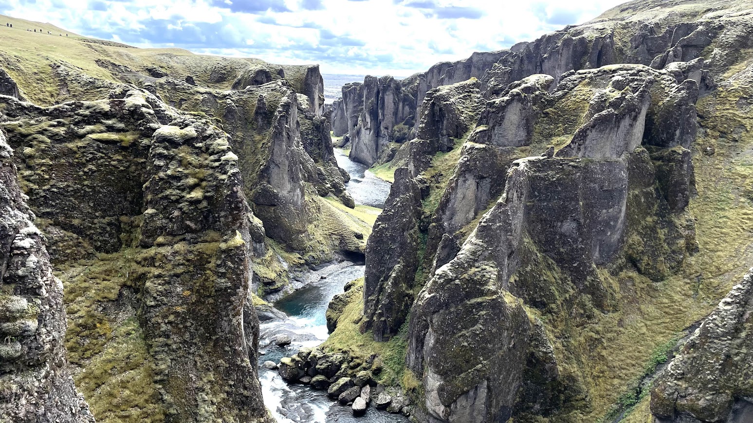
I'll close with this beautiful Iceland landscape. 


Coming soon.. Dolomite Alps and a geological conundrum.

Wednesday, April 20, 2022

Kolar Gold Field

Geology and Livelihoods #19

I came across this excellent documentary on the Kolar Gold Field via Twitter. The film is directed by Basav Biradar and produced by Sahapedia.

Email subscribers who are unable to see the embedded video can watch it here- In Search of Gold.


Like many established mining towns, Kolar too saw generations of the same family work in the mines. Son followed father into the dark shafts. Mining provided employment, but it was dangerous back breaking work. The documentary highlights the lives of workers and their struggle for better work conditions. 

Kolar gold is late Archaean in age with mineralization taking place between 2700-2500 million years ago. There are two types of deposits. There is a "stratiform sulphide type", so called because the gold bodies are contained within iron sulphide rich volcanic and sedimentary layers. These deposits formed on the sea floor contemporaneous with volcanism and sedimentation. The second type is a hydrothermal deposit wherein mineralizing fluids mobilized and precipitated gold in veins along N-NE oriented fracture zones. This mineralization event occurred at a later stage when magmatism and metamorphism affected the host terrain.

But do watch this for the many personal stories of the people who worked the mines. 

Tuesday, July 6, 2021

Coccolithophore Life Cycles and Calcite Morphology

Our world is full of examples of biological processes leading to exquisite geological products. And none more so than the one observed in the Coccolithophores. These are single celled marine algae. They produce crystals of calcite (CaCO3), which they use to create a shell around their tissue. The shell is called a coccolith. The amount of calcium carbonate used up in these shells is enormous. About 10% of global carbon is fixed in coccolithophores, making them an important carbon sink. 

The shapes of these calcite crystals vary enormously according to species, but also, as I found out in a recently published paper, on life cycle stages of the organism.

Coccolithophores have haploid (one set of chromosomes) and diploid (two sets of chromosomes) life cycles. In a haploid life cycle stage relatively simple rhombic crystals are produced in a vesicle inside the cell. The entire shell (holococcolith) is made up of an aggregation of such rhombic crystals. The diploid life cycle stage produces more complex mineral forms. Here too, the crystals are produced inside a vesicle or a compartment inside the cell, but scientists find that the development of shape may be mediated by silicon. The resulting shell (heterococcolith) is intricately shaped, made  up of a variety of crystal shapes in different species. The functional role of the shells could be varied. They may be providing mechanical stability, helping in maintenance of buoyancy, or in scattering harmful ultraviolet light in the upper column of the ocean.

Take a look at this magnified pictures of holococcoliths (a and c) and heterococcoliths (b and d). Scale bar: a and b = 5 micrometer. c = 500 nanometers. d = 1 micrometer.

Source: Role of silicon in the development of complex crystal shapes in coccolithophores: Gerald Langer et. al. 2021.

The prevailing thinking has been that the holococcoliths and heterococcoliths represent two independent origins of calcification. However, this study finds  that the calcite production sites in both life cycle stages are intracellular, and they likely use the same cellular mechanisms to transport ions, maintain calcium carbonate saturation levels, and to modulate the shape of the growing crystal by suppressing and enhancing specific growth directions. 

Based of this similarity in basic processes the researchers propose that the last common ancestor of this algal group must have had the ability to produce both holo and heterococcoliths. Holococcoliths being simpler represent the ancestral form of biomineralization in these algae. Initially, both haploid and diploid life cycle stages would have produced only holococcoliths. The haploid life stage retained this form of calcification. Subsequently, the diploid phase gained additional functionality to produce more complex crystals. Heterococcoliths thus evolved later in this ancestor,  recruiting silicon to mediate, in not yet fully understood ways, the production of varied crystal shapes. 

These algae acquired the ability to calcify around 250 million years ago. Interestingly, the simpler holococcoliths appear in the fossil record a good 37 million years later than the heterococcoliths. Scientist think that this could be an artifact of poor preservation of the simpler more fragile holococcoliths.

A parallel development in the marine realm has also had an impact on coccolithophores and other biomineralizing species. Another group of algae known as the diatoms started proliferating in the oceans in mid late Mesozoic by around 200-150 million years ago. Diatoms use silicon to produce beautiful skeletons. They progressively became efficient removers of silica from sea water. In the mid Mesozoic, large reefs built by the silica secreting sponges were common in the shallow marine settings. By late Mesozoic -Early Cenozoic times silica sponge communities shifted to deeper water and to higher latitudes, an ecologic displacement, some scientists think, forced by silica limitation in shallow tropical waters.  

By Cenozoic period diatoms had become the dominant silicon extractors from the upper layers of the ocean. So much so, that this diversion of silicon by diatoms impacted  Coccolithophores too. Many species stopped using silicon to mediate crystal growth, instead evolving alternate pathways to build their calcium carbonate shells. 

I love stories of the intricate interplay and feedbacks between evolution and geology. This is a theme I keep returning to. 


Monday, June 7, 2021

Liesegang Banding In Proterozoic Badami Sandstone

The Chalukya era (6th-8th CE) rock cut caves and sculptures at Badami in Karnataka are an archeological wonder. But there is plenty of geology there to admire. In January 2020, I spent some time wandering through Badami. The sandstone layers are 900 million years old river deposits. I wrote a long post about them, explaining the primary sedimentary structures that one can observe in these rocks, and what they tell us about the water depths and currents during deposition of the sediment. 

But these primary structures, i.e. sedimentary layer orientations that form during deposition, are not the only interesting features of these rocks. Chemical reactions in these sediments after their burial has overprinted an intriguing fabric on to the rock.

In the picture a very distinct dark and light banding is seen in one of the Badami rock surfaces. This is Liesegang banding. 

The dark bands are rich in iron oxide. The lighter bands have little or no iron oxide. Such banding forms by the mobilization of ions from one location in the sediment and their precipitation at another. Ions diffuse along a concentration gradient in the water filled pore spaces. Robert A. Berner's book, Early Diagenesis: A Theoretical Approach, has a good explanation for the formation of Liesegang banding. I am reproducing that below.

"Mobilization of different components of a substance can occur at two or more different locations. The best example of this is the formation of Liesegang banding.In Liesegang banding we have the interdiffusion of two dissolved ions which cab react with one another to form a relatively insoluble solid. The two ions can come from different sources and when their concentrations at a given site build  up, via diffusion, to sufficiently high values, precipitation of the insoluble solid occurs. This precipitation suddenly lowers concentration in the neighborhood of the solid, and as a result the diffusion profiles become altered. Continued interdiffusion results in a new build-up in concentration and precipitation at another site. Depending on the geometry of the situation, this process may result in Liesegang rings (3-dimensional), tubes (2-dimensional), or layers (1-dimensional). A common example of Liesegang phenomenoa are rhythmic bands of iron oxides often found in sandstones. In this case precipitation is most likely brought about by the interdiffusion of dissolved Fe++ (from an anoxic) source) and dissolved O2 (from an oxic source). Where the Fe++ and O2 meet, Liesegang banding occurs".

The iron (Fe++) would already have been present in the sediment perhaps in discrete grains of pyrite (FeS2), or trapped in carbonaceous plant debris.   Rainfall fed groundwater is the common source of oxygen.  As pyrite gets oxidized it releases Fe++ and sulphur ions. The ferrous ions get oxidized to ferric ions (Fe+++). These then nucleate to form iron oxide or hydroxides. Rapid diffusion of ions towards a growing crystal will eventually lower the concentration of ferric ions in the region surrounding the grain to below the nucleation threshold, at which point crystal growth stops. This threshold is reached at a different location where pyrite oxidation is releasing a fresh supply of Fe++. At this new location the concentration of ferric ions build up again to levels where they start nucleating into iron oxide. This migration of zones of dissolution (of pyrite) , diffusion, and nucleation results in the distinct banding. I've summarized this explanation from a paper by P. Ortoleva and colleagues on redox (reduction-oxidation) front propagation and formation of mineral banding.

Formation of redox fronts during the burial of a sedimentary rock can be economically important. For example, a certain type of sandstone hosted uranium deposit known as 'roll-front' occur where oxidizing fluids containing dissolved uranium meet reduced components such as pyrite or organic matter. 

Here is another close up of these Liesegang bands. They have a ring or a tube like geometry. The cross bedding indicated by the arrow is a primary structure formed by the movement of sand sculpted into ripples or waves on the river bed. The Liesegang bands have been imprinted over the cross beds subsequently. 

The chemical reactions that occur in sediment after their deposition are of great interest to geologists.  They play a large role in the reorganization of porosity and permeability through the dissolution and re-precipitation of minerals.Throughout the history of a sedimentary basin, fluids move through these pore networks mobilizing elements, and under favorable conditions, enriching them at particular locations. Geologists prospecting for metal and hydrocarbon deposits want to understand this process.


Thursday, June 3, 2021

Permian Seafloor Gardens Of Glass


In Metazoa:Animal Minds and the Birth of Consciousness, author Peter Godfrey-Smith describes the Hexactinellida, a group of sponges that construct hard parts made of silicon dioxide as a support for its soft tissue. In an earlier post I had written briefly about amorphous varieties of silica. The Hexactinellidae's skeleton is made up of opal, denoted by the chemical formula SiO2.nH2O. Sponges put together their skeleton using a variety termed opal-A , the A indicating amorphous. Over geologic time the amorphous opal-A often transforms by expelling water and re configuring the geometry arrangement of silicon and oxygen atoms to opal-CT and chalcedony, both silicon dioxide varieties showing the first glimmer of a crystalline structure.

Hexactinellida are popularly called the glass sponges because of their transparent silica frame. The basic elements of this skeleton are tiny rods or spicules which are joined to form dagger, star or snowflake like shapes. These then group together to form a hard mesh that supports the soft tissue. Upon death, the silica skeleton disintegrates, leaving a carpet of spicules on the sea floor. 

The sketches below are from Godfrey-Smith's book. They are drawings by Rebecca Gelernter of  sponges collected on the Challenger expedition of the 1870's.

One fascinating function of these glass elements could be as collectors of light. Sponges often have colonies of photosynthetic organisms like diatoms living inside them. The speculation is that the glass channels light energy into the interior of the sponge body, which the diatoms use as a power source for photosynthesis.

Glass gardens on the sea floor is an evocative way to describe these sponge communities. And occasionally in geologic history these gardens have proliferated on a scale that is simply hard to imagine. Some time back I read a very interesting paper by Edward J. Matheson and Tracy D. Frank on Late Permian age (~260 million years old) sedimentary rocks deposited on the northwestern shores of the supercontinent Pangea. Different sedimentary rock types were deposited in this long lived basin. One distinct layer, termed the Tosi Chert, contains significant amounts of chalcedony and chert. A closer examination revealed that these two silicon dioxide minerals were derived from a siliceous sponge precursor.

Scattered through these Permian rocks are 'ghosts' of spicules. The Tosi Chert was once a glass sponge garden colonizing a gently sloping sea floor.  It was staggering in scale. These sponge meadows extended over 75,000 sq km. To the east of these sponge habitats lay an arid Laurentian desert, Laurentia being the northern continent which had joined the southerly placed Gondwana to form the supercontinent Pangea. To the west was the subtropical epicontinental Phosphoria Sea. An epicontinental sea is a shallow sea that floods the interiors of continents during times of a global sea level high. Since siliceous sponges were the dominant benthos these depositional systems are called glass ramps, the latter term indicating a uniformly sloping sea bed. The paleogeographic map below shows the position and range of the  'spicule belt' (in orange) on the northwestern edge of Pangea.  The pale pink area is the desert.

Source: An epeiric glass ramp: Permian low-latitude neritic siliceous sponge colonization and its novel preservation (Phosphoria Rock Complex) Edward J. Matheson and Tracy D. Frank

The Tosi sponge communities lived during a time of sea level rise. The sedimentary variation within the Tosi Chert indicates that sponges occupied environments  ranging from subtidal settings to near shore tidal flats. In the open ocean subtidal regions the sediment was mostly sponge debris. Nearer to the shore the environments were more variable. Calcium carbonate mineralizing organsims such as molluscs lived in patchy zones. Abiogenic ooids formed in some areas. In other regions, currents transported quartz detritus from adjacent areas.  Wind blown silt size mica and iron oxide particles sourced from the eastern deserts mixed with the biogenic sediment. Landward, in shallow ponds and depressions, layers of gypsum precipitated from saline waters. 

These environments of deposition of the Tosi Member are depicted in the block graphic below. 

Source: An epeiric glass ramp: Permian low-latitude neritic siliceous sponge colonization and its novel preservation (Phosphoria Rock Complex) Edward J. Matheson and Tracy D. Frank

These conditions persisted for hundreds of thousands of  years. Eventually, sea level began to fall and the sponge communities began to die out. Calcareous biota replaced the silica sponges. The glass gardens were buried under layers of lime sediment.

Like an artist dismantling a patiently constructed exhibit of installation art, nature relentlessly ground up the delicate glass sponges and transformed them into rock. But this change took its own interesting route. 

As sea level dropped, a mosaic of tidal flats and lagoons developed. In the arid climate, high rates of evaporation resulted in the development of hypersaline magnesium rich brines. These denser pools of water percolated downwards through the shallow buried silica rich sediment. The magnesium calcium carbonate mineral dolomite started precipitating within the sponge rich sediment. Along with dolomite, the calcium sulphate mineral gypsum formed at places. 

The dolomite rich sediment then underwent another transformation. The opal skeletons of the sponges started dissolving. The released silica however did not diffuse away in to the open sea. Rather, the high amounts of released silica created zones of silica supersaturation within the pore spaces of the sediment resulting in the precipitation of chalcedony and chert. Silica got redistributed within the Tosi sediment package, first dissolving and then reprecipitating a few millimeters away. The new silica minerals were not spread evenly but formed compact masses giving the evolving rock a nodular appearance.    Here and there the original shapes of the sponge spicules were preserved, although they were no longer made up of opal, having being replaced by chalecdony and chert. 

The photomicrographs show examples of dolomite and silica nodule replacement of the original sponge skeletal debris. The pale area in the image to the left is a chert nodule with a diffuse boundary that gives way to a darker dolomite matrix. The image to the right shows a bioturbated dolomite rock with some chert replacement. Tiny lath shaped particles are ghosts of sponge spicules.

 Source: An epeiric glass ramp: Permian low-latitude neritic siliceous sponge colonization and its novel preservation (Phosphoria Rock Complex) Edward J. Matheson and Tracy D. Frank

Today the Tosi Chert is not that attractive or spectacular rock to look at. It is a few meters thick, has a grey to red to purple color and is made up mainly of  silica nodules and dolomite with minor amounts of quartz, anhydrite and gypsum. Layers of limestone, lithified from patchy molluscan and ooid sediment, interfinger with silica rich strata.

Calcium carbonate secreting organisms have been the most prolific biogenic sediment producers in Phanerozoic shallow marine settings. Siliceous sponges more commonly occur in deeper water and high latitude settings.  Occasionally though,  siliceous sponges did take over the shallow marine domain. The extensive Mid-Late Permian Pangean sponge belt is an example of such ecological opportunism, where silica rich sea water and nutrient availability resulted in prolific growth and persistence of sponge communities over vast areas of the northwestern Laurentian margin. Those majestic glass gardens, perhaps harboring photosynthetic symbionts are now gone, transformed to dull looking rock, but look closely and the ghosts of those long dead sponges are waiting to tell you their story.


Monday, May 10, 2021

Amorphous Precursors To Calcite Cements

Readers of this blog, I am sure, are familiar with terms like Agate, Jasper, Onyx, and Opal. Out of these, Opal is an amorphous variety of silica, where the silica and oxygen atoms are not attached to each other in a regular repeating geometrical pattern. Agate, Jasper, Onyx are varieties of silica that can show gradations from an amorphous form to being cryptocrystalline i.e. made up of tiny crystals. All these substances originate by hardening of a silica gel that congeals out of a silica supersaturated fluid which has separated from a magma, or from hydrothermal groundwater that has become enriched in silica by reaction with surrounding rock or soil. 

They occur as banded siliceous deposits, either as layers or as discrete nodules, in volcanic and sedimentary rocks. Amorphous silica can even be of biogenic origin. Planktonic creatures like Radiolarians have the ability to extract silica from sea water and use it to build its skeleton.

Posted below is a photomicrograph of a cavity in a sandstone filled with banded amorphous silica (center of picture). Notice the regular growth bands (left in plain polarized light)  and the silica fibers (in crossed nicols) that make up the fabric of the amorphous material. I happen to have this rock thin section in my collection , but unfortunately I don't know its provenance!

Transitions from amorphous to a fully crystalline silica (quartz) often occurs within the same rock cavity. Amorphous silica is quite stable and has been found well preserved in rocks hundreds of millions of years old.

In contrast, amorphous naturally occurring varieties of calcium carbonate seem to be exceedingly rare. In my more than two decades of following literature of sedimentary carbonates I have not come across a report of amorphous calcium carbonate cement or shell material. Until recently that is!

In the December 2020 issue of Geology, Sascha Roest-Ellis, Justin V. Strauss and Nicholas J. Tosca suggest that certain types of microspar cements in Tonian age Neoproterozoic limestones (~650 million years old), formed from an amorphous precursor stage. These microspar cements (fine grained calcite) are quite common in rocks of this time period, yet their mineralogical evolution and the geochemical conditions under which they formed is poorly understood. 

In an effort to understand the origin of these cements, synthetic sea water was prepared of a composition that was similar to that measured from fluid inclusions trapped in Neoproterozoic salt deposits. The finding was that the presence of PO4 above a value of 12 micromoles per liter inhibits the nucleation of crystalline forms of calcite and permits deposition of an amorphous Ca-Mg- Carbonate by production of dense liquid droplets once carbonate supersaturation exceeds a threshold value. Neoproterozoic sea water was rich in PO4 as evidenced by the trapped fluid inclusion composition and by calcium phosphate biomineralizing organisms of that age. 

The texture and chemistry of these microspars also suggest an amorphous precursor. The crystals have spheroidal cores which are likely remnants of immiscible liquid/gel particles that would have initially separated out from carbonate saturated sea water. The grain size distribution points to crystal growth by  Ostwald ripening, a process whereby smaller gel particles or droplets disaggregate and the chemicals are reconstituted into larger growing crystals. Furthermore, these calcites have an enhanced strontium content. Usually that occurs if they have originated from an earlier aragonite phase. But there is no sign of relict aragonite in these cements. An alternate explanation is the incorporation of strontium into an amorphous carbonate which also favors intake of strontium.

The amorphous phase does not exist today in these limestones, having recrystallized to a variety of calcite fairly rapidly, perhaps even within a few days or weeks of it forming. The photomicrograph below shows the microspar calcite hypothesized to have recrystallized from an earlier amorphous phase.

Source: Experimental constraints on nonskeletal CaCO3 precipitation from Proterozoic seawater - Sascha Roest-Ellis, Justin V. Strauss and Nicholas J. Tosca, 2020.

As it happens I've had two strikes in the past month. Subir Sarkar and colleagues in their analyses of the Cretaceous age Garudamangalam Sandstone from Ariyalur in Tamil Nadu mention that some cavity filling calcite cements developed from a gel, by which I assume they mean amorphous calcium carbonate.  But they don't pursue this aspect any further in their study. 

The absence of amorphous calcium carbonate is limestones, both ancient and recent, is likely because it forms under only very restricted chemical conditions where nucleation of aragonite and high magnesium calcite is inhibited by the presence of ions like PO4, and because its high reactivity results in it transforming quickly to crystalline calcite, erasing itself from the rock record. 

Geological discovery relies heavily on direct observation and measurements of rock/mineral material. But what about ephemeral substances? How does one imagine them and tease out their history? This study highlights the importance of experimental work in geology, where careful laboratory reconstruction of past conditions can throw light on mineralization pathways that have left no physical trace behind.

Friday, July 31, 2020

Map: The Deep Geological Cycle of Carbon

When I was a kid not so long ago in geologic time, my understanding of how diamonds are created went something like this.

In forests and swamps, large trees grew and died. The wood got buried under more wood and layers of sand and mud. The wood in the bottom layers under the influence of great pressure and higher temperatures got converted first to coal. As burial to greater depths continued, this coal turned first to graphite and then finally to diamond. The story of woody material turning eventually to coal and then to graphite was roughly correct, but this geological path doesn't lead to diamonds.

Most diamonds form at depths of about 150- 200 kilometers. Rarer varieties known as sublithospheric diamonds form even deeper down. The carbon required to make a diamond is transported from the earth's surface to those depths by a subducting plate. Subduction is the process whereby an oceanic plate made up of dense Mg and Fe rich rocks sinks into the mantle. The Marianna trench for example marks the place where the Pacific plate is sinking underneath the Japan Plate. Why can't coal then move into the mantle this way? It doesn't because coal deposits occur in continental settings where the crust is made up of much lighter rocks richer in Si, Al, Na and Ca. This continental crust is buoyant and does not subduct into the denser mantle. So there is no way for coal that began its journey in ancient river floodplain, bogs, and swamps to get directly transformed into diamonds.

The denser oceanic plate contains carbon from a variety of sources. The lower layers of the oceanic plate is made up of a Mg rich rock known as peridotite. Occasionally, faulting may bring this peridotite to shallower levels where it interacts with sea water and gets transformed into a rock known as serpentinite with calcium carbonate minerals also forming alongside. Carbon is trapped in minerals like calcite and dolomite. The upper layers of the ocean plate is made up of the volcanic rock basalt. It too interacts with sea water, with calcite precipitating in rock cavities. This becomes another source of carbon.

Then there is carbon which is part of the shells and skeletons of planktonic marine creatures. These tiny photosynthesizing organisms which live in the sunlight zones of the ocean precipitate a calcium carbonate skeleton. When the organism dies, these carbon containing skeletons sink and blanket the sea floor. This source of carbon is a relatively late addition in geologic history. Calcareous nanoplankton first appeared in the early Mesozoic, some 225 million years ago. Organic tissue of marine creatures can also get buried, making this another carbon source. And finally, carbon coated sediment washed into the ocean by rivers and then transported into abyssal depths by deep sea currents contribute some carbon to the oceanic plate.

Each oceanic plate has its own selection from this carbon menu, depending on its unique geologic history. For example, calcium carbonate starts dissolving below a depth known as the calcite compensation depth. Sea floor below this depth doesn't retain much skeletal debris. Or, oceanic crust that formed in the Cretaceous contains abundant calcite in veins and vugs, likely because the warmer Mesozoic oceans promoted calcite precipitation on the sea floor.

This beautiful map shows several subduction zones. In the map, SedCarb refers to skeletal carbonate, SedOrgC to organic carbon, AOC Carb to carbonate in altered oceanic crust, SerpCarb to carbonate in serpentinite rocks. The major source of carbon is identified by a particular geochemical signature. Mineral carbonate for example has higher amounts of the heavier isotope of carbon (C13), while carbon that makes up organic tissue is much richer in the lighter isotope (C12).


As the oceanic plate subducts carbon begins to get removed from the plate. Some carbon is removed when the sediment and altered oceanic igneous rocks are scraped off and plastered on to the sea floor. Such deposits made from scraped off sea floor are called accretionary prisms. They often poke out above sea level to form island chains. The Andaman Islands is an example of an accretionary prism that is made up of mechanically removed slices of the subducting Indian oceanic plate.

At greater depths, sediments and oceanic crust begins to be metamorphosed under higher temperatures and pressures resulting in the loss of carbon dioxide and water. This carbon dioxide makes its way into the overlying mantle and gets incorporated into magma. The spectacular volcanic eruptions along Japan, Indonesia, Caribbean and the Western North American coastlines are a result of the rising and depressurization of such volatile bearing magma. Some of the carbon in the belched out carbon dioxide has come from the burning of skeletons of marine organisms in the deeply buried plate underneath these volcanic systems.

A quantity of carbon does remain in the downgoing plate and reaches depths of 150-200 kilometer or more. The igneous rocks of the subducted plate gets altered to a dense rock known as eclogite. And at these temperatures and pressures, diamonds may form within these eclogites along carbon dioxide or methane rich domains. The subducting slab is also releasing some trapped carbon along with other volatiles which infiltrate the surrounding mantle. Diamonds can form in such metasomatized or fertile regions of the mantle as well. The main host rock here is peridotite. Subducted carbon is one source of carbon for diamonds.

Geologists think that primordial carbon retained in the mantle from when the earth formed may also be finding its way into diamonds.

Multiple sources perhaps, diamond forming chemical reactions can be summarized simply as driven by the reduction of carbon sourced from either carbon dioxide or methane.

CO2 = C + O2

CH4 + O2 = C + H2O.

From eclogite and peridotite parent rocks, diamonds are transported to the surface by an unusual magma type known as kimberlite and even less commonly by lamproites. These magmas are rich in volatiles like water, carbon dioxide, fluorine and chlorine and are also rich in magnesium. They are generated at the base of thick continental plates generally during episodes of continental fracturing. The volatile rich magma physically disaggregates diamonds from their parent rocks and carry them as they ascend through deep continent penetrating cracks with amazing speed, traveling 200 kilometers in a matter of hours, bringing to the surface its tiny but dazzling prize. The block diagram below summarizes the geological environments of diamond formation and their ascent.


The famous Panna diamonds from Bundelkhand in Central India came to the surface in a kimberlite magma eruption around 1 billion years ago. It is possible that its source carbon was transported from the surface to diamond forming depths hundreds of millions of years earlier, perhaps during the convergence and assembly of an earlier supercontinent.

Diamonds are often older than their host kimberlites by hundreds of millions to billions of years. During diamond growth, other minerals get trapped inside them as micro-inclusions. Their composition is therefore a record of the fluid chemistry of the mantle and the carbon cycle as it existed in deep time, billions of years before present.

Diamonds are one component of the deep geological cycle of carbon. We are familiar with the exchange of carbon between the atmosphere and the biosphere. Carbon is transferred to and fro in this system on a timescale of days to years to hundreds of years, but not much more. Longer geological sequestration of carbon occurs at shallower levels of the crust too. Soil can store carbon for thousands of years. Carbon can get trapped for millions of years in carbonate minerals that make up limestone and also in coal and oil. It is this shallow crustal carbon cycle that we are breaking by burning limestone and fossil fuels.

The deep geological cycle can take carbon from the surface and keep it in the mantle for hundreds of millions of years. The mantle releases it through sustained volcanism thus modulating earth's climate on long time scales. And occasionally as a return gift it throws up a few diamonds as well.