Wednesday, December 28, 2022

Holiday Readings: Ancient Amputations, First Americans, Fossil Molluscs

Wishing my readers a very Happy New Year! I hope these readings will be to your liking.

1) Can ancient amputations tell us about the care systems of our ancestors? Paleoanthropologist John Hawks surveys the fossil record of ancient humans for signs of severed limbs due to trauma or disease. He also presents cases of limb loss in other primates and offers a perspective on what all this can tell us about past social systems. 

"Both humans and nonhuman primates show us that survival and life after extreme injuries happen under varied circumstances. Bioarchaeologists tend to highlight severe injuries, which stand out from the more subtle patterns of osteological signs of disease that can be understood only across large samples of skeletons. But such individual stories rarely yield unambiguous interpretations".

2) Finding the First Americans. Anthropologist Jennifer Raff brings together often conflicting genetic and archaeological data on this ever vexing and complicated question of how the Americas were populated. 

3) Finding Molluscs. This podcast (with transcript) is part of an excellent continuing series of earth science and paleontology podcasts by Mongabay India. In this episode, host Sahana Ghosh talks with paleoecologist Devapriya Chattopadhyay on her research on fossil molluscs. Dr. Chattopadhyay uses these creatures to track ancient environmental conditions and ecology. She also speaks on the urgent need for India to create a national fossil repository and museum which will help preserve our deep history for future generations.

Tuesday, December 13, 2022

Links: Fire Use, Deep Water, Europa Geology

Sharing some interesting readings:

1) The Discovery of Fire by Humans. Jungle Book's primate king Louie was certainly aware of the transformative power of fire. As J.A.J Gowlett writes in a very informative review, many animals engage in fire foraging, opportunistically increasing their access to resources made available by natural fires. Early hominins too would have interacted with natural fires. The archeological record informs us that human engagement with and ultimately our control over fire was a long and convoluted process with evidence for early fire use going back to 1.5 million years ago. And would you believe it if I told you that the earliest preserved human fingerprint may be 80,000 years old and documents fire use? It was imprinted on a lump of pitch which is made by prolonged heating of tree bark. Pitch was used as a fixative in hafting. Fasinating stuff.  

2) The Deep Cycle of Water: Every schoolkid is taught about the hydrologic cycle wherein water moves between the atmosphere and shallow surface reservoirs. But water is present much deeper inside the earth, in fact it is present thousands of kilometers deep. It occurs not as free flowing H2O, but is incorporated inside the atomic structure of minerals as OH anions. It can escape this prison when minerals dehydrate during metamorphic reactions. The released water then rises and is expelled at the surface via volcanoes. In an alternate pathway, carried by sinking pieces of tectonic plates, water can reach even deeper in the earth, affecting the properties of the lower mantle and even the core. A short summary in Nature Geoscience on the state of our knowledge about this topic. 

3)  Plate Tectonics on Europa. The earth's outer silicate shell is broken up into tectonic plates which move around and jostle driving geologic activity and transforming the surface through geologic time. Scientists are looking to Jupiter's moon Europa and finding that its icy shell shows features indicative of intermittent plate motions, although the driving mechanisms will be different.  In Phys.Org, by Morgan Rehnburg. 

Thursday, November 24, 2022

Mid Oceanic Ridges: Geodiversity And Biodiversity

Mid Oceanic Ridges. Unlike continental mountain chains, these undersea mountain ranges are invisible to our day to day gaze. 

Yet, they are among the most dynamic of geologic features. They form where tectonic plates split and move apart, and new ocean floor is generated by upwelling magma. Sea water percolates through the cracks in this new crust, heats up in the subsurface and then rises carrying with it gases and metals. These vigorous hydrothermal circulation systems provide a link to exchange chemicals between the mantle and the crust. Varied microbial and macrofaunal communities colonize these environments depending on proximity to magma, the strength and chemistry of hydrothermal systems, and the nature of bedrock composition and fault controlled topography. 

Some specific geologic settings, those with serpentinite rocks,  have recently attracted great interest because they are thought to have provided the right combination of heat and chemicals to stimulate pre-biotic chemistry and the origin of life.

Gretchen L. Früh-Green and colleagues review this fascinating underworld, bringing out, both, the diversity of geologic processes at work and the resulting biodiversity that depends on this varied geology and energy supply. The introductory paragraph shared below gives an idea of the importance of this geological environment.

"Mid-ocean ridge (MOR) systems extend approximately 60,000 km around the globe and are the most dynamic and continuous tectonic feature on the planet (Fig. 1). On average, about 3.3 km2 yr−1 of new oceanic crust is generated at global spreading centres, which account for >70% of the total volcanism, and where about 60–70% of the Earth’s surface has been produced over the past 160–180 Myr (ref.2). Mantle melting, volcanism and faulting at MORs drive hydrothermal circulation that allows the transfer of heat, chemical compounds, metals and volatiles from the asthenosphere to the hydrosphere and biosphere. Approximately 75–80% of the Earth’s total heat flux occurs as the oceanic crust ages, and it is most pronounced at ridge flanks, where low-temperature fluid flow continues off axis for millions of years and contributes to global biogeochemical cycles. It is estimated that the volume of the ocean circulates through the oceanic ridge system in much less than 1 Myr (ref.6).

Spreading centres are one of the most extreme environments on Earth that can support oases of life at high temperatures and thriving in perpetual darkness. Microorganisms obtain energy from magmatic gases and chemical compounds of altered oceanic crust, rather than from light, through a process called chemosynthesis. In turn, many of these microorganisms symbiotically sustain macrofaunal communities that populate hydrothermal vent environments. The microorganisms with the highest known growth temperature on Earth are found within MOR hydrothermal systems and investigation of their genetic diversity has changed the current view of the tree of life".

I have put the last sentence of the first paragraph in bold to highlight the scale of this geological system. This is rich and rewarding reading. The paper is open access.

Gretchen L. Früh-Green, Deborah S. Kelley, Marvin D. Lilley, Mathilde Cannat, Valérie Chavagnac & John A. Baross: Nature Reviews Earth & Environment- Diversity of magmatism, hydrothermal processes and microbial interactions at mid-ocean ridges.

Thursday, November 10, 2022

Milam Glacier Trail - Geology

Geology enthusiasts will find the Milam Glacier trail captivating. The river Goriganga emerges from the glacier and flows in the Johar valley in this region. I walked the trail in Mid October, and came across a variety of geological features of interest. The trail begins in the village of Lilam, just north of the town of Munsiyari in the Kumaon region of Uttarakhand. It passes through the steep Greater Himalaya, and later northwards, through the Tethyan Himalaya.

The map below, intended more to show the geological set up, shows the trail as a red line. It depicts the trail only until Rilkot. Milam, the end of the trail,  is about 20 km north of the extent of this map.  

The Greater Himalaya (GH) and the Tethyan Himalaya  (TH) are two thick slices of the Indian crust which were moved southwards by great thrust faults as India collided with Asia about 50 million years ago. Both the GH and TH are made up of sequences of rocks that formed on the northern margin of the Indian plate over a vast period of time. The rocks range in age from the Proterozoic to the Eocene (1.8 billion to ~50 million years old) The GH consists of rocks which were buried to great depths during the India-Asia collision and metamorphosed at high temperatures and pressures. On the other hand, the TH rocks experienced only shallow burial and show a light metamorphic imprint while retaining many of their primary sedimentary characteristics. 

This post is mainly a visual journey intended to help trekkers make sense of the geology they will encounter along the trail. Short explanations accompany the pictures and videos. 

The map above shows three major fault zones. All three dip (tilt) north.  In Munsiyari, while you wait for your trekker permit to get processed, walk down the main bazaar road towards the petrol station. Keep a watch for the rock outcrops on your right. These are limestones of the Lesser Himalaya caught up in the Munsiyari Thrust Zone, the southernmost of the faults in this area. 

The picture collage shows the deformation in the fault zone rocks. Shearing along the fault has produced a shiny smooth surface and a mica like character to the bedding surfaces. They will feel like talc to the hand, or like porcelain. Sedimentary layers also show folding and striations, two typical deformation features along faults.

This rock below,  know as augen gneiss,  is one of the iconic rocks of the Munsiyari area. It is among the oldest dated rocks in the Himalaya, estimated to be between 1.9-1.8 billion years old. While the limestones near the petrol station are positioned below the fault plane (footwall), the augen gneiss is part of the hanging wall (above the fault plane) of the Munsiyari Thrust. Notice how the white feldspar grain (porphyroclast) is deformed into a sigmoidal shape. The feldpar is an inch in length. White arrows denote the sense of motion along the fault.The Munsiyari Thrust, as is the case with other major thrust faults in the Himalaya, shows a primarily "top to the south up" sense of shear. This means that the thrust direction is southwards.


 From Lilam, at the start of the trail, you will pass through another great fault zone known as the Vaikrita Thrust or the Main Central Thrust. The MCT carry the Greater Himalaya rocks in its hanging wall. Due to soil, scree and vegetation it is hard to see fresh rock outcrops. The picture shows the general disposition of the GH and their appearance (taken from a construction site near Lilam). These banded rocks are called gneiss and they formed when sedimentary rocks were subjected to high temperatures and pressures.


A few kilometers ahead near Bugdiyar, the Goriganga has cut a narrow gorge. It is an awe inspiring site! Check out this video. Permanent link - Goriganga Near Bugdiyar

A road is being constructed between Lilam and Milam. Sections of it coincide with the old trail, while in other parts you can avoid the road and walk the old route. Ahead of Bugdiyar, from Nahardevi to Laspa, I walked along the new road which has exposed some amazing rocks. Here, you are walking along rocks which were buried to 20-25 kilometers depth and then exhumed! Conditions were so extreme, reaching more than 800 deg C,  that the sedimentary/metamorphic rocks partially melted to form a rock with igneous and well as metamorphic features. These mixed rocks are known as migmatites. 

The video shows a rock wall with migmatite gneiss. Notice the white bands which is the melt (leucogranite), while the darker layers are the source metamorphic rock. The video spans about 25 feet. Permanent Link - Migmatite Gneiss Nahardevi


Another close up of leucogranite cutting across (dike) gneiss layers. The leucogranite magma then gets injected parallel to the layering or foliation, forming a sill (topmost light colored layer).The gneiss layers are about 2-3 feet thick. 

Ahead, in the Laspa area, you walk across the northernmost of the great fault zones, the South Tibetan Detachment System, also referred to as the Trans Himadri Fault. Across this zone, you will notice a change in the metamorphic grade. The gneiss and migmatites give way to low grade metamorphic rocks like slate and phyllite and quartzites. 

The pic shows an outcrop of carbonaceous slates and quartzites intruded by leucogranite (vein is 6-10 inches in width).  The dikes and sills of leucogranites become rarer as you walk northwards and finally disappear by the time you reach Rilkot village. The rocks from hereon along the trail are part of the Tethyan Sedimentary Sequence.


From Rilkot you enter a landscape profoundly shaped by glaciers. The advance and retreat of glaciers since the Last Glacial Maximum (20,000 years ago) has left behind characteristic glacial deposits. The two prominent types of glacial deposits seen throughout this part of the trail are lateral moraines and glacial outwash terraces. Lateral moraines is debris carried by glaciers along the walls of the valley. They are recognizable as linear ridges. Outwash terraces form when glaciers retreat and the meltwater carry and deposit sediment across the valley forming a plain. Subsequently, the river cuts down through these deposits, leaving flat topped terraces high above the active river bed. For more reading on this topic do refer to Nawaz Ali and colleagues work on the glacial history of the Goriganga Valley.

The pic below shows the Goriganga at Rilkot. LM denotes a lateral moraine of the Shalang Glacier (from a side valley near Martoli). Its age is uncertain but some scientists estimate it to be a relict of a glacial advance that took place before the Last Glacial Maximum. T refers to a glacial outwash terrace formed during a period of deglaciation about 12,000 years ago. 


Deglaciation between 16,000 years ago and 8,000 years ago resulted in two pulses of sediment deposition. Near Tola village remnants of these two episodes of terrace formation can be clearly seen, marked T1 (younger) and T2 (older).


 The video below shows a delightful steep climb up the Martoli terrace, a few km north of Tola. Erosion along the sides of the terrace has carved out the pinnacles you can see at the top. Permanent Link - Martoli Terrace.  

There are some structurally interesting outcrops of Tethyan strata near Milam. The picture shows steeply dipping near vertical beds which are folded (bracketed by yellow lines). This location is just before Milam village.


 Ahead of Milam village is this nice closeup of folds in slates and phyllite grade rocks. The picture spans about 15 feet in width. The Tethyan Sedimentary Sequence is part of a fold and thrust belt that formed in the early stages of Himalaya mountain building. 

Keep an eye towards the path from Milam village to the glacier. Strewn higgledy-piggledy is multi-colored rubble from various types of sedimentary and low grade metamorphic rocks. These are affected by multiple sets of fractures. I suspect that they come from a fault zone high up and unfortunately inaccessible to most trekkers. I have put together a collage of these pretty looking boulders.


Here is a map of the trail between Rilkot and Milam along with the geological divisions. You can use this to anticipate what type of terrain you are on. Expect to see high grade metamorphic rocks and leucogranites if you walk westwards, as for example towards Nandadevi Base Camp. And you will see sedimentary and low grade metamorphic rocks if you explore the side valleys to the east. 

Source: Nawaz Ali et.al. - Chronology and climatic implications of Late Quaternary glaciations in the Goriganga valley, central Himalaya, India

 As you gaze towards Milam village from a distance two distinct outwash terraces can be clearly seen. Here marked T1 (younger) and T2 (older).

This photo of Milam Glacier shows two beautiful lateral moraines. Notice these have a sharp crest suggesting there are young in age (compare with the LM near Rilkot). They are thought to have formed as recently as the Little Ice Age just a few hundred years ago!  

This trail is a gift to geologists. I did a rather quick nine day walk through the main trail and noticed so much interesting geology. Along this path are vestiges of processes that occurred at different times and at different levels of the crust, from rocks that formed in a seething hot metamorphic cauldron that existed during the peak of Himalaya orogeny 20 million years ago, to glacial deposits from the historical Little Ice Age when children skated on the frozen  Thames River and much of the northern hemisphere experienced intense cold phases.  

A final nod to this fantastic journey. Spectacular leucogranite dikes and sills intruding gneiss on the stretch between Nahardevi and Laspa. 

There is much left to explore. I will be surely going there again.

Monday, October 31, 2022

Milam Glacier Trail - Landscapes

Earlier in the month from October 10th to October 18th, I walked the Milam Glacier trail in the Kumaon Himalaya, Uttarakhand. A four day walk through the Johar Valley from Lilam village near Munsiyari to Milam took me past some fantastic landscapes and geology. 

After an initial breathtaking climb which takes you from about 6000 feet at Lilam to more than 9,000 feet at a high ridge known as Mainsingh Top, the trail descends towards the Indo-Tibetan Border Police outpost at Bugdiyar. After this, a gradual ascent takes you higher, with the rest of the walk undulating between 10,000 to 11,000 feet ASL. I was lucky with the weather. After walking the first two days in belting bone chilling rain the skies cleared and I was treated to some gorgeous views of the High Himalaya. 

I am posting a few pictures of the landscapes along this scenic route. The pictures are roughly ordered from the start towards the end of the trail.

The Greater Himalaya near Bawaldhar, a small resting stop which we came across on the first day.

Another view of the Greater Himalaya in the vicinity of Bugdiyar. Notice the steep slopes, narrow valleys and the sheer rock faces and the cascading Goriganga river. 

A lovely rough trail near the Laspa area. The October colors really makes the landscape radiant. 

After Laspa, the Greater Himalaya made up of high grade metamorphic rocks give way to the low grade metamorphic and sedimentary terrain of the Tethyan Himalaya. You do notice a change in the topography from the sheer steep slopes and narrow valleys typical of the Greater Himalaya to the wider valley forms and gentler gradients of the Tethyan domain. 

The Goriganga at Rilkot. The river is more serene here making a soothing gurgling sound as it flow past. Also check out the gorgeous longitudinal gravel bars in the river channel. Permanent Link: Goriganga at Rilkot.  


The high meadows of Martoli. This is a beautiful if desolate place with stunning views of the high Himalayan all around. 

A lone resident of Burfu surveys his kingdom. Most of the villages were empty of people as residents had migrated to lower altitudes for the winter. The flat plateau seen in the background is a glacial outwash terrace. It was formed by streams redepositing debris that accumulates in front of a glacier. Thick layered river deposits create a plain in front of the glacier. At a later point in time, the river cut through its own deposits, forming flat terraces stranded high on the valley slopes. 

Encounter on a lonely trail. After walking alone for hours, it is always fun to meet the locals travelling between villages. We met this small caravan between the settlements of Burfu and Bilju. Permanent link: Encounter at Bilju.

 A house in Milam village basks in the October sun. 

The Goriganga snakes its way down Milam Glacier through the fabled Johar Valley. This location is a few kilometers downstream of the glacier. 

Near Milam Glacier! The actual glacier is about 4-5 km upstream of this location, but this is a good photo spot along the trail.

What a trip! I think late September to early October is really the best time to visit this area. The countryside is lush and you get clear views of the Himalaya. The local residents have still not migrated to lower altitudes and you can get to enjoy their company in the many hamlets along the way. However, this year, rains continued well into the second week of October. I feel with climate change there will be a greater unpredictability to October weather in the future.

Finally, a big thank  you to Emmanuel Theophilus, Malika, Kamala Pandey, and Munna Singh Nitwal for being such gracious hosts and making my trip so memorable.

A post on geology tips for trekkers is coming soon... 

Monday, September 26, 2022

Readings: Earth's Ice, Neanderthal Women, Indian Monsoons

Some good stuff from the past few weeks.

1) How much of the Earth's Ice is Melting? Sid Perkins writes about the variety of methods of estimating ice loss from the high latitudes. These methods are showing where and how much melting is taking place, in turn, helping scientists make predictions of future sea level rise. The overall scenario is rather gloomy. 

2) The Lives of Neanderthal Women. "Archaeology is no exception to biases against women’s interests across science and the humanities". Archaeologist Rebecca Wragg Skykes expertly constructs a picture of what the lives of Neanderthal women might have been like.

3) Indian Monsoon Across Millennia. Stalagmites from a cave in Meghalaya, NE India are giving paleoclimatologists information about monsoon variability over a thousand years. Their geochemistry points to periodic deadly droughts that coincide with phases of major social and political turmoil in India. Paper authors Gayatri Kathayat and Ashish Sinha describe their research. 


Wednesday, August 31, 2022

LInks: India Aquifers, Early Bipedalism, Mars Geology

 Here are some interesting articles I read recently.

1) Mapping India's Aquifers.  Indian agriculture depends heavily on groundwater. To understand and manage this resource we need a good idea of the nature and extent of aquifers. Subodh Yadav, Joint Secretary, Department of Water Resources, River Development and Ganga Rejuvenation, Ministry of Jal Shakti, has written an informative article on the National Aquifer Mapping Program. Detailed reports are available to the public through the Central Ground Water Board, Aquifer Information and Management System page. Mapping and report availability is still work in progress.

2) Is Sahelanthropus the earliest biped? A good article by Brian Handwerk on the many questions spawned from a recent analysis of a 7 million year old femur fossil. Fossil remains named Sahelanthropus tchadensis were found nearly 20 years ago in Chad, and various studies have come to conflicting conclusions on whether Sahelanthropus could walk on two legs. Bipedalism is considered to be one of the key traits distinguishing members of the human branch from other apes and so there is a vital interest in understand the timing and circumstances of its evolution. 

3) Ground Penetrating Radar images from Mars Perseverance Rover. The indefatigable Mars Rover loaded with geological instruments is currently exploring the edge of the Jezero Crater on Mars. Here, rivers emptied into a large lake depositing sediment and building a delta. The first radar images show inclined sedimentary layers which could be the classic sign of a delta architecture or something else, scientists suspect. Read on! By Holly Ober, University of California, Los Angeles.

Friday, August 12, 2022

Readings: Deep Time Mexico, Neanderthals, Early Mammals

Relish these articles.

1) Mexico City Deep Time Sickness.  Modern day Mexico City is built on the bed of lakes that formed around 2 million years ago. The Mexica people in the 14th century constructed a series of dams and dykes partitioning salt water and fresh water areas. They developed agriculture called as 'chinampas' on islands made up of mud and organic debris. This region became the city state of Tenochtitlan. Later in the 16th century this vast lake was drained by Spanish Conquistadors. Over time, extraction of groundwater is causing compaction of the soft sediment. The ground is subsiding unevenly across different parts of the city. Ground shaking by frequent earthquakes is making the problem worse. As cracks grow and widen, buildings tilt, and the ground shakes, the citizens have become acutely sensitive or "tocado" to geology altering their everyday lives.

"Deep time is often framed as something antithetical to immediacy, something totally separate not only from everyday experience, but also the idea of history itself. But if we are living in a moment in which experiential time, historical time and deep time are colliding, which of these times are being written onto the walls of Mexico City apartments?

A beautiful and unnerving article by Lachlan Summers.

2) Did Neanderthals Speak? Archaeologist Anna Goldfield summarizes our current state of understanding of the throat anatomy of Neanderthals and how they might have sounded. There is a nice audio clip too! 

3) Warm Blooded Mammals. When did warm bloodedness or endothermy evolve in mammals? Katherine Irvine writes about a new study of ear canal bone structures indicative of endothermy. An analysis of fossils suggest that warm bloodedness, along with a host of traits typically associated with mammals, arose by around 233 million years ago. 

Monday, July 25, 2022

Field Photos: Italy Swiss Alps

A friend recently went for a trek to the Italian and Swiss Alps and sent me these stunning photos.

All Alps pics by Dr. Sushma Date.

A view along the Santa Magdalena or the Alp Suisse trail.

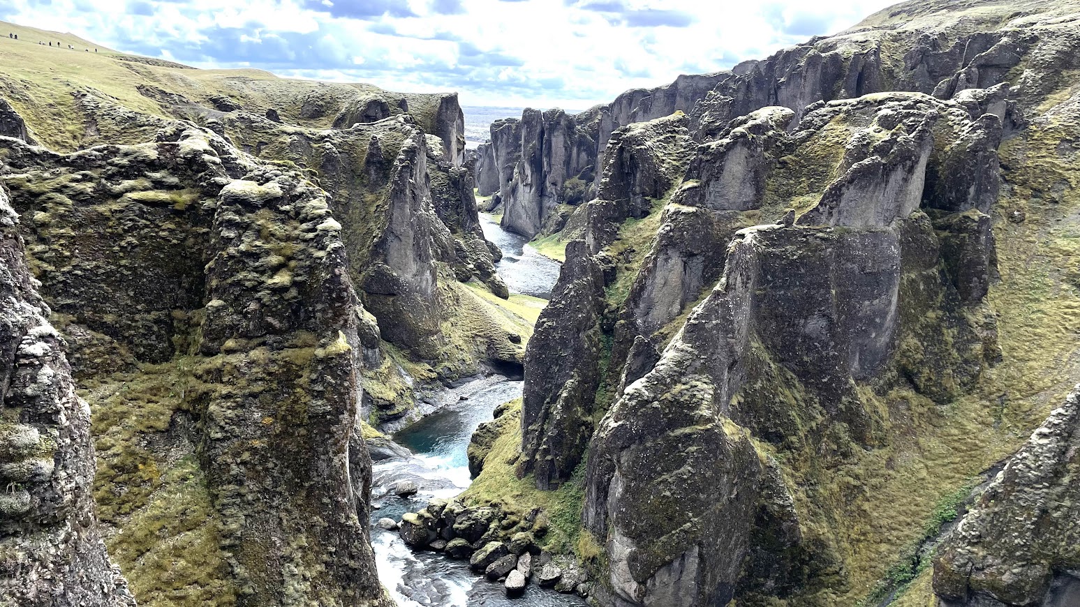
Imposing Pinnacles along the Tre Cime di Lavaredo hike in the Italian Alps.


 A close up of limestones and dolomites in the Italian Alps.


 A panoramic view of the distinctive landscape along the trail.


There is so much to see here in terms of geomorphology and how glacial erosion throughout the Quaternary Period has carved out the terrain. But my friend was also walking past rock outcrops that stand witness to one of the most enduring debates in sedimentary geology: the origin of that distinctive layering in these sediments.

The section of the Alps my friend was trekking in is made  up of Middle to Late Triassic age (225 -200 million years ago) limestones and dolomites. They formed in the warm tropical waters of the western Tethys Ocean. A closer examination of the layering reveals that the sediments were deposited in two broad subenvironments of a shallow sea, the intertidal zone and the subtidal zone. Intertidal and subtidal sediments alternate to form a depositional pulse or a cycle. Such couplets are stacked to form the thousands of feet of strata observed in this part of the Alps.

What could be causing the alternation of the intertidal and subtidal environments? Thick intervals of these Triassic deposits are made up tidal mud flats overlain by restricted lagoon sediments, or tidal mud flat overlain by open circulation subtidal environments, or lagoon deposits overlain by mud flats. When beds are traced laterally, these same environments grade into each other. Such inter-fingering arrangements suggest that environment adjacent to each other migrate, resulting in a vertical succession of alternating sediment types.  

Geologists recognize that such changes can be 'áutocyclic', driven by mechanisms internal to the sedimentary basin. A site of biological productivity and sediment production may choke itself by overproducing sediment. The loci of sediment production may shift to a more favorable site. Episodic storms keep redistributing sediment and reorganizing current directions . Such feedbacks result in similar environments appearing and disappearing from any one location, resulting in a cyclic sedimentary record. 

There are also successions of strata in the Triassic Alps which show a very different arrangement of sediment types. In this variation of cyclicity, intertidal mud flats may be overlain by relatively deeper water subtidal sediments which in turn are overlain by a red soil layer. The formation of soil on top of subtidal sediments deposited in water depths of up to 10 meters or so indicates a substantial drop in sea level. The top of the exposed subtidal layer was then chemically weathered to form a soil. 

Autocylic shifts in environments are gentle nudges which push one environment over another. They can't generate such a big drop in sea level. There must be drivers external to this environment that may cause sea level to rise and fall at regular intervals. These external agencies or  'allocyclic' mechanisms have been invoked to explain parts of these Triassic sequences. 

What could be controlling the regular rise and fall in sea level? Long term (over millions of years) tectonic subsidence of the basin floor certainly would have created the accommodation space for the accumulation of sediment. However, geologists look toward a different mechanism to explain the repeated deepening and shallowing events observed in these Triassic strata. 

Climate change can cause regular shifts in sea level. During the past 2.6 million years of the Quaternary ice age, sea levels have fallen by as much as 100 meters during phases of continental glacier growth, and risen during inter-glacial times when ice sheets melt. These changes have taken place at intervals of 400,000 years in the early part of the Quaternary, changing to beats of 100,000 years over the past million years. Sea level changes due to growth and decay of continental glaciers are termed glacio-eustacy. Unlike autocycles which can have variable time spans, there is a fixed periodicity to these climate driven allocycles. 

We now know that these climate cycles are controlled by periodic changes in the earth's orbital parameters which cause cyclic variation in the amount of incoming solar radiation. Such Milankovic glacio-eustatic cycles, named after the Serbian mathematician who worked out the details of earth's orbital behavior, have been recognized during other times of widespread glaciation such as the Permian. 

Milankovic worked out that there are three types of orbital movements that affect how much solar radiation reaches the top of earth's atmosphere. The shape of the earth's orbit or eccentricity cyclically varies with a period of 100,000 years and with a longer period of 400,000 years. Obliquity, or the tilt of the earth's axis with respect to its orbital plane, changes every 40,000 years. The third type are Precession cycles of 26,000 years. This is the wobble or the direction the earth's axis points to.

The Triassic though was a very hot world! The earth's land masses, amalgamated in the supercontinent Pangaea, were situated across the equator. There were no continental glaciers to wax and wane and drive sea level change. Glacio-eustacy is not a workable explanation for these cyclic Alpine sedimentary sequences.

Of late many geologists have started pointing to groundwater storage in continental aquifers as a means of causing periodic sea level change. It does sound like a fantastical idea! Such groundwater mediated sea level changes go by the name of aquifer eustacy. Milankovic climate cycles may not trigger glaciation during hot earth periods. But they can modulate long lasting humid and arid phases, each lasting tens of thousands of years. Sea levels are lowered during hot humid phases as oceans lose water by evaporation while continental aquifers get recharged. During arid phases, water is lost from aquifers by evapo-transpiration and discharge, resulting in a rise in sea level. 

An inverse phase relationship between groundwater level and sea level is thus an expectation of aquifer eustacy.

There is enough water in continental aquifers to modulate sea level change of several meters. Here is an impressive statistic. There is approximately 25 million cubic kilometer of pore space in the upper 1 km of continents above sea level.  If this is completely filled with water, the amount will equal the volume of water in continental ice caps. Even a small fraction of these pore spaces actually getting filled with water or emptying of it can change sea levels by several meters. 

Recent short term measurements of the hydrological cycle supports the notion that groundwater storage can influence sea level. For example, very high rainfall over Australia and part of the southern Hemisphere in 2011 resulted in a drop of 7 mm in global sea level that lasted a few months. And the Gravity Recovery and Climate Experiment satellite data since 2002 indicates that increased land water storage has actually slowed down the rate of sea level rise by a small amount.

Can some of the Triassic sedimentary cycles of the Alps be attributed to aquifer eustacy? How can one track periodic groundwater change in geologic history and test whether they coincide with sea level changes? One proxy is to use lake sediments of the same age as marine sequences.  Lakes are connected to aquifers.  High lake levels are indicators of saturated aquifers. Lake levels drop as aquifers discharge. Geologists have been studying Late Triassic age lake sediments from the Newark Basin in  northeastern U.S. They have identified sedimentary cycles formed during alternating humid (high lake levels) and arid climate (low lake levels) phases. 

The broad time span of these lake sequences coincide with the time frame of some thick intervals of marine sedimentary cycles of the Alps. Whether individual lake and marine cycles are out of phase could not be worked out due to limitations in age resolution of strata. However, a Milankovic band 400,000 year periodicity has been estimated for these cycles, a finding strongly suggestive of  climate driven eustacy.  From another time period, some analysis of  Cretaceous age lake sediments of Songliao Basin of NE China indicated lake level highs coinciding with global sea level lows. This finding also hints that aquifer recharge and discharge may be primarily responsible for periodic sea level changes during a greenhouse earth when there are no continental glaciers to modulate sea levels. 

Such questions continue to be asked and the mechanisms behind generating sedimentary cycles of the Triassic has by no means been satisfactorily worked out. There are many types of cycles in the Triassic Alps, observed R.A. Fischer, whose seminal work in the 1960's opened up avenues of debate that continue unabated. Perhaps it is the spectacular setting and stark rock faces that lend themselves to bold hypothesis making, linking sedimentary rhythms to the celestial dance of our planet.  

Thursday, July 14, 2022

Field Photos: Iceland

More pictures arrived from different parts of the world. My friends visiting Iceland and the Alps sent me some stunning photos of landscapes and geology. 

Iceland. 

All pics by Biju Mohan.

Lava flows forming gentler slopes and steep rock faces. Notice the rough columnar jointing in the upper lava flow.

Where basalt plateau meets the sea. Cliffs and a wave cut platform.

Volcanic cone and crater.

A fissure or a crack through which lava would have poured out. These are present all over Iceland.  

Iceland predominantly has basalt volcanism, broadly the same rock type as the Deccan. It is one of the few locations where the Mid-Atlantic spreading center is exposed above sea level. This is a divergent plate boundary, where the European and North American tectonic plates (along with some micro-plates) are moving away from each other.

Biju asked me an interesting question; "Did the deccan area looked like present day Iceland sometime in the past? Is there evidence for numerous volcanoes in the Deccan?

Yes, a young Deccan volcanic terrain would have looked similar to Iceland in some aspects. Since in both places, the crust was pulled apart by extensional forces, long fissures or cracks formed and were the main passageways for magma to come to the surface. These fissures from where lava came out would have been visible in a young Deccan. They have eroded away now. What is left are dike swarms, essentially cracks plugged by sheets of magma. Many of these dikes represent the feeder passages from which lava ascended to the surface. So, an exhumed lower level is now visible. Volcanic cones would also have been visible. These have mostly been eroded away in the Deccan.

As such Deccan would not have seen the development of very large steep cones, since the lava type is runny, and does not pile up much to build cones. Iceland though, besides basalts,  has more of a silica rich sticky lava type, with more explosive volcanism,  and a more pronounced development of steeper volcanic cones. Remember the Eyjafjallajökull volcano that erupted in April 2010?

Fresh lava fields would have been clearly demarcated. In young volcanic terrains it is easier to pick out discrete eruptive episodes. Lava fields erupting from different vents overlap. Slightly older lava will change color due to weathering and also get colonized by plants. Fresher lava fields will be barren and likely steaming as well! In the much older Deccan , erosion has erased such differences. Exhumation doesn't always expose a pristine surface, rather a patchwork of vertical sections where one gets a two dimensional view is the common outcrop pattern, making recognition of such lava fields challenging to the untrained eye. 

Another similarity would have been the presence of active hydrothermal systems. Today, the Deccan volcanic system is extinct, but 65 million years ago, groundwater would have been heated by flowing through hot rock and proximity to magma. Fumaroles and hot springs would have been a common phenomenon. I have been collecting secondary minerals from the Deccan Traps since my college days, and I would have loved to have wandered through a young Deccan volcanic terrain, where hot mineral saturated water were depositing silica, calcite, and zeolite minerals in cracks and cavities of the basalts. 

The oldest lava flows in Iceland are mid- Miocene in age. Erosion has been sculpting landscapes for a good 15 million years. The result is some uncanny similarities with the Deccan. The 'Trap' topography, alternations between gentler and steeper slopes is also seen in Iceland. And along the Konkan coast, basalt and laterite sea cliffs look over flat wave cut platforms just like the Iceland coast. 

Sea cliff and a wave cut bench, Harnai, Konkan.


I'll close with this beautiful Iceland landscape. 


Coming soon.. Dolomite Alps and a geological conundrum.

Tuesday, June 28, 2022

Links: Long Covid, Galapagos Islands, Origin Of Life

 I enjoyed reading these over the past few days.

1) Clues to Long Covid:  The disease that has affected us over two long years is still quite a mystery. Jennifer Couzin-Frankel has written a very informative article on the quest to understand Long Covid and how to treat it. 

2) The Galapagos Is a Glimpse of Eternity.  Geology influence organismal habitat and life habits. Penguins nesting in lava tubes. Tortoises finding warm volcanic vents to raise their body temperatures. Paul Stewart describes the landscapes of the Galapagos Islands with its amazing biodiversity, now threatened by climate change. 

3) From Pre Biotic Soup To Fine Grained RNA World. I often come across new articles breathlessly announcing that organic molecules of various types have been found on asteroids. But whatever the source of different molecules, it is specific conditions on early earth that we need to understand to arrive at a sensible theory of the origin of life. Fine article by Philip Ball.

Friday, June 17, 2022

That Day 66 Million Years Ago

Just wanted to share this abstract of a paper detailing an outcrop from Baja California, Mexico, which preserves heterogeneous deposits resulting from the Chicxulub meteorite impact 66 million years ago. 

We report K-Pg-age deposits in Baja California, Mexico, consisting of terrestrial and shallow marine materials re-sedimented onto the continental slope, including corals, gastropods, bivalves, shocked quartz grains, an andesitic tuff with a SHRIMP U-Pb age (66.12 ± 0.65 Ma) indistinguishable from that of the K-Pg boundary, and charred tree trunks. The overlying mudstones show an iridium anomaly, and fungal and fern spores spikes. We interpret these heterogeneous deposits as a direct result of the Chicxulub impact, and a mega-tsunami in response to seismically-induced landsliding. The tsunami backwash carried the megaflora offshore in high-density flows, remobilizing shallow marine fauna and sediment en route. Charring of the trees at temperatures up to >1000°C took place in the interval between impact and arrival of the tsunami, which on the basis of seismic velocities and historic analogues amounted to only tens of minutes at most. This constrains the timing and causes of fires, and the minimum distance from the impact site over which fires may be ignited.

Raging forest fires, a tsunami and its backwash, hundreds of millions of tons of sediment mobilized as gigantic mixed debris flows, ecosystems laid waste.

What a catastrophic time! 

The paper is open access but be aware that it is a preprint, yet to be peer reviewed. 

Forest fire at the K-Pg boundary on the Pacific margin of Baja California, Mexico: timing and causes- Amanada Santa Catharina et.al. 2022.

Monday, May 30, 2022

Articles: Earthquake Temperatures, Marshes, Ocean Drilling

Sharing some good stuff I came across recently.

1) Taking the temperature of faults. From AGU News. Rocks get hot as they slide past each other during faulting. Chemical changes in organic molecules and helium content in zircon crystals are sensitive to temperature changes. Scientists have used these to estimate short lived temperature rise during faulting. Understanding patterns and magnitude of earthquake generated heat informs us about earthquake intensity, heat dissipation, and fault movement history. 

2) Why a Marsh: "Neither land nor water, maybe both, a marsh is a balancing act, a collaboration between changing elements, uncertain by its very nature, in flux"

A beautiful long essay by Daniel Wolff and Dorothy Peteet on marshes and wetlands and the vital role they play in ecosystem functioning. Especially fascinating is the description of Piermont Marsh, along the banks of the Hudson river, north of New York City. Sediment cores going back a thousand years preserve a record of climate change and human modification of the landscape. The marsh was first exploited by Native Americans and then more extensively by European settlers. It is a detailed look at the wealth of information a wetland can yield about climate, ecology, and human disturbance of the environment.

3) Drilling Into the Sea Bed: This is a really interesting summary of scientific ocean drilling by Neena Notman . They are attempts going on to reach the earth's mantle by drilling into the sea bed. Although drilling in the deep ocean seems daunting, this makes more sense than trying to reach the mantle from land. The crust making up the continents is much thicker. Ocean bed drilling offers a short cut to the earth's mantle. We know about the mantle mostly through geophysical data. Actual samples of the mantle are rare. Recovering pristine pieces of the mantle will allow us to validate what we've gleaned from geophysics. Drilling is also going on along a subduction zone to understand the nature of fault interface and rock properties.


Tuesday, May 24, 2022

Book: Up The Mountains Of India

Finally it arrived! The author Mala Kumar connected with me a couple of years ago. She was writing a book on the mountains of India aimed primarily at young readers and wanted a geologist to help with fact checking some of the contents. We have had quite a few email exchanges since then, and my curiosity about this book has been growing even since. Mala has written over 40 books for children and this one is sure to enthrall them. But why just children? Anyone interested in India's varied physiography, geology, and wildlife, should read this book. 

I loved the way Mala has used everyday analogies to describe complex geology. One of my favorite examples is using a stuck piano key to explain about fault block mountains. The stuck key is a horst or a block that has moved up relative to the adjacent depressed keys which are called grabens. India's mountains are geological varied. The Himalaya, the Satpura, and the Western Ghats, for example, have formed by very different processes. Mala has used clear language and everyday familiar examples to simplify explanations of their origins. 

But this book is much more than about geology. Forests, wildlife, and human communities living in these rugged provinces really are the heart of the book. There are evocative descriptions of the animal and plant life of the different mountains ranges. Tibetan gazelles and mysterious snow leopards of the Himalaya, hoolock gibbons of the northeastern hills, majestic tigers of the Satpura and the Aravalli, and the bewildering varieties of frogs and reptiles of the Western Ghats, make us proud of our magnificent wildlife. There are lovely photographs scattered through the book. I could not stop gazing at the clouded leopard sitting elegantly on a branch deep in forests of the Mizo Hills. 

People too have lived in these mountains and forests since times immemorial. Their lives and life practices are being threatened as more mountain and forest land is gobbled up for dams, mines and expanding townships. In the northern Aravallis, villagers fought for years to save the sacred grove of Mangar Bani. In the Nallamali hills of Andhra Pradesh, members of the Chenchu tribe along with other organizations protested uranium mining that would have transgressed on the Amrabad Tiger Reserve. The book tells many stories from across the country, from the Aravallis, to the Eastern Ghats, to the Himalaya, of people struggling to conserve forests and water sources. 

Sketches and insets provide a welcome addition to the text. There are fun stories about the people of the mountains, about their crafts, about intrepid explorers, along with short quizzes, crammed in the insets that make the mountains come alive. 

Mountain ranges form the most important watersheds of our big rivers. Today, rampant development of mountain slopes coupled with climate change are becoming big threats to our water security. Mala Kumar's urgent call for conservation and sustainable development emerges again and again throughout the book and she has chosen her audience well. Whom better to inculcate a love and awareness for nature than in our children. These young citizens will be living in an increasingly challenging world and the hope of changing it for the better lies in a deeper understanding of how nature works. 

Go out for a trek in the mountains. Keep a lookout for that bright bluetail, and that curious langur who is peering at you half hidden from behind the thick leaves. Pick up pebbles from the stream bed and ask yourself about its geological secrets. Take a mountain train to the scented Nilgiri heights.  If you are hesitating, this book is an ideal place to begin.

Up the Mountains of India: A Fun, Fact-Filled Trek across the Country's Major Ranges - Mala Kumar. 


Tuesday, May 10, 2022

Field Photos: Dikes And Gneiss

My friends have been traveling across India and sending me pictures of landscapes and rocks. I am doing field work vicariously.

Posting below a few pictures that I have received.

Dikes Intruding Bundelkhand Gneiss. Pictures by Rajesh Sarde.

These two photos were taken at the Ken River gorge in Madhya Pradesh, near a gharial sanctuary. 

The dark rock making up the floor of the gorge is a dike. It has intruded the pink colored gneiss rock. Notice that the gneiss is fractured. Intrusions follow major weak zones in the gneiss.  Being softer than the gneiss, erosion over time has removed much of the dike, forming a narrow valley.

And in this picture, an arm of the dike known as an apophysis can been seen. It is almost at right angles to the gorge.


The Bundelkhand Gneiss ranges in age between 3.2 billion to about 2.5 billion years ago. The mafic dikes, igneous rocks rich in iron and magnesium silicate minerals, intruded later into the granite gneiss. Recent geochronological work on the dikes suggest two distinct events of dike emplacement, an early episode dated to about 2 billion years ago, and a later one at 1.1 billion years ago. Interestingly, the magnetic signatures frozen in these dikes have been used to make inferences about paleogeography. The results indicate that the north and south Indian crustal blocks which had independent origins were in close proximity by about 2.5 billion years ago. 

The magnetic signatures of the 1.1 billion year old dikes throw up a puzzle. They match those preserved in the Upper Vindhyan strata and intrusive rocks, seemingly constraining the age of the Upper Vindhyan sequence to around 1 billion years. However, recent fossil finds which I wrote about in a recent article for Nature India point to the Upper Vindhyans being much younger, about 550 million years old!

Dikes Intruding the Deccan Traps. Pictures by Rajesh Sarde.

These two photos were taken at the base of Tamhini Ghat, west of Pune, near a popular trekking spot known as Plus Valley. The rocks are about 66-65 million years old.

As in the previous example, the dike has eroded away faster than the host rock forming a narrow depression. Notice the closely spaced jointing pattern or cracks in the dike. 


 In this photo, the sharp boundary between the dike and the basalt rock can be clearly seen.


 Tonalite Trondhjemite Gneiss, Palolem Beach, Goa. Picture by Aneeha

These rocks, abbreviated as TTG, are relicts of early continental crust. They are about 3.4-3.2 billion years old. They represent Archaean age magmatism that formed the lighter continental crust. Such TTG's  are found all across India. They are the oldest component of cratons, the nucleus of the first continents. These magmas are generally granodiorites, rich in sodium and calcium feldspars and poor in potassium feldspars. They were deformed and metamorphosed subsequently in to a gneiss, in the process acquiring a characteristic banding. 

Next time hopefully pictures from my own field trips!

Monday, April 25, 2022

Earth Day Geology Conversations

It is really heartening to see students take an initiative in outreach. The Science Paradox is one such science outreach effort.  Do take a moment to browse through their website and subscribe to their newsletter.  

For this Earth Day 2022, they invited me for a conversation about geology. The interview was conducted by Anaya Tiwari and Bhargavi Nerikar.  We talked about my decision to take up geology, the importance of geosciences, the role of outreach, books, and my parallel existence as a sports coach.

The conversation has been broken up into seven short videos. I am embedding the section on Geotourism below. 

The complete set of links to the interview are as posted.

1) What drove you towards pursuing geoscience?

2) Importance of geosciences.

3) How do you think geosciences can be incorporated in our education system?

4) What are  your thoughts on science outreach in reaching the masses and how effective that is?

5) Science outreach through geotourism.

6) Book recommendations for the field of geology.

7) What was the motivation to shift from academia to sports coaching?

 It was fun!

Thursday, April 21, 2022

Neglected Children Of The Sea Floor

Carl Simpson and Jeremy B.C. Jackson, in an essay titled Bryozoan Revelations for Science Advances, sketch out the important biological aspects of bryozoans, a type of marine invertebrate. 

From their article: 

"Bryozoans are neglected children of the sea floor. Google corals and you get nearly 4 billion hits, whereas bryozoans get just 4 million. This disparity reflects the enormity and notable beauty of coral reefs and extraordinary diversity of associated species that have long attracted intense scientific research. Yet for all their grandeur, corals occupy less than a tiny fraction of 1% of the global ocean, whereas bryozoans extend from the equator to the poles and intertidal to abyss. Bryozoans are species-rich. As a group, they have at least 10 times more species than corals. They also have a more extensive and continuous fossil record and have been major components of vast seafloor communities for half a billion years".

The enormous diversity of bryozoan skeletal shapes and their abundance as living communities and as fossils from the late Cambrian onwards make it possible to use them to understand evolutionary questions such as timing of origins, rates of change, convergent evolution, and origin of variable form in animal communities. This succinct essay summarizes these lines of research quite well.

As a sedimentologist my interest in these organisms was the role they played as sedimentary particles. Bryozoans, along with echinoids and brachiopods, were among the most common sea floor inhabitants of Paleozoic shallow marine realms. They made up a large proportions of the sediment that formed by the disintegration of shells and skeletons of sea creatures.  

A typical bryozoan skeleton has a trellis like appearance. Bryozoans are colonial organisms building a lattice like structure with the animal living in chambers called zooids. It is these zooids that was my main interest, or rather what I could see inside them. The animal was long gone, decayed away, but the chamber or cavity was filled with different types  of calcite, archiving the process of the transformation of loose sediment into rock. Through geologic history different types of fluids had entered the open spaces within the skeleton and precipitated different types of calcite. Petrologists can infer the changing geochemical conditions as sediments get buried and importantly trace the changes in open spaces, or porosity, as fluids either dissolve sediment or deposit new minerals, information that is useful to the petroleum industry.

I will share a couple of examples of these diagenetic changes observed inside a zooid.

This thin section of a limestone from the Middle Ordovician strata of the southern Appalachian mountains has been stained using a mixture of Alizarin Red-S and Potassium Ferricyanide. The pink is an iron free calcite. The purple in the center of the zooids is an iron rich calcite. This sequence from an iron free to an iron rich calcite indicates oxygen poor reducing conditions upon burial, a chemical environment in which iron can enter the growing calcite crystal.

And in this thin section the pale bronze colored mineral highlighting the skeletal frame is chert, a variety of silica that has partially replaced the calcite skeleton. The replacement process has been quite delicate, preserving the original structure of the skeleton.

Evolution is not the only story that bryozoans reveal.

Wednesday, April 20, 2022

Kolar Gold Field

Geology and Livelihoods #19

I came across this excellent documentary on the Kolar Gold Field via Twitter. The film is directed by Basav Biradar and produced by Sahapedia.

Email subscribers who are unable to see the embedded video can watch it here- In Search of Gold.


Like many established mining towns, Kolar too saw generations of the same family work in the mines. Son followed father into the dark shafts. Mining provided employment, but it was dangerous back breaking work. The documentary highlights the lives of workers and their struggle for better work conditions. 

Kolar gold is late Archaean in age with mineralization taking place between 2700-2500 million years ago. There are two types of deposits. There is a "stratiform sulphide type", so called because the gold bodies are contained within iron sulphide rich volcanic and sedimentary layers. These deposits formed on the sea floor contemporaneous with volcanism and sedimentation. The second type is a hydrothermal deposit wherein mineralizing fluids mobilized and precipitated gold in veins along N-NE oriented fracture zones. This mineralization event occurred at a later stage when magmatism and metamorphism affected the host terrain.

But do watch this for the many personal stories of the people who worked the mines.