Showing posts with label Science and Society. Show all posts

Thursday, June 26, 2025

Fellow- Geological Society of India

I'm happy to announce that earlier this month I was elected a Fellow of the Geological Society of India in recognition of my efforts to introduce and popularize geology among the general public. 


As I came to know, some senior office bearers have been reading my blog and recommended my induction into the Society. I feel honored to be a part of this distinguished body. 

I want to thank you readers for your support and encouragement over the years. It has kept me seeking new topics to learn and write about. I started writing many years ago because I felt that there was a lack of popular style writings on the beauty of geology as a science and its relevance to society. Dramatic events such as earthquakes made news. But the field with its many sub specializations, and as a mode of inquiry into the history of the earth remained invisible to the lay audience. I aimed my writings to fill this lacunae. 

Interestingly, biologists were the first to start interacting with me. They were researchers interested in how landscapes impacted biodiversity and evolution. I have had many a fruitful exchange with them. Since then, my readership has expanded and I hear from people from diverse backgrounds. There is a sense of satisfaction that my collection of writings is being used as a resource by many science enthusiasts. A 17 year archive of my posts on varied geoscience topics is available on this blog for your perusal.

Let  me share an email I recently received from a student.

These are the moments when you think it has all been worth it.

Be sure to hum "He's A Jolly Good Fellow" when you are reading my posts. And get your friends to subscribe to this blog. Pronto!

Saturday, October 26, 2024

Darwin's House Plants, Water Diviners, Geology Podcast

 A couple of good articles and a geology podcast.

1) “Spontaneous Revolutions” Darwin’s Diagrams of Plant Movement: Darwin's unbounded curiosity for nature led him down many unexpected research pathways. Towards the end of his long career, his restless mind noticed the growth patterns of his house plants. Determined to understand more about their motion and the stimuli, he spent hours tracking tendrils grow and came up with innovative ways to record their movements on paper. Natalie Lawrence has written a lovely essay on this lesser known chapter of Darwin's life and work. 

2) Trust, cost go greater depths to sustain unscientific water divining practice: Large swaths of Indian agriculture is desperately dependent on access to groundwater. Simrin Sirur explores the reliance on water diviners in south India. Diviners use sticks, coppers tongs, coconuts, magnetic compass, and chains with keys as their instruments for sensing groundwater. Despite all this unscientific baggage, many diviners are not all that ignorant. They have a knowledge of the local landscape and groundwater availability. Their prediction relies more on their past experience and a dollop of common sense. 

I must tell you about my experience with a diviner. My neighbor requested that I accompany her to a plot of land outside Pune. She had hired a diviner to help her locate groundwater. We picked him up en route. He was the late Pandit Bhimsen Joshi's son! On reaching my friend's property he got to work with copper tongs. After a few minutes of walking  up and down the site the copper tongs started shaking. He indicated the spot to drill and suggested going down to a depth of 150 feet. On the way back he cheerfully told us that he knew that the adjacent plot owner had struck water at 150 feet. Past experience and common sense go a long way! 

3) Geology Bites Podcast:  Conversations with Geologists: Oliver Strimpel has had quite an unusual career beginning with a doctoral degree in astrophysics. He later became the director of the Computer Museum in Boston and then a patent attorney. But geology beckoned him. He has worked alongside geology researchers trying to date rocks and unravel the timing of movement of the Karkoram fault in Ladakh. Geology Bites grew out of his passion for the subject. You will find a wide range of geology topics discussed on this site. 

I have so far listened to experts talk about radioactive waste disposal, continental crust composition, the inherent bias in the global sedimentary record, and on the evolution of minerals through geologic time. All have been excellent. The talks are about half hour, so they don't tax your patience too much. 

If you have free time coming up this Diwali, I recommend you dive into this collection of geology talks.

Monday, August 21, 2023

Darwin's Earthworms, Ocean Currents, Geology Heritage Lost

My latest set of readings.

1) Why Darwin Admired the Humble Earthworm. A delightful essay by Philip Ball on Darwin's work on earthworms. Published towards the end of his career, this book apparently sold more copies than the Origin of Species! As Philip Ball wittily observes, that tells us something about the English passion for gardening. Darwin's research on earthworms consisted of detailed observations and cleverly designed experiments, often carried out with the help of family members. 

His powers of observation and analysis remained undimmed - "Darwin reported that 80 percent of leaves he removed from worm burrows had been inserted tip first—a far from random distribution".

2) No, the Gulf Stream isn't going to shut down. The premise of the movie The Day After Tomorrow is that of a catastrophic cold snap engulfing north America and Europe, triggered by the shutting down of the Gulf Stream. This massive ocean current forms in the subtropics in the western side of the Atlantic and transports heat from the lower latitudes to northern Europe, moderating the temperatures in these northern regions. Media reports claim that recent work might be pointing to a collapse of the Gulf Stream, but as Frank Jacobs explains, people are conflating two very different current systems. 

Some studies are suggesting that the Atlantic Meridional Overturning Circulation, a much smaller and restricted circulation system, might be slowing down and might even collapse by 2050. This will result in some cooling in the Greenland and Norwegian seas, but will not affect the larger Gulf Stream. The article has a nice animation of global ocean currents which I found informative.

3) They Have Put Geology in Coffins. For long, geologists have been complaining about the utter indifference shown by successive Indian governments to our natural heritage. Here is one more example from Himachal Pradesh. Along the Kalka-Shimla highway, on the stretch between Parwanoo and Solan lay a treasure. This was a section of sedimentary rocks recording the retreat of the Tethys Sea which began after the collision between India and Asia started creating high topography. Along this stratigraphic section, marine sediments give way to freshwater deposits. The outcrop was a natural outdoor laboratory for students and researchers. Now it is gone. The National Highway Authorities of India has covered it with concrete and stone walls. Science is the big loser again. 

Arundeep Ahluwalia expresses the anguish of geologists who knew and loved this part of the Himalaya- "It forever denies coming generations any chance to study the long stretches of such highways and to the nature lovers in society the excitement of the history and grandeur of the earth".  

Read and weep. 

Tuesday, January 31, 2023

Readings: Gagging Indian Scientists, Human Evolution, Sand Mining

From the past couple of weeks:

1) Slow Subsidence of Scientific Institutions: As land movement and destruction of homes in Joshimath Uttarakhand became a prominent talking point, the Indian government reacted like it usually does when faced with an awkward situation concerning its own accountability. It imposed a gag order on its scientists, forbidding them from talking to the media until publication of a final report. Dinesh C. Sharma offers a thoughtful perspective on the corrosion of autonomy of India's scientific institutions and the damage this withholding of information does to open and informed debate. 

2) Teeth Reveal How Brains Developed In Utero: How fast did our ancestors brain grow before birth? When did patterns of brain growth become more human like? Teeth start developing very early in a fetus at about 20 weeks old and they fossilize well too. Researchers found a relationship between molar length and prenatal brain growth by studying teeth from skeletons of various primate species and comparing them with gestation length and mass at birth of each species. The final conclusion was that rates of pre natal brain development increased during hominid evolution and became more human like about one million years ago.  By anthropologist Tesla Monson.

3) Grains of Sand: Too Much and Never Enough. This is a topic of great concern in India too. Unregulated sand mining is stripping river valleys barren of sand, in turn changing river morphology and devastating habitats. Alka Tripathy-Lang writes about the global demand for sand and its impact on environment and livelihoods. What is the future for this resource? Will we learn to use it sustainably?  I'll also recommend this Planet Money podcast episode on Peak Sand featuring a stolen beach! - Episode 853: Peak Sand

Monday, April 25, 2022

Earth Day Geology Conversations

It is really heartening to see students take an initiative in outreach. The Science Paradox is one such science outreach effort.  Do take a moment to browse through their website and subscribe to their newsletter.  

For this Earth Day 2022, they invited me for a conversation about geology. The interview was conducted by Anaya Tiwari and Bhargavi Nerikar.  We talked about my decision to take up geology, the importance of geosciences, the role of outreach, books, and my parallel existence as a sports coach.

The conversation has been broken up into seven short videos. I am embedding the section on Geotourism below. 

The complete set of links to the interview are as posted.

1) What drove you towards pursuing geoscience?

2) Importance of geosciences.

3) How do you think geosciences can be incorporated in our education system?

4) What are  your thoughts on science outreach in reaching the masses and how effective that is?

5) Science outreach through geotourism.

6) Book recommendations for the field of geology.

7) What was the motivation to shift from academia to sports coaching?

 It was fun!

Monday, October 25, 2021

India Fossil Outcrops, Horse Domestication, Mars Landscapes

 From the past few days:

1) India is rapidly losing fossil rich outcrops to urbanization, expanding agriculture, mining, and unregulated fossil collection.

On International Fossil Day, October 23, 2021, the Paleontological Society of India, Pune Mumbai Student Chapter, organized a very informative online symposium on this topic. I have linked to part of the talks held that day. Paleontologist Dr. Rajani Panchang was the moderator. Several young researchers describe their field work in Kutch, Tamil Nadu, and Spiti Valley. Over the past several years, changes in land use and unchecked fossil removal has resulted in outcrop degradation and impoverishment.

.Video Permanent Link - India Fossil Outcrops .

Even though the Geological Survey of India and some local agencies have identified locations of geological importance, at present India does not have a law for the preservation of geoheritage sites. D.M. Banerjee writes about the struggle to get the Indian government to take up this issue seriously in his article Fate of Indian Geoheritage and Geopark Bill, published in the July 2021 issue of Current Science.

2) The origin of domestic horses has been a tough case to crack. It was long held using archeological evidence that horses were domesticated by the Botai Culture in Central Asia around 3500 B.C. But ancient DNA studies indicated that these early domesticated lines are not the ancestors of the modern domestic horse. Instead, the origin of the modern domestic horses have been tracked to the Volga-Don region in the Western Eurasian steppes between 2500 and 2000 B.C. The abstract of the paper is worth reading through- 

Domestication of horses fundamentally transformed long-range mobility and warfare. However, modern domesticated breeds do not descend from the earliest domestic horse lineage associated with archaeological evidence of bridling, milking and corralling at Botai, Central Asia around 3500 bc. Other longstanding candidate regions for horse domestication, such as Iberia and Anatolia, have also recently been challenged. Thus, the genetic, geographic and temporal origins of modern domestic horses have remained unknown. Here we pinpoint the Western Eurasian steppes, especially the lower Volga-Don region, as the homeland of modern domestic horses. Furthermore, we map the population changes accompanying domestication from 273 ancient horse genomes. This reveals that modern domestic horses ultimately replaced almost all other local populations as they expanded rapidly across Eurasia from about 2000 bc, synchronously with equestrian material culture, including Sintashta spoke-wheeled chariots. We find that equestrianism involved strong selection for critical locomotor and behavioural adaptations at the GSDMC and ZFPM1 genes. Our results reject the commonly held association between horseback riding and the massive expansion of Yamnaya steppe pastoralists into Europe around 3000 bc driving the spread of Indo-European languages. This contrasts with the scenario in Asia where Indo-Iranian languages, chariots and horses spread together, following the early second millennium bc Sintashta culture.

The paper is open access. And there is an easier to understand article in Nature as well. 

3) The remarkable range of technologies brought to bear on understanding the geology of Mars is giving some spectacular payoffs. Two studies caught my eye:

a) Mars' surface shaped by fast and furious floods from overflowing craters: Lake breach floods produced fast flowing streams that cut deep drainage valleys, reshaping the Mars landscape. Catastrophism has played a large role in the history of Martian surface evolution.

b) The Perseverance Rover rocks on!! The stunning images it has taken of rock outcrops on Mars is enabling geologists to reconstruct details of ancient sedimentary environments. N. Mangold and colleagues describe a delta lake system and flood deposits at Jezero Crater. 

Take a look at the details available to geologists for interpreting sedimentary processes and the rock history.

On Mars, large crater lakes were sites of sediment deposition. Rivers meeting such craters dumped their sediment on the crater floor in lobes that expanded lakewards forming a delta. The architecture of the sedimentary layers within this delta environment has been vividly captured and described in this study. In the image, the bottomset strata are fine grained sediment deposited in waters ahead of the delta. The foreset strata represent deposition on the inclined growing delta front. And the foreset strata are deposits of rivers associated with the delta. The paper is quite detailed and a treat for sedimentologists. But the images can be enjoyed by all. Open Access too!  

Saturday, September 25, 2021

LiveHistory India Videos: I Speak About Deccan Volcanism

LiveHistory India has started a wonderful outreach initiative, highlighting India's geological heritage. They invited me to talk about Deccan Volcanism. I spoke about how it all began, the physiography, places of interest, and the fossil bearing intertrappean sediments and their value in understanding ecology and broader patterns of extinction and recovery spanning the mass extinction that occured 66 million years ago. 

This was recorded a couple of weeks ago, and it is now online. The original recording was about 40 minutes, but it has been edited and the video is 17 minutes long. Subtitles are in Hindi.

Permanent Link- Deccan Volcanism And Its Various Aspects


LiveHistory has put out more such videos with other Indian geologists. 

1) India's Fossil Heritage- Dr. Sunil Bajpai

2) Markers of Earth's Formation in India- Dr. Pushpendra Ranawat

3) A Panel on Geological Heritage of India- Dr. Pushpendra Ranawat, Bidisha Bayan, Dr. Reddy, and Aliya Babi

Hope you enjoy my talk!

Sunday, January 31, 2021

Mammalian Evolution, Earth Biosphere, India Geology Outreach

 Sharing these interesting items:

1) Simone Hoffman writes about one of the fundamental transitions in mammalian evolution, the transformation of bones of the lower jaw into those of the middle ear.

Lend an ear to a classic tale of mammalian evolution.

2) How has the earth's evolving biosphere from early microbes to megascopic land plants impacted the biogeochemistry of the earth? A great review article by Noah Planavsky and colleagues. Read this one quickly. It is open access for now, but might go behind a paywall in the next few weeks.

Evolution of the structure and impact of Earth’s biosphere.

3) Live History India anchored by Mini Menon has produced a great geology outreach video. Four geology enthusiasts talk about India's varied geology, how to raise awareness among our citizenry about the importance of geology in our lives, and the urgent need to protect sites of exceptional geological significance. Dr. Pushpendra Ranawat, Bidisha Bayan, Dr. Reddy, and Aliya Babi are the guests. 

Do make the time and watch this. Email subscribers who can't see the embedded video can watch it here - India: What Lies Beneath.


Thursday, October 29, 2020

Interview: Palaeontologist Prof. Ashok Sahni

This is a rich conversation between paleontologist Prof. Ashok Sahni and Dr. Devapriya Chattopadhaya of the Indian Institute of Science Education and Research, Pune.


Email subscribers who can't see the embedded video can watch it at this link: Interview- Prof. Ashok Sahni.

It was so refreshing to hear Prof. Sahni talk candidly about the state of paleontology research in India,  preserving fossil sites, motivating students, the need for Indian scientists to proactively engage with the public about their work, and the importance of building bridges between research and societal needs.

Prof. Sahni comes from an illustrious line of scientists. His uncle was the paleobotanist Dr. Birbal Sahni after whom the Birbal Sahni Institute of Palaeosciences, Lucknow is named. And his father was also a palaeontologist. His mother was not keen on him taking up geology, admonishing him that there were already too many rocks in the house. However, he persisted. 

Definitely worth your time.


Monday, July 20, 2020

Infographic: Milestones In Climate Science

Prof. Katharine Hayhoe and Skeptical Science tweeted this infographic showcasing the history of climate science. There is a long article by John Mason on this topic on the Skeptical Science site.


Beautifully compiled by John Garrett. Especially telling is the close parallel between rising carbon dioxide levels and rising temperature (the blue and green lines), a fact that the fossil fuel industry has tried mightily to suppress. Don't get taken in by their subversion of this obvious connection.

Monday, November 11, 2019

Articles: Anthropocene, Future Of Science, India's Green Tribunal

Some excellent articles I read recently.

1) What Made Me Reconsider The Anthropocene - Peter Brannen. A lovely essay and one that is really a rethinking of his earlier position wherein he had dismissed the idea of Anthropocene as hubris.

I must share an excerpt:

"For me the essence of a lot of Faulkner is, before you can be something new and different, slavery is always there, the legacy of slavery is not erased, ‘The past is never dead. It’s not even past,’” he said. In Faulkner’s work, memories, the dead, and the inescapable circumstance of ancestry are all as present in the room as the characters who fail to overcome them. Geology similarly destroys this priority of the present moment, and as powerfully as any close reading of Absalom, Absalom! To touch an outcrop of limestone in a highway road cut is to touch a memory, the dead, one’s very heritage, frozen in rock hundreds of millions of years ago—yet still somehow here, present. And because it’s here, it couldn’t have been any other way. This is now our world, whether we like it or not.

The Anthropocene, for Wing, simply states that humans are now a permanent part of this immutable thread of Earth history. What we’ve already done means that there’s no unspoiled Eden to which we could ever return, even if we disappeared from the face of the Earth tomorrow.


2) Science Must Move With The Times: Phillip Ball. How has society shaped the nature of science over the past 150 years and what is the future course. A very thoughtful essay.

3) Woes of the National Green Tribunal: Are the recent appointments unconstitutional?:  The National Green Tribunal was set up to allow people access to environmental justice. Environmental lawyer Ritwick Dutta documents the way in which this institution is being undermined by the appointment of non-experts in the experts tribunal, by leaving zonal benches vacant, and by the subversion of video conferencing.

Read and weep!

"The situation with the zonal benches is even worse. Though touted as a great innovation, the video conference which is followed for hearing cases in Pune, Kolkata, Chennai and Bhopal does not allow the litigants or their lawyers to effectively make submissions. To make matters worse, speakers are frequently put on the ‘mute setting’ when the hearing is going on. Thus, it frequently happens that while advocates in zonal benches are making forceful arguments, they are not aware of the fact that they are not audible to the Judges sitting in Delhi, since the speaker is on mute setting".

Thursday, October 31, 2019

Geology Of India TV Series- Coral Islands Episode

There is a 13 part series on the geology of India being shown on DD National, a Government of India run channel. In 2016, Vigyan Prasar, an autonomous organization under Department of Science & Technology  had commissioned Pulse Media,  a New Delhi based television production company, to shoot and produce the series.

This is really a commendable decision to give earth sciences the attention it deserves and to try to bring this fascinating field to a broader audience.

But the one episode I've seen so far has been disappointing.

Last Saturday I saw the episode on Lakshadweep Islands and was shocked to see that its depiction of the geological evolution of the islands was factually wrong. The episode describes the formation of volcanic islands (Laccadive Ridge) in the Arabian Sea west of the State of Kerala. The map shows the location of the Laccadive Ridge and adjacent basins relative to the present west coast of India.


 Source: Kerala-Konkan Basin: Directorate General of Hydrocarbons, Govt. Of India.

The audience learns through narrative and a graphic that prolonged volcanism around 66 million years ago resulted in lava piling up on the sea floor and eventually sticking out above sea level forming islands. In the Quaternary Period ( beginning 2.6 million years ago), coral colonies then formed in the shallow water around these islands. The islands then subsided, leaving behind rings of coral reefs encircling deeper lagoons. This explanation (first proposed by Darwin) applies to younger oceanic volcanic regions like the S. Pacific where thermal subsidence over the past few hundred thousand to few million years has promoted the formation of the classic reef and atoll system.

Volcanism in the Laccadive region stopped by 60 million to 55 million years ago. Any thermal effects would have long vanished. In any case, there is no evidence that the Laccadive ridge ever was an island chain. It is considered a submarine volcanic ridge. This ridge actually originated when the Indian continent broke away from Africa. The western continental margin of India was faulted and a series of ridges and depressions were formed due to block movements along faults. The Laccadive Ridge is one such 'structural ridge'. These structures formed by late Cretaceous times (90 million to 66 million yrs ago), and may have been rejuvenated from time to time.

Volcanism then poured lava on top of this ridge and over adjoining regions too. As the sea floor rises here forming a topographic high, the seas above it are shallow. Conditions favorable for calcium carbonate shell secreting organisms have persisted for millions of years. As a result, on this undersea volcanic foundation, a thick pile of limestones has accumulated over the past 50 million years.  Sediments ranging in age from the Eocene to the Pleistocene underlie the present day coral reefs.

The cross section shows the stratigraphy (sedimentary sequence) of the Laccadive Ridge and adjacent regions.


Source: Kerala-Konkan Basin: Directorate General of Hydrocarbons, Govt. Of India.

The present system of living corals has nucleated on a foundation of Pleistocene limestone. They did not form surrounding 'volcanic islands'. Coral blocks and sand originating from dead corals and other shell producing organisms has been moved by currents and has piled up above sea level forming the Lakshadweep Islands. The initiation of coral growth is really tied to creation of appropriate water depths as a result of sea level changes occurring repeatedly over the Quaternary Period due to the waning and waxing of ice ages. It has nothing to do with subsiding volcanic islands.

I was really surprised to see that a factually wrong scenario passed the filters of the subject experts credited in the episode. Did they not peruse the final script? The episodes are of 25 minutes duration. I can understand a need for brevity and simplicity of explanation.  But scientific accuracy is more important and cannot be sacrificed in pursuit of brevity. I do hope accuracy is not a victim in the remaining episodes too. The series is being shown on Saturday evening at 530 pm IST on DD National.

Disclosure: Pulse Media had hired me as a consultant to do background research for this television series. Needless to say I am disappointed that the inputs I had sent regarding the geological evolution of Lakshadweep were not included in the episode.

Monday, October 7, 2019

Geology As A Socially Embedded Science

C.P. Rajendran writes on geology as a socially embedded science, and traces its historical development from a tool to exploit natural resources to present day concerns about sustainability.

"The bottom line of the arguments is that geology fortified by its unique narrative power and reasoning prowess which are the hallmarks of all historical sciences, cannot be seen from the perspectives of physics nor should it be treated as a derivative science. Geology is a ‘preeminent example of a synthetic science’, wherein the geologist employs a suite of logical techniques and tools to understand nature and its components. And, such reasoning powers that depend on the classical hermeneutical methods or interpretative logical procedures offer far superior methodology to find answers in a world of complexities and uncertainties that we now inhabit, be it safe disposal of nuclear waste, climate change or receding groundwater levels".

Fine essay. Do read.

Open Access.

Tuesday, September 24, 2019

Musings: Two Million Page Visits

Recently, someone who spends most of the day staring at excel spreadsheets told me that geology is a 'dry' subject.

Another typical reaction I get about geology is an inquiry as to why I choose this unusual or fringe field. That too mystifies me. How can a science that is so central to understanding how the earth works be 'fringe'?

Geological knowledge makes the world turn. But the search for metals, oil and coal is not its only utility. For the past 4.6 billion years, the earth has been in a state of constant churn, a dynamic driven by the transfer of chemicals and heat between its interior and the surface. Rocks, organisms, and air feed of each other in an intricate web of energy exchanges. As historians of the earth, we build narratives about this evolution by delving into the rocky archives of past oceans, terrains and climate. We try to understand the processes connecting these different realms on timescales both vast and fleeting.

These history lessons from the deep past give geologists a unique perspective on how the surface of the earth, our home, will change in the near and distant future, changes caused by the interaction of human activity and natural process. Geoscientists will have a critical role to play in solving the big challenges of resource management, environmental degradation and climate change.

Refreshingly, I saw a different attitude towards geology in younger minds. A few weeks back I was asked to judge a school earth sciences projects contest. The children had prepared some wonderful demonstrations of how geology and our daily lives intersect. They were curious about the subject and passionate about applying the science to better our future. This early immersion in earth sciences might just make them more responsible and better informed stewards of our planet.

That day gave me some hope for the coming decades.

I write to tell these richly rewarding stories about geology. Maybe I have succeeded somewhat in my endeavor.

I am forever seeking newer audiences for my writings. A request to you to pass on the link to my blog to your friends. You can also subscribe directly by email or follow me on Twitter.

As for my friend, I am happy to say that he responded well to a treatment of 'one week in the Himalaya', so much so that towards the end of the trip he asked for a geology book list.

Thursday, June 20, 2019

Structural Geology And India's Societal Needs

This is a thoughtful essay by Manish Mamtani from the Indian Institute of Technology, Kharagpur, on the need for Indian structural geologists to tailor their research towards the concerns of industry.

Usually, a call for more 'applied' research comes from the Industry side, and so it is refreshing to see an academic ask for a reevaluation of research priorities.

The application of structural geology for society are varied, ranging from better understanding the origin of economic deposits, to assessing geological structures of mountain slopes and their associated landslide risk, to evaluating rock properties for foundations of dams and bridges.

The author worries that recommendations for forging links between academic research and industry  in this subject may remain buried in seminar abstracts and reports unless there is a change in the way research is funded and career advancement evaluated.

"I am sure many of the above aspects that outline the importance of Structural Geology studies to industry/societal issues have already been listed several times in reports of seminars held in the past. Unfortunately, we do not see much progress on the implementation side. One of the ways forward could be setting up of a special program by a funding agency that specifically targets “Applied Aspects of Structural Geology”. This can attract Structural Geology projects, the outcome of which would be useful to society/industry. Indian funding agencies could also consider a special program where two way funding is provided to academicians – partly by industry and partly by the agency itself. For e.g., MoES/DST could act as the nodal agency to bring academicians and personnel from industries like ONGC or Hutti Gold Mines Ltd (HGML) on the same table and they jointly fund Structural Geology research directly related to respective industries. 

In such a collaborative environment, there will be a natural drive in the involved academic to provide solutions to the industry. In the long term, such modus operandi can have a domino effect on the way Structural Geology courses are set, designed and taught in Indian Universities/Institutes. This can also lead to producing students who are better prepared to serve industry and society once they obtain a Master’s degree in Geosciences. But, one has to bear in mind that in doing industry-oriented project work, the “poor” geoscientist will have to sacrifice (to some extent) addition of publications to the “CV”. This would imply delay in career progression, a risk many academicians would not consider worth taking. The onus thus lies on, not only the funding agencies, but also on persons who evaluate career progression of (geo)scientists. Due credit must be given to a geoscientist whose research provides solutions to industry/society even if the “CV” is short on number of publications".

Open Access.

Friday, May 31, 2019

Geology Outreach: Darma Valley, Uttarakhand

A couple of weeks ago, in partnership with Deep Dive India,  I had taken a group of nature lovers from Bengaluru to the Himalaya for a geology outreach week. We traveled across a section of the Lesser Himalaya up to the town of Dharchula, and then headed north along the Kali valley and then the Dhauliganga valley to the area around the Panchachuli Glacier from where the river Dhauliganga (Darma river) emerges. The picture on the left shows our group at an outcrop of high grade metamorphic rocks. Picture credit: Asha Kini.

The participants were a mix of IT professionals, Chartered Accountants and Business Management executives. And they were an enthusiastic bunch. This was my first Himalaya outreach attempt and I was a bit nervous. But these people made my job much easier with their curiosity and active participation.

The map below shows our route in red.


Source: Geology, Structural and Exhumation History of the Higher Himalayan Crystallines in Kumaon Himalaya, India- R.C. Patel et. al. 2011

During our journey towards Dharchula and ahead, we drove across and learned about 'Klippen'. Beginning about 23 million years ago and continuing until around 15 million year ago, large faults (thrust faults) moved sheets of the high grade metamorphic Greater Himalaya and the oldest rocks of the Lesser Himalaya southwards, and placed them above lower grade metamorphic rocks of the Lesser Himalaya. Subsequently, erosion removed portions of these thrust sheets, leaving behind outliers or islands (Klippen) of these high grade rocks surrounded by the lower grade Lesser Himalayan rocks. We traveled across the Almora, Askot and Chiplakot klippen on our way to the start of our trekking point, which was north of Sobla. The map above shows the Chiplakot klippen surrounded by Lesser Himalayan rocks. 

Dharchula is situated on the low grade metamorphic rocks of the Lesser Himalaya Sequence. A little north of this town, we crossed into the Chiplakot Crystalline Belt (klippen), which is a  high grade metamorphic belt correlated with the  Munsiyari Formation (see map).  The Munsiyari Formation is considered the oldest unit of the Lesser Himalaya Sequence, made up of rocks metamorphosed to a higher grade. It contains the oldest rocks in the Himalaya, a very characteristic augen gneiss (named after the eye shaped clusters of quartz and feldspar), dated to 1.9 billion years.The Chiplakot Crystalline Belt and the Munsiyari Formation rocks both formed by extensive magmatism that was taking place along the Indian northern continental margin in the Paleoproterozoic (~1.9-1.8 billion years ago). These magmatic events were triggered by converging continental blocks, their eventual collision and suturing leading to the formation of a supercontinent known as 'Colombia'.

Just north of Sobla, we encountered the Greater Himalaya. The Main Central Thrust, known locally as the Vaikrita Thrust (VT), places these rocks on top of the Lesser Himalaya Sequence. We remained in this rock group for the rest of the trip. The Greater Himalaya in this area are made up of garnet to sillimanite grade gneiss, mica garnet schists, and migmatites, intruded by leucogranite sills and dikes. These leucogranites formed by the partial melting of buried Indian crust between 24 million and 16 million years ago. The picture, taken near Baaling village,  shows a leucogranite intruding gneiss. Arrows point to fragments of host rock entrapped in the intrusive magma.

Near Dugtu, we caught glimpses of the Tethyan Sedimentary Sequence high up on the ridges to the east and north of the village. And we found boulders of conglomerates and sandstones dislodged from these Tethyan rocks in small streams joining the Dhauliganga river. We also did a memorable walk along the banks of the Dhauliganga river right up to the point it emerges from an ice cave at the snout of the Panchachuli Glacier.

All along our route we stopped for geology observations at selected locations where lithologic breaks, rock folding, and fault zones could be seen. I gave the group small puzzles to solve, wherein they had to use their powers of observation and reasoning to come up with answers on the type of rocks, the sources of pebbles in streams, and differences between river and glacial deposits. In the evenings, informal discussions continued over piping hot delicious meals of roti, subzi, dal, and rajma.

I won't write in detail about the geology of this region, since I have covered it in an earlier post that I wrote when I visited this region two years ago. Please read that post titled 'Chasing the South Tibetan Detachment'.

I will make one addition to the geology covered in that post. Just north of Baaling village there is a sudden change in lithology. High grade gneiss, migmatites and leucogranites, formed at temperatures between 750-800 deg C, are overlain by lower grade metamorphic rocks (400-500 deg C) made up of slates, phyllites and greenschists (minerals like biotite, chlorite and actinolite). These lower grade rocks are locally named Budhi Schist. I could not see the contact between the two lithologic groups since the hillsides along the trail was covered with rubble and forest patches. The change seems to occur a few hundred meters north of Baaling.

I had earlier put this down to a continuous change in pressure temperature conditions within the Greater Himalaya Sequence. But walking across the lithologic transition one can notice the steep change in pressure temperature conditions as evidenced by the different mineral assemblages of the rocks, the absence of significant leucogranite in the lower grade rocks, the presence of dilation and en echelon fractures (evidence of stretching and tensile forces) in this zone, and the strong contrast in folding style between the two rock groups. Folding in the high grade rocks (upper pic) is manifest as ductile flow of dark and light colored mineral domains into wavy,  sigmoidal patterns, rootless isoclinal folds (light or dark colored mineral domains contorted into isolated folds) and ptygmatic folding of quartz-feldspar rich layers (the more competent quartz feldspar layers gets contorted into tight chaotic folds,while the softer surrounding layers flow around it) . In contrast, the strata in lower grade rocks show tight isoclinal and recumbent folding (outlined in  yellow) which can be traced over tens of meters. This indicates that the two rock groups were deformed at different depths under different rheologic conditions.

These abrupt changes in lithology and presence of extensional stress indicators strongly suggest that this transition is bracketed by a northerly dipping ductile shear zone (deeper crustal equivalent of a fault zone along which rocks are deformed and displaced) which separates lower grade hanging wall rocks (block above fault plane) formed in shallower levels of the crust from deeper crustal level and higher grade footwall rocks (block below fault plane). Lower grade hanging wall rocks juxtaposed against higher grade footwall rocks implies normal faulting.

Ideally, shear zones need to be recognized on structural criteria, i.e. the appearance of oriented structures in the rock fabric that indicate the sense of movement. Not having the required structural geology skills, I couldn't document accurately the shear sense (direction of displacement), but previous work carried out on this shear zone shows fabrics indicating a phase of top to the north-northeast normal shear, which means that the hanging wall rocks have been displaced downwards in a northerly direction. 

In the Central Himalaya two strands of the South Tibetan Detachment ( a network of extentional or normal faulting) have been recognized. The shear zone at Baaling likely represents the structurally lower strand of this fault system. The upper strand of this fault zone is present north of Dugtu village and brings into contact unmetamorphosed sediments of the Tethyan Sequence in the hanging wall with lower grade metamorphic rocks (Budhi Schist) in the footwall. 

I'll post below a few pictures of the landscapes around Naagling and Dantu villages. People of the Bhotiya tribes live in this region. We were at about 10,000 to 11,000 feet ASL. These villages  are abandoned for the winter as inhabitants move to lower altitude towns like Dharchula to spend the cold season. People start migrating back in the month of May. When we arrived, only a few families had made their way back. As a result, most villages had an empty feel around them.

1) High grade metamorphic massifs of the Greater Himalaya seen from Naagling.


2) Early morning sunshine hits Dantu Village.


3) Beautiful earthy homes and icy ranges in the background seen at Dantu.


4) Panchachuli Peaks seen from Dantu.


5) Village Goe basking in the sunshine.


6) Golden hues in the countryside around Philum village.


7) The Lassar Yankti valley (tributary of Dhauliganga) seen from Baun village looking north.


8) The picture postcard Baun village.


 9) Realm of the shepherds. Lush meadows with the Greater Himalaya looming all around. Near Baun.


10) Explaining the origin of the Himalaya to the Geo group. Picture credit: Samir Kher.


11) And.. that's me standing at the snout of the Panchachuli Glacier. You can see the river Dhauliganga emerging out of an ice cave. Picture credit: Prakash.


Overall, it was a great learning experience for me. And from the feedback I got, all the participants enjoyed it thoroughly too.

I will be doing this again!

Saturday, March 23, 2019

Two Short Talks - Deccan Basalts And Geology

My friend Milind Sathe has started an arts and science outreach initiative for children named Khula Aasmaan (Open Sky). He asked me if I could give two short talks, one on my career path and experiences in geology, and the other on Deccan Basalts.

We went to a nearby hill to shoot the videos. An abandoned quarry and the basalt rock made for a pretty and relevant backdrop to the video.

Here are the links. Email subscribers who can't see the embedded video can use the permanent link to go to the Khula Aasmaan web pages for access.

1) Link- Deccan Basalts: Eruptions, mass extinctions, western ghat escarpment, ground water properties.

One correction. I mention that India broke away from Africa about 100 million years ago. It was earlier, beginning about 160 million years ago.


2) Link- Geology: My career pathway and broad interests.


Hope you like them!

Monday, May 21, 2018

W. Bengal Bangladesh- Geologic Controls On Arsenic Distribution In Ground Water

Science writer  Priyanka Pulla has written an excellent article exploring the geologic, socio-economic and technological issues related to the widespread arsenic contamination of groundwater in W. Bengal. Sadly, the government response to this crisis has been slow.

I thought I would elaborate on the geological question -  Why are Arsenic (As) levels much higher in shallower Holocene age aquifers and lower in the deeper Pleistocene age aquifer? The answer encompasses mineralogy, climate change, sea level changes and bacteria.

The ultimate source of As are high Himalayan rocks and Indo-Burman ranges with additional contributions from the Precambrian terrains of Peninsular India and the Siwalik hills.  Minerals like biotite, magnetite, illmenite, olivine, pyroxene, amphiboles contain As. These minerals release As when they undergo weathering in catchment areas and deposits of the alluvial plains. This As is absorbed on secondary minerals like Fe hydroxides like goethite. Such Fe hydroxides are authigenic, i.e. they grow in the shallow buried sediments of the alluvial plains. Under oxidizing conditions, As is immobile, sequestered in Fe hydroxides. However,  conditions may change, and these sediments may get overlain by or be redeposited in environments rich in organic material. Certain bacterial species living on this organic material break down these Fe hydroxides, using the oxygen for their metabolism, and releasing Fe and As into the groundwater. This is known as reductive dissolution of Fe hydroxides and is the principal mechanism for As entering the groundwater in the alluvial plains of Bangladesh and West Bengal.

During the Pleistocene.. 1) the high Himalaya was glaciated. Therefore, important sources of As like the Fe-Mg rich rocks of the Indus ophiolite belt (slices of oceanic crust that existed between India and Asia which have been thrust up during continental collision) and high grade metamorphic rocks such as schists and gneisses were covered in ice and not releasing sediment. Indian cratonic areas, the Siwalik foothills  and the Indo-Burman ranges were being eroded, but overall less As was making its way on to alluvial plains. 2) Since climate was cooler and drier, there was less organic material accumulating in sediment of alluvial plains. Conditions were oxidizing and As remained sequestered in Fe hydroxide minerals. 3) Sea level was much lower then. Almost the entire continental shelf was dry land. Ganga and Brahmaputra met the sea much to the south of present shoreline. Reducing environments like delta front marshes, ponds, estuaries, existed much to the south.

Sedimentary conditions changed by 12-15 thousand years ago. Glacial melt exposed As bearing rocks in high Himalaya. As a result, more As made its way on to alluvial plains. Importantly, sea level rose and flooded the continental shelf. The Pleistocene delta front reducing environments were drowned. Shorelines shifted northwards. The climate was warmer, encouraging vegetation growth. Reducing delta front environments like swamps, coastal marshes and lakes developed on previous alluvial plain sediments.

The map below shows the position of shorelines between 7 thousand and 4 thousand years ago along with the location of wells with high levels of As. This study focuses on Bangladesh but similar conditions existed in West Bengal as well. The sea has receded 2- 3 meters to its present location since 4 thousand years ago.  The delta front and shoreline belt that existed 4-7 thousand years ago is now a densely inhabited region .


 Source: Quaternary shoreline shifting and hydrogeologic influence on the distribution of groundwater arsenic in aquifers of the Bengal Basin- M. Shamsudduha, Ashraf Uddin 2007

Notice clustering of wells with high As along the past shorelines. Here, organic rich delta marshes and swamps developed. Bacterial reduction of Fe hydroxides released As in to groundwater.

As distribution also shows correlation with topography. This map shows high As levels in groundwater coinciding with topographic lows. Such low lying areas accumulate more fine sediment and organic material. Again, this will apply also to W. Bengal.


 Source: Quaternary shoreline shifting and hydrogeologic influence on the distribution of groundwater arsenic in aquifers of the Bengal Basin- M. Shamsudduha, Ashraf Uddin 2007

So, a change in climate and shifts in sedimentary environments in response to changing sea level from Pleistocene to Holocene exerted a strong control on As distribution in the alluvial plains of Bangladesh and W. Bengal. 

Tuesday, January 30, 2018

Field Photos: Dikes At Korlai, India West Coast

Sharing a few pics of dikes intruding the Deccan Volcanics at Korlai, a small village south of Mumbai. I had taken a group of nature lovers and science enthusiasts on a traverse from Pune to the   west coast last weekend. We stopped at the Western Ghat escarpment to take in majestic views of massive lava flows and then went to the coast to observe dikes and silica geodes.

Several dikes are exposed along the rocky coastline. Most of them are oriented in a N-S to  NNW-SSE direction.

Here is one with a shape of a serpent


A close up of a dike. Notice the clear contact between the dark colored dike and the brown/grey looking basalt lava flow.


Another large dike with closely spaced fractures.


And this one, intruded along en echelon fractures, showing a sinistral or left handed offset.


A view of the rocky wave cut platform from top of Korlai fort. Arrows point to two dikes.


One interesting feature of these dikes is that many of them contain tiny fragments (2 -20 cm in diameter) of the lower crust, incorporated by the basaltic magma as it ascended. These fragments or 'xenoliths' are composed of granulite, a common rock type formed in the high temperature - high pressure environments of the lower crust. Work done by A.G Dessai and colleagues  suggest that these granulites are present at depths ranging from 15 km to 40 km below the surface. Dike chemistry suggests that the original composition of the parent basaltic magma, formed at even greater depths in the uppermost parts of the mantle, was modified  due to reaction with and assimilation of this lower crustal granulite.

That was a point of great interest to the people who participated in this field trip. They were awestruck that they were looking at solidified sheets of magma that extended to depths of more than 40 km below the surface.

Thursday, December 28, 2017

Geology Excursion To Tamhini Ghat And Korlai - India West Coast

On December 16 and 17, I took part in an excursion to the village of Korlai. This place is about 150 km west of Pune. The trip was organized by Deep Dive India, a venture started by my cousin Shirish Kher. The idea is to offer participants an immersive experience into one or two specialized fields.  On offer for this trip was geology and archaeology. I was the designated geology expert. The accompanying archaeologist was Sachin Joshi, a researcher from Deccan College Pune.

It was a lot of fun!

The group was mostly made up of working professionals with an interest in nature. Many of them came to know of this trip from my Twitter feed.  We drove westwards along the Deccan Plateau. Then, we descended the Western Ghat escarpment along Tamhini Ghat.  On this section, we made several stops to survey the landforms and to examine lava flows. I also gave the  group an introduction to Deccan Volcanism. After crossing the coastal plain we ended up at the village of Korlai, where there was more geology on offer.

We stayed in a home stay in the village of Chaul, a few kilometers away from Korlai.

The next day, Sachin Joshi gave us a fascinating walk-through the Portuguese forts at Korlai and Revdanda. These two villages are on opposite banks of the Kundalika estuary. It is quite a beautiful location. The forts were established by the Portuguese in the 1520's,  a couple of decades after Vasco da Gama rounded the Cape of Good Hope and established trading contacts with rulers and merchants of the Indian west coast.

The satellite image below shows the backwaters of  Mulshi and Varasgaon dams on the edge of the plateau, Tamhini Ghat, the coastal plain and the locations of Korlai and Revdanda villages. The sinuous N-S trending white dotted line seen along the Tamhini Ghat just west of the backwaters is the Western Ghat escarpment.


..and here are more pictures from our trip.

I gave a brief preview of the trip and explained the physiography of our traverse which took us along the Deccan Plateau, down the escarpment and to the coast along a broad coastal plain.


Along the way at Tamhini Ghat, I stopped to point out a lava flow contact. You can see pipe vesicles at the base of the upper flow.


 In Tamhini Ghat, unrolling a satellite imagery, I explained the landforms and structure of the Western Ghat escarpment to geology enthusiasts young and younger!


 At Korlai coast the group is looking down at a dike.


I demonstrated the use of a Brunton compass at this dike.


And here is a view of some of the many dikes intruding the basalts along the west coast.


The rampart and walls of Korlai fort along the rocky coast. You can see a cannon protruding through an opening in the wall.


The group standing on the surface of a lava flow showing columnar jointing. You can make out the polygonal shape of basalt blocks.


Korlai village fishing fleet moored in a back bay with the open Arabian Sea to the right. View from top of Korlai fort.


A beautiful view of Revdanda Fort, built on a sand bar, with waves crashing on to the walls and ramparts.


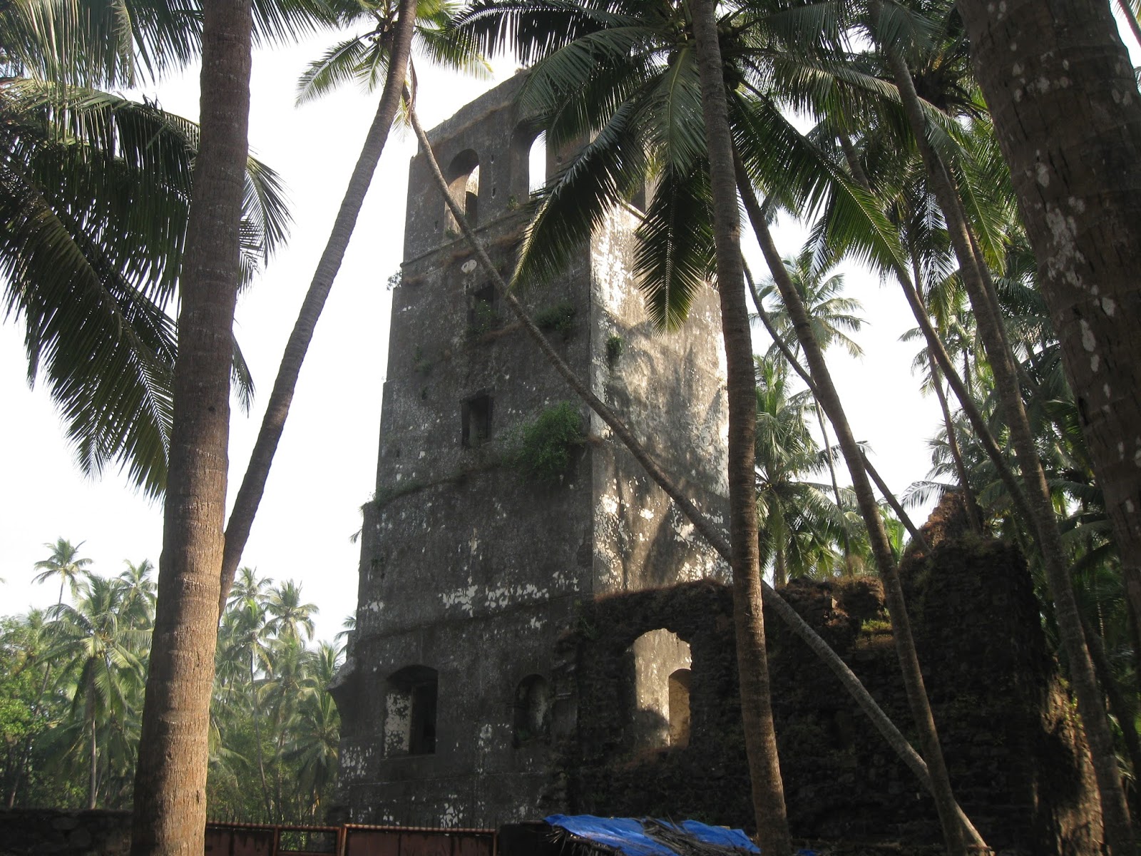
A watchtower in Revdanda Fort


An entrance with icons of a saint and official markings carved on stone.


 Through a broken wall of Revdanda Fort, a view of the Kunadalika estuary. Korlai Fort is on the stretch of land seen on the opposite side of the river.


The group enjoying themselves, exploring the fractured basalts of the west coast.


A picturesque home in Revdanda village.


This was the first time I had taken a group out on an organized trip like this. I was a bit nervous to begin with. But the atmosphere was informal and the participants enthusiastic and curious. That led to many long and enjoyable discussions on geology and archaeology.

We will be doing a repeat trip along the same route in late January... more pics then.