Showing posts with label environment. Show all posts

Thursday, January 23, 2025

Plastic In Sediment, Antarctica Ice Core, Alfred Wallace

A few interesting readings:

1) Sedimentation Shifted - How rivers move sediment along their course to the sea is an important aspect of sedimentology research. Grain size, shape, and density, all affect how currents move sediment, and where and in what proportions sand, silt, and mud particles come to be deposited. Now there is a new kid on the block: plastic. Catherine Russell has written a fascinating article diving deep into experimental work on how plastic impacts sediment transport. The work she describes has important implications for our understanding of plastic pollution in rivers, and the role plastic particles plays in enhancing erosion rates and sediment redistribution in riverbeds. 

2) Antarctica: 1.2-Million-Year-Old Ice- Scientists use gases trapped in old ice to measure ancient atmospheric composition and estimate past climatic conditions. A long running drilling program in Antarctica had so far recovered 800,000 year old ice. That record has been recently broken. Scientists have reached the very bedrock of the Antarctica continent. The oldest ice at the very bottom is 1.2 million years old. This is the longest continuous record of our climate that we have so far.  It hold much valuable information on climate fluctuations through the Pleistocene and Holocene. This article is a press release of the University of Bern. 

3) Beyond Evolution: Alfred Russel Wallace’s critique of the 19th century world- Alfred Russel Wallace is the co-discover of evolution through natural selection along with Charles Darwin. He was a brilliant naturalist and made foundational contributions to natural history. But he also was very sympathetic to the plight of local people suffering under colonialism and the environmental degradation the race to strip the land of resources was causing. Marshall A. summarizes nicely Wallace's observations on the impact of environmental damage, both in his native Wales and also during his travels in the far away Malay archipelago. 

Let me take this opportunity to share again this lovingly crafted documentary on the life and work of Alfred Wallace. It is made as a paper-puppet animation, produced by Flora Litchman and Sharon Shattuck and narrated by George Beccaloni of the  Natural History Museum London and Andrew Berry of Harvard University.


What a fine example of science outreach. 

Tuesday, September 3, 2024

Jyotirao Phule On Watershed Management

Jyotirao Phule (1827-1890) was a social reformer from Maharashtra who worked for the emancipation of the lower castes and for improving the lives of peasant agriculturists. In Shetkaryacha Asud (The Cultivator's Whipcord), written in 1883, he describes the plight of poor farmers and offers some advice on improving yield through land management practices. 

An excerpt- 

The essence of leaf, grass, flower, dead insects and animals, is washed away by summer rain, therefore our industrious government should, as and when convenient, use the white and black soldiers and the extra manpower in the police department to construct small dams and bunds in such a way that this water should seep into the ground, and only later go and meet streams and rivers. This would make the land very fertile , and the soldiers in general, having got to working in [the] open air, will also improve their health and become strong. 

.....Therefore the government should maintain these bunds in good condition, especially the backwaters. The government should conduct surveys of all the lands in its territory, employing water specialists, and wherever it is found that there is enough water to be drawn from more than one source, these places should be clearly marked in the maps of the towns, and the government should give some awards to farmers who dig wells without its assistance. Also the government should allow the farmer to collect all the silt and other things extracted from rivers and lakes, as in the older times, and it should also return all the cow pastures to the villages, which it has included in its 'forest'. 

Phule covers many of the interventions that are recommended by watershed management specialists today. The last line of the passage I have quoted is telling. Preventing villagers from using what was traditionally considered 'village commons' has always been contested by the people. Phule also called for the destruction of the "oppressive Forest Department". The conflict between agriculturists, forest dwellers, pastoralists, and the forest department continues to this day. 

This essay, translated from Marathi to English by Aniket Jaaware, has been republished in Makers of Modern India, a compilation of essays written through the 19th and 20th century by influential Indian political activists and social reformers. The collection is edited and introduced by historian Ramachandra Guha.

Monday, April 29, 2024

Links: Europa Life, Moon Geology, Citizen Activism

Some readings I perused over the past couple of weeks.

1) Our picture of habitability on Europa, a top contender for hosting life, is changing. Jupiter's moon Europa has long been a contender for hosting life. But lately some scientists have expressed their doubts. Europa has an ocean beneath a 20 km icy crust. Geologists now think that the sea floor is not active. They simulated conditions which could generate shallow earthquakes leading to fault movement and exhumation of fresh rock. Reaction of sea water and freshly exposed rocks is necessary for chemical reactions that sustain life. Results suggest an inert sea floor. Another study implied no magmatism on Europa. Rising magma brings with it heat and chemicals. But, could these be transient conditions that we have caught? Maybe there is a cyclicity to Europa's energy flow. Some interesting thoughts in this article.

2) China's Moon atlas is the most detailed ever made. The Chinese Academy of Sciences has released a stunning 1:250,000 scale geologic map of the moon. A decade of research has revealed 17 rock types ( I used to think only basalt!), 81 basins, and 12,000 odd craters! Compiled from orbiting satellites and then sharpened using data from the two lander missions.

3) How Punekars fought for their hill, Vetal Tekdi, to save its ecology. My city Pune has a proud tradition of citizen activism. For the past few years citizens have vigorously protested a road planned along a forested hill slope. This hill has been a life saver for thousands of citizens as a recreation spot. It hosts rich biodiversity and is an important groundwater recharge zone. The Pune Municipal Corporation is insisting on building this road, despite their own reports admitting an adverse environmental impact, and pointing to at best a short term marginal improvement in traffic flow. The fight to save the hill goes back a couple of decades. Shobha Surin has done a good job summarizing this long battle in Question of Cities.   

Monday, March 4, 2024

Links: Earthquake Detectives, Origin Of Life, India Water Act

Reading from the past few weeks- 

1) How earthquake scientists solved the mystery of the last “Big One” in the Pacific Northwest. The American northwest is a tectonically active region. About 150 km west of the Pacific coast is the Cascadia subduction zone. Here, the Juan de Fuca, Explorer, and Gorda tectonic plates slide underneath the continental plate of North America. Large earthquakes have occurred in the past and will occur in the future. 

Reporter Gregor Craige has written a book, On Borrowed Time: North America’s Next Big Quake, in which he explores the region's earthquake potential and the cross disciplinary studies that enable scientists to understand past earthquake history as well as the impact a big future earthquake will have. Canadian Geographic has shared an abstract from his book. The earthquake puzzle was solved by combining information from tree rings, Native American peoples memories of past events, and Japanese record of tsunamis. It is fascinating reading. 

2) To unravel the origin of life, treat findings as pieces of a bigger puzzle. Was life's beginnings in a warm little pond or in a deep sea hydrothermal vent? Did lightning provide the energy, did asteroids provide the organic matter? There are many many scenarios that try to provide an explanation to this vexing question. 

One of the leading researchers of this field, Nick Lane, and his colleague Joana Xavier, have summarized some of the key arguments and problems of the field in this tour de force of science writing. Highly recommended! 

3) Analysis: The Great Indian Water Act Of 2024. In more good news for industries, factories and foreign investors, yet another Indian environmental law has been diluted to facilitate “ease of business”. Shailendra Yashwant begins his analysis of The Water Amendment (Pollution and Prevention) Act, 2024 Bill on this depressing note. Amendments seek to "rationalize criminal provisions". Polluters can now escape jail time and get away by just paying a fine. All this when climate change and water security is one of the big challenges facing India. 

Tuesday, January 31, 2023

Readings: Gagging Indian Scientists, Human Evolution, Sand Mining

From the past couple of weeks:

1) Slow Subsidence of Scientific Institutions: As land movement and destruction of homes in Joshimath Uttarakhand became a prominent talking point, the Indian government reacted like it usually does when faced with an awkward situation concerning its own accountability. It imposed a gag order on its scientists, forbidding them from talking to the media until publication of a final report. Dinesh C. Sharma offers a thoughtful perspective on the corrosion of autonomy of India's scientific institutions and the damage this withholding of information does to open and informed debate. 

2) Teeth Reveal How Brains Developed In Utero: How fast did our ancestors brain grow before birth? When did patterns of brain growth become more human like? Teeth start developing very early in a fetus at about 20 weeks old and they fossilize well too. Researchers found a relationship between molar length and prenatal brain growth by studying teeth from skeletons of various primate species and comparing them with gestation length and mass at birth of each species. The final conclusion was that rates of pre natal brain development increased during hominid evolution and became more human like about one million years ago.  By anthropologist Tesla Monson.

3) Grains of Sand: Too Much and Never Enough. This is a topic of great concern in India too. Unregulated sand mining is stripping river valleys barren of sand, in turn changing river morphology and devastating habitats. Alka Tripathy-Lang writes about the global demand for sand and its impact on environment and livelihoods. What is the future for this resource? Will we learn to use it sustainably?  I'll also recommend this Planet Money podcast episode on Peak Sand featuring a stolen beach! - Episode 853: Peak Sand

Wednesday, January 11, 2023

Joshimath Sinking

By now, the unfolding tragedy in the mountain town of Joshimath in the Uttarakhand Himalaya is national news. Land subsidence is destroying homes. Many families have been left with no choice but to leave and resettle elsewhere. 

Journalist Kavita Upadhyay has written a good explainer on Joshimath's predicament. 

How heavy, unplanned construction and complex geology is sinking Joshimath.

And yesterday, News9 Plus with Kartikeya Sharma invited Kavita Upadhyay, along with another journalist Nivedita Khandekar, and geologist Hars Vats, to discuss not just Joshimath but also the vulnerabilities of Himalayan towns across the mountain arc. 

Their conversation is on Spotify- Joshimath Sinking

Repeated warnings by geologists were ignored for decades. As Sunita Narain points out in this Down To Earth article, engineers and technocrats with little understanding of the environmental and ecological issues are in charge of passing plans for big power projects. For Joshimath, all the relief measures are probably too late to make the town safe again, but if the destruction of this important historic town does not usher in a national soul searching about the way in which the Himalaya are being developed for tourism and hydropower, then I fear there will be much more pain and suffering in the future. 

Tuesday, May 24, 2022

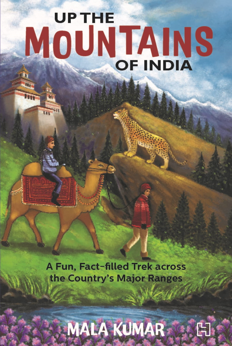
Book: Up The Mountains Of India

Finally it arrived! The author Mala Kumar connected with me a couple of years ago. She was writing a book on the mountains of India aimed primarily at young readers and wanted a geologist to help with fact checking some of the contents. We have had quite a few email exchanges since then, and my curiosity about this book has been growing even since. Mala has written over 40 books for children and this one is sure to enthrall them. But why just children? Anyone interested in India's varied physiography, geology, and wildlife, should read this book. 

I loved the way Mala has used everyday analogies to describe complex geology. One of my favorite examples is using a stuck piano key to explain about fault block mountains. The stuck key is a horst or a block that has moved up relative to the adjacent depressed keys which are called grabens. India's mountains are geological varied. The Himalaya, the Satpura, and the Western Ghats, for example, have formed by very different processes. Mala has used clear language and everyday familiar examples to simplify explanations of their origins. 

But this book is much more than about geology. Forests, wildlife, and human communities living in these rugged provinces really are the heart of the book. There are evocative descriptions of the animal and plant life of the different mountains ranges. Tibetan gazelles and mysterious snow leopards of the Himalaya, hoolock gibbons of the northeastern hills, majestic tigers of the Satpura and the Aravalli, and the bewildering varieties of frogs and reptiles of the Western Ghats, make us proud of our magnificent wildlife. There are lovely photographs scattered through the book. I could not stop gazing at the clouded leopard sitting elegantly on a branch deep in forests of the Mizo Hills. 

People too have lived in these mountains and forests since times immemorial. Their lives and life practices are being threatened as more mountain and forest land is gobbled up for dams, mines and expanding townships. In the northern Aravallis, villagers fought for years to save the sacred grove of Mangar Bani. In the Nallamali hills of Andhra Pradesh, members of the Chenchu tribe along with other organizations protested uranium mining that would have transgressed on the Amrabad Tiger Reserve. The book tells many stories from across the country, from the Aravallis, to the Eastern Ghats, to the Himalaya, of people struggling to conserve forests and water sources. 

Sketches and insets provide a welcome addition to the text. There are fun stories about the people of the mountains, about their crafts, about intrepid explorers, along with short quizzes, crammed in the insets that make the mountains come alive. 

Mountain ranges form the most important watersheds of our big rivers. Today, rampant development of mountain slopes coupled with climate change are becoming big threats to our water security. Mala Kumar's urgent call for conservation and sustainable development emerges again and again throughout the book and she has chosen her audience well. Whom better to inculcate a love and awareness for nature than in our children. These young citizens will be living in an increasingly challenging world and the hope of changing it for the better lies in a deeper understanding of how nature works. 

Go out for a trek in the mountains. Keep a lookout for that bright bluetail, and that curious langur who is peering at you half hidden from behind the thick leaves. Pick up pebbles from the stream bed and ask yourself about its geological secrets. Take a mountain train to the scented Nilgiri heights.  If you are hesitating, this book is an ideal place to begin.

Up the Mountains of India: A Fun, Fact-Filled Trek across the Country's Major Ranges - Mala Kumar. 


Wednesday, August 25, 2021

In Praise Of The Estuary

Be sure to take some time out and watch his lovely documentary on the Mulki Estuary by Dakshina Kannada Wildlife team.

Email subscribers who can't see the embedded video can watch it here - The Mulki Estuary.


This estuary has formed at the confluence of the Sambhavi and Nandini rivers (the documentary wrongly calls it the Gurpur river) on the Karnataka coast. Estuaries are particularly rich ecosystems. The confluence of fresh and saline waters, changes in water temperature and turbidity, nutrient supply by the river and coastal upwellings, the rise and fall of tides, and a meeting and interference of shore parallel and river currents create conditions suitable for a thriving biosphere. The documentary brings these aspects out beautifully in its capture of coastal landforms and varied wildlife.

Estuaries are of great interest to geologists too. The present configuration of our coastline has developed relatively recently in the geologic past. Before 15,000 years ago, during the Ice Age, sea levels were  about 100 meters lower than present. The coastline would have been tens of kilometers to the west of today's shore, and rivers like the Sambhavi and Nandini would have carved a valley across this stretch of the continental shelf and would have met the sea at a far westward location. As the Ice Age ended and the earth warmed, the rising seas progressively inundated the continental shelf. The estuaries along the Indian coast as with other coastlines are really drowned river valleys.

Coastal environments like beaches, mud flats, sand bars, mangroves, lagoons, and marshes, are in a state of constant adjustment to the movement of tides and currents, sediment supply from rivers and their distribution and deposition, and the impact of vegetation in stabilizing these features. Shore currents and sediment supply have an outsize effect on the evolution of the coast. One interesting example is found at Mangaluru, just south of Mulki, where another estuary has formed at the confluence of the Gurpur and Netravati rivers. The map shows this coastal setting. 

A geological investigation by B. R. Manjunatha and K. Balakrishna has shown that the Gurpur river once flowed a shorter route to the sea (paleo-course outlined in blue). Starting a few thousand years ago, excessive sediment deposition blocked this channel and strong southerly currents began building a barrier spit, forcing the Gurpur river to turn south and flow parallel to the coast for a good 8 kilometers before eventually joining the Netravati river in a joint exit to the sea. The Netravati river too has shifted slightly northwards over time. A quick survey along the Karnataka and Maharashtra coast show many similar situations where the river makes an abrupt turn and flows parallel to long sand spits before entering the sea. Do these rivers too have a similar history of course change? Its an intriguing observation.

Besides such adjustments to the coast due to currents and sediment deposition,  fluctuations in sea level too will change the prevailing geography. A sea level rise will push beaches and lagoons landwards, while a fall will cause rivers and deltas to extend seawards and bury past shorelines.

The estuary being a low lying region and a sediment trap preserves this history of sea level change. Geologists love to drill and take out sediment samples from the estuary bed and associated marshes and mangroves, because they contain, in its changing sediment and biological composition, clues to earlier environmental shifts. Understanding how past sea level change affected the coastal system is of great value in tuning our expectations and our preparedness of how the ongoing sea level rise will impact our present day coastlines.

I must confess that this post was inspired not just by this documentary but by my own memories of an estuary. During my student days, I had visited the coastal town of Malvan at the end of a small trek along the west coast of Maharashtra. A friend suggested we spend the day boating and exploring an estuary south of town. It turned out to be a most relaxing and enjoyable experience.

Taking inspiration from these children, we too rowed vigorously and covered quite a bit of distance. 

Malvan then was a small sleepy place and this meeting of river with the sea even more so. Not a soul was in sight, as hour after hour the waters of the estuary gently lapped against our boat. A salty sea breeze kept us refreshed. As the sun beat down upon us we finally decided to take a break. In search of something to eat and drink we scoured the shore for a small settlement. Up ahead in the middle of the estuary was our savior. 


 A luscious looking coconut island beckoned.

Friday, September 11, 2020

Bihar: Where Many Rivers Meet

I came across this passage in Vipul Singh's interesting book, Speaking Rivers: Environmental History of A Mid-Ganga Flood Country, 1540-1885. 


 "In consequence of the frequent changes which take place in the channels of the principal rivers that intersect the territories immediately to the presidency of Fort William and the shifting of the sands which lie in the beds of those rivers chars or small islands are often thrown up by alluvion in the midst of the stream, or near one of the banks and large portions of land are carried away by an encroachment of the river on one side, whilst accession of land are at the same time, or in subsequent years gained by dereliction of the water on the opposite side;... the lands gained from the rivers or sea by the means above mentioned are a frequent source of contention and affray,and although the law and customs in the country have established rules applicable to such cases these rules not being generally known, The Courts of Justice have sometimes found it difficult to determine the rights of litigant parties claiming chars or other land gained in the manner above described"

It is a section of the preamble of The Bengal Alluvion and Diluvion Regulation of 1825 which the East India Company passed to assure a regular income from Diara lands. 

Diara land are ephemeral parcels of land that accrete to river banks or emerge in the middle of the river channel by sediment deposition. They can disappear in a decade or so as a major flood cuts away the river bank or erodes an island, only for newer land to appear elsewhere along this meandering fluid riverine landscape.

The satellite imagery covering the region between Patna in the west to Munger in the east forms the heart of this mid -Ganga floodplain.

Diara lands were traditionally farmed by landless peasants for the few months of the year that they were above water and then abandoned during monsoon inundation. There was no concept of ownership of these lands. The East India Company in its quest to maximize land revenue decided to regulate ownership of the Diara. It didn't always work in practice. Zamindars were reluctant to report the ground situation accurately and maps became outdated as topography and landscapes shifted quickly. Diara lands remained and still are a source of dispute.

Fascinating is the struggle outlined in the book of two long lasting empires with this river system. Before the Mughals, the Afghan ruler Sher Shah Suri occupied this region and had adapted to the capricious environment to his advantage. The Mughals though faced a different problem. Their power center was far to the west in Delhi and Agra. Carrying grains and goods from Bihar to Agra-Delhi using pack animals wasn't possible, since the expenses of feeding these animals would have left very little surplus. Being children of the Eurasian steppe, they preferred the horse and land transport, and that meant that they were unable or unwilling to develop a river navigation network on a commercial scale. The direction of river flow also worked against them. Sailing goods-laden boats upstream was challenging, especially as Vipul Singh points out, the Ganga upstream of Varanasi becomes difficult to negotiate. As a result the Mughals could never exploit or control this region fully. 

The British though found the river to their liking. The Grant of Dewani of Bengal, which the East India Company won in 1765, extended to the mid Ganga floodplains. The Company's main port lay downstream in Calcutta and their major markets across the seas in China and Europe. Using their expertise in navigation they soon set up a thriving trade in saltpetre, calico, opium and silk. Slowly, they also began imposing a linear topography on these curving meandering rivers. The building of embankments, canals, and barrages was thought necessary to control the inundation that could lead to a loss of a cropping season. The various Regulations and Acts meant to ensure a permanent and uninterrupted stream of revenue ended up changing the people's interaction with the river. 

These land regulations, beginning with the Permanent Settlement of 1793, entrenched the power of hereditary Zamindars who became Company rent collecting agents. It became especially hard for the landless to eke out a living as they saw even the ephemeral parcels of Diara which they had been farming now being allocated to the nearest Zamindar and his tenants. Large scale flood control projects carried out by Zamindars and encouraged by Company revenue officers began reshaping the ecology of the floodplains with embankments preventing floods in one region but exacerbating them on the opposite side or in downstream areas. Embankments also prevented smaller local streams from draining into the larger rivers, resulting in the water-logging of fields. Praveen Singh in The colonial state, zamindars and the politics of flood control in north Bihar (1850-1945), details how a web of social and economic interests spurred on this construction spree despite warnings from irrigation engineers about the detrimental effects of embankments.

Vipul Singh also emphasizes the linkage between physical processes and cultural evolution.  A unique Bihari regional identity emerged based on the homogeneous ecology, similar agrarian practices and a shared reverence for the Ganga. 

The Ganga of the plains is a turbid river. It transports several hundred million tons of sediment to the Delta. In this section of Bihar, it is joined by the Sone from the south and the Ghaghara, the Gandak and the Kosi from the north. The Kosi and the Gandak are especially sediment rich, carrying a suspended sediment load of 80 million tons per year and 43 million tons per year respectively. All this sediment is what makes this region special. A significant fraction of it gets deposited every year in the river channel and its floodplains. Over time, the Ganga and its tributaries have built vast alluvial deposits, through which the river finds its way, often getting choked on its own sediment, and then breaking free by cutting a new path for itself. This abundance of water and sediment has formed a complex fluvial ecosystem of meandering channels, river islands, abandoned courses, oxbox lakes, ponds, and wetlands. The organic rich silt deposited across floodplains by the rivers during monsoon inundation nourishes multiple crops. Life's daily rhythms became embedded in this ecology and its inhabitants evolved farming practices adapted to the changing tune of the environment.

There was linguistic pride too, not in one common 'Bihari' language, but in the various dialects spoken 'eh /e paar' and 'oh o paar'; this side of the Ganga and on the other side. Bhojpuri was the dialect of the Champaner area north of the Ganga, while to its east on the north side was spoken Maithili. In the Patna region on the south side was Magahi and towards the east near about Munger was Angika. These vernaculars with their common folk tales, poetry, and myths about deities, changing seasons, local plants and animals, and the Ganga, knitted the region together, away from the pull of the Delhi-Agra-Awadhi influence which lay to the west and the Bengali cultural sphere towards the east.

Magh ke garmi, Jeth ke jar
Pahila pani bhar gail tar,
Ghag kahen ham hoban jogi,
Kuan ka pani dhoihen dhobi
.

[Heat in Magh (January-February), cold in Jeth (May-June),and the tanks filled with the first fall of rain, are the signs of drought. Ghagh says that I will become a beggar, and the washer-men will wash with well-water.]  

This is a gem of a book. Highly recommended reading! 

Sunday, August 23, 2020

Books: Speaking Rivers, The Ice Age

 Ordered and received!

Prof. Vipul Singh is with the Dept. of History, University of Delhi, and he writes in the acknowledgments section that environmental history as a formal subject of study in history departments had a late start in India. The focus of the book is the flat lands of Bihar with its annual floods and shifting river channels and how Mughal and later British land use policies transformed the people's relationship with the river system. Looks like a very meaty book with plenty of Notes, Maps and a long Reference section. Will be sharing interesting snippets as I read along.


As one blurb says... "Perfect to pop into your pocket for spare moments".  A fine introduction by Jamie Woodward. The recognition that the earth has passed through several glacial and interglacial phases is really a triumph of field geology. Thick sedimentary deposits in Europe and N. America were recognized as being left behind by advancing ice sheets. The stellar role played by geologists in the mid-late 1800's and their debates grounded within the prevailing schools of catastrophism versus uniformitarianism is highlighted. And there are good succinct sections on the many modern theoretical advances in climate science and the techniques that geologists and climate scientists bring to bear upon understanding the mode and tempo of climate change.


Happy Reading.

Sunday, August 16, 2020

Readings: India Dams, Geology Videos, Parsis in India

 Sharing some readings.

1) Neeraj Wagholikar, Parineeta Dandekar and Himanshu Thakkar weigh in on the dam building epidemic that is afflicting India. These three experts cover issues of environmental governance, destruction of fisheries and livelihoods, and a perspective on their irrigation potential and economic logic.

The deep political drive to push through permissions to build dams is best highlighted by an example of a malign recommendation in a report of the Parliamentary Standing Committee on energy published in January 2019. It seems to view in favor Himachal Pradesh's suggestion to the committee to help declare large hydropower projects as linear projects, thus enabling them to bypass Gram Sabha consent. The statement reads, “If it is done, then, to a large extent, the problem of FRA, which the Secretary also mentioned, will get resolved because the stringent provisions of FRA will get diluted. It is not our purpose to subvert them. Our only purpose is to get them more liberalised.” 

FRA is the Forest Rights Act which gives local forest dwellers a say in the site selection of infrastructure projects. 

Makes you despair and shake in anger, doesn't it?

India, Dammed.

2) Geology fans! I highly recommend Rice University Professor Cin-Ty Lee's YouTube Channel. He has a very informative collection of short videos on rocks and minerals and geologic processes. 

Here is one of my favorites.. Isostacy and what controls the elevation of mountains?

Email subscribers who can't see the embedded video, can view it here - Elevation of Mountains.

3) Like Sugar in Milk.. was the memorable assurance given by the Zoroastrian refugees to the King of Gujarat. We will assimilate in Indian society. And they have in many ways, while maintaining a distinct identity. 

What does genetics tell us? Fine post by Razib Khan.

Endogamy and Assimilation. Parsis in India.

Monday, April 27, 2020

Books: Tree Story, Rivers of Power

A friend pointed out these two books.

1) Tree Story: The History of the World Written in Rings by Valerie Trouet.

Review: "Trouet, a leading tree-ring scientist, takes us out into the field, from remote African villages to radioactive Russian forests, offering readers an insider's look at tree-ring research, a discipline formally known as dendrochronology. Tracing her own professional journey while exploring dendrochronology's history and applications, Trouet describes the basics of how tell-tale tree cores are collected and dated with ring-by-ring precision, explaining the unexpected and momentous insights we've gained from the resulting samples"...


2) Rivers of Power: How a Natural Force Raised Kingdoms, Destroyed Civilizations, and Shapes Our World by Laurence C. Smith

.."From ancient Egypt to our growing contemporary metropolises, Rivers of Power reveals why rivers matter so profoundly to human civilization, and how they continue to be indispensable to our societies and wellbeing"...

Two other books on rivers that I would recommend are Unruly Waters by Sunil Amrith and The Water Kingdom by Philip Ball.

I also want to read The Unquiet River: A Biography of the Brahmaputra by Arupjyoti Saikia. Hoping to get to it soon.


Happy Reading!

Wednesday, February 26, 2020

Articles: Dehradun, Early Dogs, Warm Blooded Dinos, Louisiana Delta

Sharing some links from the past few days:

1) Dehradun.

A story of the transformation of a beautiful hill town to an ugly unplanned urban center. We shrug resignedly at many such tales from across the country. This one is of Dehradun. Himalaya towns can only be described as disasters in the making. Unscientifically built infrastructure on steep slopes, no garbage management resulting in enormous stray dog and pig populations roaming the streets, and a dwindling water supply. Yet these towns continue to grow, pointing to worsening opportunities for making a livelihood in the Himalayan rural landscapes. The 'smart city' reference is the ultimate insult of all.

Vanishing landscape of ‘smart city’ Dehradun.

2) Early Dogs.

The early stages of dog domestication may have seen a marked behavioral shift appearing before any distinct morphological change. This change in behavior, arising from docile wolves or 'protodogs' living near human camps would have entailed a change in diets.  Scientists have compared wolf and dog like remains from a 28,500 year old site in the Czech Republic. They looked at the dental microwear pattern of these two groups of canids and noticed that the dog like canids show a pattern consistent with eating more hard brittle foods. The wolves show patterns consistent with eating more flesh. 'Throw this dog a bone" wasn't an insult then.

Dental microwear as a behavioral proxy for distinguishing between canids at the Upper Paleolithic (Gravettian) site of Předmostí, Czech Republic

write up: Dog domestication during ice age.

3) Warm Blooded Dinos?

Were Dinosaurs warm blooded like mammals? This debate has raged on for decades. Bone growth patterns have not given any unambiguous evidence of body temperature regulation. A new method known as clumped isotopes may provided a more reliable indicator of estimating body temperatures. Fossilized dinosaur egg shells contain the original calcium carbonate from which these shells were built. A variety of carbon isotopes (C12, C13) may bond with a variety of oxygen isotopes (O16, O17, O18) in the carbonate molecules (CO3). The degree of bonding or clumping of the heavier isotopes i.e. C13 to O18 varies with the temperature during mineral growth. Clumping is more at lower temperatures.

Scientists compared this C13-O18 clumpiness in dinosaur egg shells with C13-O18 clumpiness in the calcium carbonate of mollusc shells from the same fossil bed. Mollusc geochemistry is taken to be a proxy for the ambient conditions. They found out that the egg shells grew at temperatures between 25- 43 deg C, while the molluscs record growth at 25 -30 deg C. This suggests that dinosaurs were capable of maintaining a higher body temperatures than their surroundings.  As a carbonate sedimentologist, I found the details of methods in this paper  of great interest. The researchers used a variety of techniques to make sure that the egg shells had not been altered or subjected to higher temperatures later in their history, which would have made them an unreliable archive of the original temperature during growth. The analyzed egg shells came from Sauropods, Theropods and Ornithischians, a sample across the three main groups of dinosaurs. Very interesting study.

Eggshell geochemistry reveals ancestral metabolic thermoregulation in Dinosauria

write up - Fossil Eggshells Suggest All Dinosaurs May Have Been Warm-Blooded

4)  Eroding Louisiana Coastline.

Over the past several decades, barrages and levees have drastically reduced the amount of sediment that the Mississippi river is carrying to the sea. As a result, the famed Mississippi delta and coastline is eroding away. Efforts are on in a Boston warehouse to figure out a way to reverse this change. An ambitious engineering project which aims at opening up a portion of the levee to funnel sediment into the Barataria Basin south of  New Orleans is being planned. The hope is that the new channel will transport and deposit enough sediment to rebuild part of the endangered delta. A scale model built in a warehouse near Boston is testing the efficacy of this idea.

Fascinating to read the various problems geologists and engineers have to deal with when grappling with modifying nature at this scale.

To Save Louisiana’s Vanishing Coast, Build a Mini Mississippi Near Boston.

Monday, November 11, 2019

Articles: Anthropocene, Future Of Science, India's Green Tribunal

Some excellent articles I read recently.

1) What Made Me Reconsider The Anthropocene - Peter Brannen. A lovely essay and one that is really a rethinking of his earlier position wherein he had dismissed the idea of Anthropocene as hubris.

I must share an excerpt:

"For me the essence of a lot of Faulkner is, before you can be something new and different, slavery is always there, the legacy of slavery is not erased, ‘The past is never dead. It’s not even past,’” he said. In Faulkner’s work, memories, the dead, and the inescapable circumstance of ancestry are all as present in the room as the characters who fail to overcome them. Geology similarly destroys this priority of the present moment, and as powerfully as any close reading of Absalom, Absalom! To touch an outcrop of limestone in a highway road cut is to touch a memory, the dead, one’s very heritage, frozen in rock hundreds of millions of years ago—yet still somehow here, present. And because it’s here, it couldn’t have been any other way. This is now our world, whether we like it or not.

The Anthropocene, for Wing, simply states that humans are now a permanent part of this immutable thread of Earth history. What we’ve already done means that there’s no unspoiled Eden to which we could ever return, even if we disappeared from the face of the Earth tomorrow.


2) Science Must Move With The Times: Phillip Ball. How has society shaped the nature of science over the past 150 years and what is the future course. A very thoughtful essay.

3) Woes of the National Green Tribunal: Are the recent appointments unconstitutional?:  The National Green Tribunal was set up to allow people access to environmental justice. Environmental lawyer Ritwick Dutta documents the way in which this institution is being undermined by the appointment of non-experts in the experts tribunal, by leaving zonal benches vacant, and by the subversion of video conferencing.

Read and weep!

"The situation with the zonal benches is even worse. Though touted as a great innovation, the video conference which is followed for hearing cases in Pune, Kolkata, Chennai and Bhopal does not allow the litigants or their lawyers to effectively make submissions. To make matters worse, speakers are frequently put on the ‘mute setting’ when the hearing is going on. Thus, it frequently happens that while advocates in zonal benches are making forceful arguments, they are not aware of the fact that they are not audible to the Judges sitting in Delhi, since the speaker is on mute setting".

Friday, June 14, 2019

Insufficient Assessement: Pancheshwar Dam Uttarakhand

Environmental implications of Pancheshwar dam in Uttarakhand (Central Himalaya), India.

A warning from earth scientists that sufficiently detailed studies of seismic risks and potential environmental consequences have not been undertaken.

Map from the linked paper shows the location of the Pancheshwar Dam and the future backwaters in red.


Extract:

We have assessed the likely environmental consequences of the proposed Pancheshwar high dam in  Uttarakhand Himalaya (Indian Central Himalaya) in the light of current geologic and geomorphic   understanding. The study suggests that if executed in its current  format, the proposed  dam  raises  concern  about  safety  and  its sustainability due to seismicity, reservoir-induced  seismicity,  slope instability due to reservoir draw down effect, and unpredictable large volume sediment  mobilization from paraglacial zones. The study therefore, highlights the pressing need to re-assess the feasibility and its  geo-environmental implications through multidisciplinary studies.

During my recent travels in Kumaon I met locals who were also expressing fears over loss of livelihoods as large tracts of fertile land will be drowned. 

Open Access.

Thursday, May 9, 2019

Links: Petroglyphs, Language, Urban Groundwater, Dams

Some interesting articles I came across past few days.

1) Pleistocene Rock Art in India- New York Times covers the discovery of ancient rock art (40k-10K yr old?) carved on laterite plateaus of Ratnagiri District, S. Maharashtra. Good to see credit given to the stellar work of two amateur archaeologists Sudhir Risbud and Dhananjay Marathe.

Link: Ancient Rock Art In The Plains Of India.

2) Language Evolution- Linguistic analysis suggests that the Sino-Tibetan language family originated about 7200 years ago among millet farming communities in northern China.

Links: Paper - Dated language phylogenies shed light on the ancestry of Sino-Tibetan.
Summary - Origin of Sino-Tibetan language family revealed by new research.

3) Urban Groundwater- This is an issue that is gaining importance as cities in India grow and municipal water supply from surface reservoirs becomes inadequate. S. Vishwanath crunches some numbers on the ground water potential of the shallow aquifer underneath Bengaluru. It comes to more than hundred billion liters! Similar situations exist underneath other Indian cities as well, but urban groundwater has been a neglected area of study. More quantitative understanding of aquifers is needed along with a focused effort to recharge ground water.

Link:  Revisiting The Shallow Aquifer

4) Environmental Implications of Pancheshwar Dam, Uttarakhand - A review in Current Science of environmental concerns regarding the proposed Pancheshwar Dam in Uttarakhand implies that critical aspects of seismicity, slope instability, and high sedimentation rates have not been addressed in detail during the planning stages in the environment impact assessments carried out so far.

Link: Environmental implications of Pancheshwar dam in Uttarakhand (Central Himalaya), India.

Wednesday, January 30, 2019

Ganga Water: Future Availability

The Ganga river basin is being modified by the building of infrastructure to trap and divert water. There are many environmental repercussions resulting from this dam and canal construction. That is not the topic of this note.
 
Will there be enough water available for these different projects?

First, the Inland Waterways project will need water to be released from upstream dams to maintain a certain water depth in the navigable channel in the summer months. Second is the River Linking Plan, based on the rationale that there is excess water in the Gangetic system. The plan envisages transferring Ganga system water during the summer months to the southern Peninsular rivers. And third, the Uttarakhand dam building companies will try to keep as much water locked up behind dams for power generation in the summers.

Over and above the water requirements of these projects, environmental regulations will require a  certain amount of water flow to be maintained throughout the year in the river. This will be detrimental to the river linking and power generation projects.

Each of these massive waterworks will be competing for a limited amount of Ganga water during the same time of the year. This allocation problem will lead to water disputes, both, among the managers of these projects, and across different States. As a result, these projects are unlikely to operate optimally.

I haven't come across an official water budget analysis projected 100 years into the future, that takes into account water availability and the impact that these three projects will have on each other.

Sunday, November 25, 2018

India Shale Gas: Environmental Concerns

Shale gas is natural gas trapped in very fined grained sedimentary rocks like shales. These rocks are not very permeable. To release the gas trapped in the tiny pore spaces, the rock is fractured by injecting water, sand and various chemicals into it at very high pressure. Several million gallons of fresh water is needed for such ' fracking' activity at any one site. 

Shashikant Yadav, Gopal K Sarangi and M P Ram Mohan in an essay in the Economic and Political Weekly explain the environmental concerns that shale gas production poses in India.

Regarding the guidelines for environmental management released by the government -

Further, the guidelines mention that water management is one of the key concerns. They state that the major and prime difference being in the hydraulic fracturing technologies requiring a large volume of water; the activities are likely to deplete water sources and cause pollution due to the disposal of produced water. However, instead of dealing with the water-specific issues, the guidelines (apart from explaining existing provisions) stated that the generic environment clearance process adopted by the Ministry of Environment, Forest and Climate Change (MoEFCC) will suffice to ascertain water-related issues posed by fracking. But, MoEFCC has not laid down any specific guidelines, policies, or manuals differentiating between conventional and unconventional gases to grant environment clearance.  More recently, despite the gaps, on 1 August, 2018, the cabinet approved a policy allowing companies to exploit shale gas in contract areas that were primarily allocated to exploit conventional gas.

..and this in the context of the ambiguous legal framework surrounding groundwater -

Considering the limited water legislation in India, the implementation of fracking may result in geopolitical and legislative complexities. For instance, shale rocks are usually adjacent to rocks containing useable/drinking water known as “aquifers.” While implementing the hydraulic fracking, the shale fluid can easily penetrate to aquifers leading to groundwater contamination. This contamination may result in methane-poisoning of water used for drinking and irrigational purposes. To avoid such contamination, as per industry standards, a project proponent must maintain a distance of 600 metres between aquifers and fracture zones (Davies et al 2012).

The Indian water legal regime is far away to make such specific observations, as aquifers are not defined in any of the Indian environmental regulatory or legal regime leading to a free pass for unregulated mixing of shale fluid and aquifers. Moreover, the landless have no right to groundwater, and accordingly peasants and tribal communities who have no ownership rights over land have no right on groundwater. Also, a project proponent may easily exploit groundwater while implementing the hydraulic fracking process with none or limited accountability of their actions.  In such a situation, the intent of “Public Trust Doctrine” is defeated, and the precautionary principle will be non-implementable.


Open Access.

Monday, May 21, 2018

W. Bengal Bangladesh- Geologic Controls On Arsenic Distribution In Ground Water

Science writer  Priyanka Pulla has written an excellent article exploring the geologic, socio-economic and technological issues related to the widespread arsenic contamination of groundwater in W. Bengal. Sadly, the government response to this crisis has been slow.

I thought I would elaborate on the geological question -  Why are Arsenic (As) levels much higher in shallower Holocene age aquifers and lower in the deeper Pleistocene age aquifer? The answer encompasses mineralogy, climate change, sea level changes and bacteria.

The ultimate source of As are high Himalayan rocks and Indo-Burman ranges with additional contributions from the Precambrian terrains of Peninsular India and the Siwalik hills.  Minerals like biotite, magnetite, illmenite, olivine, pyroxene, amphiboles contain As. These minerals release As when they undergo weathering in catchment areas and deposits of the alluvial plains. This As is absorbed on secondary minerals like Fe hydroxides like goethite. Such Fe hydroxides are authigenic, i.e. they grow in the shallow buried sediments of the alluvial plains. Under oxidizing conditions, As is immobile, sequestered in Fe hydroxides. However,  conditions may change, and these sediments may get overlain by or be redeposited in environments rich in organic material. Certain bacterial species living on this organic material break down these Fe hydroxides, using the oxygen for their metabolism, and releasing Fe and As into the groundwater. This is known as reductive dissolution of Fe hydroxides and is the principal mechanism for As entering the groundwater in the alluvial plains of Bangladesh and West Bengal.

During the Pleistocene.. 1) the high Himalaya was glaciated. Therefore, important sources of As like the Fe-Mg rich rocks of the Indus ophiolite belt (slices of oceanic crust that existed between India and Asia which have been thrust up during continental collision) and high grade metamorphic rocks such as schists and gneisses were covered in ice and not releasing sediment. Indian cratonic areas, the Siwalik foothills  and the Indo-Burman ranges were being eroded, but overall less As was making its way on to alluvial plains. 2) Since climate was cooler and drier, there was less organic material accumulating in sediment of alluvial plains. Conditions were oxidizing and As remained sequestered in Fe hydroxide minerals. 3) Sea level was much lower then. Almost the entire continental shelf was dry land. Ganga and Brahmaputra met the sea much to the south of present shoreline. Reducing environments like delta front marshes, ponds, estuaries, existed much to the south.

Sedimentary conditions changed by 12-15 thousand years ago. Glacial melt exposed As bearing rocks in high Himalaya. As a result, more As made its way on to alluvial plains. Importantly, sea level rose and flooded the continental shelf. The Pleistocene delta front reducing environments were drowned. Shorelines shifted northwards. The climate was warmer, encouraging vegetation growth. Reducing delta front environments like swamps, coastal marshes and lakes developed on previous alluvial plain sediments.

The map below shows the position of shorelines between 7 thousand and 4 thousand years ago along with the location of wells with high levels of As. This study focuses on Bangladesh but similar conditions existed in West Bengal as well. The sea has receded 2- 3 meters to its present location since 4 thousand years ago.  The delta front and shoreline belt that existed 4-7 thousand years ago is now a densely inhabited region .


 Source: Quaternary shoreline shifting and hydrogeologic influence on the distribution of groundwater arsenic in aquifers of the Bengal Basin- M. Shamsudduha, Ashraf Uddin 2007

Notice clustering of wells with high As along the past shorelines. Here, organic rich delta marshes and swamps developed. Bacterial reduction of Fe hydroxides released As in to groundwater.

As distribution also shows correlation with topography. This map shows high As levels in groundwater coinciding with topographic lows. Such low lying areas accumulate more fine sediment and organic material. Again, this will apply also to W. Bengal.


 Source: Quaternary shoreline shifting and hydrogeologic influence on the distribution of groundwater arsenic in aquifers of the Bengal Basin- M. Shamsudduha, Ashraf Uddin 2007

So, a change in climate and shifts in sedimentary environments in response to changing sea level from Pleistocene to Holocene exerted a strong control on As distribution in the alluvial plains of Bangladesh and W. Bengal. 

Tuesday, September 19, 2017

Environment Links: River Issues In India

Sharing a few interesting and informative articles I came across in the past few weeks on rivers.

Endangered Himalayan Rivers: This one is from 2012. A large number of dams are planned on the Alaknanda and Bhagirathi rivers in the state of Uttarakhand.  Parineeta Dandekar writes about the weaknesses and bias in the Environment Impact Assessment process.

Rally For Rivers Plan. Will It Help?: The Rally For Rivers campaign by the Isha Foundation is calling on creating a 1 km wide tree plantation along the river banks. This, they claim, will help rejuvenate India's dying rivers. Veena Srinivasan, Sharad Lele, Jagdish Krishnaswamy and Priyanka Jamwal with the Ashoka Trust for Research in Ecology and the Environment, Bengaluru examine their claims in detail and find them wanting.

Caution Warranted For River Linking Project: The gargantuan river linking project envisages a series of dams and canal systems to transfer water from Himalayan rain and snow fed river basins to the drier Peninsular rivers in the south. Is it worth it?

Reuter's Erroneous Reporting On The Ken-Betwa River Linking Project: Two rivers in Madhya Pradesh and Uttar Pradesh are to be linked. SANDRP clarifies that the permissions process has yet to be completed. The two states don't even have a water sharing agreement! Reuter's screwed up.

Environment Ministry Panel Reject's Uttar Pradesh's Religious Smart City Plan: I'm including this to give an example of the utter indifference to ecology and environment shown by "planners and developers". The plan is for a smart city to be built inside the Hastinapur wildlife sanctuary, along the banks of the Ganga, which would have destroyed dolphin habitat and river ecology along a 7 km stretch. How does one even come up with such ideas? Fortunately, the usually pliant Environment Ministry has balked at approving this outrageous plan.