Showing posts with label fluvial landscapes. Show all posts

Tuesday, July 16, 2024

Ganga Earthquake, Nile, Deep Sea Habitats

Some readings over the past few weeks:

1) An Earthquake Changed the Course of the Ganges. Could It Happen Again?  Sediment load carried by big rivers like the Ganga often choke up channels and force the river to cut another path. Sudden channel shifts can also occur due to tectonic movements. A recent survey of the Ganga about 100 km south of Dhaka, Bangladesh , identified an old channel of the Ganga. Exploring this area, researchers came across veins of sand cutting across the sediment layers. These veins or sand dikes were  injected into the surrounding sediment. They are a sign of major ground trembling triggered by a large earthquake. Ground motion may pressurize buried sand and inject it  upwards. Further studies showed that this event may have been a 7-8 magnitude earthquake that occurred 2500 years ago. Kevin Krajick writes about this discovery and the larger geologic context.

2)  Lessons from the Nile about rivers and society. The Nile river has sustained agriculture, human habitation, and royal dynasties for millennia. A Nature Geoscience editorial summarizes a collection of sedimentological and geomorphologic studies that track the evolution of the Nile through the Holocene. Phases of the river cutting a deep valley changed to phases of the river flooding laterally and building fertile floodplains. This geomorphological evolution driven by climate change and more recent dam building have influenced agriculture and social systems in the past as well as the present. 

3) Ocean Exploration: Meet The Deep. I highly recommend this site. National Ocean and Atmospheric Administration, U.S.A., has compiled some stunning photographs and videos of deep sea habitats and the diverse forms of life that inhabit this little understood world. Corals, sponges, brittle stars, molluscs, worm tubes- attached to the bottom, living around energy sources such as hydrothermal vents and cold seeps. It is an absolutely fascinating exploration of the biodiversity of the deep sea. 

Octocoral and Brittle Star: Source NOAA Ocean Exploration

As a bonus, these images make great wallpaper for your mobile phone!

Wednesday, November 15, 2023

River Nira Meander

 So near Pune, yet I had never been to this location near Bhor.

It is popularly known as necklace point. The river Nira loops its way through the countryside forming a series of lovely meanders. A high point overlooking the valley allows a clear view of this feature. 

I was on a drive with some friends, spending the day exploring the back waters of the Bhatgar and Nira Deogarh dams. We eventually reached Warandha Ghat, one of the spectacular passes linking the Deccan Plateau with the western coastal plain. 

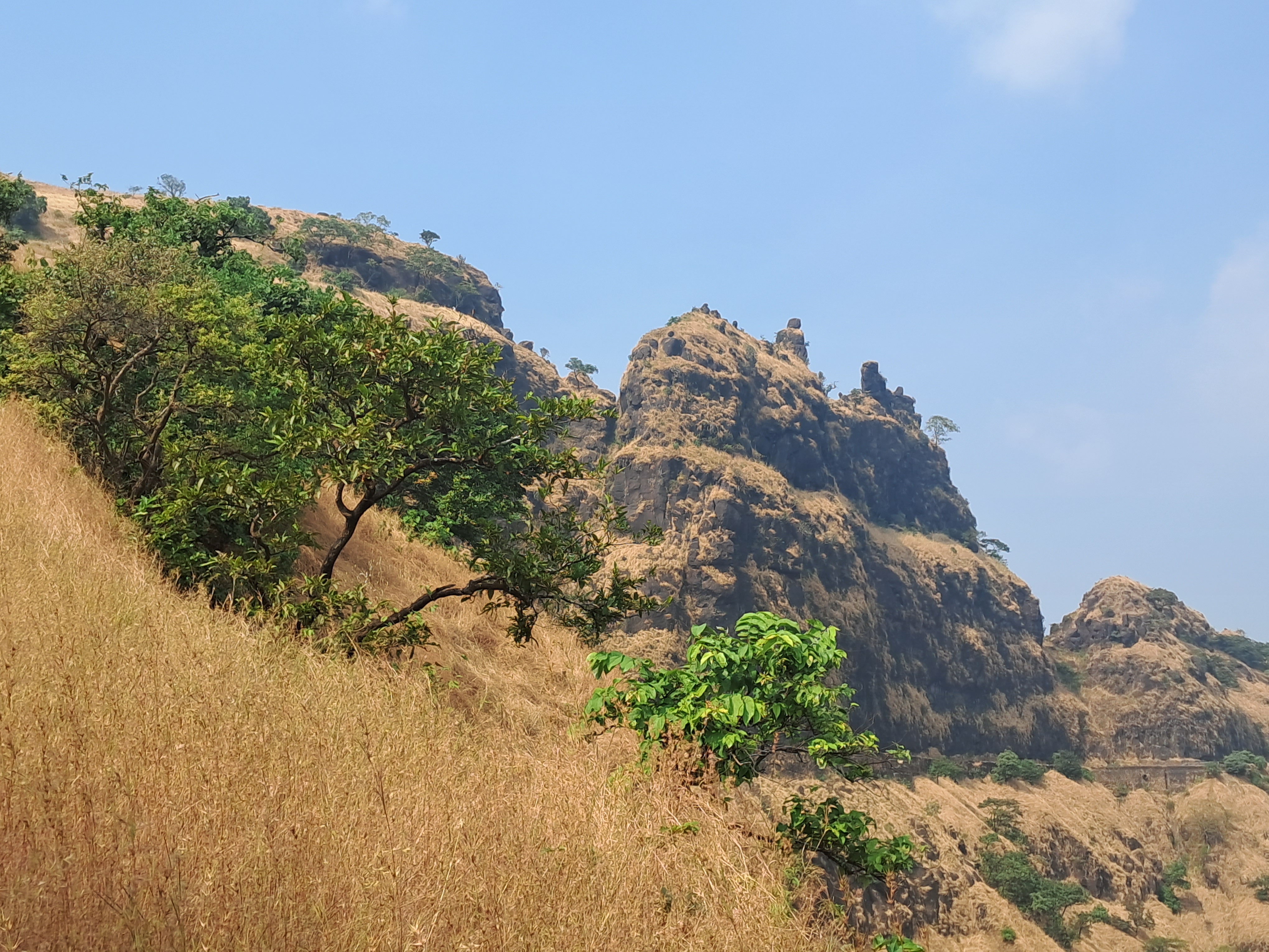
At the edge of the plateau, high relief exposes sheer rock faces. 

The grand scale of Deccan Volcanism is manifest so clearly in the lava flows traceable over hundreds of meters despite the afternoon haze.

On a satellite image, X marks the view point looking south towards the big meander.  

This is a beautiful area near Pune to spend a day out.

Monday, October 31, 2022

Milam Glacier Trail - Landscapes

Earlier in the month from October 10th to October 18th, I walked the Milam Glacier trail in the Kumaon Himalaya, Uttarakhand. A four day walk through the Johar Valley from Lilam village near Munsiyari to Milam took me past some fantastic landscapes and geology. 

After an initial breathtaking climb which takes you from about 6000 feet at Lilam to more than 9,000 feet at a high ridge known as Mainsingh Top, the trail descends towards the Indo-Tibetan Border Police outpost at Bugdiyar. After this, a gradual ascent takes you higher, with the rest of the walk undulating between 10,000 to 11,000 feet ASL. I was lucky with the weather. After walking the first two days in belting bone chilling rain the skies cleared and I was treated to some gorgeous views of the High Himalaya. 

I am posting a few pictures of the landscapes along this scenic route. The pictures are roughly ordered from the start towards the end of the trail.

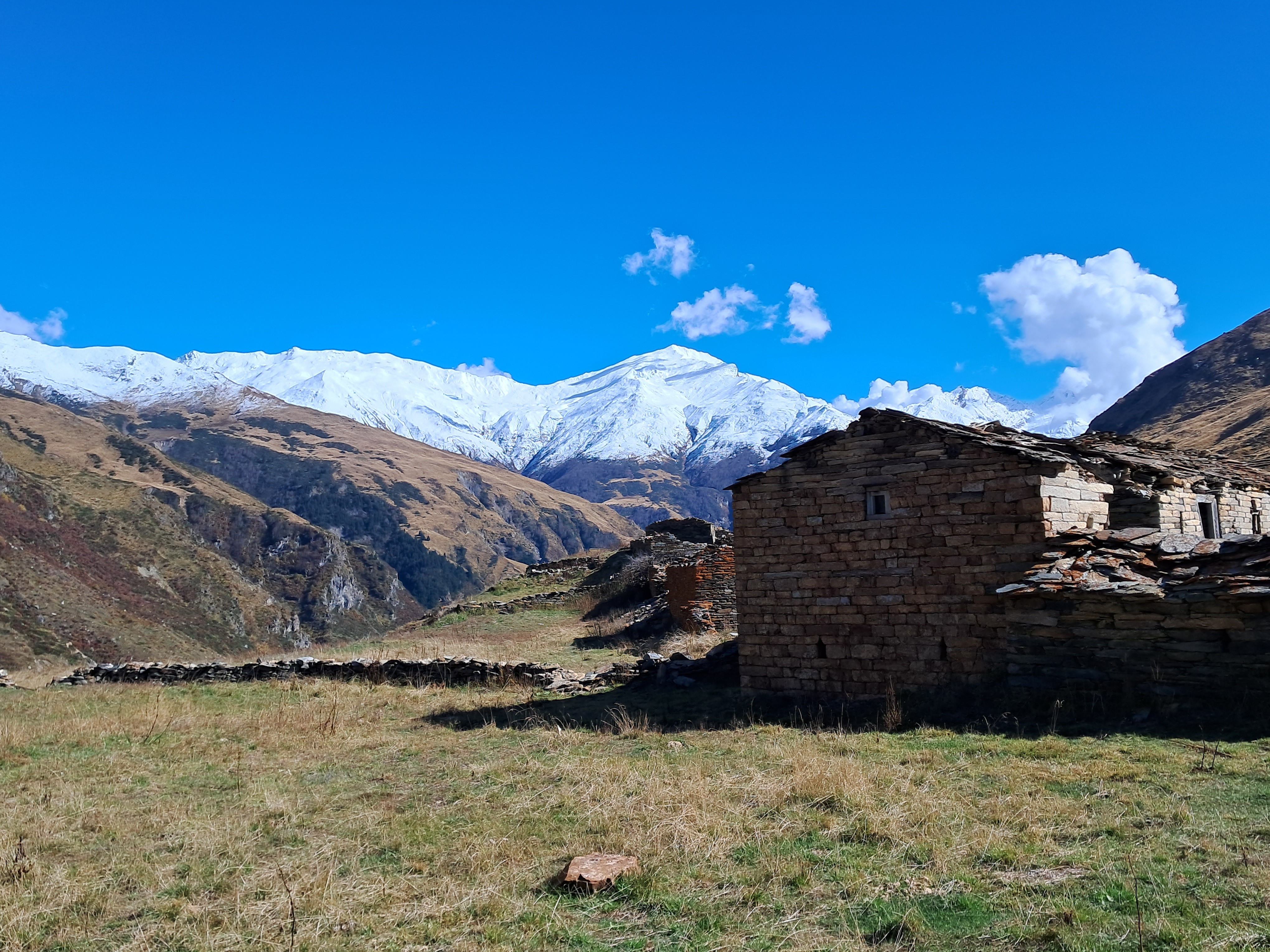
The Greater Himalaya near Bawaldhar, a small resting stop which we came across on the first day.

Another view of the Greater Himalaya in the vicinity of Bugdiyar. Notice the steep slopes, narrow valleys and the sheer rock faces and the cascading Goriganga river. 

A lovely rough trail near the Laspa area. The October colors really makes the landscape radiant. 

After Laspa, the Greater Himalaya made up of high grade metamorphic rocks give way to the low grade metamorphic and sedimentary terrain of the Tethyan Himalaya. You do notice a change in the topography from the sheer steep slopes and narrow valleys typical of the Greater Himalaya to the wider valley forms and gentler gradients of the Tethyan domain. 

The Goriganga at Rilkot. The river is more serene here making a soothing gurgling sound as it flow past. Also check out the gorgeous longitudinal gravel bars in the river channel. Permanent Link: Goriganga at Rilkot.  


The high meadows of Martoli. This is a beautiful if desolate place with stunning views of the high Himalayan all around. 

A lone resident of Burfu surveys his kingdom. Most of the villages were empty of people as residents had migrated to lower altitudes for the winter. The flat plateau seen in the background is a glacial outwash terrace. It was formed by streams redepositing debris that accumulates in front of a glacier. Thick layered river deposits create a plain in front of the glacier. At a later point in time, the river cut through its own deposits, forming flat terraces stranded high on the valley slopes. 

Encounter on a lonely trail. After walking alone for hours, it is always fun to meet the locals travelling between villages. We met this small caravan between the settlements of Burfu and Bilju. Permanent link: Encounter at Bilju.

 A house in Milam village basks in the October sun. 

The Goriganga snakes its way down Milam Glacier through the fabled Johar Valley. This location is a few kilometers downstream of the glacier. 

Near Milam Glacier! The actual glacier is about 4-5 km upstream of this location, but this is a good photo spot along the trail.

What a trip! I think late September to early October is really the best time to visit this area. The countryside is lush and you get clear views of the Himalaya. The local residents have still not migrated to lower altitudes and you can get to enjoy their company in the many hamlets along the way. However, this year, rains continued well into the second week of October. I feel with climate change there will be a greater unpredictability to October weather in the future.

Finally, a big thank  you to Emmanuel Theophilus, Malika, Kamala Pandey, and Munna Singh Nitwal for being such gracious hosts and making my trip so memorable.

A post on geology tips for trekkers is coming soon... 

Friday, February 4, 2022

Human Impact On Earth's Sediment Cycle

One common type of argument I hear from anthropogenic climate change deniers is that human activity is too insignificant to affect the balance of global natural processes. On one debate a participant claimed that one large volcanic eruption emits more carbon dioxide than that by human activity. The actual amounts contradict this claim. Volcanism on earth emits about 0.13 -0.44 billion tons of CO2 per year. Human activity on the other hand emits about 35-40 billion tons of CO2 per year.

Jaia Syvitski and colleagues have produced a similar eye opening review of the human impact on earth's sediment cycle. The production, mobilization , transport, and deposition of sediment is based on a balance between tectonic processes, climate, erosion, and human activities. Our impact on sediment movement and its sequestration has now become so large that it dwarfs natural processes. 

The paper is open access for a limited time. Earth's sediment cycle during the Anthropocene. 

It is dense reading, full of numbers on sediment loads and fluxes.

"Human activities have increased fluvial sediment delivery by 215% while simultaneously decreasing the amount of fluvial sediment that reaches the ocean by 49%, and societal consumption of sediment over the same period has increased by more than 2,500%".

or: The Indus River once transported about 270 million tons of sediment to its delta. It presently deposits only about 13 million tons per year. So much of Indus water is siphoned off by canals, that it  often turns dry before reaching the sea.  

 and one more: "Large dams have trapped about 3,200 Gt of sediment since 1950 (ref.123), approximately 74% of which would likely have reached the coastal ocean". (Gt =billion tons)

There are many such stories from around the globe about the staggering amounts of sediment extracted and redirected for human use. Next time, don't shrug off the news you read about unregulated sand mining from our rivers. It is causing serious damage to riverine and coastal ecosystems.

The review ends with a proposal to set up a ‘Earth Sediment Cycle Grand Challenge’, a collaborative effort to better understand the changes to the sediment cycle. Such an initiative we surely need to address the many ongoing and future threats to our rivers and deltas.

Monday, October 25, 2021

India Fossil Outcrops, Horse Domestication, Mars Landscapes

 From the past few days:

1) India is rapidly losing fossil rich outcrops to urbanization, expanding agriculture, mining, and unregulated fossil collection.

On International Fossil Day, October 23, 2021, the Paleontological Society of India, Pune Mumbai Student Chapter, organized a very informative online symposium on this topic. I have linked to part of the talks held that day. Paleontologist Dr. Rajani Panchang was the moderator. Several young researchers describe their field work in Kutch, Tamil Nadu, and Spiti Valley. Over the past several years, changes in land use and unchecked fossil removal has resulted in outcrop degradation and impoverishment.

.Video Permanent Link - India Fossil Outcrops .

Even though the Geological Survey of India and some local agencies have identified locations of geological importance, at present India does not have a law for the preservation of geoheritage sites. D.M. Banerjee writes about the struggle to get the Indian government to take up this issue seriously in his article Fate of Indian Geoheritage and Geopark Bill, published in the July 2021 issue of Current Science.

2) The origin of domestic horses has been a tough case to crack. It was long held using archeological evidence that horses were domesticated by the Botai Culture in Central Asia around 3500 B.C. But ancient DNA studies indicated that these early domesticated lines are not the ancestors of the modern domestic horse. Instead, the origin of the modern domestic horses have been tracked to the Volga-Don region in the Western Eurasian steppes between 2500 and 2000 B.C. The abstract of the paper is worth reading through- 

Domestication of horses fundamentally transformed long-range mobility and warfare. However, modern domesticated breeds do not descend from the earliest domestic horse lineage associated with archaeological evidence of bridling, milking and corralling at Botai, Central Asia around 3500 bc. Other longstanding candidate regions for horse domestication, such as Iberia and Anatolia, have also recently been challenged. Thus, the genetic, geographic and temporal origins of modern domestic horses have remained unknown. Here we pinpoint the Western Eurasian steppes, especially the lower Volga-Don region, as the homeland of modern domestic horses. Furthermore, we map the population changes accompanying domestication from 273 ancient horse genomes. This reveals that modern domestic horses ultimately replaced almost all other local populations as they expanded rapidly across Eurasia from about 2000 bc, synchronously with equestrian material culture, including Sintashta spoke-wheeled chariots. We find that equestrianism involved strong selection for critical locomotor and behavioural adaptations at the GSDMC and ZFPM1 genes. Our results reject the commonly held association between horseback riding and the massive expansion of Yamnaya steppe pastoralists into Europe around 3000 bc driving the spread of Indo-European languages. This contrasts with the scenario in Asia where Indo-Iranian languages, chariots and horses spread together, following the early second millennium bc Sintashta culture.

The paper is open access. And there is an easier to understand article in Nature as well. 

3) The remarkable range of technologies brought to bear on understanding the geology of Mars is giving some spectacular payoffs. Two studies caught my eye:

a) Mars' surface shaped by fast and furious floods from overflowing craters: Lake breach floods produced fast flowing streams that cut deep drainage valleys, reshaping the Mars landscape. Catastrophism has played a large role in the history of Martian surface evolution.

b) The Perseverance Rover rocks on!! The stunning images it has taken of rock outcrops on Mars is enabling geologists to reconstruct details of ancient sedimentary environments. N. Mangold and colleagues describe a delta lake system and flood deposits at Jezero Crater. 

Take a look at the details available to geologists for interpreting sedimentary processes and the rock history.

On Mars, large crater lakes were sites of sediment deposition. Rivers meeting such craters dumped their sediment on the crater floor in lobes that expanded lakewards forming a delta. The architecture of the sedimentary layers within this delta environment has been vividly captured and described in this study. In the image, the bottomset strata are fine grained sediment deposited in waters ahead of the delta. The foreset strata represent deposition on the inclined growing delta front. And the foreset strata are deposits of rivers associated with the delta. The paper is quite detailed and a treat for sedimentologists. But the images can be enjoyed by all. Open Access too!  

Friday, June 25, 2021

Articles: Trace Fossils, Supercontinents, Harappan Hydrology

 Some interesting geology rich readings from the past few weeks:

1) Ichnology is a branch of palaeontology that studies the traces made by organisms in soft sediment. These could be tracks and trails as animals move around on a substrate, or burrows constructed as escape structures or as dwellings, or bite marks on shells and bones. All these are indicative of behavior, which otherwise would be hard to discern from just the fossilized remains of body parts. Science writer Jeanne Timmons has written this lovely article on Ichnofossils and what they tell us about past ecology and animal behavior.

Trace fossils, the most inconspicuous bite-sized window into ancient worlds.

2) The earth has seen over its long geological history episodes of continents coming together to form a supercontinent, then breaking up and drifting apart forwhat seems an eternity, but eventually coalescing to form another giant landmass. When did this supercontinent cycle begin on earth. What are the forces that initiated and subsequently has maintained this mode of surface reconfiguration, and what are its consequences on tectonics, and the physical and chemical evolution of earth. A great review article by Ross N. Mitchell and colleagues.

The Supercontinent Cycle.

3) The rivers that sustained the Bronze Age Harappan Civilization have been the subject of lively research in recent years. Ajit Singh and colleagues have worked on the Markanda river catchment in the Sub-Himalaya dun region. Markanda joins the Ghaggar-Hakra river flowing through present day Harayana, Punjab and Rajasthan. They find that during the Mature Harappan Period (2600 B.C. to 1900 B.C.), large floods in the Himalaya foothill rivers sustained flow in downstream reaches, making  agricultural viable, even as northwestern parts of India experienced a reduction in summer monsoon strength.

Larger floods of Himalayan foothill rivers sustained flows in the Ghaggar–Hakra channel during Harappan age (behind paywall).


Friday, September 11, 2020

Bihar: Where Many Rivers Meet

I came across this passage in Vipul Singh's interesting book, Speaking Rivers: Environmental History of A Mid-Ganga Flood Country, 1540-1885. 


 "In consequence of the frequent changes which take place in the channels of the principal rivers that intersect the territories immediately to the presidency of Fort William and the shifting of the sands which lie in the beds of those rivers chars or small islands are often thrown up by alluvion in the midst of the stream, or near one of the banks and large portions of land are carried away by an encroachment of the river on one side, whilst accession of land are at the same time, or in subsequent years gained by dereliction of the water on the opposite side;... the lands gained from the rivers or sea by the means above mentioned are a frequent source of contention and affray,and although the law and customs in the country have established rules applicable to such cases these rules not being generally known, The Courts of Justice have sometimes found it difficult to determine the rights of litigant parties claiming chars or other land gained in the manner above described". 

It is a section of the preamble of The Bengal Alluvion and Diluvion Regulation of 1825 which the East India Company passed to assure a regular income from Diara lands. 

Diara land are ephemeral parcels of land that accrete to river banks or emerge in the middle of the river channel by sediment deposition. They can disappear in a decade or so as a major flood cuts away the river bank or erodes an island, only for newer land to appear elsewhere along this meandering fluid riverine landscape.

The satellite imagery covering the region between Patna in the west to Munger in the east forms the heart of this mid -Ganga floodplain.

Diara lands were traditionally farmed by landless peasants for the few months of the year that they were above water and then abandoned during monsoon inundation. There was no concept of ownership of these lands. The East India Company in its quest to maximize land revenue decided to regulate ownership of the Diara. It didn't always work in practice. Zamindars were reluctant to report the ground situation accurately and maps became outdated as topography and landscapes shifted quickly. Diara lands remained and still are a source of dispute.

Fascinating is the struggle outlined in the book of two long lasting empires with this river system. Before the Mughals, the Afghan ruler Sher Shah Suri occupied this region and had adapted to the capricious environment to his advantage. The Mughals though faced a different problem. Their power center was far to the west in Delhi and Agra. Carrying grains and goods from Bihar to Agra-Delhi using pack animals wasn't possible, since the expenses of feeding these animals would have left very little surplus. Being children of the Eurasian steppe, they preferred the horse and land transport, and that meant that they were unable or unwilling to develop a river navigation network on a commercial scale. The direction of river flow also worked against them. Sailing goods-laden boats upstream was challenging, especially as Vipul Singh points out, the Ganga upstream of Varanasi becomes difficult to negotiate. As a result the Mughals could never exploit or control this region fully. 

The British though found the river to their liking. The Grant of Dewani of Bengal, which the East India Company won in 1765, extended to the mid Ganga floodplains. The Company's main port lay downstream in Calcutta and their major markets across the seas in China and Europe. Using their expertise in navigation they soon set up a thriving trade in saltpetre, calico, opium and silk. Slowly, they also began imposing a linear topography on these curving meandering rivers. The building of embankments, canals, and barrages was thought necessary to control the inundation that could lead to a loss of a cropping season. The various Regulations and Acts meant to ensure a permanent and uninterrupted stream of revenue ended up changing the people's interaction with the river. 

These land regulations, beginning with the Permanent Settlement of 1793, entrenched the power of hereditary Zamindars who became Company rent collecting agents. It became especially hard for the landless to eke out a living as they saw even the ephemeral parcels of Diara which they had been farming now being allocated to the nearest Zamindar and his tenants. Large scale flood control projects carried out by Zamindars and encouraged by Company revenue officers began reshaping the ecology of the floodplains with embankments preventing floods in one region but exacerbating them on the opposite side or in downstream areas. Embankments also prevented smaller local streams from draining into the larger rivers, resulting in the water-logging of fields. Praveen Singh in The colonial state, zamindars and the politics of flood control in north Bihar (1850-1945), details how a web of social and economic interests spurred on this construction spree despite warnings from irrigation engineers about the detrimental effects of embankments.

Vipul Singh also emphasizes the linkage between physical processes and cultural evolution.  A unique Bihari regional identity emerged based on the homogeneous ecology, similar agrarian practices and a shared reverence for the Ganga. 

The Ganga of the plains is a turbid river. It transports several hundred million tons of sediment to the Delta. In this section of Bihar, it is joined by the Sone from the south and the Ghaghara, the Gandak and the Kosi from the north. The Kosi and the Gandak are especially sediment rich, carrying a suspended sediment load of 80 million tons per year and 43 million tons per year respectively. All this sediment is what makes this region special. A significant fraction of it gets deposited every year in the river channel and its floodplains. Over time, the Ganga and its tributaries have built vast alluvial deposits, through which the river finds its way, often getting choked on its own sediment, and then breaking free by cutting a new path for itself. This abundance of water and sediment has formed a complex fluvial ecosystem of meandering channels, river islands, abandoned courses, oxbox lakes, ponds, and wetlands. The organic rich silt deposited across floodplains by the rivers during monsoon inundation nourishes multiple crops. Life's daily rhythms became embedded in this ecology and its inhabitants evolved farming practices adapted to the changing tune of the environment.

There was linguistic pride too, not in one common 'Bihari' language, but in the various dialects spoken 'eh /e paar' and 'oh o paar'; this side of the Ganga and on the other side. Bhojpuri was the dialect of the Champaner area north of the Ganga, while to its east on the north side was spoken Maithili. In the Patna region on the south side was Magahi and towards the east near about Munger was Angika. These vernaculars with their common folk tales, poetry, and myths about deities, changing seasons, local plants and animals, and the Ganga, knitted the region together, away from the pull of the Delhi-Agra-Awadhi influence which lay to the west and the Bengali cultural sphere towards the east.

Magh ke garmi, Jeth ke jar
Pahila pani bhar gail tar,
Ghag kahen ham hoban jogi,
Kuan ka pani dhoihen dhobi
.

[Heat in Magh (January-February), cold in Jeth (May-June),and the tanks filled with the first fall of rain, are the signs of drought. Ghagh says that I will become a beggar, and the washer-men will wash with well-water.]  

This is a gem of a book. Highly recommended reading! 

Sunday, August 23, 2020

Books: Speaking Rivers, The Ice Age

 Ordered and received!

Prof. Vipul Singh is with the Dept. of History, University of Delhi, and he writes in the acknowledgments section that environmental history as a formal subject of study in history departments had a late start in India. The focus of the book is the flat lands of Bihar with its annual floods and shifting river channels and how Mughal and later British land use policies transformed the people's relationship with the river system. Looks like a very meaty book with plenty of Notes, Maps and a long Reference section. Will be sharing interesting snippets as I read along.


As one blurb says... "Perfect to pop into your pocket for spare moments".  A fine introduction by Jamie Woodward. The recognition that the earth has passed through several glacial and interglacial phases is really a triumph of field geology. Thick sedimentary deposits in Europe and N. America were recognized as being left behind by advancing ice sheets. The stellar role played by geologists in the mid-late 1800's and their debates grounded within the prevailing schools of catastrophism versus uniformitarianism is highlighted. And there are good succinct sections on the many modern theoretical advances in climate science and the techniques that geologists and climate scientists bring to bear upon understanding the mode and tempo of climate change.


Happy Reading.

Wednesday, January 22, 2020

Sedimentary Structures: Building Stones of Badami, Aihole And Pattadakal Temples

Is this sandstone slab in its original geological orientation (as when the sedimentary layers were deposited) or is it upside down? I'll answer this a little later, but first some background.


I recently visited the Chalukya style temples and rock cut monuments at Aihole, Pattadakal and Badami (6th -8th CE) in northern Karnataka and noticed some great sedimentary structures in the building stones. The term sedimentary structures refers to the shape and form sedimentary layers get sculpted into by the action of waves, currents, tides and wind during deposition of the sediment. The size of the deposited sedimentary particles and the orientation of layers are a reflection of both the vigor of the currents and waves and the direction of flow of water or wind.  


These monuments are made up of Neoproterozoic age (900-800 million year old) sandstones. Geologists have recognized using detailed sedimentological analysis that the sandstones formed mostly in a large braided river system that flowed in a northwesterly direction.

Between  roughly 1800 -800 million years ago, over the course of a billion years, the Indian continental crust sagged due to various tectonic forces to form several long lasting sedimentary basins. The Kaladgi Basin in which the Badami area sandstones were deposited is one such basin. The paleogeographic reconstruction below shows the position of the Indian continent at about one billion years ago and the location of the various sedimentary basins within it.


Source: Shilpa Patil Pillai, Kanchan Pande and Vivek S Kale: 2018: Implications of new 40Ar/39Ar age of Mallapur Intrusives on the chronology and evolution of the Kaladgi Basin, Dharwar Craton, India.

Much of this deposition took place in inland or epeiric seas that flooded the Indian continent. During intervals of sea level fall, rivers carved valleys and deposited coarse sediment. The Badami Cave sandstones are river deposits of the Kaladgi Basin. The stratigraphic column shows various sedimentary deposits of the Kaladgi Basin and their inferred environments of deposition.

Source: Shilpa Patil Pillai, Kanchan Pande and Vivek S Kale: 2018: Implications of new 40Ar/39Ar age of Mallapur Intrusives on the chronology and evolution of the Kaladgi Basin, Dharwar Craton, India.

The Badami braided river system was receiving sediment eroded from Archean age (>2.5 billion year old) rocks situated SE of the basin. These were granites, granodiorites, and low to medium grade metamorphic  rocks of the Dharwar craton (a large block of stable old continental crust). 

Land plants did not exist then. Weathered debris was moved quickly by surface flow into streams. Large sediment load, moving by traction i.e. by rolling and sliding on the stream bed, repeatedly choked the channels, forcing bifurcation of streams and formation of braids. Very broad braided rivers formed since there were no plants to stabilize banks.  The Badami sandstones (Cave Temple Formation) are technically known as arenites. This term indicates that the rock is made up of mostly coarse sand with very little finer sized mud. Accumulation of mostly coarser sand size and pebbly particles reflects a locale of repeated high discharges and vigorous currents which winnowed away the finer sized mud.  The braided river shown below as an example is from the Canterbury Plains of New Zealand.


 Source: Braided Rivers: What's the Story?

The Badami rocks preserve a record of  various subenvironments of this paleo-river. Picture shows channel and bar deposits in outcrop.


Source: Mukhopadhyay et. al. 2018; Stratigraphic Evolution and Architecture of the Terrestrial Succession at the Base of the Neoproterozoic Badami Group, Karnataka, India.

As river channels episodically migrated sideways and the basin floor subsided to accommodate more sediment, channel deposits and adjacent sand bars got stacked to form thick 'multi-story' sandstones. Each bed tells a story of a discrete depositional episode.


The arrangement of sand layers within each bed tells us about the subenvironments in which it formed and the energy and direction of water flow during deposition. I came across many types of these internal structures. I recognized tabular cross beds, trough cross beds, planar lamination and rippled beds. Water (or wind) can move & shape sand into piles or waves. Sand grains roll along the direction of flow, then avalanche down the steeper side (lee side) of the wave forming a layer inclined (cross) to the orientation of the main sand body. Successive avalanches form a set of cross beds. The graphic shows the formation of a set of cross beds.

 Source: Dr. Diane M Burns in Teaching Sedimentary Geology in the 21st Century.

Here is an example of cross beds from near the town of Badami.


And this one is from a building stone from Pattadakal temple.
 

Such cross beds were built by sediment avalanching on the lee side of migrating sand bars during high flow.

This picture show trough cross bedding from near the Badami cave complex. These represent the internal structure of migrating sinuous sand dunes on a channel floor. 


See this elegant explanation by Dawn Sumner, a sedimentologist at the University of California at Davis,  of how trough cross beds form.


Email subscribers who may not be able to see the embedded video, click on this link: Trough Cross Bedding Video.

And here is a beautiful example of trough cross bedding found in a Pattadakal temple building stone.


This is planar lamination on a slab at Pattadakal. The bed is constructed of parallel layers of coarse sand. It is interpreted to have been deposited in a high flow regime from sheets of water flowing over mid channel sand bars.
 

Ripples on a slab at Pattadakal. This is a rare preservation of a bedding surface showing rippled sand. Erosion usually cuts off the wavy upper part. These ripples indicate migration of small sand waves in a quieter flow regime on the channel floor.


Remember, cross beds are the inclined layers that form on the lee side of a ripple or wave or dune. Here are small cross sets on the floor of Aihole rock cut temple! These represent the cross beds formed by migration of small ripples. The ripples themselves have been eroded away. Arrows indicate the direction of water flow and cross bed accretion as ripples migrated.


Okay, let's go back to my first question. Is the slab I showed in the picture geologically upside down?

Yes it is. But how to tell?

As sand avalanches down the lee slope it forms a tail at the toe of the slope resulting in cross beds which become tangential to the floor. In picture the cross beds are tangential towards the top of slab i.e. that is actually the base.


Lets see at how the cross bed contact with the top and bottom bedding plane looks in an outcrop. Here is the original depositional orientation of cross beds manifest in this outcrop near Badami caves. They show a tail or tangential contact of the cross beds with the base. Since top of cross beds are not usually preserved they show a high angle contact truncated by upper bedding plane.


This slab is upside down too! Notice again the tangential contact of the cross beds (white arrow) is towards the top, which means that must have been the base. Yellow arrow points to high angle contact with the upper bedding surface. 


Towards the top of the exposed section of sandstone around Badami I came across some truly impressive examples of cross bedding. These particular exposures were on the crags opposite the four main Badami temples. There is a narrow passage past the archaeological museum and a short climb to the top. Take a look at these beauties!


These large cross beds reminded me of the inclined beds of wind blown sand dunes. Is it possible that abandoned sand bars were sculpted by wind in to big dunes? Or does this upper level sandstone represent, as a recent study suggests, the beginning of a marine incursion in to the basin? In this scenario, deposition of sand took place in high-energy shallow waters near the shore. These cross beds represent large migrating sand waves which were eventually shaped in to beach ridges and tidal bars.

The outcrops and building stones of these monuments mostly record the processes within the Badami braided paleo-river. 900 million yrs ago a complex of channels and bars, quieter pools and rippled sand beds existed where these temples stand today.


Do visit Aihole, Pattadakal and Badami and gaze at its splendid architecture and sculptures. But spare some time to appreciate the magnificent record of our natural history that these monuments preserve. 


Quiz- Is this slab upside down or in its true depositional orientation? 😉


Until next time....

Sunday, December 22, 2019

Glacial Saraswati?: New Data On An Old Question

Did a perennial glacial fed river flow through the Indus Civilization region of what is now Haryana and Rajasthan? Previous work on the fluvial history of this region had indicated that a distributary of the glacially sourced Sutlej was flowing through a network of paleo-channels buried under the river now known as the Ghaggar until around 8,000 years ago. The Sutlej distributary system then died out, turning that river course into a smaller monsoon fed channel system.

For a more detailed history of research on this topic you can follow this link - Ghaggar /Saraswati Posts.

Recently, in November 2019, Anirban Chatterjee and colleagues published new data on deposits of grey sand in the subsurface of the Ghaggar channel and adjacent floodplains. The youngest of these deposits are 4, 500 years old. Geochemical fingerprinting points to High Himalayan granites and gneisses as their source. This likely extends the glacial phase of the Ghaggar to more recent times, until about the beginning of the urbanization of the Indus Valley Civilization (IVC).

Here is the abstract:

The legendary river Saraswati of Indian mythology has often been hypothesized to be an ancient perennial channel of the seasonal river Ghaggar that flowed through the heartland of the Bronze Age Harappan civilization in north-western India. Despite the discovery of abundant settlements along a major paleo-channel of the Ghaggar, many believed that the Harappans depended solely on monsoonal rains, because no proof existed for the river’s uninterrupted flow during the zenith of the civilization. Here, we present unequivocal evidence for the Ghaggar’s perennial past by studying temporal changes of sediment provenance along a 300 km stretch of the river basin. This is achieved using 40Ar/39Ar ages of detrital muscovite and Sr-Nd isotopic ratios of siliciclastic sediment in fluvial sequences, dated by radiocarbon and luminescence methods. We establish that during 80-20 ka and 9-4.5 ka the river was perennial and was receiving sediments from the Higher and Lesser Himalayas. The latter phase can be attributed to the reactivation of the river by the distributaries of the Sutlej. This revived perennial condition of the Ghaggar, which can be correlated with the Saraswati, likely facilitated development of the early Harappan settlements along its banks. The timing of the eventual decline of the river, which led to the collapse of the civilization, approximately coincides with the commencement of the Meghalayan Stage.

The geological work looks to be sound. The data on sediment fingerprinting overlaps with what we know about High Himalayan geochemical signatures and present day Sutlej sand composition.

I do want to comment on another sentence from the abstract (emphasis mine)-

"This revived perennial condition of the Ghaggar, which can be correlated with the Saraswati, likely facilitated development of the early Harappan settlements along its banks"

Saraswati is the name given to this river by the Vedic people. Correlation of the river's perennial phase between 9,000-4,500 years ago with Saraswati is valid only if  you can demonstrate that the Vedic people were inhabitants of this region from before 4,500 yrs ago. Geological studies cannot establish this. A combination of archeology, linguistics (cracking the Indus script would be nice!) and genetics will eventually answer that. The other scenario is that the Vedic people could have migrated into this region much later and began venerating a smaller monsoonal Ghaggar as Saraswati. Work by Liviu Giosan and colleagues suggests that stronger monsoons over the Siwaliks sustained sufficient flow in the old channels of the Ghaggar until the late IVC period (~1800-1600 B.C).

When did this river come to be called the Saraswati is still an open question.

Two recent genetics papers using ancient DNA recovered from the IVC site of Rakhigarhi and from Central Asia argue that people from the Pontic-Caspian steppes migrated into South Asia between 2000 -1500 B.C. bringing with them the Indo-Iranian branch of the Indo-European language family. These would presumably be the Vedic people.

Read these papers. They are interesting.

1) On the existence of a perennial river in the Harappan heartland.
2) The formation of human populations in South and Central Asia.
3) An Ancient Harappan Genome Lacks Ancestry from Steppe Pastoralists or Iranian Farmers.


Friday, July 13, 2018

Sutlej Paleochannels- More Details

A while back I had written a post in response to a paper (Ajit Singh et. al. 2017) on the paleo-Sutlej river. The study used geochemical analysis to identify ancient channels of the river. Today, the Sutlej flows out of the Himalaya and joins the Indus River. But this study showed that until about 8000 years ago, the Sutlej (or at least a strand of the river) flowed along a different course. Its paleo-channels coincide with  the course of the river Ghaggar in Haryana and Rajasthan in northwest India. This topic is of relevance in studying how rivers may have impacted agricultural practices and settlement patterns of the Harappan Civilization. The geography of the river Ghaggar also matches that of the river Saraswati, described in the Rig Ved. There is therefore considerable interest in working out the detailed history of these rivers.

I had pointed out that an earlier paper by Liviu Giosan and colleagues has used topographic criteria to come to a similar conclusion as Ajit Singh and colleagues. Giosan's study stressed that today the Sutlej and Yamuna flow along deeply incised valleys that were cut in the early Holocene (~10,000 to 8700 years ago). The absence of such valleys in the region between the present day Sutlej and Yamuna indicates that the Ghaggar channel was not being fed by glacially sourced rivers since 10,000 -8700 years ago.

The relief rendition below is from Ajit Singh's paper. It shows clearly the incised valleys of the Sutlej and Yamuna. I had overlain the blue line and suggested that if the Sutlej had flowed into the Ghaggar in early Holocene, there should have been an incised valley along the blue line.


As it happens, Sanjeev Gupta, who was the lead scientist of the study by Ajit Singh and colleagues, is a reader of my blog. He emailed me and has provided more insights regarding these paleo-channels.

I am posting his comments below with his permission.

My comment from the earlier post- The modified relief rendition below also shows the course of the abandoned Sutlej incised valley. Note that this valley is much narrower than the Sutlej and Yamuna incised valleys. Also, trace these narrower incised valleys upstream and you can see that they originate in the Siwaliks. There are no deep extensive incised valleys along the route I have marked in blue. The Sutlej would have carved a prominent incised valley roughly along the blue route had it been flowing into the Ghaggar during most of the early and mid Holocene. Its absence suggests to me that the valley annotated as the abandoned Sutlej incised valley was really carved out in the earlier part of the Holocene by the smaller Ghaggar river originating in the Siwaliks.

Sanjeev Gupta's reply - Just to respond... we only see the incised channel in the SRTM where the valley is not completely infilled. Indeed where we see the valley in SRTM it is not the base of the incised valley. but a partially infilled valley. So along the blue line you have drawn there is likely to have been a valley but it is entirely infilled.

My comment (with regards to the 'abandoned Sutlej incised valley' in the above relief rendition) - (it)....was really carved out in the earlier part of the Holocene by the smaller Ghaggar river originating in the Siwaliks.

Sanjeev Gupta's reply- This is not possible because all the geochemistry signature is of the Sutlej - the base of the valley actually occurs in the stratigraphy.

We have some newer data that better constrain the timing of incision but I stress the topographic surface is not the base of the incised valley - that lies in the subsurface.

...end.......

So, Sanjeev Gupta's view is that present day topography is not necessarily a more reliable guide to the course of these ancient rivers. Geochemical fingerprinting is the way to go.

Update July 22 2018:

Liviu Giosan posted a comment which led to an extended exchange with him regarding this topic. I have copied his comments below with his permission.

Me- Hi Liviu- was going to message you about my post when I saw your comment. Regarding Sanjeev Gupta's view, wondering if this is a matter of scale. The subsurface paleo valleys he says exist were much smaller valleys carved by a waning Sutlej and hence got infilled? Not quite the wider incision profile carved later by the river  along the present course.

Liviu Giosan - A matter of scale, time since abandonment, and location relative to a sediment source. Maybe I do not see Sanjeev's point. His work confirmed ours for holocene and in adition showed a pre-Holocene channel. A recent paper by Dave et al. showed the same thing for Yamuna.

Me- thanks. Can you send me the link to Dave et. al.?

Liviu Giosan - I can send you the paper. Please elaborate: what is Sanjeev's point?

Me- He hasn't elaborated. Those two short para's  i put up was all he emailed. I guess he is saying that there are incised valleys in the interfluve subsurface but are now infilled and so not picked  up by SRTM.

Liviu Giosan - That may be true but I doubt they will be all the way in filled unless they are old (preHolocene). After all his work shows a network of holocene streams in the region using SRTM. Further geochemistry we did  downstream so far is pretty (Clift et al. not cited by Sanjeev) shows no holocene contribution from Sutlej. Even more Sutlej incised since early Holocene making it almost impossible to feed shallow channels on the interfluve. This needs to be interpreted with all available evidence. Geochem is no silver bullet in isolation.

..end...

Sanjeev Gupta did mention to me that the point about topography is important but they did not have the space to address it in their paper. So, while there are differences in viewpoints about emphasis on techniques,  the overall data does point to a switch in the course of the Sutlej around 8-10 thousand years ago.

The paper on the paleo-Yamuna that Liviu Giosan mentioned is by Aditi Krishna Dave and colleagues. They examine detailed lithologs of the Chautang channel near the town of Hisar, Harayana, and with OSL (Optically Stimulated Luminesence which indicates the time of burial of sediment) age constraints propose that the Yamuna, which was flowing westwards and joining the Ghaggar-Hakra downstream of its confluence with the Sutlej, changed course and started flowing eastwards by 24 thousand years ago. I'll put up a short post on that shortly.

Tuesday, January 9, 2018

Note On The Sutlej Paleochannels

The topographic relief rendition posted below shows beautifully the incised valleys of the glacially sourced Yamuna and Sutlej rivers. This rendition has been derived from the NASA Shuttle Radar Topography Mission (SRTMv3) DEM (Digital Elevation Model) with a 1 arc-second or 30m spatial resolution. The region depicted in the figure is immediately west of the Himalaya frontal ranges covering parts of Punjab and Haryana.


Source: Ajit Singh et. al. 2017 - Counter-intuitive influence of Himalayan river morphodynamics on Indus Civilisation urban settlements.

This incision began during the early Holocene, beginning about 10,000 to 8700 years ago and continuing over the next few thousand years, as proposed in an earlier study by Liviu Giosan and colleagues. A decline in monsoon strength over northwest India resulted in low sediment load carried by the rivers. Under such conditions, starved of sediment, the river starts cutting down or incising into its older deposits. Over time they carve out large valleys as the Yamuna and Sutlej have.

During the mid Holocene, from about 6000 years to 3800 years ago, the region between the Yamuna and the Indus was extensively settled and farmed by the Harappan people. The river Ghaggar flows through this region. One popular theory supported by many geologists was that during Harappan times the river Sutlej flowed into the river Ghaggar, switching to its present course only about 4000 years ago. However, Giosan and colleagues had argued that had that been the case, a large incised valley should have been carved by the Sutlej from the point it exits the Himalaya to the point it joins the Ghaggar. The absence of a wide NE-SW oriented incised valley in the interfluve between the Yamuna and the Indus indicates that the Sutlej did not flow into the Ghaggar during most of the Holocene.

 A recent study led by geologist Sanjeev Gupta (Ajit Singh et. al. 2017)  has validated this scenario using geochemical criteria. They have shown that the Sutlej river once did flow into the Ghaggar but changed course and joined the Indus in the late Pleistocene -early Holocene between 15000- 12,000 years and 8000 years ago. Additional data from Giosan and colleagues shows (SI Text) fluvial deposits of Late Pleistocene-Early Holocene age (latest being 10,000 years old) along the present day Sutlej floodplain. These staggered dates imply that a major channel of the Sutlej avulsed or changed course as early as 15000 to 12000 years ago. A smaller strand of the river continued to flow into the Ghaggar until about 8000 years ago or so.

All this means that the Harappan settlements and agriculture in this region was not sustained by a large perennial glacial fed river. Rather, the Harappans adapted their water usage strategy and farming practices to exploit a smaller and maybe an ephemeral river and more distributed water sources.

The geochemical  work by Gupta and colleagues has been rightly praised and highlighted in many media reports. What did go unnoticed and unappreciated was the relief rendition of the incised channels. They provide a very powerful visual representation of the Holocene fluvial history of this region.

The modified relief rendition below also shows the course of the abandoned Sutlej incised valley. Note that this valley is much narrower than the Sutlej and Yamuna incised valleys. Also, trace these narrower incised valleys upstream and you can see that they originate in the Siwaliks. There are no deep extensive incised valleys along the route I have marked in blue. The Sutlej would have carved a prominent incised valley roughly along the blue route had it been flowing into the Ghaggar during most of the early and mid Holocene. Its absence suggests to me that the valley annotated as the abandoned Sutlej incised valley was really carved out in the earlier part of the Holocene by the smaller Ghaggar river originating in the Siwaliks.


Modified from :  Ajit Singh et. al. 2017 - Counter-intuitive influence of Himalayan river morphodynamics on Indus Civilisation urban settlements

Aside: After Liviu Giosan's paper came out, the archaeologist Shereen Ratnagar asked me whether incised valleys are diagnostic of glacial rivers. She was puzzled because the monsoonal rivers Marakand, Ghaggar and a number of smaller streams which originate in the Siwaliks have also carved incised valleys. The answer is no, they are not. What Giosan's work was pointing out was that wide incised valleys of a particular telltale orientation were absent, thus providing a clue as to when the Sutlej changed its course.

Thursday, August 10, 2017

China Hydraulic Engineering - Yellow River And The Grand Canal

I am reading Philip Ball's excellent book The Water Kingdom: A Secret History Of China. It describes the epic problems of river flow management that China has grappled with over millennia. Enormous floods have always ravaged China. At the site of a large dam at Sanmenxia on the Yellow River is an inscription in honor of the Great Yu ( ~ 2200- 2100 B.C), who as the story goes,  conquered a flood. The inscription says " When the Yellow River is at Peace, the Nation is at Peace". Flood control required enormous civic resources and cooperation and the ability to tame river waters gave political and moral legitimacy to the ruling class.The taming of nature using cooperative people power and as a sign of a strong united society has deep roots in Chinese political thinking.

One particular vexing problem was the very high rates of silt load carried by the Yellow River. A vast area of the Yellow River watershed drains the Loess deposits of north central China. This is a plateau made up of loose friable sand and silt blown in from the Gobi desert of Mongolia. Erosion of Loess fills the river with sediment. There is 300 grams of sediment for every kilogram of Yellow River water giving the river a reddish golden color. Erosion has carved the Loess Plateau in to a landscape of ravines and gorges. The American journalist Edgar Snow in the 1930's described it thus:

" an infinite variety of queer, embattled shapes - hills, like great castles, like ranges torn by some giant hand, leaving  behind the imprint of angry fingers. Fantastic, incredible and sometimes frightening shapes, a world configurated by a mad God - and sometimes a world of strange surrealist beauty. "

High rates of sedimentation meant that the Yellow River bed could aggrade or rise, increasing the risk of the river breaking its banks and flooding the countryside. Dyke building to constraint the river channel began as early as the seventh century B.C. by the state of Qi.

Constant dredging of the Yellow River and the associated tributaries and canal systems ( the Grand Canal) was also required to maintain a channel deep enough for navigation to move armies and grains from south to north.  River channel and canal maintenance acquired a new urgency when Zhu Di known as the Yongle Emperor of the Ming dynasty moved the capital north from Nanjing in the eastern province of Jiansu to Beijing in the early 1400's. The rational was probably to keep the political center closer to the armies amassed on the northern frontier where the Ming faced a threat from the Mongol and Manchurian steppe people. Later in the 1600's, the Manchurians overthrew the Ming and established the Qing Dynasty. Although over time, the Qing assimilated into the larger Han cultural milieu, they felt more at home in the north of the country. That meant the Yellow River and the Grand Canal system had to kept in top navigable order.

Desperation to unclog  the river channel spurred technological innovation. 

An extract:

Removing silt from the Yellow River demanded some impressive technology, not to mention serious organization. The Song government set up a Yellow River Dredging Commission in 1073 which began to deploy boats equipped with dredging tools. The vividly named  "iron dragon-claw silt dispersing machine" was a great rake pulled along the riverbed to agitate the silt and return it to the flow. This principle was extended with the 'river-deepening harrow', a 2.5 metre-long rotating beam fitted with iron spikes, like a thresher for riverine mud. The Ming imperial censor Chen Bangke introduced new techniques in the late sixteenth century, such as wooden machines set rolling and vibrating by the current to constantly stir up the sediment. In the dry season Chen proposed simply digging out the silt manually.

The Ming official Pan Jixun in 1565 or so came up with a solution that has made him one of China's water heroes. He pointed out that if one confines the water flow to a narrow channel, it will have enough strength to scour the sediment off the river bed. There would be minimal need for laborious manual dredging. He may have borrowed the  idea from a Confucian text of the Han era (~200 B.C - 220 A.D) called Zhou li (Rites of Zhou) which stated "A good canal is scoured by its own water". 

Chinese philosophical tradition impacted river management strategies. Daoists argued that the river be given room to spread and build wide floodplains in concert with the principle of wu wei which could be read to mean "do nothing" or "having a yielding attitude".  Confucians on the other hand wanted the river to be managed by human  engineering and recommended the construction of high dykes to keep the river channel narrow and constrained.

Joseph Needham, the noted historian of China writes that 'during twenty centuries the two schools contented'.. 'and neither proved wholly successful'.

Highly Recommended.

Friday, July 28, 2017

The Lost Rivers Of The Harappan Civilization- Remote Sensing Analysis

A lot of ink has been spent of this topic, both in the scientific literature as well as in popular books about the Harappan Civilization. The focus of many of these efforts has been on locating the "Vedic Saraswati", a river mentioned in the Rig -Ved. It is described as occupying the region between the Yamuna and the Sutlej and has been identified by many workers as the present day Ghaggar-Hakra.

Settlements of the Harappan Civilization were spread out over quite a large area in northwest India. Hence, it is necessary to map in detail the broader once existing hydrologic networks to assess the relationship between settlements and patterns of water availability and water use. This study uses remote sensing data and image processing techniques to unearth some of the buried paleo-river networks of this region of northwest India.

Twenty eight years of Landsat 5 imagery totaling 1711 multi-spectral images was bulk processed. This use of data covering multiple dates in a year allowed the investigators to reduce visibility issues related to shifting land use and cultivation, changing moisture patterns and variable cloud cover. 8000 km of paleo-river channels were mapped, some identified in previous studies, but many recognized anew.

The paper describes the various image processing techniques used to tease out the spectral signatures of the buried rivers. Don't be alarmed by words like Normalized Difference Vegetation Seasonality Index (NDVSI), Principal Component Analysis and the Tasselled Cap Transform.  One can understand the final interpretations without getting into the details of these techniques. Let me give a brief idea though.

These are techniques has increase the contrast between vegetation, soils with different moisture levels and bare terrain. For example, due to stronger water flow the river channel itself and the levees it builds contain coarser sediment as compared with the adjoining floodplains. These coarser sediment contain less organic matter and are less fertile. Less vegetation grows on the buried channels and levees than on the more fertile fine grained floodplain sediment. This contrast shows up well on data processed using NDVSI which essentially maps the vigor of vegetation. This technique was useful in delineating channels in the northern part of the study area.

The southeast part of the study area is more arid and has less changes in vegetation across the landscape. Here, the Tasselled Cap Transform was more useful in identifying river channels. This techniques organizes the spectral information into several (usually three) main axis or bands of information. One axis contains data variability of reflectance of bare terrain (mineral mixtures). The second contains variability in greeness (vegetation), and the third contains variability of wetness (water and soil moisture). Again, to give an example, this southeast region is fed by rivers draining Aravalli limestones. The calcium carbonate leached away from the rock is precipitated along river channels as a chalky mineral deposit. Buried channels show up as ribbons of  bright reflectance in  the Tasseled Cap Transform brightness band. Imagery of the dry months shows these channels more clearly, since in the wet months, increased soil moisture reduces the contrast of calcium carbonate rich sediment.

A judicious use of such techniques thus enabled the researchers to identify buried networks with different vegetation, soil moisture and mineral brightness properties. 

A map of the interpreted buried rivers is posted below.


Source: Hector A. Orengo and Cameron A. Petrie 2017

Of importance is a critique of some previous studies which attempted to highlight the spatial relationship between river channels and archaeological sites (emphasis mine):

The data provided by these analyses are also important in contextualising previous studies in which palaeo-rivers have been dated using the distribution of known archaeological sites. Notwithstanding the positional accuracy of these locations (see [10,63,64]), which would severely hamper their use for validation purposes, the results for the northern sector of the study area (Figure 3) suggest that proximity to the river might not be a good indication of contemporaneity as the fields close to the river channel might not have been the most productive in agricultural terms. Sites with an agricultural orientation might have preferred to occupy elevations above flooding level in the finer sediment accumulation area. Flooding events and changing river courses could also have had an important effect in the preservation of archaeological sites eroding and burying those that were locatedin the path of new courses or in their sediment accumulation areas.

In addition to these factors, the scale at which these correlations between specific palaeo-channels and settlement locations have usually been published (e.g., [30] (pp. 359–387), [31] (Figure 4.2)]) do not allow the accurate correlation between the two elements. The use of large area (small scale in a geographic sense) site distribution maps for these correlations results in a visual association between the shape of the palaeo-river and the line formed by the grouping of sites, but at these scales the sites could be aligned to a number of palaeo-channels given the number of rivers and the parallel morphology of the drainage in the Sutlej-Yamuna interfluve revealed here. This analysis thus suggests that at these scales it is not possible to co-relate lineal distribution of archaeological sites to any particular palaeo-river that we have documented. The results from previous studies reconstructing the chronology of the hydrological system using the position of archaeological sites and vice versa(e.g., [24,25], [30] (pp. 359–384), and [31]) are, therefore, considered unreliable.


..and

Given the complexity of the hydrological system, the variety in the climatic and weather system of this region, and the diversity of ways that ancient populations are likely to have obtained water, it is unwise to use the date of occupation at specific settlements to date when specific channels carried water. It is essential to date the different palaeo-courses independently to properly reconstruct the evolution of hydrological networks over long periods. The chronologically consistent reconstruction of this palaeo-river network would allow the testing of different hypothetical scenarios of water availability through the use of network analysis in combination to hydrological analysis.

Interesting work. Open Access.