Showing posts with label field work. Show all posts

Friday, May 1, 2026

Across The Eparchean Unconformity

An unconformity is a gap in the recording of earth's history, similar to missing pages in a book. These breaks are more common than is realized. Stratigraphers, who organize geologic history, estimate that the time spans of non deposition exceed that of episodes of deposition. These gaps could be fleeting, as in a river meandering away and then reoccupying the old channel, or they could indicate conditions of non deposition and erosion lasting tens to even hundreds of millions of years.

Geologists recognize a hierarchy with the longer lasting breaks often pointing to major changes such as a mountain building phase accompanied by a prolonged sea level fall. As sediment deposition stops, erosion will often sculpt the top of the rock formation into an uneven surface. Eventually sediment deposition will resume. Geologists term such a break between the two phases of rock formation as an erosional unconformity.

Recently, the Geological Survey of India added the Eparchean Unconformity to its growing list of Geo-Heritage sites of national importance. This is one of those major long lasting erosional breaks seen in the Precambrian terrains of India. The chosen site is near Kalinjar Fort, in Banda District of Uttar Pradesh. Image Source: Geological Survey of India.

At this location, 1.2 billion year old sandstone of the Vindhyan Basin overlie 2.5 billion year old Bundelkhand granites marking more than a billion years of non deposition and erosion. While the amount of unrecorded time is significant, the real importance of this site is in the very different earth conditions represented by the older Bundelkhand granite as compared to the much younger Vindhyan sandstone. This unconformity marks the transition between the older Archean Eon and the younger Proterozoic Eon.

The Archean was a much hotter world. Melting of the earth’s mantle was producing large batches of silica rich magma which solidified to form buoyant continental crust, small rafts at first, growing into larger blocks as time went by. Vertical crustal movements created narrow depressions which got filled with lava and sediment eroded from nearby granitic highlands. These volcano-sedimentary successions were deformed and metamorphosed, and were preserved as enclaves within the granitic terrains.

By around 2.5 billion years ago, magmatic growth of continents petered out. Geologists estimate that around 70% of the present volume of continental crust was generated between 4 billion to 2.5 billion years ago.

As the mantle cooled, the more stable continental crust became the floor for a younger generation of sedimentary basins. The processes of chemical weathering and sediment transport became more prolonged on this wide gently subsiding continental terrain. As a result, waves and currents had more time to sort sediment by size, shape, and density before it was buried.

Thick deposits sorted by size into gravel, sand, and mud are the typical features of these younger basins. At places, ocean water saturated with calcium carbonate precipitated layers of calcite and aragonite sediment, preserved today as thick limestone. The biosphere was dominated by bacteria and unicellular eukaryotes, their morphology often imprinted on the rocks as wavy layers or as small mound shaped objects.

Magmatism and continental crustal growth continued less frequently in pulses coinciding with regions of plate convergence and orogeny. This phase, before large animal life evolved, lasting between 2.5 billion years and 539 million years ago is known as the Proterozoic Eon.

The newly listed National Geological Monument at Kalinjar Fort showcases these changing earth conditions.

For many decades though, exactly where to place the Eparchean Unconformity was something of a problem in Indian field geology. There was only sparse information on the absolute age of rocks and no consensus on the time span the Archean represented. Field mapping through Peninsular India indicated the presence of a distinct erosional break between deformed and metamorphosed rocks (crystalline basement) and younger flat lying or less deformed sediments. This appeared to be the natural horizon between the Archean and the Proterozoic.

But flat lying sedimentary sequences in different Indian basins, often referred to as Purana Basins, had been deposited at different times on older deformed rocks of varying ages. In some cases the foundation of the sub-horizontal sedimentary basins was indeed Archean. In other locations, the highly metamorphosed and deformed older rocks were actually Proterozoic. That meant that the Eparchean Unconformity, as earlier conceived, was not a useful marker of synchronous changes in earth processes. Many of these doubts are summarized early in this 1968 perspective on the Eparchean Unconformity by Dr. T V V G R K. Murthy, faculty at University of Sagar.

The dates for the Archean-Proterozoic transition have now been fixed at 2500 million years by the International Subcommisson of Precambrian Stratigraphy, without any condition regarding the rock type above and below the unconformity surface. As a result, the older criteria for identifying a particular erosional break as the Eparchean interval based on only rock types and extent of deformation was no longer tenable.

We finally have an answer for the question posed by Dr. Murthy so long ago:

“Does the eparchaean unconformity become evident by recognizing Archaean and Purana formations or are the Archaean and Puranas recognized by identifying the eparchaean unconformity”.

Today, better absolute dating of rocks makes differentiating Archean from Proterozoic rocks easier. The Eparchean Unconformity though is still an informal but useful term in Indian field geology signifying the cooling trajectory of the earth’s interior, with a hotter Archean transitioning to a cooler Proterozoic.

One of my earliest encounters with the Eparchean Unconformity occurred during my graduate studies. I was assigned to map an area of the Cuddapah Basin near Gani village in Andhra Pradesh, South India. I first traveled by the Dadar -Madras (now Chennai) Express to Guntakal. There, I transferred to a medium gauge train passing through small market towns connecting a vast hinterland an urban kid like me was unfamiliar with. The train chugged along eastwards towards Nandyal. For a couple of hours from Guntakal, we were firmly on Archean terrain, an agricultural landscape interrupted by small hillocks of granitic rocks. In a distance through the late morning haze we could see the low Cuddapah hills with their distinct tilted strata.   

The train crossed the Eparchean Unconformity and entered the Proterozoic through a breach in the Cuddapah hills at Dhone Junction. Ahead was the Cuddapah Basin stretching to the horizon.

We moved through quartzites, limestone, and shale, the three predominant sedimentary rock types of the shallow marine Proterozoic continental shelf. At Nandyal I had to hop onto a bus going to Kurnool. Gani village was midway between these two places. I remember arriving at Gani late evening to a warm welcome by my host Mr. Sivanand Rao. Next morning, with maps and aerial photos, hammer, and a geologic compass I started out. A half hour walk south of Gani were outcrops of the sedimentary rocks I had to map. It was a challenging and immensely satisfying introduction to field geology.

Picture shows a very youthful me and my field guide Yanganna standing in front of a quartzite hill. Captured by my accompanying batch mate Nitin Rane. June 1987.


Someday soon I hope to retrace my steps to little Gani village. The medium gauge tracks from Guntakal to Nandyal have long been replaced by standard gauge. Express trains pass through Nandyal, eventually swerving north towards Vishakapatam, or continuing south east towards the Coromandel Coast.

From Nandyal I may hire a car to Gani. I hope to meet Mr Sivanand Rao who so graciously hosted me over two field trips. I want to walk again towards the hills made of Paniam Quartzite, a sand deposit sorted and washed clean by powerful Proterozoic tides. Today, the Kurnool-Gani solar park stands near Gani, its tilted solar panels made up of ultra pure silica wafers making up an Anthropocene analogue of the more ancient quartz rich deposits.

Photomicrograph shows the Proterozoic Paniam Quartzite classified as a “super mature quartz arenite”. Notice the well rounded quartz grains outlined by iron oxide. Location - Gani anticline.

Beyond the quartzite hills are the Vempalle Formation dolomite, a vestige of the Proterozoic ocean I first waded in to begin my life long association with carbonate sedimentology. It will be a home coming of sorts for me.

Photomicrograph shows microbial layers in the Vempalle dolomite. Dolomite crystals of different size and shape have replaced the original organic mats. Location- Gani anticline.

I have one more incentive to relive this journey. The filter coffee at Guntakal railway station canteen. It is the very best.

Friday, May 30, 2025

Shrinking Panchachuli Glacier

Over the past few years I have been regularly visiting the Panchachuli Glacier in the Kumaon Himalaya. Accompanying me are a group of geology enthusiasts from all walks of life. This is an outreach effort I have undertaken in collaboration with Deep Dive India. 

Every time I make it a point to walk to the glacier snout where the river Dhauliganga emerges from an ice cave. Every time my experience of approaching the glacial terminus is different. The Panchachuli Glacier is a shape shifter. I have to walk a little longer each time to reach the snout, negotiating the changing configuration of rubble mounds and streams.

I thought I would document the retreat of the snout over time using field photos from my visits beginning year 2017 and supplemented by Google Earth imagery going back to the year 2000. I won't keep you in suspense. The glacier snout has retreated by about 1 kilometer in the last 25 years. That is by 40 meters per year. But the rate has varied, with an acceleration in the past 8 years.

Let's begin with a synoptic view of the glacial valley.


The walk begins at village Dantu. It is about 6 kilometers to the present position of the snout. The red lines are edges of old lateral moraines. They are stable features and are easily recognizable in the satellite images. They are my fixed marker posts against which I will track the changing position of the snout. Distance to the snout in all images is estimated from marker post A. 

Year 2000- Google Earth Imagery.

Notice the curvilinear cracks (white arrow) near the snout. The glacier retreats by slices of ices cleaving off these cracks. Between the two marker posts is a smaller glacial valley. Semicircular depressions and ponds have formed on the glacier surface due to thawing of the ice. The distance to the snout from A is about 1.3 kilometers.

Year 2012- Google Earth Imagery.


Distance to the snout from marker post A is 840 meters indicating a retreat of 460 meters in 12 years, averaging about 38 meters per year. The smaller valley still has a fair amount of ice accumulation.   

Year 2017- Field Photo.

This was taken during my first visit from a high vantage point along the trail to "Zero Point", a popular trekking spot along an old lateral moraine. 

Year 2017- Google Earth Imagery.

Between 2012 and 2017, the snout has retreated a further 120 meters, an average retreat of about 26 meters per year. The frontal part of the smaller side glacier is now showing signs of collapse. Pronounced curvilinear cracks have appeared and glacier retreat has left behind rubble mounds producing an uneven topography at the front.

Year 2023- Field Photo.

Taken from close to the 2017 vantage point. 

Year 2023- Google Earth Imagery.

The snout is now just 280 meters from marker post A. This implies a retreat of about 430 meters between the years 2017 to 2023. The average rate of retreat is an astonishing 71 meters per year. There are signs of significant changes around the glacial terminus. The snout is now up-valley of marker post B. The smaller valley between the marker posts is almost completely ice free. A surface drainage has developed along this side valley and joins the main Dauliganga stream just downstream of the snout. The multiple small streams in the area is due to drainage finding its way around fresh mounds of rubble.

My most recent visit was earlier this month in May. Google Earth does not have imagery from 2025. But I will share a field photo taken from the high slopes looking down towards the snout.


The snout has retreated by tens of meters and is almost in line with marker post A, strongly suggestive of high rates of retreat persisting over the last couple of years. The area around the terminus is a degraded landscape with rubble heaps everywhere. We could not get very close to the ice cave this time due to time constraints but I assessed it would have been a more difficult passage negotiating the multiple streams and boulders. 

The rates of retreat that I have estimated are a little higher than those made by geologists from other parts of the Himalaya. A Ministry of Earth Sciences press release from 2023 has shared some data on Himalaya glaciers. The average retreat rate for Ganga Basin glaciers is about 15 meters per year, while that for Brahmaputra Basin is about 20 meters per year. 

A more detailed study of Gangotri, India's most famous glacier, shows a retreat rate of 20 meters per year. Significantly, the retreat accelerated in the past few years to about 33 meters per year, a pattern I too have observed for the Panchachuli Glacier. 

Himalayan rivers provide water security for hundreds of millions of people in the Indian subcontinent. Glacial runoff contributes a timely and significant amount of water to these rivers. The Indian government is building and planning scores of dams in the Indus, Ganga, and Brahmaputra basins with elaborate arrangements of water use and water sharing with different stakeholders. Given the massive ice loss and changing climatic patterns, it is imperative that detailed feasibility studies of these projects in terms of both safety, and near, mid, and long term projections of water availability are carried out. 

I'm putting up this final image taken in May 2025 from near the Dhauliganga stream looking towards the terminus. 


It captures nicely the long term changes that have taken place. The blue line marks the top of the glacier. Fresh collapse has exposed shiny ice walls. The brown line above is the crest of an old lateral moraine, several hundred feet higher than the present day glacier surface. 

Is there a better landscape to contemplate and appreciate climate change and the dynamic glaciers which have shaped our planet over past centuries?

Wednesday, February 26, 2025

Oil Hunters Of India

At Independence in 1947, India had just a few operational oil wells situated in the northeastern region of the country. Most of the subcontinent's sedimentary basins remained unexplored for their hydrocarbon potential. The Oil Hunter: Journey of a Geologist for India's Oil Exploration by Dr. Shreekrishna Deshpande is a personal recollection of the immense effort undertaken by Indian geologists to re imagine these basins as hydrocarbon source and reservoir rocks. It is the story of the development of India's oil industry told with unconcealed pride.

Russia, France, and the U.S. offered personnel and technical help along the way, but the lion's share of the credit goes to geologists of the Oil and Natural Gas Corporation for their perseverance and resilience in the face of immense challenges.

Dr. Deshpande joined the ONGC in its early days in 1961 and describes vividly his field experience in remote locales all across the country, from scorching Kutch, to steep Himalaya terrain, to facing personal danger during an insurgency in Assam. There were inevitable career challenges along the way due to changing institutional structure and unrealistic political expectations. Their impact on company work culture and productivity is described in honest and direct language.

One of my favorite passages comes towards the end of the book where he explains the divergence between geologists and management in their basic understanding of exploration and discovery.

"Subsurface discoveries of oil reserves cannot be projected with certainty. The inputs to the discoveries are always deterministic, but the result is never so, and there is a strong factor of probability. Exploration efforts are to reduce the risk factor and increase the probability of discovery. Methods for direct detection of  hydrocarbons from the surface, are  yet to be evolved. This contrasts with any other industry, where the output is more predictable and proportionate to the input. 

.... As a simplistic approach the management decides the cost of discovery of one tonne of oil by dividing the amount of discovered oil by the expenditure met. It is expected by them that similar expenditure should proportionately result in additional discoveries.

When a sedimentary basin turns old and mature, the addition to the existing stock of subsurface oil becomes increasingly difficult. Non-geoscientists then blame geologists for such uncertainty. Only the high profitability in the oil industry is visible; its probabilistic nature and the risks involved are not so obvious. The stochastic nature of oil discoveries is not appreciated by non-explorationists". 

My one complaint about this book is that there is very little geology in it! Dr. Deshpande describes the geology work he and others undertook in very broad strokes. I felt that a few examples of how specific types of geologic data is useful for petroleum exploration would be illuminating for the non specialist reader. 

Let me give an example. Early in his career he is sent to Osmania University, Hyderabad, to analyze some sedimentary rock samples using Differential Thermal Analysis. He simply mentions that the results were used by ONGC in their exploration efforts, but how so? DTA is a way to understand whether the sedimentary rock was baked during burial to temperatures that are conducive for hydrocarbon formation. 

Another example, and one that involves his specialization, could have been a brief passage describing his work on limestones. What is a carbonate sedimentologist looking for in these rocks? The main reservoir of Mumbai High, India's biggest oilfield, are Miocene age limestone beds which were deposited repeatedly during phases of oscillating sea level. Among other things, exploration geologists want to know how open spaces or porosity in these rocks has evolved over time and whether its occurrence can be predicted throughout the sedimentary section. There was a geological detective story waiting to be told there. 

But these are mere quibbles. Overall, this is a very readable account of the productive and remarkable career of a pioneer exploration geologist of India.  Popular accounts of Indian geology and industry are rare. Recently, Himalaya geology expert Dr. Om N. Bhargava released his memoir, Travails and Ecstasy of a Geologist Addicted to the Himalaya, on his experiences of working in the Himalaya. Indian earth scientists are beginning to share the good work they have done with a more general audience, bringing a much needed familiarity with a lesser appreciated but critical field of study. 

Saturday, January 11, 2025

Shear Luck Near Sunderdunga River

As I settled down for lunch by the Sunderdunga riverside during my recent Kumaon trek, I noticed a polished boulder nearby. It had a striking appearance dominated by a large crystal of feldspar set in a much finer grained material. This finer matrix had a pronounced streaky fabric, as if made up of very fine layers. Upon closer examination, these layers or foliation was due to the planar arrangement of minerals like amphiboles, mica, quartz, and feldspar. The larger eye catching feldspar grain in the center of the boulder seems a little flattened along one axis and elongated along the orthogonal, giving it a crude sigmoid shape.

I had chanced upon a rock caught up in a shear zone. These are fault zones where movement of the crust causes intense rock deformation. The type of deformation I observed typically occurs at a deeper level where high temperatures make rocks soft and ductile. Rocks caught up in fault zones at shallower levels undergo brittle deformation. They have a broken appearance, made up of sharp edged fragments set in a crushed finer matrix. The rock is fractured, and these cracks get filled with minerals like calcite and quartz. 

This typical brittle like deformation was absent in this rock. There was no sign of any fracturing and breakage of the rock. Instead, the finer grained minerals seemed to flow around the larger feldspar crystal. Grain size reduction occurs by plastic rearrangement of atomic layers and recrystallization of softer minerals during deformation. The stronger resistant minerals which remain as large crystals are called porphyroclasts. Since rocks are sliding past, there is a rotational component to deformation also. Larger grains often show signs of being rotated, while finer groundmass wraps around.

The end stage of such ductile deformation are rocks known as mylonites. These have a flinty or glassy appearance due to the extreme grain size reduction.

I suspect this particular rock has not quite reached the mylonite stage. Let us call it a protomylonite. It does show a clear contrast between the finer matrix made up of stretched and elongated minerals and a large porphyroclast.  

The asymmetry of the porphyroclast gives geologists an idea of the sense of motion along faults. The annotated photo below shows the relative sense of shear or motion.  

Hundreds of such measurements have been made in the Greater Himalaya. When measured in-situ,  the direction of relative motion is 'top to the south', indicating the general direction of movement of Himalaya thrust faults.  Deformation is not uniformly distributed throughout the Greater Himalaya but appears restricted to narrow zones. These zones of intense shearing containing deformed rocks including mylonites have allowed the recognition of  major thrust fault zones such as the Main Central Thrust which emplaces the Greater Himalaya slab on top of the Lesser Himalaya.

There are minor shear zones too. I think this rock was eroded from one such shear zone in the Sunderdunga valley. 

Coming back to the brittle versus ductile deformation regimes. Almost all the deformation you observe in the Greater Himalaya took place in the ductile regime. Here are a few examples from the Greater Himalaya of ductile deformation seen in schists and gneisess. These are my observations from various treks in the Kumaon. 


A cross section of the Himalaya is presented here to showcase the metamorphic gradients along the Greater Himalaya slab (green). For this reading, you can ignore the rest of the Himalaya orogen shown in the figure. Temperature gradient increases towards the core of the slab with kyanite (k) and sillimanite (sill) as the prime high grade metamorphism indicators. This example is from the Nepal Himalaya, but the arrangement of the different Himalaya divisions is identical in adjacent Kumaon. 

 Source: Mike Searle et.al. Tectonophysics 2017

Notice the localization of mylonites along the Main Central Thrust zone. Metamorphism of rocks above around 600 degree centigrade during the Eocene (~35 million years ago) and in the Miocene (~25-16 million years ago) has resulted in the ubiquity of ductile deformation observed in the Greater Himalaya. In hotter pockets in the core, metamorphic rocks partially melted and the resulting granitic magma was injected along penetrative weak planes, forming dikes, sills, and small plutons.

Channeled between two great fault zones, the Main Central Thrust at the base and the South Tibetan Detachment as roof, this hot mushy crustal material was then tectonically extruded to shallower levels, its ductile fabrics frozen and preserved as the rocks cooled. Subsequent tectonism has superimposed brittle deformation on the Greater Himalaya ductile structures. 

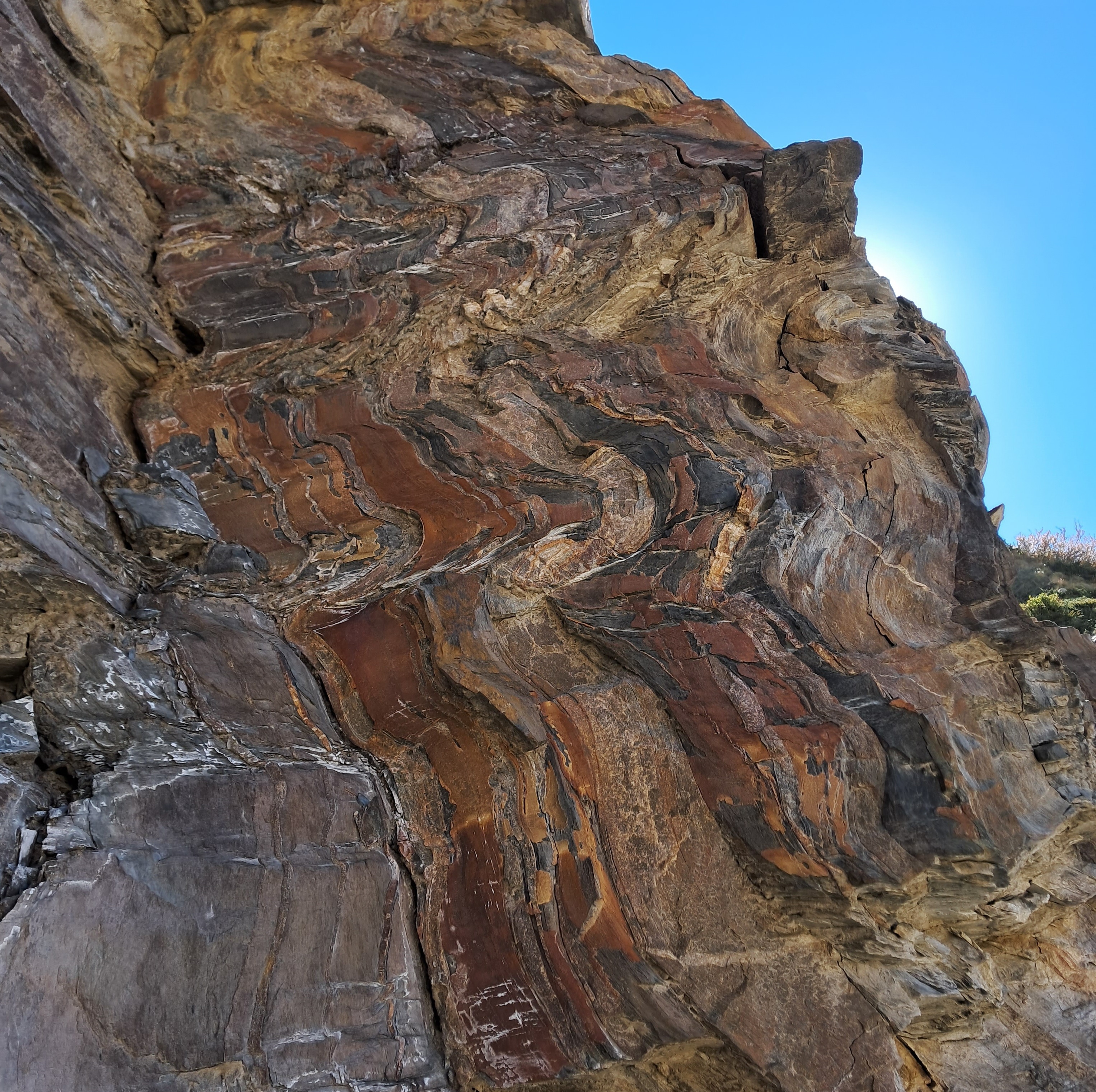
Finally, another beautiful example of a gneiss showing ductile shearing.  Fish shaped white feldspar are set in a biotite mica and quartz matrix which flows around the porphyroclasts. Can you guess the sense of relative motion?

Observing features that you have seen only in a textbook - that is the great joy of going out in the field.

Monday, September 9, 2024

Dr. V.V. Peshwa, Geologist Extraordinaire, 1939-2024

My Guruji, Dr. V. V. Peshwa passed away on August 27, 2024. He was my thesis advisor during my Master's education in Pune. His career as a faculty with the Department of Geology, Pune University (now Savitribai Phule Pune University), was full of distinction and dedication to the noble cause of teaching. Field geology, remote sensing, and mineralogy. He had a mastery over these subjects and taught them with extraordinary clarity. His lectures on mineral optics, delivered without the aid of notes, remain some of the most lucid explanations I have heard on any aspects of geology.  

Dr. Peshwa also set up the remote sensing lab at Pune University in the early 1970's,  having received a specialized Master's degree from the Netherlands. Over the years he amassed a vast collection of aerial photographs and satellite imagery of Indian landscapes, teaching with great panache the fine skills of image interpretation. He was a formidable researcher too, with publications in igneous and metamorphic petrology, remote sensing of the Deccan Basalts and Proterozoic sedimentary basins, and on geohazards. 

I will recount two incidents from my association with him. I had to choose a thesis guide at the end of my first year of Master's course at Pune. I asked Dr. Peshwa if he was willing to be my guide. As was his style, he promptly said no! I was unsure how to persuade him, but fortunately my senior, Anand Kale, came up with a brilliant plan. I was told to sit on a chair outside his room and poke my head inside every few minutes until he said yes. I agreed, and like a security guard sat outside his room all morning. Towards early afternoon Dr. Peshwa had given up trying to ignore this motionless sentry outside his door and agreed to my request, but on one condition. I had to go and map an area in Andhra Pradesh in the Cuddapah Basin.  He had some aerial photos of this place and wanted someone to study a fold structure that was spectacularly exposed near Nandyal town. The imagery below is from ISRO Cartosat.

Folded Cuddapah Group and Kurnool Group sediments south of Gani.

Dr. Peshwa accompanied me during my second trip to the field area. It was mid January and one early morning we set off to the low range of hills, about an hour walk from where we were staying. We worked till the afternoon, and by around 3 pm decided to call it a day. We were running out of water and were famished. We thought we should walk to the next village which was just 15 minutes away, have a snack and then turn back to our camp in Gani village. To our surprise every shop in the village was closed. Dejectedly we started walking to Gani. After a while we spotted a man on a bicycle coming in our direction. We recognized him as a shopkeeper from Gani. He stopped and explained that it was the auspicious day of Pongal and everything was closed. He slipped his hand into a bag and gave us two round dry buns to eat and cycled away. We tried to bite into them, but they was rock hard, harder than the Cuddapah quartzites we were trying to break with a hammer. We collapsed with laughter and trudged along, where our host was waiting for us with a hot sumptuous meal! 

For all his exuberance and light heartedness, Dr. Peshwa never compromised on the quality of work he expected from his students. He supervised with an eagle eye my petrographic analysis, read every word of my thesis, and even sent me back to the library because he thought my literature search was not exhaustive enough. He gave me full independence to follow my interest in carbonate sedimentology, but cautioned me to remain within the bounds of data. He did not like grand theorizing or explanations by 'arm waving'. Some might call him conservative, but it made us into careful researchers, and brought a rigor to our work. 

He remained active in geology long after his retirement, accompanying younger faculty and students to the field and acting as their mentor and advisor. I live near his house and used to stop by once in a while for a chai and long conversations about geology. He will be missed greatly. The picture below shows Dr. Peshwa, seated center, on his 80th birthday.

Now, only all those memories remain to serve as inspiration and to help us stay true to what the rocks are telling us.

Sunday, June 30, 2024

Field Photo: Unusual Himalaya Metamorphic Rock

My friend Emmanuel Theophilus, who spends a lot of time wandering in the high Kumaon Himalaya, sent me this photo of a feldspar rich gneiss.,

He observed this loose boulder near the small settlement of Bugdiyar in the Goriganga valley, north of Munsiyari town. Bugdiyar is located in the Greater Himalaya. This is a high grade metamorphic rock terrain. As you walk along the many trails that lead to places like Nandadevi Base Camp and Milam Glacier,  you can observe mica and amphibole rich schist with gleaming garnets, quartz and feldspar rich gneiss, migmatite gneiss (partially melted gneiss), and leucogranite (quartz and feldspar rich magma) intruding this high grade ensemble. 

This traverse takes you into the core of the Himalaya orogen, where high temperature and pressure during mountain building that took place 35 to 15 million years ago transformed the sedimentary protolith into metamorphic rocks. 

This particular gneiss rock has an extraordinary texture. I have never before seen such large feldspar (white crystals) in a metamorphic rock. Judging by the pebbles and other rocks strewn by the side, these are inches long feldspar grains. 

I want to introduce two terms used to describe texture in metamorphic rocks; porphyroblastic and porphyroclastic. Both these terms describe rocks with very large crystals surrounded by fine grained minerals. These are rocks with two distinct crystal size classes. 

Porphyroblastic texture forms when one mineral grows more quickly than other minerals during metamorphism. Large crystals of the rapidly growing mineral are set in a finer crystalline matrix. Both the large and small sized minerals have recrystallized, but at different rates.  

In contrast, porphyroclastic texture forms when there is a size reduction of some minerals , leaving one unaffected mineral larger than the rest. This situation occurs most commonly in fault zones where softer minerals may get crushed more easily leaving the resistant mineral as a large porphyroclast. These types of rocks have a broken appearance. The softer minerals become aligned to give the rock a prominent streaky banded texture. The more competent mineral may also develop an elongated shape.

Which of the above is the rock Theo found? My guess is that it is a porphyroblastic gneiss. Take a closer look at the beautiful large grains. They seem to be the result of growth during metamorphism, in the process engulfing small pockets of mica in their interiors. The rock lacks the streakiness and the often broken, bent, and stretched large grains characteristic of a porphyroclastic texture.

However, there is a subtle sign of deformation too. Have a look at this close up. 

The black arrows point to rugby ball shaped feldspar grains. They have a long axis and a short axis and appear to be stretched in one direction. Also notice the grey cracks running along the longer axis of many of these crystals and continuing into the rock. These are paper thin zones where force or stress was localized. The change in shape (strain) in the feldspar grains follows these very narrow zones of deformation. 

All of the above is my reasoned speculation on the origin of this texture. The next step is to meet up with Theo near Bugdiyar and walk along the Goriganga in search of the outcrop.

The Goriganga near Bugdiyar. It is spectacular out there!

Monday, August 14, 2023

Field Photos: Boudinage In Sandstone

Boudinage is a structure that is developed when rock layers are being pulled and stretched. The term is derived from the French word for sausage. A rock layer is deformed by necking and is segmented into a string of sausages. The structure is best developed when there is contrast in competence or strength in a rock pile. The stronger layer is broken up in boudins, while the weaker layer 'flows' around and fills the gaps created in the neighboring boudin layer.

I wanted to showcase examples of boudins from igneous, sedimentary, and metamorphic rocks. 

The first example has been recently documented in a paper on silica rich magmatism from Sausrashtra by Anmol Naik and colleagues. The photograph shows a rhyolite with boudinage (black arrow) developed in a lava flow band. This deformation is due to layer parallel stretching during flow of a viscous lava.

 Source: Anmol Naik et.al. Geological Magazine 2023

The second instance is from Darma Valley, Kumaon,  near the village of Philum, not so far from the Panchachuli Glacier. It is a remarkable instance of boudins developing in a sandstone. Black arrows highlight elliptical and oval knobs, fragments of a once continuous sand rich layer. Notice how the surrounding thinly layered material has flown into the gaps between these boudins. The more competent sand layer broke up, while the softer clay rich material got wrinkled and warped but did not break. 

And lastly, here is an example of the more common variety of boudinage encountered in the field. This has developed in a high grade metamorphic rock. The lighter more competent layer made up of quartz and feldspar has been deformed into a series of boudins, while the mica rich grey layers are ductile. This outcrop is also from Darma Valley, Kumaon, near the village of Baaling. 

The three examples showcase deformation which produced similar structures in very different settings. Internal forces generated during flow of a viscous lava can result in folding and boudins. In sedimentary basins, similar forces may  affect a sand rich slurry moving down slope as a gravity flow or on semi consolidated sediment shaken during an earthquake. And forces acting on high grade metamorphic rocks  produce some spectacular boudins at high temperatures during episodes of mountain building.

Documenting rock deformation in the field is fun! 

Tuesday, June 20, 2023

Field Photos: Folds- Tectonic Or Soft Sediment Deformation?

During my wandering in the high valleys of Kumaon I have been noticing some intriguing boulders of sandstone which have rolled down from the high ridges in the vicinity of Panchachuli Glacier and Milam Glacier. I have access to only these blocks and for now have not been able to observe them in outcrop.

But they do show some spectacular deformation as seen in the picture below.

Is this folding due to tectonic forces that crumpled up the sedimentary sequence in to a series of small scale folds much later in the history of this region, perhaps during Himalaya orogeny?. Or, is this soft sediment deformation that took place contemporaneously with the deposition of these sedimentary layers? This occurs when semi hardened sediment moves and slides down slopes during earthquakes, contorting layers into small folds.

At this point I have not been able to decide which of the two mechanisms is at play here. What these blocks do demonstrate very nicely is how materials with different rigidity respond differently to an applied force.

Look at the sandstone boulder below.

The folding is restricted only to the central part of the block. This may happen because that layer is soft enough to flow under stress. The more rigid layers enveloping it don't warp. 

Here is another example. Notice the tiny white veins (black arrows). They occur only within a thin rust colored layer. These to me appear to be tear cracks. These small fractures open up under the influence of localized tensile forces. The rust layer was hard and brittle enough to crack while the surrounding material was too soft.


Although I haven't been able to see these sandstones in outcrop, I do get the feeling that this deformation is very localized and doesn't affect the entire sequence. This is because I have observed blocks with undisturbed thin layering, like in this cross bedded slab below. This hints that intermittent soft sediment deformation is the likely explanation, but I can't say for sure without examining the layers in outcrop.

 And this final picture of a large boulder with some crazy contorted layers. 

This is why geology field work is so much fun. You keep coming across these puzzles that make you think and which stay with you long after you have packed up camp and returned home. 

Looking once again at these pictures, I am desperate to head back. And there is more to understand about these boulders. I'll be writing about their stratigraphy i.e., their position within the thick rock unit known as the Tethyan Sedimentary Sequence, and their significance in understanding the geologic events occurring along the northern margin of the Indian subcontinent in the early Paleozoic, about 500-475 million years ago.

------------------


Monday, February 20, 2023

Geology Outcrop Quiz: Milam Glacier Area

In the outcrop below, which direction are the strata dipping (tilting)? North is to the right. 

If your answer was towards the right (north), you would be wrong.

The apparent northward dip of the rock layers is an illusion caused by fractures intersecting the plane of the exposure. The outcrop below from a nearby spot shows the real geometry of the strata.

This is an across the bedding exposure. You can see that the strata are almost vertical and are warped into small scale folds. Look at the black arrows on the left centre of the image. They point to sub horizontal cracks (fractures) penetrating the rocks. These are axial plane fractures as they follow the plane that divides the folds symmetrically. To the top right, the red arrow points to the distinctive planar fabric that has arisen due closely spaced fractures. 

In contrast to this perspective, when the outcrop is a bedding plane exposure i.e. a slice parallel to the bedding, as it is in the first picture, you won't see the folding. Instead you can only observe a bedding surface cut by horizontal fractures that divides the rock wall into layers and gives the impression from afar of horizontal or gently tilted beds.

The photo below is a close up of an outcrop with prominent nearly vertical thin orange-brown and dark grey folded beds. Notice the white horizontal bands? These are the axial plane fractures which later were filled with quartz, as mineral saturated groundwater circulated through the rocks.  

The outdoors is such a good classroom. This final outcrop illustrates how erosion along a hillslope has sliced the rock body at different angles with respect to the bedding, exposing both, the true orientation of the strata as well as the pseudo bedding. 

To the right of the waterfall is an across the bedding cut, exposing the nearly vertical gently folded strata. To the left of the waterfall is an along the bedding exposure. Only a sheer rock wall is observed with the axial plane fractures imparting a crude layering to the rock face, giving the illusion of bedding.

All these exposures are along the road side trail near Milam village in Kumaon, Uttarakhand. You can test your observational skills when you next visit that area. 

Trekking in the Himalaya is always a treat.  And when you come across these small geology puzzles, it is with a double scoop topping.

Wednesday, December 26, 2018

Extreme Fieldwork In The Karakoram Mountains

This remarkable passage from Colliding Continents by Mike Searle:

"After two weeks of acclimatizing on the Lobsang Spire and Cathedral granite cliffs above camp and establishing our attack camp full of supplies we were ready to go for the summit. I was keen to climb a line up through the granite cliffs in order to map out and sample a vertical profile through the granite batholith. These Karakoram granite spires provide a unique opportunity to map and sample over 3 kilometers deep into such a batholith. We left once again at 3 a.m. for the dangerous plod through the icefall, and arrived at the ice-shelf camp at about 10 a.m. As soon as the sun came on to the glacier, freezing night-time temperatures soared up to incredibly high hot temperatures above 350C. Frozen icicles dripping off the rock face turned into trickles of water and then into torrents. Huge avalanches of powder snow exploded down the steep granite faces all around us. This was nature in the raw: powerful, frightening, but at the same time immensely beautiful.

Next morning we left at the usual 3 a.m., roped up, and started climbing the steep ice face on the south face of Biale. Very soon the ice petered out and we were on vertical solid granite. Climbing vertical granite walls with a 20 kg rucksack, a rack full of slings and nuts and big plastic double boots was not easy. I was trying to record geological observations in the granites and put those onto a map at the same time; the sample collection was to be done on the way down. After two days of this steep and scary climbing we finally broke out of the cliffs onto a  large snowfield that led up to a knife-edge ridge. As we approached the ridge the most spectacular mountain panorama I have ever seen unfolded in front of us. We were in the middle of the Karakoram, with huge glaciers flowing all around us, separating ridiculously steep cliffs of pure granite".

The Himalaya ranges are the northern edge of the Indian continental crust which was deformed during the India-Asia collision. Similarly, the Karakoram ranges are the southern margin of the Asian continent which was deformed during the India-Asia collision. Mike Searle and his colleagues were trying to work out their deformation, metamorphic and uplift history.

In the satellite imagery below, I have overlain the major lithologic and structural elements of the India-Asia collision zone. The imagery covers the central and eastern Karakoram ranges.


The southern margin of the Asian plate is made up of two amalgamated terrains. In the mid Cretaceous (~110 million years ago) a separate terrain/microplate known as the Kohistan-Ladakh block existed south of the Asian continental mainland. As the Indian plate pushed northwards, oceanic crust which made up its leading edge dove under the Kohistan-Ladakh terrain. As the dense crust subducted, it heated up, releasing water trapped in the sediment cover. This water migrated upwards, lowering the melting point of rocks in the lower part of the Asian plate (mantle) and triggering melting. Magmatism and volcanism formed an intra-oceanic island arc system above the subduction zone. The Dras Arc Volcanics are part of this island arc, which continues westwards into Kohistan. The Ladakh batholith represents the root of this arc system, made up of granitic and granodioritic magma congealed in the deep subsurface. Volcanic rocks at the famous Khardung-La Pass are the surficial expression of the Ladakh magmatic system.

Between 70-80 million years ago, the Kohistan-Ladakh arc collided with the Asian mainland forming a composite terrain. The Main Karakoram Thrust-Shyok Suture marks the zone of collision between these two terrains. The Indian plate continued subducting under the Asian plate. Magmatic growth of the Kohistan-Ladakh batholith continued until about 50 million years ago. By this time, the Indian oceanic crust had been consumed and as a result the Indian continental crust collided with Asia. This collision zone is marked by the Indus-Tsangpo Suture.

The pre-collision tectonic setting of the Kohistan-Ladakh arc is depicted in the graphic posted below.


Source: Searle et. al. 1999

There is another model which proposes that the Kohistan-Ladakh arc first collided with the Indian plate around 85 million years ago. Collision of this combined plate with Asia then took place around 50 million years ago. I am ignoring this debate in this post.

Continental collision lead to crustal thickening on both sides of the suture zone. In the Karakoram region, high temperatures and pressures in the lower parts of the thickened crust resulted in metamorphism of buried rocks (Karakoram Metamorphic Complex). Eventually, temperatures in the buried crust exceeded the melting point of rocks, triggering magma generation. These post-collisional crustal melts intruded the surrounding metamorphic rocks forming sills (intrusions parallel to the layering) and dikes (intrusions cutting across the layering). Granites formed in this manner are most conspicuously exposed in the region around the Baltoro Glacier. These granites form many of the jagged spires and pinnacles that Mike Searle describes so vividly in his book. They are part of the Karakoram batholith.

Crustal melting and granite magma formation occurred in the thickened Indian plate as well, south of the Indus-Tsangpo suture zone. These granites are exposed along the crest of the High Himalaya ranges. The Himalayan post-collisional granites are beautiful to look at.  Faceted crystals of black tourmaline and red garnet, along with gleaming flakes of white mica, are set in a white to pink colored matrix made up of quartz and feldspar. The picture to the left shows a tourmaline bearing leucogranite from the Greater Himalaya Sequence making up the Panchachuli range in Kumaon, Uttarakhand. I collected it from the moraines of the Panchachuli glacier.

The Karakoram Batholith is a composite body made up of magmas formed during different times. Older granitic rocks (150-70 million years ago) in this batholith formed in an Andean type margin setting wherein the Tethyan ocean crust was subducting under the Asian continental plate.

Certain metamorphic minerals like kyanite, sillimanite and garnet are thermobarometers. Their elemental ratios tell us about the temperature and pressure prevalent during mineral growth. Geologists estimate that the sillimanite and kyanite bearing Karakoram metamorphic rocks were formed at 35 km depth. These metamorphic rocks, along with the earlier formed granites of the Karakoram batholith, eventually partially melted to form the Baltoro granites.

Geologists have also been able to work out when metamorphism and melting took place. Using radiogenic uranium isotopes trapped in zircon crystals they find that peak metamorphism took place in several pulses. The oldest metamorphic event occurred around as early as 60-65 million years ago, with the heat source likely being the collison of the Kohistan Arc. Subsequent metamorphic pulses, driven by crustal thickening,  have been dated to about 45 million yeas ago and an even younger event to about 16 million years ago.

Magmas which form the Baltoro granites intruded and crystallized between 20 million to 13 years ago, similar in age to the post collisional leucogranites of the High Himalaya which are 24 million to 15 million years old . Crustal melting and granite formation in the Karakoram continued sporadically until around 9 million years ago.

The deep crustal processes occurring in the Karakoram region were also taking place eastwards in the thickened crust below Tibet. In the Karakoram, metamorphic rocks and granites formed in the lower levels of the crust now lie spectacularly exposed along the steep mountain sides. Erosion over the past 30 million years has removed over 35 km of overburden, exhuming these deep crustal layers. The Tibetan plateau however is made up of sedimentary and volcanic rocks. Only the uppermost parts of the crust are exposed here. Karakoram equivalent high grade metamorphic rocks and crustal melt granites, which undoubtedly exist in this region, still lie deeply buried in the subsurface.

Why is there such a difference between Karakoram and the Tibetan Plateau in the level of crustal exposure?  Take a look at the satellite imagery. Karakoram is covered by snow, while much of the Tibetan Plateau lies bare. Karakoram receives rain and snowfall from both the India summer monsoon as well as the north westerlies bringing winter moisture from the Mediterranean and Caspian areas. Tibet lies in the rain shadow of both these systems.  High rates of stream incision and the enormous erosive power of glaciers has resulted in high rates of exhumation in the Karakoram, eventually exposing deeply buried crust. Low erosion rates in the arid Tibetan region has failed to cut deeply into the crust, resulting in exposure of only the uppermost levels of the crust. Both Karakoram and Tibet have an average elevation of about 5000 meters. In the Karakoram though there is prolific relief, with peaks in the 7000-8000 m range and valleys at 2000-3000 m elevation. Relief in Tibet is subdued.

Climate plays an enormous role in shaping the topography and evolution of mountains.

Thursday, August 24, 2017

Field Photos: Glacial Deposits Of The Darma Valley, Kumaon Himalaya

During my recent trek to the Panchachuli Glacier in the Kumaon Himalaya, I obsessed about observing changes in metamorphic grade of the Greater Himalayan Sequence on the trek route and also about finding the South Tibetan Detachment fault system. I wrote about this in an earlier post.

But there were other interesting geological observations too. The Panchachuli Glacier has left a thick record of glacial deposits. The river Dhauliganga originates from this glacier. Along this river valley, glacial deposits can be observed to a distance of at least 5 kilometers downstream of the present location of the snout of the glacier, indicating that the glacier was much more extensive in the past. Tributary glaciers flowing out of the ranges east of the Dhauliganga have also left an extensive record in the form of thick fluvio-glacial deposits. These can be observed as far south as the village of Baaling.

We heard anecdotes in village Dugtu about how this glacier was much bigger in living memory and how it has been receding rapidly in the past few decades. On one level such stories are believable because studies of Himalayan glaciers have shown that many of them have been shrinking over the past few decades (ref). This is partly due to anthropogenic global warming, but glacial response to warming may be varied due to local variations in topography, precipitation and wind conditions. Some glaciers don't show retreat while some are actually seen to be expanding. Overall though, there a substantial ice loss observed across the Himalaya. Exactly how much of that is due to recent global warming and how much, as some scientists caution, due to natural factors is still being studied. Sustained warming though will cause these glacier to shrink further over the next century.

There is also a longer geological story of glacial advance and retreat written in these deposits.

I've embedded below an annotated interactive map of the glacial deposits of the Dhauliganga river valley in the Panchachuli Glacier area. This will enable readers to zoom in and recognize the various glacial landforms present in the valley. You can also access it via this Permanent Link.


The annotations depict:

a) The dark blue lines are the snout of the glacier.
b) The light blue lines are the recent terminal moriane fields.
c) The pink lines are older lateral moraines.
d) The yellow lines are outlines of older fluvio-glacial deposits
e) Numbers 1 -12 mark the locations of glacial deposits.

I have mapped only a few representative examples of each of the feature types. Readers can use these to explore similar features scattered throughout the valley. 

Location 1: This is the snout of the glacier. It is a mass of ice and frozen mud. The river Dhauliganga emerges out of an ice cave.


Location 2: Taken from near the snout of the glacier looking downstream. Ridges of the terminal moraine can be seen in the foreground. The arrows in the background outline a ridge of an older lateral moraine. Notice how the ridge decreases in elevation downstream suggesting that the terminus of this older glacial phase in somewhere nearby downstream.


Location 3: The older lateral moraine can be clearly seen as a sharp ridge line (arrow) separated from the valley wall by a depression. 


This moraine top is a few hundred meters above the valley floor implying that the glacier was thicker in the past. When was this lateral moraine deposited? It may be at least a few hundred years old. In the Garhwal Himalaya, similar older lateral moraines close to the glacier has been dated to be several hundred years old. They have been interpreted to be a result of glacial growth and deposition during the Little Ice Age, a period of earth cooling and climate instability that lasted from around the 1300's to the mid 1800's (for more on this climatic episode, I recommend Brian Fagan's book The Little Ice Age: How Climate Made History 1300-1850).

Location 4: A view of the glacier and an older lateral moraine (arrow) on the other side of the valley.


Location 5: Further downstream are thick glacial deposits. The river has incised or cut through these sediments. As a result the deposits form flattish plateaus or terraces that hug the mountain slopes. Village Dugtu, where we stayed, has been built on top of one such glacial terrace. The arrow in the top picture points to an exposure of these glacial deposits. A close up of this deposit is seen in the bottom picture. Notice the extremely ill sorted texture. Such ill sorted sediment deposited by glaciers is called Till. Large boulders are mixed in with  gravel, pebbles and much finer sized rock flour (the light to brown colored matrix).


Location 6: Another exposure of a glacial deposit near Dugtu. Again, notice the ill sorted deposit. However, at the top is a well sorted pebbly layer. This suggests deposition in more vigorous flowing water. Glacial retreat from time to time would have resulted in the establishment of a fluvial regime and deposition in these streams. These deposits may be a few hundred to several thousand years old.


Location 7: The glacial terrace on which village Dugtu is built is seen in the lower right corner. Farther away is village Philam built on the thick fluvio-glacial deposits of a tributary glacier originating in the range east of Dugtu. At village Dugtu, the east flowing river Dhauliganga makes a sharp southerly turn. The river has cut through these deposits and the slopes of the valley are thickly forested suggesting the great antiquity of these deposits.


Location 8: A nice view of glacial deposits south of village Baun along a smaller tributary of the  Dhauliganga. Notice the waterfall!


Location 9: A walk right through these thick fluvio-glacial deposits along a forested section of the valley slope. Again, notice the ill sorted nature of the deposits. Glacier are viscous and cannot sort sedimentary particles like water or air can. The result is a jumble of boulder, gravel and rock flour.


Location 10: Another cliff made up of fluvio-glacial deposits. I'm calling the deposits east of Dugtu as fluvio-glacial, since I observed intervals which show layering. This suggest deposition in water, either in streams or in melt water lakes and ponds that form in front of glaciers.


Location 11: A thick sequence of fluvio-glacial deposits along the Dhauliganga river. If you zoom and pan the satellite image you can recognize these terraces  southwards almost up to the village of Baaling.


I did not observe such deposits south of Baaling. However, there are smaller glaciers, such as the Naagling glacier, originating in the ranges on either side of the Dhauliganga. There would be smaller deposits scattered in these tributary valleys.

I have been vague about how old these deposits could be. If we assume that the Panchachuli glacier would have attained its maximum extent in the Pleistocene during the Last Glacial Maximum about 20,000 years ago, then the deposits furthest away from the present location of the glacier would be the oldest. As the glacier recedes one should find younger and younger deposits closer to the active glacier.

A study by Dirk Scherler and colleagues in the Garhwal Himalaya found such a pattern. They studied deposits of the prominent Jaundhar Glacier and the Bandarpunch Glacier in the Tons Valley. I've posted below a map showing the interpreted ages of deposition of glacial sediments.


 Source: Scherler et. al. 2010

Notice how the oldest deposits are further away from the present location of the glaciers (eastern most extremity of the map). These oldest deposits point to the maximum extent of the glacier that was reached in the Pleistocene during the Last Glacial Maximum.  However, the decreasing ages of the deposits upstream aren't the result of a uniform recession of the glacier. Instead, they point to several glacial episodes during which the glacier advanced, then receded, and then advanced again during the Holocene. Their data shows five such episodes of glacial growth dated to approximately 16 ka (ka = thousand years ago), 11-12 ka, 8-9 ka, 5 ka and less than 1 ka.


It turns out that the climate history of the Holocene is not one of uniform warming since the end of the last glacial period. The earth has gone through several minor cooling phases during the Holocene. The well known Younger Dryas Event around 12.9 -11.7 ka is one example.  Some studies suggest cooling episodes around 8.2 ka  and around 4.2 ka . And there is the Little Ice Age during the last millennium.

Another climate dynamic is fluctuating monsoon strength through the Holocene. The authors don't favor the explanation that these periods of glacial growth were triggered by global cooling events.  They argue that glacial growth corresponds to small phases of increased monsoon strength interrupting a longer trend of decreasing monsoon strength. More moisture means more snow and glacial growth. Since the long term trend in this part of the world is one of decreasing monsoon strength, every successive phase of glacial growth was smaller than the previous, resulting in younger and younger deposits upstream. The Little Ice Age deposits (which were likely driven by global cooling and not necessarily increased precipitation) mark the last major phase of glacial growth.

How are these deposits dated? Scherler and colleagues use a technique known as cosmogenic nuclide dating. This technique is one way to date the timing of surface exposure. Glaciers carry rock debris. These form a layer below the moving ice. When the glacier recedes the rock debris is deposited as a moraine or as an erratic boulder. It is exposed to the atmosphere and starts getting bombarded by cosmic rays. Energetic cosmic ray neutrons falling on atoms of minerals like quartz results in spallation reactions. This means that the collision of neutrons is energetic enough to fragment the nucleus. Oxygen bound up with silicon in the mineral quartz gets converted to an isotope of Beryllium (10Be). The amount of nuclides generated this way is proportional to the length of exposure. By measuring the amount of 10Be and comparing it with other isotopes, an 'exposure age' is estimated. This is essentially the age of glacial recession and the deposition of glacial sediment.

Samples have to been selected carefully for this method to give a true estimate of surface exposure and deposition. Care must be taken to avoid sampling rocks that have been repeatedly buried and exposed. Rocks which show signs of being subjected to prolonged glacial erosion are selected since  erosion will remove outer shells of material that may have accumulated nuclides during an earlier period of exposure.  Debris with a polished surface or with striations and grooves generally suggest subglacial transport and prolonged glacial erosion and are preferred samples.

 The figure below taken from the same study shows the reconstructed glacial extents using exposure dates of the moraine sequences in the upper Tons Valley.


Source: Scherler et. al. 2010

Such dating of glacial deposits at other locations in the Garhwal Himalaya (ref) tell a similar story of glacial growth and decay over the Holocene. And what about the Pleistocene? Is there evidence of older glacial cycles in the Himalaya? There are many studies that have identified glacial phases during the Pleistocene as well. For example, in northwest Garhwal, the Bhagirathi Glacial Stage has been dated to 63 ka (ref). And in the Ladakh Himalaya the oldest glacial stage has been dated to 430 ka (ref). Pleistocene ice ages have impacted glacial dynamics in the Himalaya too although more work needs to be done to understand the specific mechanisms of glaciation.

Location 12: Its back to the Dhauliganga valley floor. This moraine ridge (arrows) may be the remnant of an older terminal moraine. It is located about 2 kilometers downstream of the glacier.


The Panchachuli and other glaciers in the Kumaon region to the east of the Garhwal will also have their own history of past glory and recession. How much of the retreat of the Panchachuli and other Kumaon glaciers due to recent global warming?  And what is its fate? Hopefully, someone will study them with more precision in the future.