Showing posts with label sedimentary basins. Show all posts

Friday, May 1, 2026

Across The Eparchean Unconformity

An unconformity is a gap in the recording of earth's history, similar to missing pages in a book. These breaks are more common than is realized. Stratigraphers, who organize geologic history, estimate that the time spans of non deposition exceed that of episodes of deposition. These gaps could be fleeting, as in a river meandering away and then reoccupying the old channel, or they could indicate conditions of non deposition and erosion lasting tens to even hundreds of millions of years.

Geologists recognize a hierarchy with the longer lasting breaks often pointing to major changes such as a mountain building phase accompanied by a prolonged sea level fall. As sediment deposition stops, erosion will often sculpt the top of the rock formation into an uneven surface. Eventually sediment deposition will resume. Geologists term such a break between the two phases of rock formation as an erosional unconformity.

Recently, the Geological Survey of India added the Eparchean Unconformity to its growing list of Geo-Heritage sites of national importance. This is one of those major long lasting erosional breaks seen in the Precambrian terrains of India. The chosen site is near Kalinjar Fort, in Banda District of Uttar Pradesh. Image Source: Geological Survey of India.

At this location, 1.2 billion year old sandstone of the Vindhyan Basin overlie 2.5 billion year old Bundelkhand granites marking more than a billion years of non deposition and erosion. While the amount of unrecorded time is significant, the real importance of this site is in the very different earth conditions represented by the older Bundelkhand granite as compared to the much younger Vindhyan sandstone. This unconformity marks the transition between the older Archean Eon and the younger Proterozoic Eon.

The Archean was a much hotter world. Melting of the earth’s mantle was producing large batches of silica rich magma which solidified to form buoyant continental crust, small rafts at first, growing into larger blocks as time went by. Vertical crustal movements created narrow depressions which got filled with lava and sediment eroded from nearby granitic highlands. These volcano-sedimentary successions were deformed and metamorphosed, and were preserved as enclaves within the granitic terrains.

By around 2.5 billion years ago, magmatic growth of continents petered out. Geologists estimate that around 70% of the present volume of continental crust was generated between 4 billion to 2.5 billion years ago.

As the mantle cooled, the more stable continental crust became the floor for a younger generation of sedimentary basins. The processes of chemical weathering and sediment transport became more prolonged on this wide gently subsiding continental terrain. As a result, waves and currents had more time to sort sediment by size, shape, and density before it was buried.

Thick deposits sorted by size into gravel, sand, and mud are the typical features of these younger basins. At places, ocean water saturated with calcium carbonate precipitated layers of calcite and aragonite sediment, preserved today as thick limestone. The biosphere was dominated by bacteria and unicellular eukaryotes, their morphology often imprinted on the rocks as wavy layers or as small mound shaped objects.

Magmatism and continental crustal growth continued less frequently in pulses coinciding with regions of plate convergence and orogeny. This phase, before large animal life evolved, lasting between 2.5 billion years and 539 million years ago is known as the Proterozoic Eon.

The newly listed National Geological Monument at Kalinjar Fort showcases these changing earth conditions.

For many decades though, exactly where to place the Eparchean Unconformity was something of a problem in Indian field geology. There was only sparse information on the absolute age of rocks and no consensus on the time span the Archean represented. Field mapping through Peninsular India indicated the presence of a distinct erosional break between deformed and metamorphosed rocks (crystalline basement) and younger flat lying or less deformed sediments. This appeared to be the natural horizon between the Archean and the Proterozoic.

But flat lying sedimentary sequences in different Indian basins, often referred to as Purana Basins, had been deposited at different times on older deformed rocks of varying ages. In some cases the foundation of the sub-horizontal sedimentary basins was indeed Archean. In other locations, the highly metamorphosed and deformed older rocks were actually Proterozoic. That meant that the Eparchean Unconformity, as earlier conceived, was not a useful marker of synchronous changes in earth processes. Many of these doubts are summarized early in this 1968 perspective on the Eparchean Unconformity by Dr. T V V G R K. Murthy, faculty at University of Sagar.

The dates for the Archean-Proterozoic transition have now been fixed at 2500 million years by the International Subcommisson of Precambrian Stratigraphy, without any condition regarding the rock type above and below the unconformity surface. As a result, the older criteria for identifying a particular erosional break as the Eparchean interval based on only rock types and extent of deformation was no longer tenable.

We finally have an answer for the question posed by Dr. Murthy so long ago:

“Does the eparchaean unconformity become evident by recognizing Archaean and Purana formations or are the Archaean and Puranas recognized by identifying the eparchaean unconformity”.

Today, better absolute dating of rocks makes differentiating Archean from Proterozoic rocks easier. The Eparchean Unconformity though is still an informal but useful term in Indian field geology signifying the cooling trajectory of the earth’s interior, with a hotter Archean transitioning to a cooler Proterozoic.

One of my earliest encounters with the Eparchean Unconformity occurred during my graduate studies. I was assigned to map an area of the Cuddapah Basin near Gani village in Andhra Pradesh, South India. I first traveled by the Dadar -Madras (now Chennai) Express to Guntakal. There, I transferred to a medium gauge train passing through small market towns connecting a vast hinterland an urban kid like me was unfamiliar with. The train chugged along eastwards towards Nandyal. For a couple of hours from Guntakal, we were firmly on Archean terrain, an agricultural landscape interrupted by small hillocks of granitic rocks. In a distance through the late morning haze we could see the low Cuddapah hills with their distinct tilted strata.   

The train crossed the Eparchean Unconformity and entered the Proterozoic through a breach in the Cuddapah hills at Dhone Junction. Ahead was the Cuddapah Basin stretching to the horizon.

We moved through quartzites, limestone, and shale, the three predominant sedimentary rock types of the shallow marine Proterozoic continental shelf. At Nandyal I had to hop onto a bus going to Kurnool. Gani village was midway between these two places. I remember arriving at Gani late evening to a warm welcome by my host Mr. Sivanand Rao. Next morning, with maps and aerial photos, hammer, and a geologic compass I started out. A half hour walk south of Gani were outcrops of the sedimentary rocks I had to map. It was a challenging and immensely satisfying introduction to field geology.

Picture shows a very youthful me and my field guide Yanganna standing in front of a quartzite hill. Captured by my accompanying batch mate Nitin Rane. June 1987.


Someday soon I hope to retrace my steps to little Gani village. The medium gauge tracks from Guntakal to Nandyal have long been replaced by standard gauge. Express trains pass through Nandyal, eventually swerving north towards Vishakapatam, or continuing south east towards the Coromandel Coast.

From Nandyal I may hire a car to Gani. I hope to meet Mr Sivanand Rao who so graciously hosted me over two field trips. I want to walk again towards the hills made of Paniam Quartzite, a sand deposit sorted and washed clean by powerful Proterozoic tides. Today, the Kurnool-Gani solar park stands near Gani, its tilted solar panels made up of ultra pure silica wafers making up an Anthropocene analogue of the more ancient quartz rich deposits.

Photomicrograph shows the Proterozoic Paniam Quartzite classified as a “super mature quartz arenite”. Notice the well rounded quartz grains outlined by iron oxide. Location - Gani anticline.

Beyond the quartzite hills are the Vempalle Formation dolomite, a vestige of the Proterozoic ocean I first waded in to begin my life long association with carbonate sedimentology. It will be a home coming of sorts for me.

Photomicrograph shows microbial layers in the Vempalle dolomite. Dolomite crystals of different size and shape have replaced the original organic mats. Location- Gani anticline.

I have one more incentive to relive this journey. The filter coffee at Guntakal railway station canteen. It is the very best.

Wednesday, February 26, 2025

Oil Hunters Of India

At Independence in 1947, India had just a few operational oil wells situated in the northeastern region of the country. Most of the subcontinent's sedimentary basins remained unexplored for their hydrocarbon potential. The Oil Hunter: Journey of a Geologist for India's Oil Exploration by Dr. Shreekrishna Deshpande is a personal recollection of the immense effort undertaken by Indian geologists to re imagine these basins as hydrocarbon source and reservoir rocks. It is the story of the development of India's oil industry told with unconcealed pride.

Russia, France, and the U.S. offered personnel and technical help along the way, but the lion's share of the credit goes to geologists of the Oil and Natural Gas Corporation for their perseverance and resilience in the face of immense challenges.

Dr. Deshpande joined the ONGC in its early days in 1961 and describes vividly his field experience in remote locales all across the country, from scorching Kutch, to steep Himalaya terrain, to facing personal danger during an insurgency in Assam. There were inevitable career challenges along the way due to changing institutional structure and unrealistic political expectations. Their impact on company work culture and productivity is described in honest and direct language.

One of my favorite passages comes towards the end of the book where he explains the divergence between geologists and management in their basic understanding of exploration and discovery.

"Subsurface discoveries of oil reserves cannot be projected with certainty. The inputs to the discoveries are always deterministic, but the result is never so, and there is a strong factor of probability. Exploration efforts are to reduce the risk factor and increase the probability of discovery. Methods for direct detection of  hydrocarbons from the surface, are  yet to be evolved. This contrasts with any other industry, where the output is more predictable and proportionate to the input. 

.... As a simplistic approach the management decides the cost of discovery of one tonne of oil by dividing the amount of discovered oil by the expenditure met. It is expected by them that similar expenditure should proportionately result in additional discoveries.

When a sedimentary basin turns old and mature, the addition to the existing stock of subsurface oil becomes increasingly difficult. Non-geoscientists then blame geologists for such uncertainty. Only the high profitability in the oil industry is visible; its probabilistic nature and the risks involved are not so obvious. The stochastic nature of oil discoveries is not appreciated by non-explorationists". 

My one complaint about this book is that there is very little geology in it! Dr. Deshpande describes the geology work he and others undertook in very broad strokes. I felt that a few examples of how specific types of geologic data is useful for petroleum exploration would be illuminating for the non specialist reader. 

Let me give an example. Early in his career he is sent to Osmania University, Hyderabad, to analyze some sedimentary rock samples using Differential Thermal Analysis. He simply mentions that the results were used by ONGC in their exploration efforts, but how so? DTA is a way to understand whether the sedimentary rock was baked during burial to temperatures that are conducive for hydrocarbon formation. 

Another example, and one that involves his specialization, could have been a brief passage describing his work on limestones. What is a carbonate sedimentologist looking for in these rocks? The main reservoir of Mumbai High, India's biggest oilfield, are Miocene age limestone beds which were deposited repeatedly during phases of oscillating sea level. Among other things, exploration geologists want to know how open spaces or porosity in these rocks has evolved over time and whether its occurrence can be predicted throughout the sedimentary section. There was a geological detective story waiting to be told there. 

But these are mere quibbles. Overall, this is a very readable account of the productive and remarkable career of a pioneer exploration geologist of India.  Popular accounts of Indian geology and industry are rare. Recently, Himalaya geology expert Dr. Om N. Bhargava released his memoir, Travails and Ecstasy of a Geologist Addicted to the Himalaya, on his experiences of working in the Himalaya. Indian earth scientists are beginning to share the good work they have done with a more general audience, bringing a much needed familiarity with a lesser appreciated but critical field of study. 

Monday, March 18, 2024

Geological Contacts: Angular Unconformity Kaladgi Basin

 Remotely India Series #12

Through the Proterozoic Eon, beginning around 2 billion years ago,  extensional forces acting on continental crust opened up several sedimentary basins across what is now peninsular India. Crustal blocks subsided along faults and these depressions filled in with sediments deposited in fluvial and shallow marine environments. These basins were long lived, some lasting for more than a billion years. 

Sedimentation was not continuous.  Pulses of sediment deposition were punctuated by long periods of non deposition. Tectonic movements deformed early deposited piles of sediment. They were uplifted and an extensive basin wide erosional surface formed.

There was then a renewed phase of basin development. Sediment of these successor basins were deposited on tilted and folded older strata. Commonly, these younger packages of sediments are relatively undeformed. They are preserved as mesas and plateaus made up of flat lying strata. This discordance in attitude between two sets of strata separated by a widespread erosion surface is known as an angular unconformity.

In this post I will highlight an angular unconformity from the Kaladgi Basin from north Karnataka, south India. I have used high resolution imagery from Indian Space Research Organization's Cartosat.  Imagery is available for browsing and download from ISRO's Bhuvan 2D web maps.

The first image shows the area around Ramdurg village. The multi-stage history of the basin is readily apparent. The light colored strata exposed along narrow ridges are folded, while the rust brown hills are made up of undeformed sediments. The light toned strata are quartzites of the Bagalkot Group. The brown sandstone which rest on the Bagalkot quartzites are the Badami Group. Standard annotations show the varying dip and strike of the folded Bagalkot sediments. The white cross in grey circle denotes horizontal Badami strata. 

Kaladgi Basin history has become clearer based on recent geochronologic work by Shilpa Patil Pillai, Kanchan Pande, and Vivek S.Kale. They infer that basin initiation occurred around 1.4 billion years ago. Sedimentation of the Bagalkot Group terminated by 1.2 billion years ago. Movement along major WNW-ESE and tranverse NNE-SSE to NE-SW trending faults deformed the Bagalkot sediments into a series of folds around 1.1 billion years ago. This was followed by uplift and erosion of these folded sediments. Deformation was accompanied by low grade metamorphism of these rocks.

The basin floor subsided again around 900 million years ago initiating deposition of the Badami Group of sediments. The famous cave temples of Badami have been cut out from the lower part of the Badami sedimentary sequence.

The next imagery is a good example on how to recognize the relative timing of deformation events. Arrows point to fracture sets in the Bagalkot quartzites. These lineaments do not extend into the Badami sediments implying that fracturing occurred during an earlier phase of deformation. 


Let's look at a location that shows the angular discordance between the Bagalkot and Badami sediments. This is near Shirur town, north of Badami.  The lighter toned steeply tilted Bagalkot sediments outcrop as E-W trending narrow ribbons, north of Budanagad village. The brown colored Badami sediments form a more extensive plateau. Since these strata are horizontal, the traces of bedding planes form concentric bands mimicking contour lines. 

The final location is just south of Ramdurg village. The unconformity here is a little harder to decipher, but you can make out the tilt of the light colored Bagalkot quartzites, annotated by the standard notation of strike and dip. The quartzites form triangular facets sloping eastwards. Like the previous example, the concentric bands of brown in the adjacent hill indicates that this is the overlying horizontally disposed Badami sandstone.

Many Proterozoic basins of India contain such unconformity bounded sequences. Some more classic examples come from the Chattisgarh, Cuddapah, and Vindhyan basins. These sequences from different basins were not deposited synchronously. Each basin has it own trajectory of sedimentation, deformation, and erosion. 

Detailed field mapping, supplemented by absolute dating of rocks wherever possible, is elucidating the complex poly-phase history of Indian Proterozoic sedimentary basins in the context of global continental breakup and reassembly. For arm chair geologists and enthusiasts, easily available web mapping technology makes it possible to join in the excitement of teasing out these terrain's many secrets hiding in plain sight.

Tuesday, February 22, 2022

Marking Vindhyan Time

About this time last year I wrote a piece for Nature India on the discovery of the fossil Dickinsonia from the uppermost Vindhyan strata exposed at Bhimbetka caves in Central India. Dickinsonia is considered to be an early animal that lived between 560 to 550 million years ago. This finding seems to confirm an Ediacaran age  (635-541 million years ago) for the youngest Vindhyan strata, termed formally as the Bhander Group. Earlier thinking was that these rocks are 1000 to 900 million years old! 

I have been thinking on and off about this discovery, not as much doubting it as trying to understand its implication from a different angle, that of the ways in which sediments accumulate in a basin and how the passage of time is recorded in sedimentary successions. 

The sedimentary rocks of the Vindhyan Basin have been subdivided by field geologists into four units based on characteristic sediment associations. From the oldest to the youngest, these are, the Semri Group, the Kaimur Group, the Rewa Group, and the Bhander Group.  Deposition of the Semri sediments began around 1700 million years ago and ended by 1600 million or so. Tectonic movements then uplifted, tilted, and eroded these rocks. Between 1200 million and 1100 million years ago the basin floor subsided and new sediment was deposited on the inclined layers of the Semri Group. There is thus a marked  'angular unconformity' between Semri and the overlying Kaimur strata, marking two distinct phases of basin history separated by 400 million years.

The age of Kaimur, Rewa and Bhander Groups, which are often referred to as the Upper Vindhyans, has been more difficult to pin down due to a lack of reliable radiogenic dating and age diagnostic biota. Despite this, a combination of magnetic properties, a few Uranium series dates from limestones, and the age ranges from zircon found in Bhander sandstones,  hinted that the youngest Vindhyan sediments are about 900 million years old.

The fossil Dickinsonia has upended this assumption and appears to have expanded the life of the Vindhyan Basin by a whopping 350-400 million years. This revision has been bolstered by two other age criteria. Microbial fossils typical of the Ediacaran Period have been reported from the Bhander. And secondly, in the year 2020, a detrital zircon dated to 548 million years ago was recovered from the Bhander. Zircons form in magmas or during high temperature metamorphic reactions. The mineral is then eroded away from these source rocks and deposited as a sedimentary particle in adjacent basins. The youngest zircon population in a sedimentary layer sets its maximum age,  since the strata cannot be older than the detritus it is made up of. It could be much younger than the contained zircon, but in this case a lack of Cambrian fossils has constrained the age of the Bhander to be older than 541 million years ago.

Let me now dive in to what has been pricking my geological curiosity. The Kaimur, Rewa and the Bhander are thought to be three distinct episodes of sedimentation. Stratigraphers may recognize them as 'depositional sequences' formed when accommodation space for sediment to accumulate is being created either by the basin floor sinking due to tectonic movements or due to eustatic (global) sea level changes. 

Such depositional sequences are building blocks of sedimentary successions in basins of all ages, each episode lasting at most few tens of million of years. V.S. Kale in a discussion note on Indian Purana basins points out that the physical characters of the sediments are not suggestive of slow sedimentation rates, and given their thickness, estimates that these sequences span 10-20 million years each. Even assigning the upper limit, Kaimur, Rewa and Bhander were deposited in about 60 million years or so. If Upper Vindhyan sedimentation began around 1200 -1100 million years ago and ended by 550-540 million years ago, that leaves about 550 million years of unrecorded elapsed time.

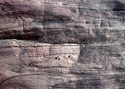
Sedimentation is an inherently episodic process with periods of non-deposition alternating with sediment accumulation. See this close up of an outcrop of a cross bedded sandstone from the Badami area in Karnataka.  


These sediments were deposited in a long lasting river system. Surfaces that result from non-deposition are marked as S1, S2.  In this hierarchical scheme, S1 spans perhaps a few minutes to a few hours and is a break in deposition on the lee side of  migrating ripples due to fluctuations in current energy. The S2 surface has developed over the channel sand body and spans months to years and represents seasonal fluctuations in currents or even a long drought which dries up the channel. 

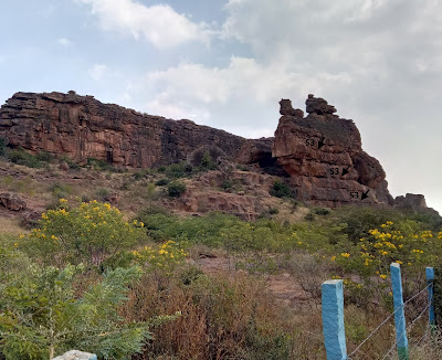
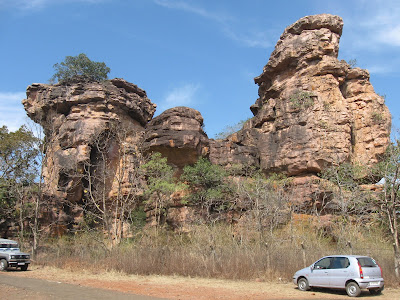
 Now, cast  your eye on this larger outcrop of the Badami sandstone. 

 
It has formed by the stacking of smaller sandstone units, each containing several surfaces of non deposition. The higher order surface S3 in this thicker pile marks a longer period of non-deposition and indicates a shift in course of the river channel. Hundreds, even thousands of years will pass, before the channel migrates back to its original location and deposition resumes at that locale.

Although I may be amiss in my specific interpretation of these surfaces of non-deposition, what I want to convey is that sediment deposition in all types of environments is interrupted by periods of non-deposition ranging from a few minutes, to thousands, even millions of years. The vast majority of elapsed time a sedimentary succession represents may be accounted for by periods of non-deposition and erosion. 

The Kaimur, Rewa and Bhander collectively account for a 60 million year time-span. If the revised age range for the Upper Vindhyans is correct then there were gaps of hundreds of millions of  years between the deposition of these Groups.

But these very long breaks invariably result due to tectonic uplift and cause pronounced erosion and chemical alteration of the exposed sedimentary surface. In outcrop it is recognizable as an undulating surface with the debris of weathering consolidated into hard soils, and in the formation of solution pits in limestone terrains. Such basin wide surfaces of marked erosion have not been found separating the Kaimur and the Rewa, and between the Rewa and the Bhander strata. 

Smaller breaks though do occur. Chandan Chakraborty in a study of sedimentary cycles of the Vindhyan Basin finds an angular discordance between the Kaimur and the Rewa, and the Rewa and the Bhander. However, this is restricted only to the south of the Vindhyan Basin. The discordance between the older and younger sequences dies out towards the north. This stratigraphic relationship  suggests that the tectonic movements were contemporaneous with sedimentation. The basin floor was tilted up on one side interrupting sedimentation and eroding the exposed strata there, while at the other end (north), subsidence and deposition continued. The periods of non-deposition and erosion between these sequences was a more localized event, lasting few millions of years at most. The kind of tectonic upheavals that may halt deposition for hundreds of millions of years across the entire basin are simply not attested to in the stratigraphic record of the Upper Vindhyans. 

It seems to me, and I say this mischievously, that the earlier estimate of 1000-900 million year age of the uppermost Bhander strata and for the end of Vindhyan sedimentation sounds quite reasonable! 

How secure is the finding of Dickinsonia and the assigned Ediacaran age of the Bhander Group? I am in no way trying to rebut this finding. The microbial fossil Arumberia found in the Bhander is considered by experts to be a reliable Late Ediacaran age indicator. However, the identification of Dickinsonia is based on a 3D digital reconstruction of photographs taken at the site of discovery. Due to the protected status of the Bhimbetka Caves, the scientists were unable to excavate the impression and subject it to a physical examination or a chemical test for organic residue. This is the only report of Dickinsonia from the entire Vindhyan Basin.

The young 548 million year date of the detrital zircon is based on one grain. The researchers are confident of their analysis and see no reason to reject this data point, though they admit that further corroboration of this date will be necessary given that previous studies did not report such young zircons from the Bhander strata. Curiously, no source terrain of this young zircon is identified in the paper.  

The news about Dickinsonia received wide coverage in India. That was expected given the long standing uncertainty of the age of the Vindhyans and the importance of the fossil for understanding early animal evolution and Ediacaran ecology and paleogeography.  But these new proposed timelines have thrown up a puzzle about rates of accumulation of sedimentary sequences and magnitudes of intervening breaks. We are quick to appreciate changes in sedimentary layer color, their structures, and their geometry, and interpret these changes in the context of fluctuating depositional conditions. But what about surfaces of non-deposition? Do they have anything valuable to contribute to our understanding of geological processes. 

The paleontologists Niles Eldredge and Stephen Jay Gould once perceptively observed that 'stasis is data'. The unchanging morphology of many fossil species lineages tell us something about the mode and tempo of evolution. Geological surfaces of stasis, when sedimentation has come to a standstill, are richly informative too in their own way. Surfaces representing very long time-spans may develop during convulsions in the earth's crust and periods of mountain building. The soils that often mantle such surfaces archive information about past climate and terrestrial life. Breaks of smaller and smaller time-spans like wise have a variety of drivers such as orbital control on climate and sea level, migration of depositional environments, and even tidal cycles.  

How many more hiatuses of unknown duration lie hidden within the Vindhyan sediment pile?  They may mark phases when no sediment accumulated but they are as much an integral part of basin history as are the iconic sandstone faces of Bhimbetka.


Monday, May 3, 2021

Cretaceous Cauvery Basin Stratigraphy

In the second year of my bachelor's degree course, a few of us friends had gone fossil hunting near the town of Ariyalur in Tamil Nadu. Ariyalur sits on Cretaceous age sediments deposited in a basin that formed as India broke away from Antarctica and Australia. The basin got filled slowly over time, by sediments brought in by rivers, as well as in the marine realm, as the sea episodically kept encroaching on to the continent interior. 

Before leaving for the trip we had approached Dr. V.D.Borkar, a research scientist with the Agarkar Research Institute in Pune, to help us plan the fossil collection. He very generously lent us maps and gave us a detailed idea of the villages to travel to and nearby field locations. 

All in all it was a fun field trip. We roamed the countryside around Ariyalur and collected plenty of fossils. In our collection were plant impressions on clay, ammonoids, belemnites, echinoids, coral fragments, and a variety of bivalves. The non geology highlight was the absolutely delicious vegetarian thali meal served in the canteen next to the town bus station! We used to gorge on it everyday, twice a day.

At that time I didn't have a good understanding of stratigraphy and even sedimentary geology. As it happened I did not grasp the broader implications of the distribution of particular fossils and the arrangement of strata that I was observing in the field. 

Its never too late to update yourself! The past month I have been reading three papers on the Cretaceous outcrops around Ariyalur which focus on basin development and stratigraphic evolution. In simpler language, stratigraphic evolution means the patterns by which basins fill up. A closer look reveals that basins are not made up of uniform continuous layers (layer cake stratigraphy) of one sediment type succeeding another, but rather there is lateral interfingering of different types of sediment, controlled by sediment distribution patterns, water energy, and basin topography.  

There are exogenous influences too. A long term drop in sea level will result in a particular arrangement of strata known as 'progradation', formed for example when deltas build out in to the sea. This may be followed by a long term sea level rise forming an overlay of a different sedimentary pattern, called  'retrogradation'. In this case as the sea encroaches on land, coarser sediments that are deposited closer to the shore get buried under deeper water fine grained sediments  A sedimentary section from base to the top (older to younger) reveals in its sediment characteristics these changing environmental conditions.

Documenting these patterns in not as esoteric an exercise as it may seem to some. Such analysis is very keenly taken up during petroleum exploration.  One may find during outcrop mapping that coarse sand deposits (potential petroleum reservoirs) occur at repeated intervals and are juxtaposed against finer organic rich mud rocks (potential hydrocarbon source rocks). This then may become a guide for optimizing detailed exploration strategy in areas of the basin where strata are buried and can't be observed directly. Just such a situation occurs in the Cretaceous Cauvery Basin. The sediments around Ariyalur is one of the main accessible outcrops. But further to the east, these sedimentary layers continue under the sea bed of the Bay of Bengal. A well documented and well understood outcrop provides an analogue for the unseen portions of the basin.

These three papers clarified to me much of the Cretaceous stratigraphy that I had failed to understand in my college days.

Here are the links:

1) Cretaceous tectonostratigraphy and the development of the Cauvery Basin, southeast India: Matthew P. Watkinson, Malcolm B. Hart and Archana Joshi

A broad study of basin formation by continental rifting and the resulting patterns of basin infilling interpreted in the context of tectonic events, major sea level fluctuation and depositional episodes.

2) Sea level changes in the upper Aptian-lower/middle(?) Turonian sequence of Cauvery Basin, India  An ichnological perspective: Amruta R. Paranjape, Kantimati G. Kulkarni, Anand S. Kale.

Ichnology is the study of trace fossils. These are tracks, trails and burrows made by the movement of  creatures living on the basin floor. Traces differ depending upon the nature of sediment substrate and environmental conditions and can be used along with other sedimentological and fossil data to interpret patterns of sea level change.,

3) Siliciclastic-carbonate mixing modes in the river-mouth bar palaeogeography of the Upper Cretaceous Garudamangalam Sandstone (Ariyalur, India): Subir Sarkar, Nivedita Chakraborty, Anudeb Mandal, Santanu Banerjee, Pradip K. Bose.

The Garudamangalam Sandstone formed during a sea level highstand i.e. at the peak of a sea level change cycle, when the rate of sea level rise finally slows down and stops. Sediment transported by east flowing rivers began building a delta. The exposed Garudamangalam Sandstone is part of this delta complex. This is a very nice analysis of sedimentary processes and products. The various subenvironments in this delta complex are identified and the chemical changes in the sediment after their deposition are documented using various techniques like chemical staining and cathodoluminescence. I really enjoyed reading this one!

On a personal note, the Covid catastrophe unfolding in India is making reading and writing difficult. However, I did find that a few hours of geology time that I am managing to hold on to brings me some comfort. 

Friday, February 19, 2021

Fossil Dickinsonia in Bhimbetka Sandstones: Nature India Article

 My short piece published in Nature India on the surprising report of Ediacaran age fossil Dickinsonia in the Bhimbetka caves near Bhopal, Central India, and its geological and biological significance.

an excerpt:

"The biological affinity of Dickinsonia is controversial. Most scientists tend to accept it as an early animal. Some like Gregory Retallack, co-discoverer of this fossil, think of it to be a large algae or lichen. He argues that the mainstream view that Dickinsonia was a marine animal is based on weak evidence, while his own detailed work shows that Dickinsonia was a land creature, forming biogenic crusts on soils. Interestingly, the Bhimbetka rocks were deposited in a mostly terrestrial setting, more in alignment with Retallack's interpretation. Importantly for geology, its restricted time span, being found only in rocks between 555-550 million years old, makes it a diagnostic age indicator. So far, no animal fossils have been found in the Vindhyan rocks. This finding may inspire geologists to start searching contemporaneous Indian basins afresh for such subtle clues".

Fossil from dawn of animal life found in India’s famous caves.

Wednesday, January 27, 2021

Fossil Dickinsonia Indicates Ediacaran Age For Upper Vindhyans

 It looks like one of the long running debates in Indian stratigraphy has been resolved. 

The Vindhyan Basin is one of several Proterozoic age basins in Peninsular India. The youngest rocks in this basin have been accepted to be of Neoproterozoic age i.e. less than 1 billion years old. But absolute dating of these rocks is tough. Criteria like youngest detrital zircon ages, which tell us the age of the youngest source rocks from which sediments were derived, were hinting at an age of about 850- 900 million years for the uppermost Vindhyan strata. On the other hand, presence of fossils like Arumberia and Beltanelliformis minuta, both considered microbial organisms, were suggesting of an Ediacaran age (637-541 million years) for youngest Vindhyan rock units, although there wasn't a widespread acceptance of these dates. Then, last year, a paper by Lan and colleagues published new detrital zircon dates of 548 million years from the Maihar Sandstone. They indicated that the uppermost Vindhyans are late Ediacaran in age. Detrital zircon age tells us that the sediment cannot be older than the zircon, i.e. it gives a maximum age for the deposition of the sedimentary layer.

Now, a stunning fossil find seems to confirm this chronology. The Ediacaran age fossil Dickinsonia has been dated to about 555 million years from sites in Russia. This fossil was found as impressions on Maihar Sandstone at the site of Bhimbetka in Madhya Pradesh. Bhimbetka caves are famous for pre-historic cave art. Gregory Rettalack and colleagues report Dickinsonia, in their own words.. " hiding in plain sight, on the roof of the Audi-torium Cave (N22.938402° E77.613504°), the first of several Paleolithic and Mesolithic cave painting and petroglyph sites on the path into Bhimbetka Rock Shelters"..

The fossils remain in place at the site as negative relief impressions and has been documented photographically (pics below).


            Source: Retallack G. et.al., 2021: Dickinsonia discovered in India and late Ediacaran biogeography.

The biological affinity of Dickinsonia is contested. Some paleobiologists think it is a representative of an extinct group of early animals. Others think it is likely to be a macro algae. No unequivocal indicators of animal life, either in the form of body or trace fossils, has been found in the Vindhyan Basin so far. Such a recent age for the uppermost Vindhyan strata may renew hope that the earliest stages of animal evolution are preserved in these rocks. 

I had written a long post on the age problem of the upper Vindhyans some time back. In that I had mentioned that physical signals like magnetic signatures and chemical criteria like carbon isotope trends were suggestive of the uppermost Vindhyans being not much younger than 850 million years. But similar magnetic signals and carbon isotope trends may be repeatedly produced under similar physical and chemical conditions.

Fossils are a better guide to age. Evolution produces unique life forms. Species exist over a restricted time range. This is the basis for constructing a relative time scale for global strata. Presence of the same species or same group of organisms in physically disconnected rocks indicate contemporaneity of these units. To ascertain their absolute age they need to be dated using one or more of radiogenic dating methods, usually relying on interlayered volcanic ash which contains the  appropriate minerals. Or, as in this case, using detrital zircon, which gives us the maximum age of the unit.  Global surveys of late Neoproterozoic strata show that Dickinsonia is not found in rocks younger than about 550 million years. This brackets the age range of the Dickinsonia containing unit of the Maihar Sandstone at Bhimbetka to between 555 -550 million years. Detrital zircon ages of 548 million years for Maihar Sandstone indicate that Vindhyan sedimentation continued for some time after.

I find myself compelled to ask one question here. What is the source of the 548 million year old zircons reported from the Maihar Sandstone? I haven't read Lan et. al.'s paper, so I am guessing. The age of the youngest zircons from the Aravalli and Central Indian terrains which were the main source of sediments supplied to the Vindhyan Basin are about 800- 900 million years. The Bastar region could be one source for these even younger zircons. High grade gneiss and granitoids from this craton have yielded 500 million year old zircons likely produced during the collision of the Eastern Ghat terrain with the eastern margin of India. Or perhaps they were sourced from terrains which are now far far way in Antarctica.

There are other Proterozoic basins in Peninsular India where age uncertainties of especially the uppermost units continue to be the subject of lively debate. This fossil find might just inspire geologists to start a fresh search for hitherto elusive age indicators.

Wednesday, January 22, 2020

Sedimentary Structures: Building Stones of Badami, Aihole And Pattadakal Temples

Is this sandstone slab in its original geological orientation (as when the sedimentary layers were deposited) or is it upside down? I'll answer this a little later, but first some background.


I recently visited the Chalukya style temples and rock cut monuments at Aihole, Pattadakal and Badami (6th -8th CE) in northern Karnataka and noticed some great sedimentary structures in the building stones. The term sedimentary structures refers to the shape and form sedimentary layers get sculpted into by the action of waves, currents, tides and wind during deposition of the sediment. The size of the deposited sedimentary particles and the orientation of layers are a reflection of both the vigor of the currents and waves and the direction of flow of water or wind.  


These monuments are made up of Neoproterozoic age (900-800 million year old) sandstones. Geologists have recognized using detailed sedimentological analysis that the sandstones formed mostly in a large braided river system that flowed in a northwesterly direction.

Between  roughly 1800 -800 million years ago, over the course of a billion years, the Indian continental crust sagged due to various tectonic forces to form several long lasting sedimentary basins. The Kaladgi Basin in which the Badami area sandstones were deposited is one such basin. The paleogeographic reconstruction below shows the position of the Indian continent at about one billion years ago and the location of the various sedimentary basins within it.


Source: Shilpa Patil Pillai, Kanchan Pande and Vivek S Kale: 2018: Implications of new 40Ar/39Ar age of Mallapur Intrusives on the chronology and evolution of the Kaladgi Basin, Dharwar Craton, India.

Much of this deposition took place in inland or epeiric seas that flooded the Indian continent. During intervals of sea level fall, rivers carved valleys and deposited coarse sediment. The Badami Cave sandstones are river deposits of the Kaladgi Basin. The stratigraphic column shows various sedimentary deposits of the Kaladgi Basin and their inferred environments of deposition.

Source: Shilpa Patil Pillai, Kanchan Pande and Vivek S Kale: 2018: Implications of new 40Ar/39Ar age of Mallapur Intrusives on the chronology and evolution of the Kaladgi Basin, Dharwar Craton, India.

The Badami braided river system was receiving sediment eroded from Archean age (>2.5 billion year old) rocks situated SE of the basin. These were granites, granodiorites, and low to medium grade metamorphic  rocks of the Dharwar craton (a large block of stable old continental crust). 

Land plants did not exist then. Weathered debris was moved quickly by surface flow into streams. Large sediment load, moving by traction i.e. by rolling and sliding on the stream bed, repeatedly choked the channels, forcing bifurcation of streams and formation of braids. Very broad braided rivers formed since there were no plants to stabilize banks.  The Badami sandstones (Cave Temple Formation) are technically known as arenites. This term indicates that the rock is made up of mostly coarse sand with very little finer sized mud. Accumulation of mostly coarser sand size and pebbly particles reflects a locale of repeated high discharges and vigorous currents which winnowed away the finer sized mud.  The braided river shown below as an example is from the Canterbury Plains of New Zealand.


 Source: Braided Rivers: What's the Story?

The Badami rocks preserve a record of  various subenvironments of this paleo-river. Picture shows channel and bar deposits in outcrop.


Source: Mukhopadhyay et. al. 2018; Stratigraphic Evolution and Architecture of the Terrestrial Succession at the Base of the Neoproterozoic Badami Group, Karnataka, India.

As river channels episodically migrated sideways and the basin floor subsided to accommodate more sediment, channel deposits and adjacent sand bars got stacked to form thick 'multi-story' sandstones. Each bed tells a story of a discrete depositional episode.


The arrangement of sand layers within each bed tells us about the subenvironments in which it formed and the energy and direction of water flow during deposition. I came across many types of these internal structures. I recognized tabular cross beds, trough cross beds, planar lamination and rippled beds. Water (or wind) can move & shape sand into piles or waves. Sand grains roll along the direction of flow, then avalanche down the steeper side (lee side) of the wave forming a layer inclined (cross) to the orientation of the main sand body. Successive avalanches form a set of cross beds. The graphic shows the formation of a set of cross beds.

 Source: Dr. Diane M Burns in Teaching Sedimentary Geology in the 21st Century.

Here is an example of cross beds from near the town of Badami.


And this one is from a building stone from Pattadakal temple.
 

Such cross beds were built by sediment avalanching on the lee side of migrating sand bars during high flow.

This picture show trough cross bedding from near the Badami cave complex. These represent the internal structure of migrating sinuous sand dunes on a channel floor. 


See this elegant explanation by Dawn Sumner, a sedimentologist at the University of California at Davis,  of how trough cross beds form.


Email subscribers who may not be able to see the embedded video, click on this link: Trough Cross Bedding Video.

And here is a beautiful example of trough cross bedding found in a Pattadakal temple building stone.


This is planar lamination on a slab at Pattadakal. The bed is constructed of parallel layers of coarse sand. It is interpreted to have been deposited in a high flow regime from sheets of water flowing over mid channel sand bars.
 

Ripples on a slab at Pattadakal. This is a rare preservation of a bedding surface showing rippled sand. Erosion usually cuts off the wavy upper part. These ripples indicate migration of small sand waves in a quieter flow regime on the channel floor.


Remember, cross beds are the inclined layers that form on the lee side of a ripple or wave or dune. Here are small cross sets on the floor of Aihole rock cut temple! These represent the cross beds formed by migration of small ripples. The ripples themselves have been eroded away. Arrows indicate the direction of water flow and cross bed accretion as ripples migrated.


Okay, let's go back to my first question. Is the slab I showed in the picture geologically upside down?

Yes it is. But how to tell?

As sand avalanches down the lee slope it forms a tail at the toe of the slope resulting in cross beds which become tangential to the floor. In picture the cross beds are tangential towards the top of slab i.e. that is actually the base.


Lets see at how the cross bed contact with the top and bottom bedding plane looks in an outcrop. Here is the original depositional orientation of cross beds manifest in this outcrop near Badami caves. They show a tail or tangential contact of the cross beds with the base. Since top of cross beds are not usually preserved they show a high angle contact truncated by upper bedding plane.


This slab is upside down too! Notice again the tangential contact of the cross beds (white arrow) is towards the top, which means that must have been the base. Yellow arrow points to high angle contact with the upper bedding surface. 


Towards the top of the exposed section of sandstone around Badami I came across some truly impressive examples of cross bedding. These particular exposures were on the crags opposite the four main Badami temples. There is a narrow passage past the archaeological museum and a short climb to the top. Take a look at these beauties!


These large cross beds reminded me of the inclined beds of wind blown sand dunes. Is it possible that abandoned sand bars were sculpted by wind in to big dunes? Or does this upper level sandstone represent, as a recent study suggests, the beginning of a marine incursion in to the basin? In this scenario, deposition of sand took place in high-energy shallow waters near the shore. These cross beds represent large migrating sand waves which were eventually shaped in to beach ridges and tidal bars.

The outcrops and building stones of these monuments mostly record the processes within the Badami braided paleo-river. 900 million yrs ago a complex of channels and bars, quieter pools and rippled sand beds existed where these temples stand today.


Do visit Aihole, Pattadakal and Badami and gaze at its splendid architecture and sculptures. But spare some time to appreciate the magnificent record of our natural history that these monuments preserve. 


Quiz- Is this slab upside down or in its true depositional orientation? 😉


Until next time....

Thursday, August 23, 2018

Proterozoic Upper Vindhyan Succession: Fossils And Age

I came across a remarkable paper by S. Kumar published in the December 2016 issue of The Palaeontological Society of India. It is an overview of all the published reports of megafossils from the Proterozoic age Vindhyan Basin of Central India. The findings read like a special issue of Retraction Watch. I am not implying any fraud or scientific misconduct (neither does S. Kumar), and the papers in question have not been retracted either. Rather, he concludes, based on a rereading of earlier reviews and new analysis, that there has been a widespread misinterpretation of data. Practically all megascopic features interpreted variously as trace fossils (burrows, trails, scratch marks), impressions and body fossils are not fossils. They are abiotic in origin. Only some carbonaceous megafossils represent the remains of large microbial communities.

The map below shows the outcrop pattern of the Vindhyan Basin.


Source: Candler C. Turner et. al. 2013

..and this figure summarizes our evolving understanding of the age range of the Vindhyan sedimentary succession.


Source: Geoffrey J. Gilleaudeau et. al. 2018

The most sensational and controversial of fossil reports from the Vindhyans are from the lower part of the succession. In the late 1990's and continuing in the early 2000's, Dr. Azmi, a researcher from the Wadia Institute of Himalaya Geology, reported microscopic embryo like globules,  rod like and filamentous microfabrics and oddly shaped mineral fragments. These fossils were found in the Rohtas Limestone and the Tirohan Dolomite of the Semri Group. He interpreted some of the globules to be animal embryos and the odd fragments as 'small shelly fossils', essentially bits and pieces of shells of marine animals. Based on this identification he claimed that the rocks were Late Neoproterozoic to Early Cambrian in age (~ 650 Ma to 520 Ma; Ma = mega annum = million years). This claim though has never gained wider acceptance.

First, since his discovery, improving geochronology of the Lower Vindhyans firmly brackets their age as between 1.7 Ga years to 1. 6 Ga (Ga= giga annum= billion years). And second, no Cambrian age animal fossils have been found from rocks younger than the Rohtas Limestone and Tirohan Dolomite. These shallow marine sediments should have yielded a prolific Cambrian fossil record. The consensus now is that those fossil remains are microbial and eukaryotic algal forms, and the odd shaped mineral fragments are just that; odd shaped inorganic mineral growths. Dr. Azmi's claim does not require a revision of Vindhyan stratigraphy.

An even more subversive fossil claim was made by A. Seilacher, P.K. Bose and F. Pfluger in 1998. They reported to have found burrows of triploblastic animals from the Chorhat Sandstone (dated to about 1.6 Ga) of the Lower Vindhyan Semri Group.  They accepted that the rocks are more than a billion years old and suggested that multicellular animals had evolved more than half a billion years before the appearance of the first animal body fossils in the Latest Neoproterozoic to Early Cambrian times. This claim too has been rejected by most workers. As S. Kumar writes in his review, the burrows have been shown  to be syneresis cracks, resulting from subaqueous shrinkage of sediment. They are not fossils. Molecular phylogeny indicates that multicellular animals originated between 800 Ma and 650 Ma and discernible megascopic fossils, in the form of traces, impressions, and body parts, appear first by around 560- 550 Ma. Any claim of megascopic metazoan 'fossils' in rocks older than 600 Ma needs to be treated with extreme skepticism.

In summary, most paleontologists now accept that there is no credible evidence of fossils of multicellular animals in the Vindhyan sediments. The youngest Vindhyan sediments are thought to be considerably older than the Cambrian (base of the Cambrian is 541 Ma).

When did Vindhyan sedimentation end? What is the age of the youngest Vindhyan rocks? This is one of the conundrums in Indian stratigraphy. Different types of data and methods of dating rocks have come up with conflicting ages.

Only three direct dates for the Upper Vindhyan Bhander Group are available. The Lakheri Limestone in the Rajasthan sub basin shows a date of 1073 Ma +- 210 Ma. The overlying Balwan Limestone has been dated to 866 Ma +- 180 Ma. About 60 m of sediment overlies the Balwan Limestone.  The Bhander Limestone in the Son Valley sub basin has yielded a date of 908 Ma +- 72 Ma. In the Son Valley, there is about 400 m of sediment overlying the Bhander Limestone. There is no direct method available yet to date these youngest rocks.

According to S. Kumar, the Maihar Sandstone, which is the uppermost Vindhyan strata exposed in the Son Valley, are around 650 Ma or slightly younger. The few non-carbonaceous remains that actually are fossils according to S. Kumar are found in these rocks. They are the microbial mat structure Arumberia and the body fossil Beltanelliformis minuta, which recently has been shown to be of cyanobacterial affinity. They are both Ediacaran age (637 Ma - 541 Ma) fossils. Kumar concludes that Vindhyan sedimentation in the Son Valley continued well into the Neoproterozoic, finally terminating in earliest Ediacaran times.

In contrast, an older age range is being hinted at by two very different types of data.  Bijaigarh black shales of the Kaimur Group have been dated to around 1200 Ma. The diamond bearing Majghawan kimberlite intrudes the Baghain Sandstone of the Kaimur Group near the town of Panna in Madhya Pradesh. It has been dated to about 1073 Ma. The Kaimur Group is dated between 1200 Ma and 1100 Ma. The kimberlite does not intrude the overlying Rewa and Bhander strata. They are younger than 1073 Ma, but apparently not much younger. The magnetic signatures frozen in the kimberlite match those preserved in the Rewa and Bhander rocks, suggesting that deposition of the Rewa and Bhander sediments did not persist for too long into the Neoproterozoic. The Bhander Limestone has recently yielded a date of 908 Ma (+- 72 Ma). Vindhyan sedimentation may have ended by 900 Ma.

Support for this scenario comes from the age of detrital zircon found in the Maihar Sandstone. The zircon has yielded a date of 1020 Ma. This date reflects the time when the zircon crystallized out of a magma. Zircons from this igneous rock were then eroded, transported and deposited in the Vindhyan basin. The Maihar Sandstone thus cannot be older than 1020 Ma. But, there is also an absence of zircons younger than 1020 Ma in the Maihar Sandstone. Geologists doing provenance work on the Vindhayans agree than the Aravalli orogenic belt to the west was an important source of sediments into the Vindhyan basin, as was the Central Indian Tectonic Zone (CITZ) to the south. Both of these belts could have yielded the 1020 Ma zircons, since they both contain igneous rocks of that age. The CITZ lacks igenous activity younger than this. But magmatism took place to the west of the Aravalli orogen between 873 Ma to 800 Ma (Erinpura Granite) and between 780 Ma and 750 Ma (Malani rhyolites and associated plutons). The erosion of these two igneous provinces could have provided a source of younger zircons to the Vindhyan basin. Their absence has been taken to imply that the Vindhyan Basin had closed by that time.

I am putting up these contrasting age signals here, but I don't really have a strong position on either of them. For one, geochronology of the Upper Vindhyans is still sparse and the few dates have come with large margins of error. I don't have the expertise to evaluate the magnetic data. The zircon data might seem to make a strong case for an earlier termination of Vindhyan sedimentation. But there is an alternate explanation for the lack of younger zircons in the uppermost Vindhyan sediments. The Erinpura Granite and the Malani igneous rocks lie to the west of the Aravalli belt. Orogenic activity  around 1 Ga, which deformed and uplifted the Delhi Group sediments, would have formed significant topography and a barrier to rivers flowing eastwards into the Vindhyan basin. Thus, a provenance cutoff rather than an end to sedimentation could explain the lack of younger age zircons.

Some workers have suggested that the Vindhyan sub basin to the west in Rajasthan closed earlier by around 900 Ma, but sedimentation continued until early Ediacaran times in the eastern parts of the basin exposed in the Son Valley in Madhya Pradesh.  Geoffrey J. Gilleaudeau and colleagues used variations in carbon isotopes of carbonate rocks to suggest age ranges for Vindhyan rocks in Rajasthan and the Son Valley. They found that carbon isotope values in carbonate formations in Rajasthan did not vary much and fitted the pattern observed for the late Mesoproterozoic (slightly older than 1 Ga) elsewhere around the globe. However, another study by Bivin George and colleagues of  the Balwan Limestone, which is the uppermost carbonate unit in the Rajasthan sub basin, showed substantial shifts in carbon isotope values through the section. The Balwan Limestone has been recently dated to about 866 Ma, but with a margin of error of +- 180 Ma! Bivin George and colleagues suggest that these variations match the 800 Ma globally synchronous Bitter Springs carbon isotope anomaly. Considering the presence of a 60 m shale layer above the Balwan Limestone, they put  the closure of the Vindhyan Basin in Rajasthan at around 770 Ma.

In Son Valley, carbon isotope values in the Bhander Limestone showed oscillations from enriched in the heavier isotope to sharply lighter values. This pattern is seen throughout the Neoproterozoic (younger than 1000 Ma) in sections elsewhere around the world. The sharp variations are thought to be due to large environmental perturbations that punctuated the Neoproterozoic from time to time.

During warmer climes, in healthy ecosystems, photosynthesizing marine organisms preferentially suck up the lighter carbon (C12) isotope. Sea water gets enriched in the heavier isotope (C13) which makes its way into carbonate minerals, resulting in 'heavier' or positive C isotope values of carbonate rock.  Environmental crises may cause a population crash of photosynthesizers. More of the lighter isotope is now available to enter carbonate minerals, resulting in  'lighter' or negative C isotope values of carbonate rock.

One problem in having a high confidence in this isotope curve matching is the inadequate geochronology of the Upper Vindhyans. Limestone ages in the Rajasthan sub basin have large margins of error (up to 200 Ma). Just one direct date of 908 Ma +- 72 Ma is available for the Bhander Limestone in the Son Valley sub basin. This means it is difficult to assign a particular pattern of variation to a specific Neoproterozoic interval. The technique has real potential but currently also underscores the need for sharper geochronology data.

However, the fossils Arumberia and Beltanelliformis found in the Maihar Sandstone support this scenario of a diachronous end to Vindhyan sedimentation. But there are niggling doubts too. The Sturtian (717 -643 Ma) and Marinoan glaciations (650 - 635 Ma) took place during the Neoproterozoic, covering much of the earth in ice. These glaciations ended with ice transported tillite deposits overlain by distinctive limestone or dolomite layers known as the 'cap-carbonates'. But there are no reports of unequivocal glacial deposits in the Rewa and Bhander sediments. Why their absence? Is that a hint that they are older than the Cryogenian Period i.e. older than 720 Ma, or is it because India was located at lower latitudes which were not glaciated? It is noteworthy that the latest Neoproterozoic (~ 590 Ma) Blaini Formation exposed in the Lesser Himalaya near Nainital and Mussoorie does contain glacially transported deposits.

But if the Upper Vindhyans are older than the Cryogenian, then what about the Ediacaran age fossils from the Maihar sediments?...

watch this space.