Showing posts with label deccan volcanics. Show all posts

Thursday, March 12, 2026

Deccan Volcanism And Mass Extinction

What role did Deccan Volcanism play in the end Cretaceous mass extinction? 

There is widespread agreement that an asteroid struck what is now the Yucatan Peninsula region of Mexico 66.05 million years ago. The resulting environmental catastrophe precipitated an abrupt mass extinction, wiping out 70% of all species. In the rock record, a thin clay layer preserves evidence of the extraterrestrial origin of this impact event. It is referred to as the K-Pg boundary layer, K being Cretaceous and Pg referring to the Paleogene. The biota below the boundary layer is very different from fossil assemblages above it.

The earth at that time was also experiencing a major episode of basalt volcanism. This Large Igneous Province (LIP) is known as the Deccan Volcanic Province or the Deccan Traps. Volcanism occurred both before and after the impact event. Geologists have been divided on whether most the lava erupted after the asteroid hit or before it with different implications for the role of volcanism in the mass extinction. There was also an uncertain and incomplete assessment of the volumes of lava involved.

A new paper by Vivek S. Kale and coworkers titled “Spatio-temporal volume recalibration shows Deccan volcanism caused Terminal Cretaceous Mass Extinction” leaves no room for doubt about which side of the divide this group stands. The researchers examine over 80 lava sections across the Deccan Volcanic Province and recalculate the lava volume, assigning packages of lava a time bracket based of absolute dating, magnetic signatures, and fossils. They find that around 70% of the Deccan lava erupted in a time span of 300,000 years before the mass extinction.

Their results are summarized in this infographic. Source: Vivek S. Kale and coworkers, GSA Bulletin, November 2025.

The volume estimates of previous workers and their study is shown to the left. Also presented are marine paleo-environmental indicators represented by a paleo-temperature curve and carbon isotope curves spanning the mass extinction.

A short explanation of these curves will be useful.

For estimating temperature, geologists use the ratio of Oxygen 18/Oxygen 16 preserved in the shell (CaCO3) of planktonic organisms like foraminifera or calcareous nanoplankton. During warm phases, vigorous evaporation results in more of O18 escaping into the atmosphere, enriching the ocean slightly in the lighter O16. Calcium carbonate shell growth incorporate O18 and O16 without preference, maintaining the same O18/O16 ratio of sea water .

Warmer seas will result in shells having a lower O18/O16 ratio, than shells that grow in cooler water. The temperature is estimated from these measured oxygen isotope ratios.

The increase in sea surface temperature observed here, known as the Late Masstrichtian Warming Event (LMWE), has been linked to increased CO2 emissions during Deccan Volcanism.

Carbon isotope trends through time are presented by measuring the C13/C12 ratio of the target sample. ‘Bulk’ carbon means any carbon from hard parts as against carbon from organic material. It might mean just ground up limestone made up of a mixture of shells and lime mud. Jurassic onward, the proliferation of planktonic foraminifera has allowed geologists to select shells of just one or two species for their measurements. This makes it easier to screen for post depositional alteration which could reset the original oceanic C13/C12 ratio due to reaction with fluids of a different composition. It is more difficult to recognize these effects in a mixed sample, especially one with fine calcium carbonate mud.

Variation in C13/C12 ratio through time is generally regarded as an indicator of primary productivity. Photosynthesizing organisms have a strong preference for the lighter C12 to build organic tissue. The C13/C12 ratio of organic matter is strongly depleted compared to the sea water C13/C12 ratio. Similar to oxygen intake, growing shells preserve the C13/C12 ratio of the ocean. During environmental crises, reduced primary productivity enriches the ocean in the lighter isotope, also depressing the C13/C12 ratio of shells growing under these conditions.

The modest (relative to earlier Phanerozoic mass extinctions) carbon isotope excursion coincident with the K-Pg boundary suggests a decrease in primary productivity due to the extinction of some photosynthesizing groups. In contrast, the amplitude range of the isotope excursions seen during the Late Maastrichtian Warming Event can also be explained by a non-biological driver.

Carbon dioxide of volcanic origin is isotopically lighter than sea water. Pulses of volcanism may result in a large enough pool of lighter C12 dissolving in the ocean and shifting sea water C13/C12 ratio to the depleted values measured in Late Cretaceous shells.

Kale and coworkers argue that increased volume of lava eruption and emissions of CO2 and other gases in the Late Maastrichtian caused global warming and destabilized the biosphere. Ecosystems were already tottering when the asteroid delivered the knockout punch.

Just how stressed was the ecosystem? The most visible indicator of environmental changes impacting an ancient biosphere is the fossil record of that time period. Their paper however does not present any analysis of the Late Maastrichtian biota.

The several studies (Ref. 1, 2, 3) where from Kale and coworkers source the paleo-temperature and isotope record all unambiguously conclude that the LMWE had a limited impact on marine life. Species diversity did not change much. Fossil community structure remained stable, or where it did change, it reflected migration and range shifts. An example of this is L. Woelders and coworkers study of a Late Cretaceous section from the South Atlantic where they find fluctuating abundances of benthic foraminifera and dinoflagellates tracking climate and sea level cycles.

That is not to say that organisms were unaffected by this warming event. Other studies across the marine realm have documented biotic stress. Vincente Gilabert and coworkers find fragmentation of shells, abundance of low oxygen tolerant taxa, and dwarfing of some species, in their study of planktonic foraminifera of the Caravaca section in Spain. Similarly, Gerta Keller and coworkers study on planktonic foraminifera also reveals species dwarfism and abundance of high stress opportunistic species in the late Maastrichtian of the Indian Ocean and South Atlantic.

Nicholas Thibault and Dorothee Husson in a survey of the Late Cretaceous ocean point out that nanoplankton species numbers dropped during the LMWE, but diversity rebounded and increased with no significant extinction in the last 140,000 years of the Cretaceous. Michael Henehan and coworkers infer an increase in ocean acidity coinciding with the LTME based on reduced preservation of calcium carbonate shells on the sea floor. Shell preservation and sea water carbonate saturation return to pre event values in the last 200,000 years before the K-Pg impact event.

Do these observations on plankton species signal some sort of a beginning of the end of ecosystems across the entire marine biosphere? Since Deccan Volcanism spanned several hundred thousand years, could there have been a mass extinction if there had been no asteroid hit? It is conceivable that the prolonged volcanism could have resulted in a ratcheting of environment stress, eventually crossing tolerance thresholds.

This proposition has been hard to test because the asteroid crashed the Cretaceous party denying us an extended view of a volcanism only unfolding of history.

Still, we do have a good 300,000 year record before the impact of sedimentary deposition that coincided with the most voluminous phase of Deccan volcanism. Finer scale resolution of marine sections in the past few years allow us to examine global biotic trends from this time span.

As mentioned above, the impact of ocean warming seems to be quite limited to changes in shell size, temporary species abundance shifts, and adjustments by migration to favorable locales. Importantly, there is no signal of elevated extinction in diverse groups such as planktonic foraminifera, radiolarians, nanoplankton, ammonoids, bivalves, and gastropods in the final few hundred thousand years of the Cretaceous, when volcanism was at its peak (Ref 1,2,3,4).

A closer look at the environmental proxy data is revealing. After a warming phase, the paleo-temperature curve shows a 150 thousand year cooling trend in the terminal Maastrichtian until the K-Pg boundary. Mirroring this cooling trend is a distinct shift towards heavier carbon isotope values. This may be due to increasing primary productivity signaling a general amelioration of ocean conditions.

What could cause such a cooling despite ongoing voluminous volcanism and CO2 emissions? The answer may be enhanced weathering of all that fresh basalt which kept sequestering carbon dioxide during silicate weathering reactions.

There are two lines of observation that support increased weathering during end Cretaceous times.

The first observation is the recovery of calcium carbonate saturation level of the ocean. Weathering releases divalent cations like calcium and magnesium in to the ocean resulting in an excess positive charge (alkalinity) in sea water. The charge imbalance promotes dissociation of the poorly soluble CO2 gas (represented in equations as carbonic acid -H2CO3) and the formation of more stable negatively charged bicarbonate (HCO3) or carbonate (CO3) anions, raising carbonate saturation state. A decrease in dissolved gas leads to a draw down of atmospheric CO2 in to the ocean by air-sea gas exchange. Alkalinity can also be described as the buffering capacity of the ocean against excessive CO2 buildup.

Today, rapid atmospheric CO2 increase is a major concern for ecosystem and societal health. Research and small scale demonstrations to enhance ocean alkalinity are gaining importance as we try to replicate on human time scales what nature does over much longer time spans.

The other independent support for enhanced weathering comes from another isotope system, the osmium 187/osmium188 ratio. Continental crust is enriched in Rhenium187 which decays to Osmium187. Rocks like basalt derived directly from partial melting of the mantle have much lower Rhenium187 and consequently Osmium187. There is a progressive decrease in the Osmium187/Osmium188 ratio in Late Maastrichtian ocean sediments. This is consistent with weathering and increased supply of non-radiogenic Os188 from a fresh basalt source. Some of the decline can also be explained by a reduced supply of Os187 as large areas of radiogenic continental crust were blanketed by lava.

Late Cretaceous marine ecosystem health can also be assessed by looking at the difference in the C13/C12 ratio between surface dwelling planktonic and bottom dwelling benthic foraminifera shells. This isotope gradient is maintained by the biological pump, a transfer of organic carbon and nutrients from the sea surface to depths. Organic carbon is enriched in the lighter isotope compared to planktonic shells (as explained earlier). This organic matter sinks to the ocean depths and oxidizes, enriching the Dissolved Organic Carbon (DIC) pool in C12. Shells of benthic foraminifera (bottom dwelling) have a lower C13/12 ratio than planktonic calcifiers.

A noticeable C13/C12 gradient is present (Ref. 1, 2) in the latest Cretaceous ocean. It converges immediately above the K-Pg boundary, indicating a disruption of the marine carbon cycle only after the asteroid impact.

Environmental perturbations need not precipitate a terminal decline of ecosystems. My reading of the fossil record and the different proxies is that the effects of the LMWE were transient. Key biogeochemical cycles remained intact through the Late Maastrichtian implying that volcanism did not greatly diminish pelagic ecosystem function. The end Cretaceous marine biosphere shows recovery and resilience and not signs of a ‘critically damaged’ system.

David E. Fastovsky and Antoine Bercovici perceptively ask in their review of the terrestrial record of the K-Pg extinction- “how does one weaken an ecosystem in terms of its ability to withstand catastrophic, that is to say, very short-term events? In other words, this is not a ‘straw that broke the camel’s back’ situation, where preceding events play a big role in the eventual failure. Since large swaths were simply obliterated in the asteroid’s wake, and more distant regions experienced acute shock, it wouldn’t have mattered if ecosystems were weakened or hale and hearty.

I expressed a similar sentiment earlier in the post. To attribute a causal role to Deccan volcanism, there have to be signs that significant global extinction events occurred prior to the asteroid strike. The data just doesn’t point in that direction.

Earlier in earth history, the end Permian (251.9 million years ago) and the end Triassic (201.4 million years ago) mass extinctions have been more convincingly linked to massive environmental damage triggered by sustained igneous activity. The impact on the environment due to Deccan volcanism appears muted in comparison.

One reason could be that during the Permian and Triassic igneous episodes, magma intruded through thick sedimentary basins filled with limestone, organic rich shale, and sulfur bearing evaporites. Interestingly, the mass extinction coincided with the emplacement of thick sills, tabular bodies of magma injected parallel to the strata. As a result, a surge of volatiles emanating from baking sediment amplified volcanic emissions, overwhelming the earth’s natural buffering capacity. Both these mass extinctions are estimated to have unraveled in just tens of thousands of years.

In central Peninsular India, Deccan volcanism intersected older sedimentary basins only at the northern and southern fringes. Slow cooling shallow subsurface sills facilitating effective heat transfer to surrounding crust are absent. Instead, eruptions were fed by magma ascending rapidly along thin conduits (dikes) aligned in swarms. More relevant is that only sterile granitic rocks underlie the regions where the most voluminous eruptions took place.

Volatile bearing sedimentary rocks did play a role in the end Cretaceous mass extinction. But by a quirk of fate, it was the asteroid that found them. The Yucatan region of Mexico where the asteroid hit is underlain by hydrocarbon rich sediments, and sulfur rich salt. The impact released soot and sulfate aerosols in the atmosphere resulting in global cooling and reducing photosynthesis for weeks to months. Eventually, the dust settled upon a world utterly transformed. It was the beginning of a new world, one where flowering plants, song birds, and mammals diversified and flourished. From time to time, chance events have opened up entirely new avenues for evolution to explore.

It is pertinent to stress again the paramount importance of rates of processes in the context of our developing climate crises. Although in absolute terms humans may not emit more than past large volcanic events like the Cretaceous Deccan Volcanism or the Siberian Volcanism of late Permian times, we are emitting CO2 at a rate many times faster than these natural events. Carbon dioxide is building up in the atmosphere too quickly for weathering and ocean ecosystems to offset over the next few hundred years.

Lastly, Jurassic onward, the proliferation and evolution of plankton shell building organisms such as foraminifera and coccolithophores have played an important role in regulating ocean chemistry and as a buffer against atmosphere CO2 changes. This occurs by various processes. For one, the heavy shells act as ballast, exporting attached organic matter to depths before their degradation consumes oxygen in the uppermost oceanic layer. Much of this carbon gets buried, becoming a long term carbon sink.

The other important function is sustaining the ocean alkalinity balance. Precipitation of calcite and aragonite (CaCO3) removes positive charge from the ocean, in the form of divalent Ca cations, reducing alkalinity (see previous section on weathering). This alkalinity is recovered when calcareous skeletons, falling through the water column like an ocean snow, start dissolving when they sink below a threshold depth, releasing divalent Ca ions. This process known as carbonate compensation maintains the ocean’s capacity to absorb atmospheric CO2.

The cooling trend observed in the final 150,000 years of the Cretaceous suggests that the rates of emissions during Deccan volcanism likely remained relatively low. Silicate weathering on land and enhanced ocean alkalinity coupled to weathering runoff and carbonate compensation would have substantially offset Deccan CO2 emissions, moderating their environmental impact.

In the pre-Jurassic ocean, most carbonate skeleton producing organisms lived in the water column or on the sea bed of shallow continental shelves where the sea water was saturated with calcium carbonate. Skeletons did not dissolve in this environment and the biological contribution to ocean alkalinity was limited. This changed when the more geographically widespread plankton evolved biomineralization and their skeletons began settling down to depths where the ocean water is undersaturated with calcium carbonate. The calcareous plankton ecosystem has made post Jurassic oceans more resistant to external shocks, albeit over times scales of thousands of years.

By now readers may be wanting to ask- What about the dinosaurs? Did they persist right until the asteroid hit, or did they go extinct earlier? The avian branch of dinosaurs did survive. The following section is about the non-avian groups and the terrestrial fossil record.

There would have been an extirpation of local populations of dinosaurs and other fauna and flora living in areas directly affected by Deccan Volcanism. But what about the global record?

Terrestrial environments such as lakes and rivers which can preserve dinosaur fossils are patchily distributed. Frequent erosion also removes sediment, making the reconstruction of organic diversity and evolutionary trends much more difficult than for biota living in deep sea environments.

Despite these limitations, we do have some sedimentary sections which inform us about dinosaur life and the terrestrial biosphere of the Late Maastrichtian.

In their work on peat deposits from the Western Interior, U.S., Lauren O’Conner and coworkers estimate end Cretaceous paleo-temperatures based on configuration of preserved organic compounds. Besides the LMWE, they identify shorter warming and cooling phases in the final 100,000 years before the K-Pg boundary, likely driven by Deccan volcanism. However, the impact on the biota seems limited, with no decline in angiosperm diversity until the mass extinction.

Andrew J Flynn and coworkers study in New Mexico on the Naashoibito Member, a dinosaur rich sedimentary deposit, shows that dinosaurs were diverse and formed regionally distinct assemblages during the final few hundred thousand years before the asteroid strike.

The Hell’s Creek Formation spread over the States of North Dakota and Montana also offers insights in to the terrestrial ecosystems (Ref. 1, 2, 3) . Pollen and leaf assemblages attest to a healthy end Cretaceous flora. Both show a substantial and abrupt extinction at the K-Pg boundary. Vertebrate diversity also shows no decline throughout the Late Maastrichtian.

Mammals appear to the exception here. Gregory P Wilson and coworkers detailed survey of the Hell’s Creek Formation reveals two sequential changes in mammalian fauna 650,000 years and 200,000 years before the K-Pg boundary. Apart from changes in mammal assemblages, there is a decline in the abundance of metatherians. The authors link this decline to regional environmental changes, but don’t rule out the effect of Deccan volcanism.

Dinosaur fossils at the Hell Creek section have been found to within a few tens of cm of the K-Pg boundary, representing the last few hundred to a few thousand years of the Cretaceous. Their presence in numbers comparable to lower levels of the sedimentary section negates arguments that dinosaurs were either declining or had gone extinct well before the K-Pg impact event.

The icing on the cake is some recent work by Robert DePalma and coworkers on a debris layer in the Hell’s Creek section. These chaotic beds made up of boulders and fossils was deposited by a tsunami triggered by the asteroid hit. Among other organic remains, the researchers have found a fossil hind limb of an ornithiscian dinosaur. Their work was presented at the EGU 22 General Assembly 2022 in Vienna, Austria. The peer reviewed paper is yet to be published and some scientists have expressed skepticism and called for a more detailed examination of the fossils. But this initial announcement, along with other documented dinosaur fossil finds from North America, does strongly suggest that dinosaurs were well and alive until the very day the world changed 66.05 million years ago.

Friday, October 31, 2025

Deccan Traps: Thickness And Elevation

I recently read Peter Brannen’s excellent book “The Ends of the World: Volcanic Apocalypses, Lethal Oceans And Our Quest To Understand Earth's Past Mass Extinctions”. He has packed quite a few details on the geologic triggers and ecologic upheavals the earth has witnessed from time to time, resulting in the episodic reorganization of the earth’s biosphere.

In the chapter on the Late Cretaceous mass extinction he writes, referring to the Deccan Basalts, .. “today in Western India, 11,500 -foot-tall bar-coded mountains, like the jagged banded peaks of Mahabaleshwar have been carved from this surfeit of molten rock”.  He presents a lively discussion on what impact such a prolonged phase of volcanism could have had on environmental health and biodiversity. 

The view below of a section of the Deccan Basalts at Warandha Ghat, SW of Pune city, illustrates nicely the 'bar coded mountains" that Brannen mentions. 


Repeated effusion of lava which spread rapidly away from eruptive vents has produced the distinct layered architecture.  Differential weathering of softer and hard layers produces intermittent rubbly vegetated slopes alternating with scarps resulting in a "bar coded" edifice.

But what about the 11,500 foot tall reference? "Tall" will be read by most as elevation. That is a curious number since the "jagged banded peaks" of the popular hill station of Mahabaleshwar are around 4700 feet high. The highest region in the Deccan Volcanic Province is Kalsubai near Nasik, standing at 5400 feet.

Why such a large discrepancy between Brannen and the measured elevation in the Deccan Volcanic Province? I suspect what Brannen is referring to is a composite stratigraphic thickness of the lava in Western Maharashtra. Refer to the table below. It presents two different approaches to organizing the lava pile into discrete units. 

 Source: Vivek S Kale and coworkers 2017- Geological Society of London, Special Publications. 

"Lithostratigraphy" relies on systematic physical differences in lava packages to classify them into formal units. The "Chemostratigraphy" classification uses chemical differences in successive phases of eruption to subdivided the lava pile. 

Add up the thickness of the individual units and you end up with a 3400 meters or 11,150 feet thick section of lava. Branner may have used a slightly different estimate of lava thickness to arrive at a 11,500 foot thickness for the Deccan Basalts. 

If, as seen in the section at Warandha Ghat, the lava is nearly horizontally disposed, why then is the stack of lava "only" 4700 feet at Mahabaleshwar and caps out at 5400 feet at Kalsubai? 

The answer is in the way the different subunits of the lava are exposed all across the volcanic province. The map below shows sections of the Deccan Traps at different locations.


Source: L Vanderklyusen and coworkers 2011- Journal of Petrology.

In this map, the chemostratigraphic subdivisions are shown. What is important is that all the subunits never stack up in any one place. The reason is in the regional structure of the volcanic pile. It is in the form of a gently waveform with younger packages of lava offlapping towards the south. 


Source: M. Widdowson and K.G. Cox 1996: Earth and Planetary Science Letters.

This north to south cross section of the Deccan Traps along the Western region shows how different subgroups are exposed along the profile. You can see how at any one place the lava thickness and altitude is between 1000 to 1500 meters ASL.

It is important to mention that this is a regional view of the lava section across a distance of around 650 km depicted with a 40x vertical exaggeration.  The inclination of the lava layers is very subtle and has been deduced from careful measurements of the altitude of the subunit boundaries at different locations along the profile. 

The section below shows a close up of the lava stratigraphy along two north to south profiles in mid Western Maharashtra in the well known Harishchandragarh - Bhimashankar area. Notice again how only a few of the units stack in any one location.  


Source: Vivek S Kale and coworkers 2017- Geological Society of London, Special Publications.

Why did such an arrangement of the lava units emerge? Is the waveform a regional volcanic dome with lava radiating from one central eruptive center? Or is it due to post-eruption arching of the crust? Have younger lava sections been removed by erosion from the northerly locales, or has there been a southerly migration of eruptive centers over time, resulting in the offlapping arrangement? Anne E. Jay and Mike Widdowson in a study published in the Geological Society of London estimate that as much as 1.5 km of lava section has been removed by erosion from the Nasik area. That region would have stood much taller tens of millions of years ago. We will leave these questions lingering for another time. 

What I do wish is that Mahabaleshwar really stood 11,500 feet tall. I could have ice skated on Lake Venna. 

Friday, August 22, 2025

Easterly Tilt Of The Deccan Plateau - Update

I first wrote about this topic in 2011 in response to a question by a reader. I thought I would update my post with some new maps and explanations. Why is there such a pronounced pattern of easterly flow of the rivers in the Indian Peninsula.  I keep getting asked this question.  It was time for an update on this interesting topic on geology and landscapes. 

The region south of the Tapi river covering the Deccan basalts and the southern Indian peninsula exhibits an easterly drainage with the rivers flowing into the Bay of Bengal. The map below shows the Indian peninsular region with easterly drainage. The Deccan Plateau is mostly but not entirely covered by the Deccan basalts. South of this region is the Karnataka Plateau with a Precambrian geology. Along the east coast there are Permian-Triassic and Cretaceous basins.

Source: Hetu C. Sheth: Deccan Beyond the Plume Hypothesis

The question posed to me was - What is the relationship between the Deccan volcanics and the easterly tilt of the Indian plateau (i.e. the plateau covering the Deccan volcanics and the southern Indian peninsular region)?

The easier more intuitive answer would have been that the western ghats provide the topography and Deccan volcanism created a lava pile that is thicker to the west and which thins to the east, thus generating an east sloping surface. Rivers follow the slope to the Bay of Bengal. 

There are some geologic age inconsistency in this answer and this also does also not fully explain why the region south of the Deccan Volcanics too has an easterly drainage. Clearly, something more is going on. 

To understand the evolution of the Peninsular drainage patterns let us look back to the time when the Peninsula didn't exist. In early Mesozoic, India was part of Gondwanaland and was joined to Antarctica and Australia to the east, and Africa to the west. The triangular shape of south India with characteristic eastern and western coastlines had not formed yet. 

How can we find out the direction rivers were flowing back then? Geologists look to clues in the sedimentary basins of that age. The composition of sand in sandstone is matched to the most likely source terrain. And current directions can be inferred from studying ripples preserved on the surface of ancient sand. 

The paleo geographic maps below shows Gondwanaland and the location of the Pranhita Godavari basin in the Mesozoic. 


Source: Sankar Kumar Nahak and Coworkers 2024.

West North West flowing rivers originating in the highlands of the future Antarctica and in the Eastern Ghats were funneling sediment to the basin. Much of the interior of the region that would become the southern Peninsular India was a peneplain. There wasn't much topography towards the west for an easterly drainage network to develop. 

India broke away from Antarctica beginning about 140 million years ago. A distinct eastern continental margin formed. Several NE- SW oriented basins developed along the edge of the Indian continent. Since by this time an expanding Indian Ocean lay to the east, the orientation of a natural drainage system would have been from the west towards the east. 

We can say with some confidence that by 90 to 80 million years ago, east flowing rivers originating in the interior of the Indian continent were depositing sediment along the eastern Indian margin. See this map of sediment distribution along the Indian east coast. 


 Source: K.S. Krishna and Coworkers 2016.

It shows the thickness of  Mid- Late Cretaceous sediment, ranging in age from about 100 million years ago to 65 million years ago. The sediment lobes coincide with the mouths of the Godavari, Krishna rivers and other southern rivers, indicating that the paleo Godavari and the paleo Krishna system had begun building deltas from that time. Since there were no Western Ghats then, these rivers may have been shorter, with their source somewhere in the Archean and Proterozoic terrain of Peninsular India. 
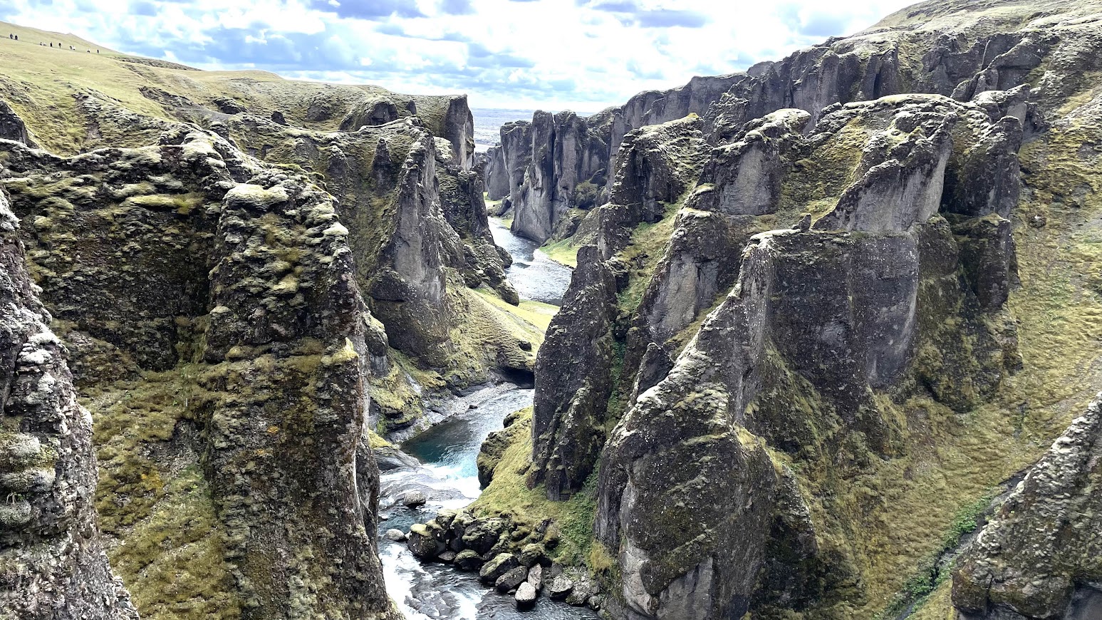
Further to the south, geologists find a similar story with the ancient Cauvery. The Cauvery basin formed when Sri Lanka detached from the Indian continent. Its delta and marine deposits too contains sediment from the Late Cretaceous. 

The easterly drainage pattern of Peninsular India developed before Deccan Volcanism and the formation of the Western Ghats. 

India broke away from Madagascar about 88 million years ago  and subsequently from the Seychelles about 66-64 million year ago. The latter separation coincided with Deccan Volcanism and the eventual formation of the western Indian continental margin. Block faulting that accompanies continental breakup would have created a north south oriented high area, which would eventually evolve into the present day Western Ghats. The thinning of the lava pile to the east also would have created an easterly slope. Rivers originating in the western highland now would flow across the length of the Peninsula. 

New streams would have incised the fresh volcanic surface as lava buried the older etched landscape. But the regional  pattern of easterly flow persisted.

Some geologists maintain that there has been some fairly recent Cenozoic age (past 15-20 million years) uplift of the Western Ghats which has accentuated relief and produced the youthful looking topography of scarps, waterfalls, and deep canyons. These earth movements would have certainly given new energy to the drainage system, but there is some geologic evidence to suggest that the streams originating in the western ghat region are antecedent to the uplift of the ranges. 

For example, in the Mahabaleshwar area easterly drainage cuts across the axis of a north south oriented gentle anticlinal structure, implying that the drainage predates the uplift and warping of lava flows. Evidence from sedimentation patterns of the eastern river deltas also show that the easterly drainage originated much earlier than the formation of the Western Ghats. 

What then created that initial slope to the east that imprinted the drainage network that continues today? 

One reason is that the eastern margin formed first. Basin formation along the eastern edge of the continent would have created a relief difference between the western interior and the eastern depressions, resulting in stream networks flowing eastwards.  Secondly, the new oceanic crust made of lava that formed when India and Antarctica separated in the Late Jurassic and Early Cretaceous would have cooled by Late Cretaceous times. Becoming colder and denser it has been sinking and dragging the Peninsular region with it. 

Earlier eastern basin formation and a tug from the floor of the Bay of Bengal may have been enough to impress an east flowing drainage. Later, the east sloping lava surface and the rise of the Western Ghats reinforced this distinction between the west and the east perpetuating the direction of river flow initiated since Cretaceous times. 

Monday, January 29, 2024

Is It A Lava Tube?

My latest field geology video is about a small cave in the basalt lava near my house in Pune city. The location is Hanuman tekdi, also known as Fergusson College Hill. The cave is along the slope right behind IMDR canteen. 

Is the cave a remnant of a lava tube, or has it formed by some other process? 

Sound on. Permanent Link - Fergusson College Hill Cave.


You can access this cave by walking along the path starting from the main gate of Gokhale Institute of Politics and Economics. Turn left as you approach the hill and after a few steps look up to the right. 

Visit quickly. As you can see from this photo, rubble from the construction works of water tanks at the top of the slope is slowly spreading and might cover up this cave. I hope not. 

More geology videos soon!

Tuesday, January 9, 2024

Kenjalgad Perched Aquifer

I have been experimenting with shooting videos of geological features with an accompanying commentary. Here are two of my recent efforts.

Last month I visited Kenjalgad, a small fort near the town of Bhor. As is typical of forts of the Sahaydri ranges, it sits atop a thick basalt scarp. 

The videos explain the geological conditions for the formation of a perched aquifer. I hope I have been clear in my explanation. Sound on please! 

Kenjalgad aquifer. Location 1- Permanent Link


Kenjalgal aquifer. Location 2- Permanent Link

Kenjalgad as seen in this picture is quite an impressive mesa.


The aquifer I described in the video occurs within the topmost rock layers of the scarp forming basalt. They form discrete accumulations of groundwater high up on these ridges, separate from the aquifers underlying the surrounding valley.

I am planning on making more of these videos of various geologic features. Should they be a little longer, say two or three minutes each? I would appreciate some feedback from you.

Wednesday, November 15, 2023

River Nira Meander

 So near Pune, yet I had never been to this location near Bhor.

It is popularly known as necklace point. The river Nira loops its way through the countryside forming a series of lovely meanders. A high point overlooking the valley allows a clear view of this feature. 

I was on a drive with some friends, spending the day exploring the back waters of the Bhatgar and Nira Deogarh dams. We eventually reached Warandha Ghat, one of the spectacular passes linking the Deccan Plateau with the western coastal plain. 

At the edge of the plateau, high relief exposes sheer rock faces. 

The grand scale of Deccan Volcanism is manifest so clearly in the lava flows traceable over hundreds of meters despite the afternoon haze.

On a satellite image, X marks the view point looking south towards the big meander.  

This is a beautiful area near Pune to spend a day out.

Sunday, July 23, 2023

Septarian Concretion from Khambhat

My friend Bhushan Panse, who is a geology enthusiast and an avid rock and mineral collector, handed this specimen to me over a coffee meeting. He had bought it from a mineral supplier from Khambhat, Gujarat.

I commented that it is a septarian concretion. These hard ellipsoidal or oval shaped lumps form in mud and silt layers by the precipitation of calcite  around a nucleus. Khambhat and many other parts of Gujarat are underlain by Mesozoic and Cenozoic age sedimentary rocks. The process of concretion formation would have taken place at shallow burial depths when these sediments were still porous and water saturated. Mineral deposition in pore spaces often takes place in concentric layers. The calcium carbonate comes from saturated marine pore water or is derived from shells as they start dissolving during shallow burial. Notice the rust to brown color of the concretion. It is likely due to the presence of iron oxide and hydroxides which formed in the pore spaces from the iron contained in clay minerals.

The term Septarian Concretion refers to the radiating cracks or Septaria (derived from Septum). Cracks come in a variety of shapes. There are radiating cracks as seen in this specimen. These cracks are wider near the center and taper outwards. Other concretions may show concentrically oriented cracks, or overlapping sigmoidal shapes. Cracks may intersect, pointing to multiple cracking events. They are filled with either calcite or silica. The crystals filling these cracks are sometimes broken and displaced, and cracks may contain mud and silt. These features indicate a variety of stresses at play in concretions interiors. 

There are many ideas on how these cracks form. They have been interpreted as shrinkage cracks due to desiccation and hardening of mud. Dehydration during chemical transformation of clay minerals is another explanation.  A third hypothesis links the formation of cracks to gas expansion released during putrefaction of organic material. 

Sedimentologist Brian Pratt has offered another novel explanation. He proposed that these cracks result due to shaking of sediment during synsedimentary earthquakes. Shaking during ground motion results in variable stress fields in the interior of the concretion forming a large variety of crack geometries. These concretions may be preserving signals of  seismicity affecting that sedimentary basin!

Here is his compilation of the large variation in septarian concretion cracks from various sedimentary basins across Canada.


 Source: B. Pratt: Septarian concretions: internal cracking caused by synsedimentary earthquakes

A geologist friend who worked with the Geological Survey of India suggested another intriguing explanation. Parts of the region near Khambhat experienced explosive volcanic activity towards the waning phases of Deccan Volcanism. Ash expelled from volcanoes can coat small broken lava fragments forming lumps known as  'áccretionary lapilli'. Aggregations of ash and pyroclastic material if larger than 64 mm are known as volcanic bombs. This concretion fits the size range of a bomb. The dark fragments in the center of the concretion do resemble a fine grained igneous rock. A closer examination under a microscope is needed for a confirmation of its origin.

It is fun to examine hand specimens that friends collect from various part of the world and try to identify the rocks and minerals. But often a clear cut answer is not possible due to the need for additional information from a higher resolution or the chemical makeup. But a guessing game over coffee is always welcome. 

Geodes, nodules, and concretions found in volcanic and sedimentary rocks are mystery objects. You never know what you will see inside when you break open one of these lumps. There may be an array of perfectly faceted purple amethyst crystals and multicolored calcite. Or a trapped fossil. Or a crack network filled with bright and shiny calcite and quartz. These crystal rich interiors give us important information on the composition of fluids which react with rock at many different times during their geologic history. This water rock interaction is of interest to mineralogists and  economic geologists who want to understand the history of fluid flow through sedimentary basins and the conditions that lead to the concentration and deposition of metals. 

Geological investigation at all scales inform us about how the earth works. One can stand and gape at great mountain ranges and wonder about the movement of tectonic plates. But you can also crack open a rather dull colored lump from a shale and marvel at its insides, all telling a story of groundwater flow and chemical reactions, and who knows, past earthquakes as well. 

Thursday, July 14, 2022

Field Photos: Iceland

More pictures arrived from different parts of the world. My friends visiting Iceland and the Alps sent me some stunning photos of landscapes and geology. 

Iceland. 

All pics by Biju Mohan.

Lava flows forming gentler slopes and steep rock faces. Notice the rough columnar jointing in the upper lava flow.

Where basalt plateau meets the sea. Cliffs and a wave cut platform.

Volcanic cone and crater.

A fissure or a crack through which lava would have poured out. These are present all over Iceland.  

Iceland predominantly has basalt volcanism, broadly the same rock type as the Deccan. It is one of the few locations where the Mid-Atlantic spreading center is exposed above sea level. This is a divergent plate boundary, where the European and North American tectonic plates (along with some micro-plates) are moving away from each other.

Biju asked me an interesting question; "Did the deccan area looked like present day Iceland sometime in the past? Is there evidence for numerous volcanoes in the Deccan?

Yes, a young Deccan volcanic terrain would have looked similar to Iceland in some aspects. Since in both places, the crust was pulled apart by extensional forces, long fissures or cracks formed and were the main passageways for magma to come to the surface. These fissures from where lava came out would have been visible in a young Deccan. They have eroded away now. What is left are dike swarms, essentially cracks plugged by sheets of magma. Many of these dikes represent the feeder passages from which lava ascended to the surface. So, an exhumed lower level is now visible. Volcanic cones would also have been visible. These have mostly been eroded away in the Deccan.

As such Deccan would not have seen the development of very large steep cones, since the lava type is runny, and does not pile up much to build cones. Iceland though, besides basalts,  has more of a silica rich sticky lava type, with more explosive volcanism,  and a more pronounced development of steeper volcanic cones. Remember the Eyjafjallajökull volcano that erupted in April 2010?

Fresh lava fields would have been clearly demarcated. In young volcanic terrains it is easier to pick out discrete eruptive episodes. Lava fields erupting from different vents overlap. Slightly older lava will change color due to weathering and also get colonized by plants. Fresher lava fields will be barren and likely steaming as well! In the much older Deccan , erosion has erased such differences. Exhumation doesn't always expose a pristine surface, rather a patchwork of vertical sections where one gets a two dimensional view is the common outcrop pattern, making recognition of such lava fields challenging to the untrained eye. 

Another similarity would have been the presence of active hydrothermal systems. Today, the Deccan volcanic system is extinct, but 65 million years ago, groundwater would have been heated by flowing through hot rock and proximity to magma. Fumaroles and hot springs would have been a common phenomenon. I have been collecting secondary minerals from the Deccan Traps since my college days, and I would have loved to have wandered through a young Deccan volcanic terrain, where hot mineral saturated water were depositing silica, calcite, and zeolite minerals in cracks and cavities of the basalts. 

The oldest lava flows in Iceland are mid- Miocene in age. Erosion has been sculpting landscapes for a good 15 million years. The result is some uncanny similarities with the Deccan. The 'Trap' topography, alternations between gentler and steeper slopes is also seen in Iceland. And along the Konkan coast, basalt and laterite sea cliffs look over flat wave cut platforms just like the Iceland coast. 

Sea cliff and a wave cut bench, Harnai, Konkan.


I'll close with this beautiful Iceland landscape. 


Coming soon.. Dolomite Alps and a geological conundrum.

Tuesday, May 10, 2022

Field Photos: Dikes And Gneiss

My friends have been traveling across India and sending me pictures of landscapes and rocks. I am doing field work vicariously.

Posting below a few pictures that I have received.

Dikes Intruding Bundelkhand Gneiss. Pictures by Rajesh Sarde.

These two photos were taken at the Ken River gorge in Madhya Pradesh, near a gharial sanctuary. 

The dark rock making up the floor of the gorge is a dike. It has intruded the pink colored gneiss rock. Notice that the gneiss is fractured. Intrusions follow major weak zones in the gneiss.  Being softer than the gneiss, erosion over time has removed much of the dike, forming a narrow valley.

And in this picture, an arm of the dike known as an apophysis can been seen. It is almost at right angles to the gorge.


The Bundelkhand Gneiss ranges in age between 3.2 billion to about 2.5 billion years ago. The mafic dikes, igneous rocks rich in iron and magnesium silicate minerals, intruded later into the granite gneiss. Recent geochronological work on the dikes suggest two distinct events of dike emplacement, an early episode dated to about 2 billion years ago, and a later one at 1.1 billion years ago. Interestingly, the magnetic signatures frozen in these dikes have been used to make inferences about paleogeography. The results indicate that the north and south Indian crustal blocks which had independent origins were in close proximity by about 2.5 billion years ago. 

The magnetic signatures of the 1.1 billion year old dikes throw up a puzzle. They match those preserved in the Upper Vindhyan strata and intrusive rocks, seemingly constraining the age of the Upper Vindhyan sequence to around 1 billion years. However, recent fossil finds which I wrote about in a recent article for Nature India point to the Upper Vindhyans being much younger, about 550 million years old!

Dikes Intruding the Deccan Traps. Pictures by Rajesh Sarde.

These two photos were taken at the base of Tamhini Ghat, west of Pune, near a popular trekking spot known as Plus Valley. The rocks are about 66-65 million years old.

As in the previous example, the dike has eroded away faster than the host rock forming a narrow depression. Notice the closely spaced jointing pattern or cracks in the dike. 


 In this photo, the sharp boundary between the dike and the basalt rock can be clearly seen.


 Tonalite Trondhjemite Gneiss, Palolem Beach, Goa. Picture by Aneeha. 

These rocks, abbreviated as TTG, are relicts of early continental crust. They are about 3.4-3.2 billion years old. They represent Archaean age magmatism that formed the lighter continental crust. Such TTG's  are found all across India. They are the oldest component of cratons, the nucleus of the first continents. These magmas are generally granodiorites, rich in sodium and calcium feldspars and poor in potassium feldspars. They were deformed and metamorphosed subsequently in to a gneiss, in the process acquiring a characteristic banding. 

Next time hopefully pictures from my own field trips!

Saturday, September 25, 2021

LiveHistory India Videos: I Speak About Deccan Volcanism

LiveHistory India has started a wonderful outreach initiative, highlighting India's geological heritage. They invited me to talk about Deccan Volcanism. I spoke about how it all began, the physiography, places of interest, and the fossil bearing intertrappean sediments and their value in understanding ecology and broader patterns of extinction and recovery spanning the mass extinction that occured 66 million years ago. 

This was recorded a couple of weeks ago, and it is now online. The original recording was about 40 minutes, but it has been edited and the video is 17 minutes long. Subtitles are in Hindi.

Permanent Link- Deccan Volcanism And Its Various Aspects


LiveHistory has put out more such videos with other Indian geologists. 

1) India's Fossil Heritage- Dr. Sunil Bajpai

2) Markers of Earth's Formation in India- Dr. Pushpendra Ranawat

3) A Panel on Geological Heritage of India- Dr. Pushpendra Ranawat, Bidisha Bayan, Dr. Reddy, and Aliya Babi

Hope you enjoy my talk!

Wednesday, May 5, 2021

Mass Extinction, Peopling Of America, Tale Of The Horse

 Sharing some interesting items:

1) What was the impact of Deccan Volcanism on the end-Cretaceous mass extinction? Improved dating of the timing of volcanism shows that volcanism spanned the mass extinction. But what changes occurred to marine environments because of the outgassing wasn't well documented. A new study uses the oxygen isotope ratios in foraminifera shells to estimate ocean temperature changes before and after the mass extinction. The finding is that the oceans warmed well before the extinction but cooled back again. The warming event doesn't appear to correlate with marine extinctions. Rather the mass extinction coincides with evidence for a meteorite impact. 

Here is a figure from the paper on the estimated temperature changes collated using a variety of proxies:

Source: On impact and volcanism across the Cretaceous-Paleogene boundary

Joshua Sokol has written a good summary of the paper:

A Rapid End Strikes the Dinosaur Extinction Debate.

2) Anthropological geneticist Jennifer Raff has pieced together the genomic story of the peopling of the American continents in this really insightful article. Do read it!

Genomes Reveal Humanity’s Journey into the Americas.


3) And next, onwards to a bit of Indian history. A very interesting conversation between Live History India editor Mini Menon and author Yashaswini Chandra on Ms. Chandra's new book, The Tale of the Horse: A History of India on Horseback. Fascinating story of the horse trade from Central Asia into India and its assimilation as a war animal and into Indian society. 

The Tale of the Horse (video). 


Monday, May 25, 2020

Magmas And Mass Extinction: Late Triassic

A new study on the synchronicity of igneous activity and the Late Triassic mass extinction which occurred around 201.5 million years ago.

Large-scale sill emplacement in Brazil as a trigger for the end-Triassic crisis- Thea H. Heimdal, Henrik. H. Svensen, Jahandar Ramezani, Karthik Iyer, Egberto Pereira, René Rodrigues, Morgan T. Jones & Sara Callegaro. The article is open access.

Magma intruded a thick pile of sediments in Brazil. The thermal reactions in the sediment would have resulted in the release of 88 trillion tons of CO2 from the degassing of sediments!

Abstract:

The end-Triassic is characterized by one of the largest mass extinctions in the Phanerozoic, coinciding with major carbon cycle perturbations and global warming. It has been suggested that the environmental crisis is linked to widespread sill intrusions during magmatism associated with the Central Atlantic Magmatic Province (CAMP). Sub-volcanic sills are abundant in two of the largest onshore sedimentary basins in Brazil, the Amazonas and Solimões basins, where they comprise up to 20% of the stratigraphy. These basins contain extensive deposits of carbonate and evaporite, in addition to organic-rich shales and major hydrocarbon reservoirs. Here we show that large scale volatile generation followed sill emplacement in these lithologies. Thermal modeling demonstrates that contact metamorphism in the two basins could have generated 88,000 Gt CO2. In order to constrain the timing of gas generation, zircon from two sills has been dated by the U-Pb CA-ID-TIMS method, resulting in 206Pb/238U dates of 201.477 ± 0.062 Ma and 201.470 ± 0.089 Ma. Our findings demonstrate synchronicity between the intrusive phase and the end-Triassic mass extinction, and provide a quantified degassing scenario for one of the most dramatic time periods in the history of Earth.

This prolonged phase of igneous activity resulted in the formation of the Central Atlantic Magmatic Province. Its connection to the mass extinction was hard to pin down due to a lack of accurate dates of the oldest igneous activity. This and some other work now show that phases of this magmatic episode were synchronous with the mass extinction.

A similar problem of lack of accurate dating of events had limited our understanding of the role of Deccan Volcanism in the mass extinction that took place at 66.04 million year ago. New geochronology work (summarized by Kale et. al. 2019)  is showing that volcanism spanned this mass extinction. Significant amount of lava eruptions took place before the mass extinction and would have played a role in the deterioration of environmental conditions. And volcanism continued well after the mass extinction delaying biotic recovery for hundreds of thousand of years.

Large injections of magma as laterally extensive intrusions (sills) into sediment has also been thought to have been the trigger for the end-Permian mass extinction that took place around 252  million years ago. Interestingly, like the end-Triassic, it was not emissions of carbon dioxide and methane directly from lava eruptions that is thought to be the driver of environmental change. Rather, it was the subsurface emplacement of sills and the thermal reaction (contact metamorphism) in buried sediment in contact with this hot magma that resulted in volumetric degassing from sediments. Limestones when heated this way would have released carbon dioxide upon breakdown of the mineral calcite. And organic matter would have released methane.

The long trajectory of evolution on earth has been disrupted and reoriented many times from deep within.

Friday, March 13, 2020

Palghar Earthquake Swarm

My article on Palghar's mystery earthquakes has been published in The Wire Science. The article is an explanation of a recent paper that was published in the journal Tectonophysics. It favors the view that groundwater circulation is causing slippage along faults. According to the scientists involved the earthquakes are due to these very local processes.

One important point is that a link between groundwater and these tremors, even if it does exist here, represents a tipping point in a longer buildup of stress due to tectonic forces. The western margin of India is riddled by large fracture zones and faults. These structures haven't formed by groundwater movement. They are a legacy of earlier and ongoing crustal deformation due to regional and continent wide geological forces.  Groundwater flow or a build up of pore pressure cannot by itself generate enough stress to develop a fault de novo.

Dhundhalwadi is experiencing what is known as an earthquake swarm, a sequence of seismic activity with no clear peak (mainshock), and which is localised to one area. A recent study by researchers around India, including the National Institute of Seismology, has found one potential explanation for the swarm that draws a link between the monsoons, groundwater circulation and rock deformation...

Read more here.

Saturday, November 30, 2019

Field Photos: Natural Arch, Lava Channel NE Of Pune

Last Saturday I went for a field trip organized by the Centre for Education and Research in Geosciences. This is an outreach effort initiated by geologists Dr. Sudha Vaddadi and Natraj Vaddadi along with the student community from various Pune colleges. They undertake these programs regularly through the  year. We explored the Deccan Plateau region northeast of Pune.

On Pune Nasik Highway we turned east at Ale Phata. Our first stop was a little past Gulunchwadi . Across the road an inclined dike intruding into older basalt flows is visible. And a groundwater seep is seen along the contact between two basalt flow units.


Such water seeps can slowly weather and remove rock eventually creating larger passages and undercuts. We saw that just a few minutes ahead. Besides a small roadside temple is a steep stairway leading you into a streambed below. There you come across a wondrous natural arch.


I am not sure I have a good explanation of how exactly this feature formed. Was there a larger waterfall cascading from the top before? At the same time, groundwater seeping along the contact between the two flow units would have eroded rock material creating large passageways which eventually coalesced. Stream flow got directed along the bed of this large tunnel. Further down cutting by the stream has lowered the level of the stream bed, leaving a stranded 'bridge'. 

Also notice in the satellite picture below that the stream makes an abrupt turn at a couple of different points along its course. Its pathways appear to be controlled by fractures.They would have provided weak zones that focused and enhanced erosion.


From this site we proceeded to Mandahol Dam. A little north of this dam is a ridge line named Mhasoba Zap. Can you spot something unusual in the topography of the ridge?


The sinuous feature is an exhumed river of lava!  It erupted between 67 and 66 million years ago.

Basalt lava is less viscous and can flow for long distances. It can follow a preexisting valley or lows in the landscape, forming a lava channel. The image below is from a USGS monitoring station that has captured a lava channel formed during a recent eruption in Hawaii. 


The view in this photo at Mhasoba Zap is looking upslope. The winding ridge which you can follow up to the isolated hill in the background is the exhumed lava channel. It stands out about 50-100 meters above the adjacent plains. 


And here is the lava channel looking downslope. It continues for a distance of about 3 kilometers 'downstream' before dying out.


The margin of the channel (white arrows) are made up of a basalt which looks a little different from the basalt in the central parts of the channel. The margin rock is reddish in color. A closer look (in the field) will tell you that it is glassy to fine grained.  Lava at the margins cools quickly. This cooled lava gets broken up because of the stresses imparted by flowing lava in the center of the channel. This gives a fragmented character to the margins. The iron in the quenched glassy matrix rusts to impart a orange red hue to the rock.


In a close up I have outlined the base of the channel in orange lines.  Dr. Sudha Vaddadi who has mapped this region when she was working with the Geological Survey of India tells me that this entire ridge is actually a lava tube. The top has been eroded away! She was able to identify the 'roof' a km away downslope.


Lava at the surface cools and solidifies quickly. That leaves a tube or a pipe through which lava is supplied from the vent across long distances. The solid crust insulates and keeps the interior hot, allowing the lava to reach long distances from its source. The photo is of a lava tube from the Reunion Islands, a site of ongoing volcanism.

Photo Credit: Nandita Wagle

Let's take a closer look at the margin rock.   It is distinctive due to the reddish color and the fractured fragmented nature of the rock.  It has also been extensively affected by secondary mineralization. Cracks are filled with (white veins) of fibrous scolecite (zeolite family) and calcite.


Blobs and lava spatter accumulates at the margins, cooling and welding together to form an 'agglomerate'. The close up shows globular masses of lava stuck together. 


In this synoptic view, almost the entire lava channel is visible.  Downslope it breaks up into distributary 'fingers'. 


This really was a fun trip. From this lava ridge we traveled south and saw stalactites at the Duryabai Temple near Wadgaon Durya and then went further south to see the famous potholes in the Kukdi river bed near Nighoj village.  I will write about these features in a later post.

In the embedded map look for Malaganga Temple, Mhasoba Zap, Wadgoan Durya and Nighoj. 


Email subscribers may not be able to see the map. Follow this Permanent Map Link.

Although the Western Ghat escarpment with its spectacular views captures a lot of attention, the Deccan plateau region to the east and northeast of Pune has a lot of interesting geology and landscapes.

Get out there and explore!