Showing posts with label western ghats. Show all posts

Tuesday, September 30, 2025

Dinosaur Engineers, Laterite Plateau, Social Insects

The latest batch of readings and a video for you readers.

1) How the death of the dinosaurs reengineered Earth. Here is an interesting linkage between dinosaurs, sedimentary rock type distribution and river geometry. Fluvial sedimentary environments are different before (Cretaceous) and just after (Paleocene) dinosaur extinction.

In the latest Cretaceous, large bodied dinosaurs destroyed riverside vegetation, destabilizing banks and preventing stable meanders. Natural levees were breached causing sand to spill onto the floodplains, resulting in an open riverine environment. Post dinosaur extinction, vegetation growth stabilized banks, forming stable channels and meander belts, promoting a sharper division between the constrained channel sands and surrounding floodplain fine mud and organic rich swamps.

Ecosystem engineering by dinosaurs!

2) The Rocky Life: Plateaus of the Monsoon. South of the town of Satara in Maharashtra, the crest of the Western Ghats is mantled by a thick hard iron rich soil known as laterite. This red crust is a deep weathering profile that developed by chemical breakdown of the Deccan basalts (in Maharashtra) and of Precambrian metamorphic rocks (Goa and southern Western Ghats) around 50 million years ago in the Eocene during a warm and wet climate phase. For long, these high regions were treated as "wastelands", devoid of vegetation and wildlife. 

But as biologist Varad Giri explains in this excellent video, there is a hidden world that a careful observer will notice. 

And conservation biologist Neha Sinha writes about (under paywall) the plant life on these rocky plateaus- Why India's "wastelands"are biodiversity hotspots in disguise.  As she evocatively wrote about the Kaas Plateau near Satara on her X timeline- "Lakhs of flowers - carnivorous, parasitic, wild, mesmerising, ephemeral, resilient".

3) One mother for two species via obligate cross-species cloning in ants.  Social insects must rank as some of the most amazing creatures.

In one species of ants, the mother gives birth to offspring of two different species! This happens because the mother uses sperm from another species male to produce the worker caste.

Yes, they have caste too!

I’ll reproduce the abstract here and leave you to roll your eyes in wonder-

“Living organisms are assumed to produce same-species offspring. Here, we report a shift from this norm in Messor ibericus, an ant that lays individuals from two distinct species. In this life cycle, females must clone males of another species because they require their sperm to produce the worker caste. As a result, males from the same mother exhibit distinct genomes and morphologies, as they belong to species that diverged over 5 million years ago. The evolutionary history of this system appears as sexual parasitism that evolved into a natural case of cross-species cloning, resulting in the maintenance of a male-only lineage cloned through distinct species’ ova. We term females exhibiting this reproductive mode as xenoparous, meaning they give birth to other species as part of their life cycle”.

I love the first line-  Living organisms are assumed to produce same-species offspring. After all, we never tried too hard to prove it!

Friday, August 22, 2025

Easterly Tilt Of The Deccan Plateau - Update

I first wrote about this topic in 2011 in response to a question by a reader. I thought I would update my post with some new maps and explanations. Why is there such a pronounced pattern of easterly flow of the rivers in the Indian Peninsula.  I keep getting asked this question.  It was time for an update on this interesting topic on geology and landscapes. 

The region south of the Tapi river covering the Deccan basalts and the southern Indian peninsula exhibits an easterly drainage with the rivers flowing into the Bay of Bengal. The map below shows the Indian peninsular region with easterly drainage. The Deccan Plateau is mostly but not entirely covered by the Deccan basalts. South of this region is the Karnataka Plateau with a Precambrian geology. Along the east coast there are Permian-Triassic and Cretaceous basins.

Source: Hetu C. Sheth: Deccan Beyond the Plume Hypothesis

The question posed to me was - What is the relationship between the Deccan volcanics and the easterly tilt of the Indian plateau (i.e. the plateau covering the Deccan volcanics and the southern Indian peninsular region)?

The easier more intuitive answer would have been that the western ghats provide the topography and Deccan volcanism created a lava pile that is thicker to the west and which thins to the east, thus generating an east sloping surface. Rivers follow the slope to the Bay of Bengal. 

There are some geologic age inconsistency in this answer and this also does also not fully explain why the region south of the Deccan Volcanics too has an easterly drainage. Clearly, something more is going on. 

To understand the evolution of the Peninsular drainage patterns let us look back to the time when the Peninsula didn't exist. In early Mesozoic, India was part of Gondwanaland and was joined to Antarctica and Australia to the east, and Africa to the west. The triangular shape of south India with characteristic eastern and western coastlines had not formed yet. 

How can we find out the direction rivers were flowing back then? Geologists look to clues in the sedimentary basins of that age. The composition of sand in sandstone is matched to the most likely source terrain. And current directions can be inferred from studying ripples preserved on the surface of ancient sand. 

The paleo geographic maps below shows Gondwanaland and the location of the Pranhita Godavari basin in the Mesozoic. 


Source: Sankar Kumar Nahak and Coworkers 2024.

West North West flowing rivers originating in the highlands of the future Antarctica and in the Eastern Ghats were funneling sediment to the basin. Much of the interior of the region that would become the southern Peninsular India was a peneplain. There wasn't much topography towards the west for an easterly drainage network to develop. 

India broke away from Antarctica beginning about 140 million years ago. A distinct eastern continental margin formed. Several NE- SW oriented basins developed along the edge of the Indian continent. Since by this time an expanding Indian Ocean lay to the east, the orientation of a natural drainage system would have been from the west towards the east. 

We can say with some confidence that by 90 to 80 million years ago, east flowing rivers originating in the interior of the Indian continent were depositing sediment along the eastern Indian margin. See this map of sediment distribution along the Indian east coast. 


 Source: K.S. Krishna and Coworkers 2016.

It shows the thickness of  Mid- Late Cretaceous sediment, ranging in age from about 100 million years ago to 65 million years ago. The sediment lobes coincide with the mouths of the Godavari, Krishna rivers and other southern rivers, indicating that the paleo Godavari and the paleo Krishna system had begun building deltas from that time. Since there were no Western Ghats then, these rivers may have been shorter, with their source somewhere in the Archean and Proterozoic terrain of Peninsular India. 

Further to the south, geologists find a similar story with the ancient Cauvery. The Cauvery basin formed when Sri Lanka detached from the Indian continent. Its delta and marine deposits too contains sediment from the Late Cretaceous. 

The easterly drainage pattern of Peninsular India developed before Deccan Volcanism and the formation of the Western Ghats. 

India broke away from Madagascar about 88 million years ago  and subsequently from the Seychelles about 66-64 million year ago. The latter separation coincided with Deccan Volcanism and the eventual formation of the western Indian continental margin. Block faulting that accompanies continental breakup would have created a north south oriented high area, which would eventually evolve into the present day Western Ghats. The thinning of the lava pile to the east also would have created an easterly slope. Rivers originating in the western highland now would flow across the length of the Peninsula. 

New streams would have incised the fresh volcanic surface as lava buried the older etched landscape. But the regional  pattern of easterly flow persisted.

Some geologists maintain that there has been some fairly recent Cenozoic age (past 15-20 million years) uplift of the Western Ghats which has accentuated relief and produced the youthful looking topography of scarps, waterfalls, and deep canyons. These earth movements would have certainly given new energy to the drainage system, but there is some geologic evidence to suggest that the streams originating in the western ghat region are antecedent to the uplift of the ranges. 

For example, in the Mahabaleshwar area easterly drainage cuts across the axis of a north south oriented gentle anticlinal structure, implying that the drainage predates the uplift and warping of lava flows. Evidence from sedimentation patterns of the eastern river deltas also show that the easterly drainage originated much earlier than the formation of the Western Ghats. 

What then created that initial slope to the east that imprinted the drainage network that continues today? 

One reason is that the eastern margin formed first. Basin formation along the eastern edge of the continent would have created a relief difference between the western interior and the eastern depressions, resulting in stream networks flowing eastwards.  Secondly, the new oceanic crust made of lava that formed when India and Antarctica separated in the Late Jurassic and Early Cretaceous would have cooled by Late Cretaceous times. Becoming colder and denser it has been sinking and dragging the Peninsular region with it. 

Earlier eastern basin formation and a tug from the floor of the Bay of Bengal may have been enough to impress an east flowing drainage. Later, the east sloping lava surface and the rise of the Western Ghats reinforced this distinction between the west and the east perpetuating the direction of river flow initiated since Cretaceous times. 

Saturday, September 30, 2023

Iron Pisolites From Western Ghats

A reader sent me this photograph of a pebble he had collected from a stream bed near Belgaum, Karnataka.

 Photo credit: Gopisundar

These look to me like iron rich pisolites. These spheroidal grains form by the accretion of iron, manganese, and aluminum hydroxides around a nucleus. The core may be an aggregate of soil particles, a rock fragment, or even wood debris. 

You will notice that the core is quite massive and structureless but in a few grains a crude concentric layering is seen at the margins. The pisolites are bound together into a firm mass by mixture of clay and iron aluminum hydroxide. Pisolites form during prolonged episodes of chemical weathering of  rocks like basalt or shale or iron aluminum rich metamorphic rocks. They are present in thick laterite and bauxite profiles. 

The picture below is a representative example of pisolite from a location in Brazil. It shows the occurrence of pisolite layers in a weathered soil profile, along with a hand sample and a cross section under high magnification.


Source: K Marques et.al. 2022: Geochronology (preprint).

Here is a map of the landscape just south of Belgaum that I am describing in this post. 


 Source: Amanda Jean et.al 2020: Journal of Geological Society

It shows the distribution of three distinct horizons of chemically weathered soil, named as the S1, S2 and S3 surfaces. Each of these horizons consist of tens of meters of laterite or bauxite and manganese rich ore. There has been some recent success in dating these weathered layers using the mineral crytomelane, a potassium rich manganese oxide. Three distinct weathering periods are documented. As India broke away from Gondwanaland it eventually drifted northwards into tropical climatic belts. Throughout the Eocene to Miocene, long phases of hot humid climate resulted in intense chemical alteration of the Western Ghat landscape. 

The oldest soil, surface S1 in the map, formed between 53-44 million years ago. Surface S2 formed later in the Oligocene-Miocene between 39-22 million years ago. And surface S3 developed in the mid Miocene, between 14-10 million years ago. 

The graphic below tells a story of landscape evolution recorded in the formation of these three weathering profiles. 


 Source: Amanda Jean et.al 2020: Journal of Geological Society

Episodic dissection of a plateau through the Cenozoic kept stripping away rock layers, and younger bauxite and manganese rich soils formed at lower altitudes on freshly exposed rock and debris flows. The youngest surface S3 has developed on a pediment. These are layers of debris eroded from surrounding hills that accumulate in low lying areas. Surface S3 indicates a very active phase of weathering and erosion of the surrounding mountains ranges that took place between 22 and 14 million years ago. As a once contiguous plateau was fragmented, older surfaces S1 and S2 remain preserved on isolated mesas and table lands.

The pisolite my friend sent me could have broken off from one of these surfaces. Its hard to say which one. The overall light color suggests that it is aluminum rich, and may have been sourced from the bauxitic S1 or S2. But this is just a guess. 

Pebbles from a stream can hold many secrets. Don't just chuck them away :)

Thursday, January 10, 2019

Cracks In A Rock And The Western Ghat Escarpment

A friend sent me this picture of a section of the Western Ghat escarpment. It is taken from Jivdhan fort, looking north towards the hook nose of Naneghat. This location is about a hundred odd kilometers west-north-west from Ahmednagar town. Naneghat was a mountain pass for travel between the coastal plain and the plateau.

Photo credit: Rajesh Sarde

The yellow bloom makes a pretty contrast with the grey basalt. My geology eye was drawn towards something else; a suspiciously straight flowing stream, which I have highlighted with an arrow.

I looked at a satellite imagery of this location and the stream is seen following a fracture zone (black arrows)  that cuts across Jivdhan fort as well. The escarpment area is riddled with such fractures. They occur as north-south, northwest-southeast, and northeast-southwest (brown arrows) trending sets.


These fractures are regions of shattered rock. That zone erodes away quicker. Water flowing in the linear depressions that form enhance this topographic difference and eventually cut deep straight valleys.

Large fractures or cracks along slopes causes slabs of rocks to cleave away from mountain sides. Slopes retreat due to such rock falls. A large crack is seen in the picture just a few feet away from where my friend took his photograph. At some point a portion of rock will detach itself and Jivdhan fort will become that much narrower.

Look at the zoomed out satellite imagery of this area. The plateau edge has been fragmented into isolated hillocks, mesas and pinnacles by enhanced erosion along fractures oriented in various directions. You can follow some of these fractures (white arrows) to the straight edges of the escarpment suggesting that slab breakoff has played a role in shaping the morphology of the cliff line.


Such fracture systems not only have formed a landscape of mesas and pinnacles but have caused the Western Ghat escarpment to retreat eastwards for at least tens of kilometers from its original location. The escarpment is a legacy of the breakup of the western margin of India with Seychelles at the end of the eruptions of the Deccan Basalts. At that time in the Paleocene (~60 million years ago), continental stretching caused the formation of a series of north-south oriented faults which sloped (dipped) to the west. The westerly block of each of these fault sets sank, created a staircase like crustal structure descending towards the west, with west facing cliffs. The Western Ghat escarpment would have been the easterly most of these cliffs.

See the schematic below which shows this staircase crustal structure of the western margin of India.


The red portion would have been the original extent of the Deccan plateau. It has retreated eastwards over several millions of years. As a result, the coastal plain became progressively broader. Give a thought to the humongous amount of rock that has been removed by erosion.

Along the west coast the erosional  retreat has not wiped clean all evidence of the original plateau. From the coastal plain rise isolated ranges and mesas. The hill station Matheran, where people go to catch the cool wind and a spectacular view, is a fine example.

See the satellite imagery below.


Matheran was where the plateau edge and escarpment once was. It has now moved eastwards (arrows) leaving behind an erosional remnant,  a splendid outlier of the Deccan plateau rising abruptly from the plains.

Let's end with a 3D view of the escarpment along the Jivdhan-Naneghat area.


If you take a flight out of Pune to Delhi, the plane will fly a northerly route parallel to the plateau edge for the first 20-25 minutes of your journey. The Western Ghat escarpment appears as it does in the tilted perspective above, a sinuous line of majestic black cliffs, testimony to the forces of volcanism, continental breakup, and erosion.

A section of this stunning landform deserves to be included in our National Geological Monuments list.

Tuesday, January 30, 2018

Field Photos: Dikes At Korlai, India West Coast

Sharing a few pics of dikes intruding the Deccan Volcanics at Korlai, a small village south of Mumbai. I had taken a group of nature lovers and science enthusiasts on a traverse from Pune to the   west coast last weekend. We stopped at the Western Ghat escarpment to take in majestic views of massive lava flows and then went to the coast to observe dikes and silica geodes.

Several dikes are exposed along the rocky coastline. Most of them are oriented in a N-S to  NNW-SSE direction.

Here is one with a shape of a serpent


A close up of a dike. Notice the clear contact between the dark colored dike and the brown/grey looking basalt lava flow.


Another large dike with closely spaced fractures.


And this one, intruded along en echelon fractures, showing a sinistral or left handed offset.


A view of the rocky wave cut platform from top of Korlai fort. Arrows point to two dikes.


One interesting feature of these dikes is that many of them contain tiny fragments (2 -20 cm in diameter) of the lower crust, incorporated by the basaltic magma as it ascended. These fragments or 'xenoliths' are composed of granulite, a common rock type formed in the high temperature - high pressure environments of the lower crust. Work done by A.G Dessai and colleagues  suggest that these granulites are present at depths ranging from 15 km to 40 km below the surface. Dike chemistry suggests that the original composition of the parent basaltic magma, formed at even greater depths in the uppermost parts of the mantle, was modified  due to reaction with and assimilation of this lower crustal granulite.

That was a point of great interest to the people who participated in this field trip. They were awestruck that they were looking at solidified sheets of magma that extended to depths of more than 40 km below the surface.

Thursday, December 28, 2017

Geology Excursion To Tamhini Ghat And Korlai - India West Coast

On December 16 and 17, I took part in an excursion to the village of Korlai. This place is about 150 km west of Pune. The trip was organized by Deep Dive India, a venture started by my cousin Shirish Kher. The idea is to offer participants an immersive experience into one or two specialized fields.  On offer for this trip was geology and archaeology. I was the designated geology expert. The accompanying archaeologist was Sachin Joshi, a researcher from Deccan College Pune.

It was a lot of fun!

The group was mostly made up of working professionals with an interest in nature. Many of them came to know of this trip from my Twitter feed.  We drove westwards along the Deccan Plateau. Then, we descended the Western Ghat escarpment along Tamhini Ghat.  On this section, we made several stops to survey the landforms and to examine lava flows. I also gave the  group an introduction to Deccan Volcanism. After crossing the coastal plain we ended up at the village of Korlai, where there was more geology on offer.

We stayed in a home stay in the village of Chaul, a few kilometers away from Korlai.

The next day, Sachin Joshi gave us a fascinating walk-through the Portuguese forts at Korlai and Revdanda. These two villages are on opposite banks of the Kundalika estuary. It is quite a beautiful location. The forts were established by the Portuguese in the 1520's,  a couple of decades after Vasco da Gama rounded the Cape of Good Hope and established trading contacts with rulers and merchants of the Indian west coast.

The satellite image below shows the backwaters of  Mulshi and Varasgaon dams on the edge of the plateau, Tamhini Ghat, the coastal plain and the locations of Korlai and Revdanda villages. The sinuous N-S trending white dotted line seen along the Tamhini Ghat just west of the backwaters is the Western Ghat escarpment.


..and here are more pictures from our trip.

I gave a brief preview of the trip and explained the physiography of our traverse which took us along the Deccan Plateau, down the escarpment and to the coast along a broad coastal plain.


Along the way at Tamhini Ghat, I stopped to point out a lava flow contact. You can see pipe vesicles at the base of the upper flow.


 In Tamhini Ghat, unrolling a satellite imagery, I explained the landforms and structure of the Western Ghat escarpment to geology enthusiasts young and younger!


 At Korlai coast the group is looking down at a dike.


I demonstrated the use of a Brunton compass at this dike.


And here is a view of some of the many dikes intruding the basalts along the west coast.


The rampart and walls of Korlai fort along the rocky coast. You can see a cannon protruding through an opening in the wall.


The group standing on the surface of a lava flow showing columnar jointing. You can make out the polygonal shape of basalt blocks.


Korlai village fishing fleet moored in a back bay with the open Arabian Sea to the right. View from top of Korlai fort.


A beautiful view of Revdanda Fort, built on a sand bar, with waves crashing on to the walls and ramparts.


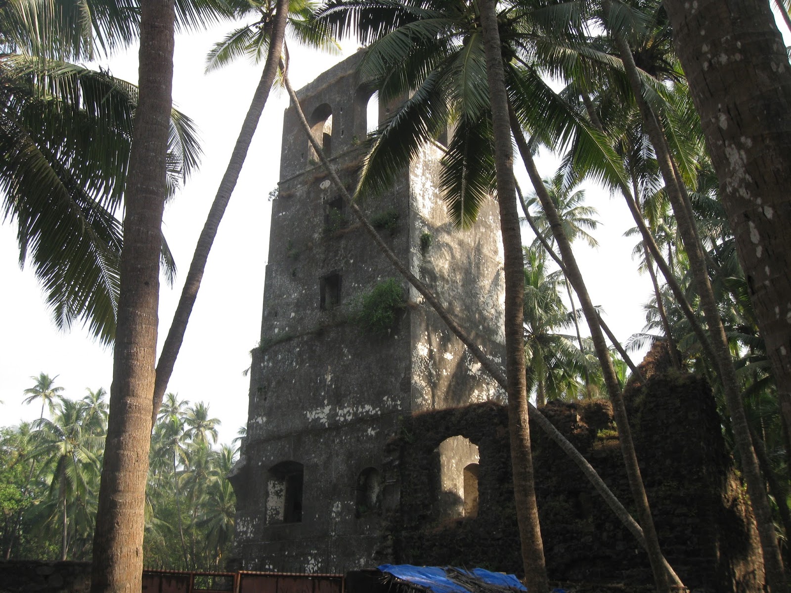
A watchtower in Revdanda Fort


An entrance with icons of a saint and official markings carved on stone.


 Through a broken wall of Revdanda Fort, a view of the Kunadalika estuary. Korlai Fort is on the stretch of land seen on the opposite side of the river.


The group enjoying themselves, exploring the fractured basalts of the west coast.


A picturesque home in Revdanda village.


This was the first time I had taken a group out on an organized trip like this. I was a bit nervous to begin with. But the atmosphere was informal and the participants enthusiastic and curious. That led to many long and enjoyable discussions on geology and archaeology.

We will be doing a repeat trip along the same route in late January... more pics then.

Wednesday, April 19, 2017

Evolution Of The Konkan-Kanara Coastal Plain

The Konkan coastal plains is a beautiful getaway from west coast city life. Palm fringed beaches, quiet rivers and estuaries, betel nut plantations and forest tracts. Small villages and settlements dot the landscape. To the east, the coastal plains abut against the imposing Western Ghat escarpment.

How did this coastal plain of Maharashtra form? (Kanara refers to the stretch south of Maharashtra in the state of Karnataka).  I came across a paper by Mike Widdowson on the evolution of laterite in Goa. It also has a broader discussion on the conditions that led to the formation of geomorphology of the coastal lowlands extending all along the west coast of India.

Here it is summarized nicely in this figure below:


Source: Evolution of Laterite in Goa: Mike Widdowson  2009

After Deccan Volcanism ended, rifting of the Indian west coast and down faulting of the western side led to the formation of a west facing fault scarp. Erosion of this scarp over the early mid Cenozoic (from about 60 million years ago) has caused it to retreat eastwards. The Western Ghat escarpment is this retreated scarpThe coastal plain formed as an erosional surface that became broader and broader with the progressive eastward retreat of this cliff to the current location. The fault which caused the western side to subside thus lies in the Arabian Sea along the west coast.

In Mid-Late Miocene (~10 million years ago), a phase of humid climate resulted in intense chemical weathering of the basalts and pediment (rock debris) exposed along the coastal plains. This alteration of the basalts formed thick iron rich soils. The reddened and indurated crust of this soil is commonly termed laterite. In the Western coastal lowlands this laterite may be a few meters thick.

Subsequent uplift of the west coast and concomitant down cutting by west flowing rivers formed a dissected landscape composed of laterite capped mesas (table lands) and entrenched meandering streams. These mesas reach altitudes of 150-200 m in the eastern parts of the coastal plain. Nearer the coast they are about 50 -100 m above sea level. 

The western margin of India has seen multiple episodes of extensive laterite formation. The famous table lands of the hill stations of Panchgani and Mahabaleshwar are also made up of laterite. They occur at altitudes of around 1200 m to 1500 m.  However, this upland or high altitude laterite is much older, having formed about 60- 50 million years ago in the early Cenozoic, soon after Deccan volcanism ended. The Konkan and Goa lowland laterites point to another younger phase of laterization. Sheila Mishra and colleagues have identified two more surfaces in the Deccan Traps at 650 m ASL and 850 m ASL that preserve remnants of laterite cover. This suggests a complex polyphase history of denudation and chemical weathering and tectonic stability of the Sahaydri ranges of the Western Ghats.

The sea cliffs that one encounters as you travel along the Konkan and Goa coastline are a result of a late Cenozoic uplift. I remember with fondness a trek I did during my college days from the town of Ratnagiri south to the town of Malvan. There were absolutely majestic sections where we walked on the edge of laterite capped sea cliffs with the Arabian Sea heaving and thundering below us. Little coves and beaches of sparkling white sand lay between the cliffs. Here and there local fisherman had kept their fish catch to dry out in the sun. The pungent smell urged us on!

The satellite imagery below shows a section of the coastal plains from Ratnagiri in the north to Devgarh in the south. White arrows point to the laterite capped table lands dissected by stream networks. Orange arrows point to sea cliffs. Black arrows shows the Western Ghat escarpment.


This is a very interesting paper. Open Access.

Saturday, February 25, 2017

Field Photos: Western Uplands And Giant Plagioclase Basalts

Last Sunday I visited Chavand fort near the town of Junnar, about 110 km north of Pune. This is a rugged terrain marked by several NW-SE oriented ridges separated by broad U shaped valleys. In the map below the black cross marks the location of Chavand. WGE refers to the Western Ghat Escarpment and KCB refers to the Konkan Coastal Belt. Trekkers familiar with this region will recognize the hill ranges, especially the Bhimashankar range and the Harishchandragad range. And near the town of Junnar is Shivneri fort, birthplace of the Maratha king Shivaji.


Source: Kale et. al, 2016

When Deccan volcanism ended, this region would have been a vast flat- to- gently undulating lava surface. At that time, some 60 million years ago, you could have walked from where Bhimashankar temple now stands to the present location of Harishchandragad along broadly the same elevation without the need to climb down several hundred feet or so into a valley and then climb up again. Over time however, south easterly flowing rivers and tributaries have gouged out grooves within this large plateau, dissecting it into a valley and ridge terrain.

The geomorphology of this region therefore reflects the creation of relief due to removal of material by erosion. This contrasts with other areas like the famous Basin and Range Province in western United States, where parallel faults have moved blocks of crust hundreds of feet to form a system of flat bottomed valleys (grabens) and flat topped ridges (horsts).

The Western Uplands end abruptly along the Western Ghat Escarpment, a sinuous west facing cliff overlooking the Konkan coastal plain. The escarpment is the edge of the Deccan Plateau.

There is another factor that has shaped this landscape. Take a look below at a satellite imagery of this area. The arrows mark fracture systems that have broken this plateau.


Erosion along these zones of weakened rock results in slabs of basalts peeling on rock faces. Over time, the result is a landscape that fragments into mesas, buttes and pinnacles. Chavand is one such mesa. Notice its straight edged polygonal shape suggestive of erosion along fracture planes.

Many of these fracture systems originated in the tensional forces that the western margin of India experienced during rifting and associated Deccan volcanism. After its separation from Madagascar around 88 million years ago, the Indian continent's rifted and the fractured western margin migrated over the Reunion hotspot, an unusually hot area of the mantle. The result, beginning around 68 million years ago was Deccan volcanism. Some of these linear structures, common in the area around Sangamner, are dikes. They are the pipes which brought up magma from deep subsurface chambers to the surface. Continued rifting of the western margin resulted ultimately in crustal blocks subsiding along a series of N-S oriented parallel faults. The Western Ghat Escarpment likely originated as a west facing fault scarp, but it would have been located as much as a 100 km to the west of its present location. Erosion over million of  years has resulted in an eastward retreat of this feature to where it stands now.

Picture below shows how hill ranges have been broken by a fracture system, resulting in isolated pinnacles.


And here is a picture of Chavand.


Recently my friend Vivek Kale and colleagues complied some very interesting geomorphologic, structural and sedimentology data to suggest that these western uplands have experience some tectonic movements during Quaternary times (past 2.58 million years). They emphasize that the Deccan plateau and Western Upland should not be regarded as a monolithic stable crust block. They point to three major fracture systems (F1, F5, F7 in the map below) which have segmented this part of the western upland. The central segment, i.e. the area north of Chavand, roughly between fracture systems F1 and F5 has moved up relative to the blocks to the north and south. The presence of sediments deposited in the Pravara river system and along F1 and some streams to the south  is evidence that the these blocks subsided somewhat, resulting in stretches of streams becoming sediment traps.


Source: Adapted in Kale et. al 2016 from Dole et.al. 2000, Dole et. al. 2002, Bondre et.al. 2006

These sediments represent deposition over the past 100,000 years or so. At some localities along the Mahalungi river, they have been deformed. Soft sediment deformation structures such as slumping, load structures and sand dykes have been recorded by Dole and colleagues. Such structures are evidence of ground shaking and sediment liquefaction and remobilization during earthquakes.  Also observed at one locality is reverse faulting. The faulting has been inferred to be of Holocene age, as recent as the past 10,000 years.

These structural movements have also disrupted and modified the antecedent drainage of this region. The map above shows several easterly flowing streams (R. Mahaludi, R. Adula, R. Mula, R. Madvi, R. Pushavati) in this region abruptly turning southeast as they intersect NW-SE trending fractures. The yellow overlay on the map indicates sedimentary deposits. The major fracture systems F1, F5, F7 likely reflect faults in the Precambrian continental crust underlying the Deccan volcanics. They have been rejuvenated in Quaternary times and have cut across and caused dislocations of the volcanic pile.

There are other interesting drainage features in this region. Many streams have stretches with potholes (Nighoj on R. Kukdi), cascades (stretches of R. Pushpavati, R. Mula, R. Ghod, R. Bhama) and entrenched meandering channels (R. Pravara, R. Mula, R. Ghod, R. Vel) all suggesting episodes of increased vigor of stream down cutting. Whether this is a climatic signal (e.g. increase in rainfall will increase water flow and stream erosive power) or is tectonically triggered (e.g. slight uplift and  tilting of land will increase stream gradient, resulting in more vigorous stream flow and down cutting), as Kale and colleagues have recently argued, is an active area of research.

Finally, the giant plagioclase basalts. Plagioclase, which belongs to the feldspar family of minerals, is a major component of basalts. The entire Deccan volcanic lava sequence is subdivided into three subgroups based on geochemical differences. The giant plagioclase basalt lava flows occur predominantly in the lower part of the volcanic sequence. The table on the left (Kale et. al. 2016) shows the geochemical stratigraphy of the Deccan volcanic sequence with the location of the giant plagioclase basalts (GPB). The GPB flows cap individual formations within the Kalsubai Subgroup. This has been  interpreted by many geologists to mean that they mark the final eruptions of a magmatic cycle. Because of their distinctive appearance these GPB flows have proved to be useful as marker horizons in stratrigraphic mapping.

The plagioclase crystals are greater than 1 cm and often have grown to several centimeters long. They are surrounded by a fine grained to glassy matrix. The picture below is a close up of a giant plagioclase basalt, showing tabular plagioclase phenocrysts (arrows).


Geologists agree that these giant crystals grew slowly in magma chambers tens of kilometers deep in the subsurface. These crystals were then brought to the surface by ascending magma, which then cooled rapidly on the surface forming a fine grained to glassy matrix. This two stage crystallization history is the reason for the two distinct grain sizes in this rock.

The picture below shows Chavand fort hill face. The giant plagioclase basalt lava flow makes up the shrubby gentler slope.  These basalts are vesicular (containing pits and holes due to trapped gas bubbles in the lava) and softer and have weathered to form the gentler slopes. The upper harder and more compact basalt forms cliffs.  


There are differing views however on how long these crystals were growing in the subsurface and what that implies for the mode and duration of Deccan eruptions. I"ll leave the details for another post. Meanwhile, here is another picture of the giant plagioclase basalt showing lath shaped plagioclase grains (1) and a rosette of plagioclase phenocrysts (2).


...And a few more pictures of the terrain as seen from the top of Chavand.

A large water tank dug out from the hard basalt


Mesa top grasslands give way to the rugged ranges of the Western Uplands. This is a north facing view with the Harishchandra range at the far end.


A south facing view with the Bhimashankar range with its forested plateaus.


..did I mention it was a pretty steep climb?


Until next time...

Monday, July 6, 2015

Monsoon Trekking Season Is Here

I hereby declare the Deccan Volcanics Western Ghat 2015 monsoon trekking season officially open!


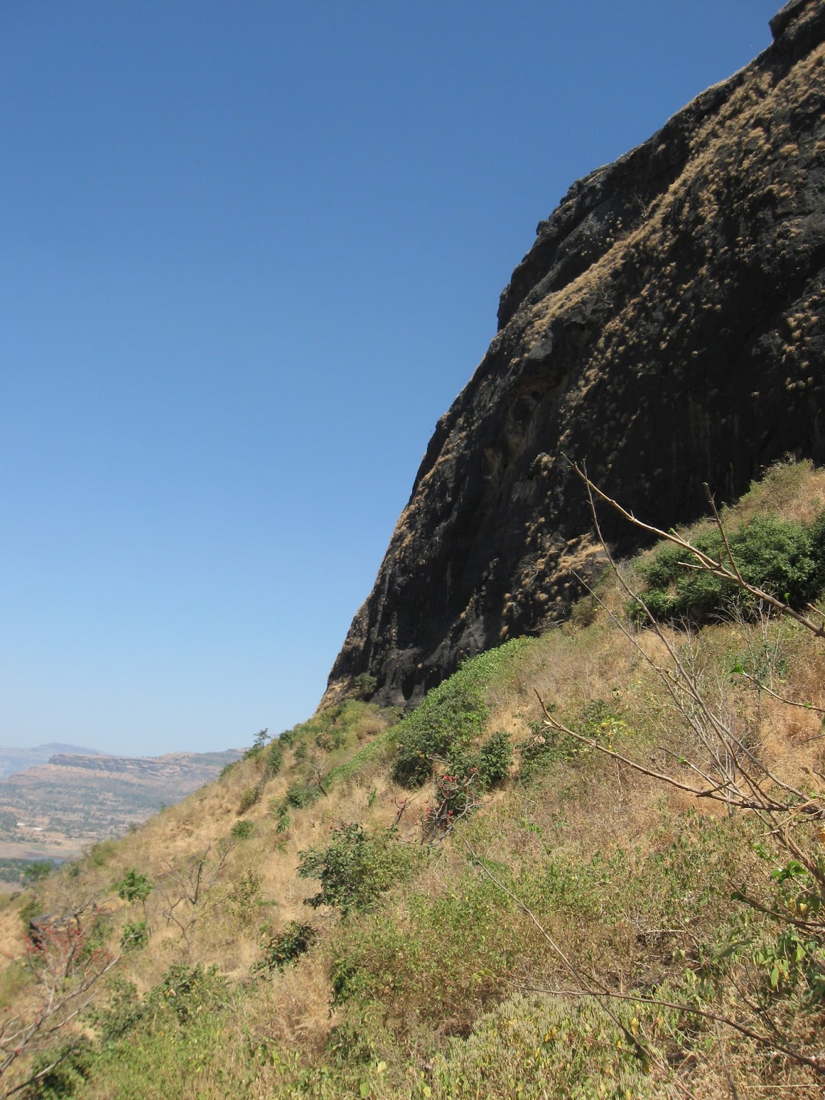
That picture is of the steep slopes of Fort Rajgad about an hour's drive from Pune, taken a couple of years ago.

Last year the geology highlight of my treks into the Deccan Basalt countryside was this dyke with horizontal columnar joints near the summit of Fort Ghangad.


Columnar joints are cooling cracks which develop perpendicular to the cooling surface. In lava flows, the cooling surface is mostly horizontal and so the result is vertically oriented, often hexagonal shaped columnar  joints.  In this case, the cooling surface was the near vertical contact between the intruding hot magma and the colder older lava flow. The cooling cracks therefore are horizontal.

I will be posting more pictures from this year's trekking season. The Western Ghats in the monsoon and the winter are a sight to savor!