Wednesday, April 26, 2023

Links: Crust Evolution, CO2 Emissions, DNA Structure

I'm posting a reading list after a long interval. Hope you like this selection. 

1) Secular Evolution of Continents and Earth Systems. The earth's outer shell has evolved and changed in its chemical and mechanical properties over time. This long term evolution has had profound consequences for geological and biological processes. Peter A. Cawood and colleagues have written an informative article in Reviews in Geophysics on the geologic history of the continental crust and its value as an archive for earth processes. The paper is open access, and there is also a shorter Q &A with lead author Peter Cawood which I have linked to in the title. 

2) Carbon dioxide removal is not a current climate solution. What is the best approach to limiting global warming? Do geoengineering methods which remove CO2 from the atmosphere offer a way out? David T. Ho, using a simple and effective explanation, refutes that notion and argues convincingly that drastic emission cuts is the only way to slow down temperature rise.  

3) Rosalind Franklin's contribution to the discovery of DNA's structure. 1953 was a standout  year in our understanding of life with the publication of papers proposing a structure for DNA. Rosalind Franklin's role in this story has been either sidelined or misunderstood until recently. The authors of the linked essay, Matthew Cobb and Nathaniel Comfort, are writing biographies of Francis Crick and James Watson respectively. They recently went through Rosalind Franklin's notes and some other unpublished documents which helped them piece together a different account of the discovery of the structure of DNA and Rosalind Franklin's key insights. 

This essay goes beyond the popular eureka moment narrative which held sway over people's imagination for a long time. Instead, we find collaboration between the teams working on this problem and many twists and turns before Watson and Crick came up with the solution. The article also raises important issues of ethics and sexism in science. 

Thursday, April 13, 2023

Exploring The Panchachuli Glacier Geotrail This May

Folks, join me for a walk to explore the geological landscapes near Panchachuli Glacier, Darma Valley, Kumaon Himalaya. The plan is from May 7 to May 13 2023.

This geo excursion is being organized by Deep Dive India. I will be the geology expert accompanying the group. We will be observing a variety of geologic terrains made up of rocks that tell a story of Himalaya mountain building. High grade gneisses and migmatites, leucogranite dikes and sills, mica and garnet schists, sandstone and conglomerates. As we walk along the terrain we will observe how rock varieties change and what that tells us about the very process of continental collision and Himalaya orogeny. 

There are glaciers too! The Panchachuli Glacier dominates this region. The landscape is littered with moraines and glacial lake and stream deposits. Their locations along the valley hint at fluctuating climate and glacial growth and retreat. 

The terrain will be categorized by trekking companies as 'éasy to moderate'. We will be walking about 4 to 5 hours daily. It is really a very accessible region and you can get close to some fabulous geology. 

Do contact Deep Dive India if you are keen on joining us. The contact details are in the graphic.     

You can email me too at suvrat_k@yahoo.com. Email subscribers, as you know, I have switched to a new delivery service. Follow.it tech support is still working to fix a glitch with the The Reply-To button. In case you need to email me, kindly put in my address manually.

Friday, April 7, 2023

Pavement Geology: Pegmatites

Admin Note:

Hello Email Subscribers-

You will have noticed a change in the delivery service and formatting of this email post. Mailchimp, my earlier email delivery service has become unaffordable. I have switched to using Follow.it

There will be no other change in your experience. New posts will be delivered directly to your inbox. For some of you, there will be a subscription confirmation banner displayed at the bottom of this post. Do take a moment to click on the 'confirm your subscription' link. 

Thank you again for your continuing support of this blog.

****************************************************

Pavement Geology:

At a new construction site, just a few minutes walk from my house, I came across these polished countertops used on building exteriors.


Isn't it a beauty? It has the texture of a pegmatite. These are a variety of igneous rocks made up of large interlocking crystals of feldspar, quartz, mica and smaller amounts of minerals like tourmaline, hornblende, calcite and many others. They crystallize from a magma rich in dissolved water and other volatile elements like flourine and chlorine. The presence of these fluids enhance the delivery of elements to sites of mineral growth, enabling the crystals to grow to a large size. 

This counter top has amazingly large faceted white feldspar crystals set in an oily grey quartz rich matrix. 

I wondered where it was from? And as I stood there, I wondered whether it was a natural rock or an engineered composite. I could not get close to feel the texture and hardness, but there is a sure shot way to distinguish natural from artificial rock. Always look for identical repeating patterns.

On another panel, I found the exact same crystal association.

The crystals had the same cleavage, cracks, inclusions, and resorbed edges (uneven jagged boundary due to reaction of the crystal with the remaining magmatic fluids). Natural products will be variable. This is definitely a synthetic material perhaps with a printed laminate mimicking a geologic texture.

It is extremely well done though! The building owner happened to be there and I asked her where she got them. She told me the panels were shipped in from Dubai. She could not say anything more about them.

Classic!

One last picture of a vertical panel. Check out the identical pointed white crystals of feldspar and the duplications in the quartz matrix. 

More pavement geology to come. I might make it into a mini series of blog posts.

Thursday, March 2, 2023

Tethyan Himalaya And Trans Himalaya

What is the difference between Tethyan Himalaya and Trans Himalaya?

I've seen the two terms being used interchangeably, but geologists recognize them as geologically distinct terrains. Their geographic locations and geologic context has been annotated in the satellite imagery below. 

The Indus Suture is the zone of collision between the Indian and Asian tectonic plates. It contains broken pieces of  oceanic crust and deep sea sediments which were uplifted and jammed between the colliding continents, forming a sort of a geologic no-man's land. The Tethyan Himalaya are the ranges immediately south of the Indus Suture. They are the deformed rocks of the Indian plate. The Trans Himalaya are the ranges north of the Indus Suture made up of a variety of rocks of the Asian plate.

The Tethyan Himalaya is a pile of Paleozoic and Mesozoic sedimentary rocks which was deformed into a fold and thrust belt during the early stages (45-35 million years ago) of the India Asia collision. At places, the sedimentary cover has been stripped away by erosion and high grade metamorphic rocks formed deep in the crust have been exposed. These 'windows' are known as gneiss domes since the sedimentary cover rocks have been arched up during uplift and exhumation of the high grade rocks. The area around the famous Tso Moriri lake is one of the best examples of a gneiss dome.

If your are traveling in Zanskar, Spiti, Lahaul, upper reaches of Kinnaur, and near about Milam and Panchachuli Glaciers,  you are in the Tethyan Himalaya. 

In the late Cretaceous (100 million  years ago), the leading edge of the Indian plate began subducting underneath Asia. As the plate dove deeper it heated up and released water, which triggered the formation of magma in the upper mantle of the Asian plate. This magma rose and assimilated rocks from the Asian lower crust. It then intruded older sedimentary and metamorphic rocks of the Asian crust and solidified as giant bodies of granites and granodiorites (containing calcium rich feldspars). These large granitic intrusions or 'batholiths' range in age from 100 million years to about 50 million years ago. One example is the Ladakh Batholith on which the town of Leh sits. Some of this magma also erupted on the surface through volcanoes. The rocks of Khardungla Pass are remnants of this ancient volcanic terrain. 

A similar situation today is along the western South American margin. There, subduction of the Nazca Plate underneath South America has triggered large scale magmatism and formation of giant batholiths of the Andes Mountains. 

Another impressive geologic feature of the Trans Himalaya is the Karakoram Fault Zone. It is a NW-SE aligned right lateral strike slip fault where crustal blocks have been sliding past each other since about 18 million years ago, resulting in a 150 km of offset of rocks. There has been some vertical movement also along this fault and this uplift has resulted in the formation of the Pangong Ranges where high grade metamorphic rocks have been exhumed from a deeper crustal level. The Pangong Lake is a drowned river valley formed by the damming of the river on its western end due to fault uplift. 

Strike slip faults have been in the news recently. The devastating earthquake in Turkey and Syria was caused by movement along the left lateral strike slip East Anatolian Fault. 

The India Asia collision resulted in the partial melting of deeply buried rocks of the Asian crust in the Miocene (21-16 million years ago) and the resulting granitic magmas have intruded the upper levels of the crust as dikes and sills. These melt channels also coalesce to form plutons and batholiths. Granitic intrusions of Miocene age which formed as crustal melts differ in their composition from the older Ladakh batholith which has a mixed mantle and crustal origin. There is a lot of interesting and complicated geology in the Trans Himalaya too! 

There are lots of technical papers on this topic. For good popular style book I recommend Mike Searle's Colliding Continents: A Geological Exploration of the Himalaya, Karakoram and Tibet. 

If you want a short answer to the question I posed, it is this: The Himalaya (including the Tethyan Himalaya) is the deformed northern edge of the India Plate. The Trans Himalaya is the deformed southern edge of the Asian Plate.
 

Monday, February 20, 2023

Geology Outcrop Quiz: Milam Glacier Area

In the outcrop below, which direction are the strata dipping (tilting)? North is to the right. 

If your answer was towards the right (north), you would be wrong.

The apparent northward dip of the rock layers is an illusion caused by fractures intersecting the plane of the exposure. The outcrop below from a nearby spot shows the real geometry of the strata.

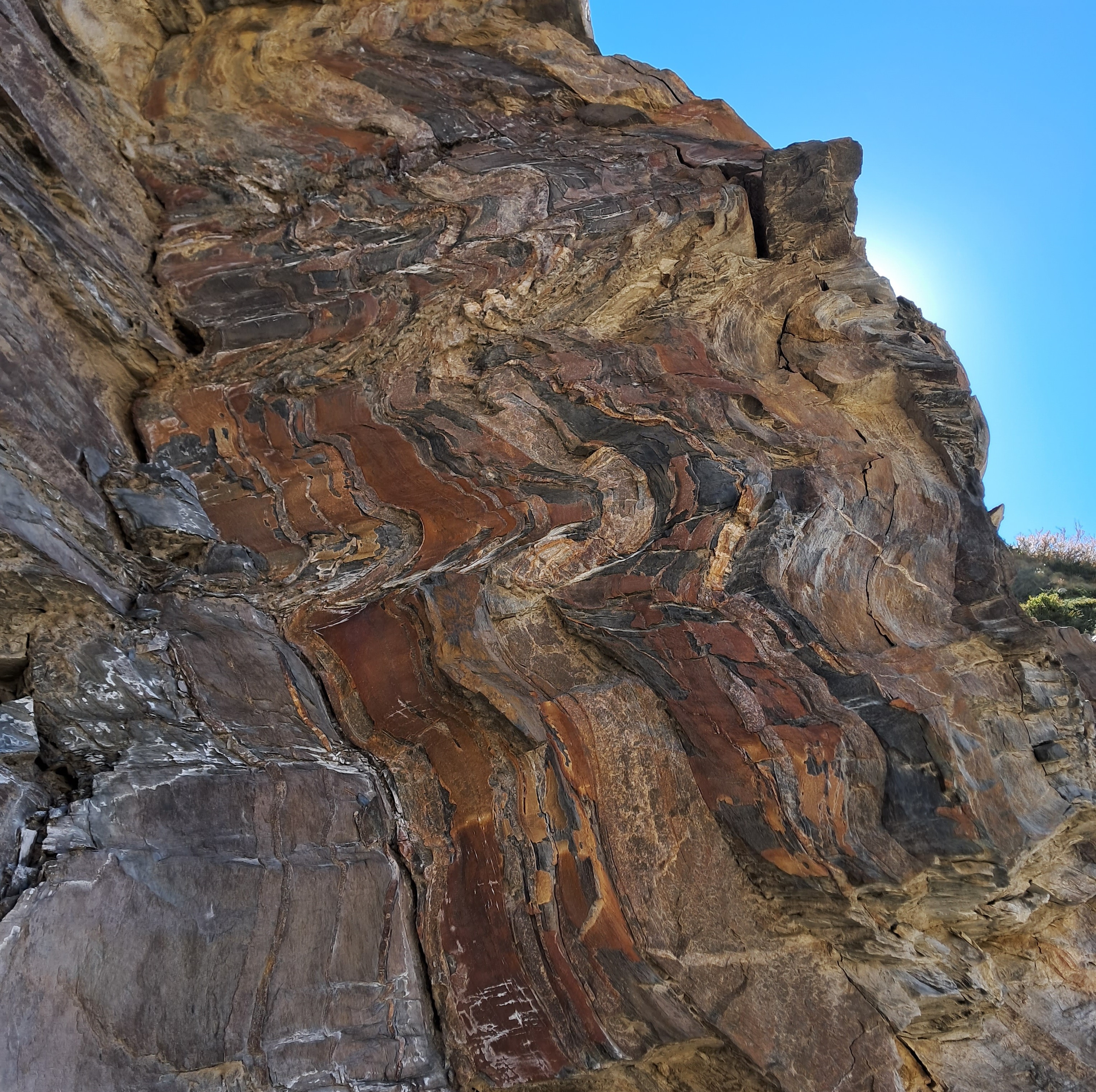
This is an across the bedding exposure. You can see that the strata are almost vertical and are warped into small scale folds. Look at the black arrows on the left centre of the image. They point to sub horizontal cracks (fractures) penetrating the rocks. These are axial plane fractures as they follow the plane that divides the folds symmetrically. To the top right, the red arrow points to the distinctive planar fabric that has arisen due closely spaced fractures. 

In contrast to this perspective, when the outcrop is a bedding plane exposure i.e. a slice parallel to the bedding, as it is in the first picture, you won't see the folding. Instead you can only observe a bedding surface cut by horizontal fractures that divides the rock wall into layers and gives the impression from afar of horizontal or gently tilted beds.

The photo below is a close up of an outcrop with prominent nearly vertical thin orange-brown and dark grey folded beds. Notice the white horizontal bands? These are the axial plane fractures which later were filled with quartz, as mineral saturated groundwater circulated through the rocks.  

The outdoors is such a good classroom. This final outcrop illustrates how erosion along a hillslope has sliced the rock body at different angles with respect to the bedding, exposing both, the true orientation of the strata as well as the pseudo bedding. 

To the right of the waterfall is an across the bedding cut, exposing the nearly vertical gently folded strata. To the left of the waterfall is an along the bedding exposure. Only a sheer rock wall is observed with the axial plane fractures imparting a crude layering to the rock face, giving the illusion of bedding.

All these exposures are along the road side trail near Milam village in Kumaon, Uttarakhand. You can test your observational skills when you next visit that area. 

Trekking in the Himalaya is always a treat.  And when you come across these small geology puzzles, it is with a double scoop topping.