Thursday, December 28, 2017

Geology Excursion To Tamhini Ghat And Korlai - India West Coast

On December 16 and 17, I took part in an excursion to the village of Korlai. This place is about 150 km west of Pune. The trip was organized by Deep Dive India, a venture started by my cousin Shirish Kher. The idea is to offer participants an immersive experience into one or two specialized fields.  On offer for this trip was geology and archaeology. I was the designated geology expert. The accompanying archaeologist was Sachin Joshi, a researcher from Deccan College Pune.

It was a lot of fun!

The group was mostly made up of working professionals with an interest in nature. Many of them came to know of this trip from my Twitter feed.  We drove westwards along the Deccan Plateau. Then, we descended the Western Ghat escarpment along Tamhini Ghat.  On this section, we made several stops to survey the landforms and to examine lava flows. I also gave the  group an introduction to Deccan Volcanism. After crossing the coastal plain we ended up at the village of Korlai, where there was more geology on offer.

We stayed in a home stay in the village of Chaul, a few kilometers away from Korlai.

The next day, Sachin Joshi gave us a fascinating walk-through the Portuguese forts at Korlai and Revdanda. These two villages are on opposite banks of the Kundalika estuary. It is quite a beautiful location. The forts were established by the Portuguese in the 1520's,  a couple of decades after Vasco da Gama rounded the Cape of Good Hope and established trading contacts with rulers and merchants of the Indian west coast.

The satellite image below shows the backwaters of  Mulshi and Varasgaon dams on the edge of the plateau, Tamhini Ghat, the coastal plain and the locations of Korlai and Revdanda villages. The sinuous N-S trending white dotted line seen along the Tamhini Ghat just west of the backwaters is the Western Ghat escarpment.


..and here are more pictures from our trip.

I gave a brief preview of the trip and explained the physiography of our traverse which took us along the Deccan Plateau, down the escarpment and to the coast along a broad coastal plain.


Along the way at Tamhini Ghat, I stopped to point out a lava flow contact. You can see pipe vesicles at the base of the upper flow.


 In Tamhini Ghat, unrolling a satellite imagery, I explained the landforms and structure of the Western Ghat escarpment to geology enthusiasts young and younger!


 At Korlai coast the group is looking down at a dike.


I demonstrated the use of a Brunton compass at this dike.


And here is a view of some of the many dikes intruding the basalts along the west coast.


The rampart and walls of Korlai fort along the rocky coast. You can see a cannon protruding through an opening in the wall.


The group standing on the surface of a lava flow showing columnar jointing. You can make out the polygonal shape of basalt blocks.


Korlai village fishing fleet moored in a back bay with the open Arabian Sea to the right. View from top of Korlai fort.


A beautiful view of Revdanda Fort, built on a sand bar, with waves crashing on to the walls and ramparts.


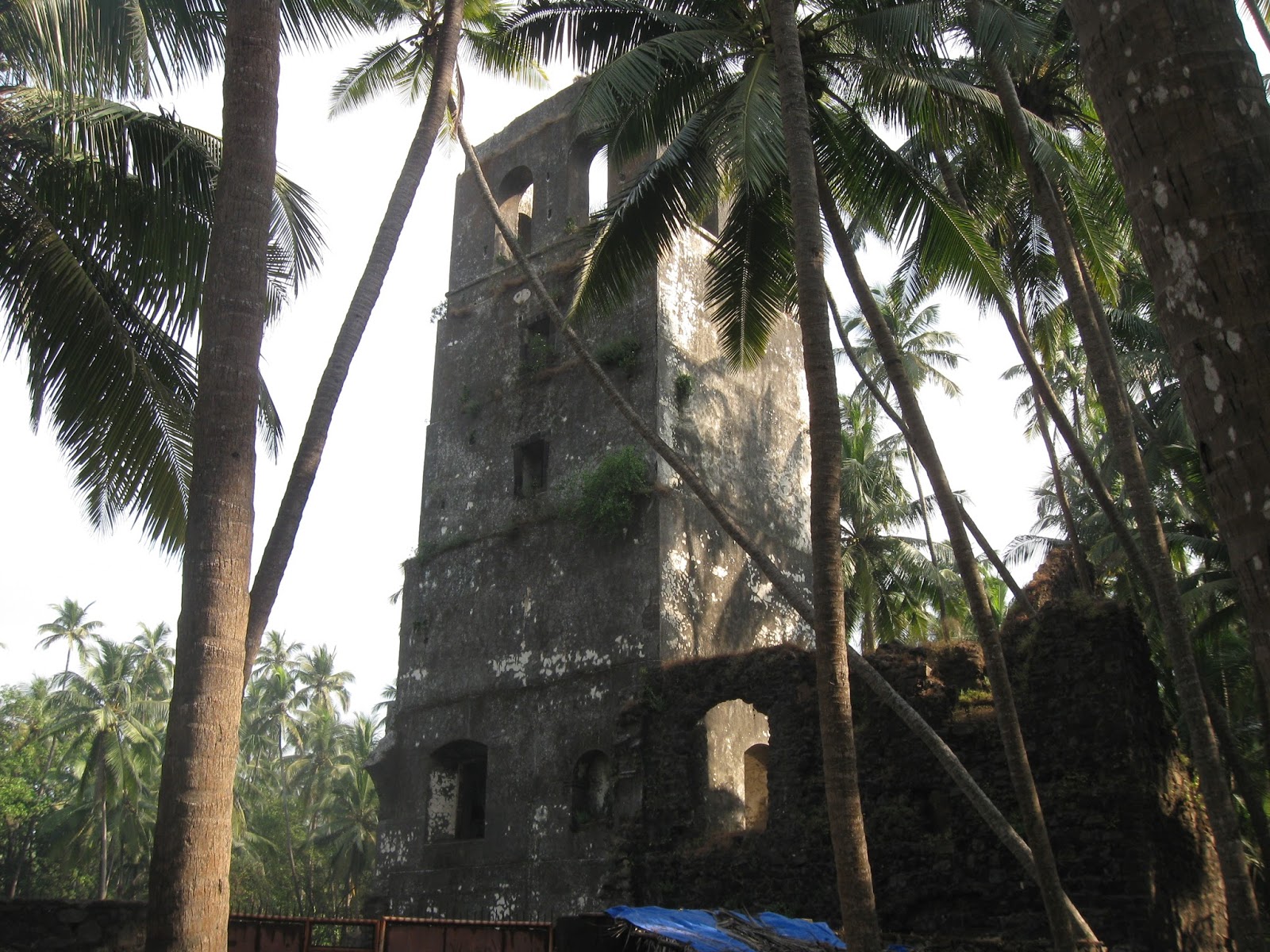
A watchtower in Revdanda Fort

An entrance with icons of a saint and official markings carved on stone.


 Through a broken wall of Revdanda Fort, a view of the Kunadalika estuary. Korlai Fort is on the stretch of land seen on the opposite side of the river.


The group enjoying themselves, exploring the fractured basalts of the west coast.


A picturesque home in Revdanda village.


This was the first time I had taken a group out on an organized trip like this. I was a bit nervous to begin with. But the atmosphere was informal and the participants enthusiastic and curious. That led to many long and enjoyable discussions on geology and archaeology.

We will be doing a repeat trip along the same route in late January... more pics then.

Thursday, December 21, 2017

Lamarckism Continues To Cast A Shadow Over The Archaeological Survey Of India

A friend mentioned that she was planning to visit the famous rock shelters at Bhimbetka in Madhya Pradesh. These sandstone caves are famous for rock art and stone tools ranging in age from Paleolithic to more recent times. The site is looked after by the Archaeological Survey of India (ASI).

I remembered my own trip there over three years ago. Diving into my picture collection I  came up with this gem. This plaque was in front of a cave where Paleolithic stone tools had been found. It describes the grand story of human evolution.


Underlined in yellow is the explanation for the evolution of our dexterous hands. I am not highlighting the language but the very Lamarckian-sounding mechanism. If the claim is that hands capable of making sophisticated tools evolved just by continuous handling of stone, then this is evolution occurring through inheritance of acquired characteristics. Just like a blacksmith passing on his musculature to his children. This is not a viable mechanism of evolution. Physiological changes acquired due to a life experience are not passed on to progeny. Our gametes are sequestered from our somatic cells. I strongly suspect that a lot of people still conflate inheritance of acquired characters with natural selection.

The very first sentence "Millions of  years after Ramapithecus the species Australopethecus and its subspecies came into existence" is confusing too.  As is another plaque which shows the classic linear march of hominin evolution from a more primitive looking ape to modern humans. In it, Ramapithecus appears to be an early ancestor of humans.


Australopithecus (genus, not species), did appear millions of years after Ramapithecus, but there is no ancestor-descendant relationship between the two. Ramapithecus was initially identified as a Miocene ape and a possible ancestor of humans. Its range was the Himalaya foothills, leading to some excitement that the human family roots can be traced to the Indian subcontinent. More fossil finds have changed this early interpretation. Ramapithecus is not even considered a valid taxon anymore. The fossils named Ramapithecus are now subsumed under the genus Sivapithecus. This latter genus includes a great variety of Asian ape species. The lineage is more closely related to the ancestors of the Orangutan and not to living African apes and the hominin family.

This is just a poor show by the ASI. They need to urgently upgrade the information they are providing the public.

Wednesday, December 13, 2017

Remotely India: Structural Control On Drainage

 Remotely India #10

Check out this amazing example of fracture controlled stream flow. Follow blue arrows.


The stream originates on the steep west facing slopes of Tamhini Ghat (west of Pune) and flows a north westerly course in a NW-SE trending fracture, then makes an abrupt left turn and flows south west into a NE-SW trending fracture. It then exhibits a number of right angle turns. Finally, it turns sharply and flows north along a N-S trending fracture before joining the larger Kundalika river near Mhasewadi.

This area comprising the edge of the Deccan Volcanic Plateau and the coastal plain has been shattered by several fracture systems which formed due to tensile forces affecting the western margin of India during and post Deccan volcanism.


Take some time looking at this image above. You will see scores of small streams flowing along fractures and making sharp turns at fracture intersections. The geomorphology of this part of the Deccan Volcanic Province is a joy to explore.

Thursday, November 30, 2017

Remotely India: Folding At Margins Of The Vindhyan Sedimentary Basin

Remotely India # 9 (a post series about landforms and geological structures imaged by remote sensing satellites).

This is a geology rich image!


Source: Rajasthan Tourism

It shows Gagron Fort in the Jhalawar district of Rajasthan. I came across it while watching a history show on EPIC channel. Looking at the steeply dipping strata I identified them as the metamorphosed and deformed Aravalli Group sediments of early Proterozoic age.

I then checked a geological map and realized I had gotten the stratigraphy completely wrong. These steeply dipping rocks belong to the mid-late Proterozoic Vindhyan Group of sediments.

There are two distinct categories of Proterozoic basins in India. There are the mobile belts. An example of a mobile belt is the Aravalli orogenic belt. As the name suggests, these basins formed as linear depressions at the margins of Archaean cratonic blocks. They are filled with volcano-sedimentary successions, intruded by granitic bodies and subjected to intense deformation and metamorphism during convergence and collision between different cratonic blocks. They are economically important. Lead, zinc, copper, iron ore is mined from various mobile belts. The Aravalli belt formed due to the collision between the Aravalli craton and the Bundelkhand craton. Sedimentation in the Aravalli basin was initiated around 2 billion years ago. Their deformation and metamorphism has been dated to around 1.7-1.6 billion years ago.

The second category of basins are the epicratonic basins, developed as either rift basins or foreland basins within cratonic blocks. Volcanic activity is mostly restricted to the early stages of basin evolution. Sedimentary successions are sandstones, shale and limestone. Collectively these are known as the 'Purana' (ancient) basins. They show very light to no metamorphism and relatively gentle deformation. Flat lying strata form mesas and plateaus in the interior of such basins. The degree of deformation usually increase at the basin margins. In proximity to basin margins faults, sediments are often spectacularly folded. The Vindhyan Basin is a 'Purana' style basin.

I am putting up a few examples of folding in Vindhyan Basin sediments. These range in age from about 1.7 billion to 650 million years.

The first one is the Jhalawar anticline in proximity to the Mukundara Fault. Fort Gagron was built  on the steep NE dipping limb made up of the Kaimur sandstones.


Mukundara Fault is an easterly directed thrust fault. See this cross section across the Jhalawar anticline.


Source: Rajeev Bhoj, Avdhesh Nautiyal and Rajesh Sharma 2011:  Regional Structural Style of Chambal Valley Vindhyan Basin, Rajasthan, India

This second example of folding is south and east of the famous fort at Chittorgarh. Lower Vindhyan Group sediments have been folded into N-S trending tight anticlines and synclines. 


This folded zone abuts the Great Boundary Fault which structurally juxtaposes the Bundelkhand Craton with the Aravalli Craton. The fault brings into contact the Aravalli mobile belt and the Vindhyan 'Purana' basin. The Great Boundary Fault is a NW dipping thrust fault (ref).

Finally, northeast of the previous location, also along the Great Boundary Fault in the vicinity of the town of Bundi are these folded Upper Vindhyan sediments. These are the sandstones and limestones of the Rewa and Bhander Group.


And below is a geological map of the region to give some context to these structures. The Great Boundary Fault and the Mukundara Fault are orthogonal to each other, testimony to differently oriented compressive forces  affecting the Vindhyan Basin.


Source: Rajeev Bhoj, Avdhesh Nautiyal and Rajesh Sharma 2011:  Regional Structural Style of Chambal Valley Vindhyan Basin, Rajasthan, India

Three distinct structural trends can be seen in this part of the Vindhyan Basin. A NE-SW trend of the Great Boundary Fault. A N-S trend of the tight folds south and east of Chittorgarh. And a NW-SE  trend of the Mukundara Fault and associated folds. The other major structural trend in the Vindhyan Basin is the E-W trend of  Narmada rift fault zone which forms the southern boundary of the basin.

All satellite images from the Indian Remote Sensing satellite Cartosat series, accessible through ISRO's web mapping application Bhuvan.

Sunday, November 19, 2017

Geology And Homo Sapiens Habitats Pleistocene Indian Subcontinent

Came across an interesting passage from this review paper:

Environments and Cultural Change in the Indian Subcontinent: Implications for the Dispersal of Homo sapiens in the Late Pleistocene - by James Blinkhorn and Michael D. Petraglia

Yet beyond relief, the geological structure of the Indian subcontinent plays another important role in patterns of habitability in the region. The analysis of the structure of geological basins within the Indian subcontinent led Korisettar (2007) to the conclusion that the Purana basins exerted a strong influence on hominin dispersals and occupation history. Although direct precipitation within the Purana basins is lower than other regions of the subcontinent, perennial supplies of freshwater are available because of spring activity from aquifers that deliver water resources from regions that receivemuch higher monsoonal precipitation.As a result of reliable water resources and abundant raw materials for stone tool manufacture, these geological basins are thought to have acted as refugia not only for hominin populations but also for varied flora and fauna (Korisettar 2007).

The importance of such Purana basins for providing refugia is well exemplified by the recent study of fauna from the Billasurgum caves, located within the Cuddapah Basin. Here, excavations revealed the first stratified sequence to document patterns of faunal occupation spanning the late Middle Pleistocene to Late Pleistocene (Roberts et al. 2014). This study illustrated the long-term continuity of large-bodied fauna within South Asia with only a single taxon of twenty-four identified as having gone extinct across the subcontinent (Roberts et al. 2014).


The "Purana" basins are Proterozoic in age. They are scattered all over Peninsular India. A common lithology is silica cemented sandstone or quartzite which forms prominent hill ranges, ridges and escarpments with ledges, overhangs and caves. These hard quartzites would have been one source of raw material for stone tools.  The rocks are also fractured and networks of pervasive cracks allow the storage and movement of groundwater.

The map (from a different paper) below shows the distribution of Middle Paleolithic sites (red dots) in India, Arabia and Eastern Africa. I have outlined in black (very approximate!) the location of three Purana basins. V stands for Vindhyan, C for Cuddapah and B&K for Bhima and Kaladgi.

 Modified from Huw S. Groucutt et.al. 2015

This paper have lots of information about climate change, ecology and stone tool record found in India. The authors discuss the Late Acheulean (130k - 100 K) ,  Middle  Paleolithic (94k - 34 K) and the Late Paleolithic ( < 45 K). These terms refer to particular styles of stone tool manufacture.

The India skeletal fossil record is very poor. However, based on comparisons with Middle Paleolithic of Africa and Homo sapiens fossils and tool associations in SE Asia and Australia, the authors are in favor of a wave of  Homo sapiens migrating into India as early or perhaps a little earlier than 100 k ago. This was followed by a later wave around 50 k years ago.  Do changes in cultural style and tool use point to changing populations.. with an intrusive population replacing an earlier one?.. that is an intriguing question. Some recent genetic work suggests that people from these earlier migrations died out without leaving a genetic legacy in us. All non African humans have descended from migrants who left Africa between 50K-80K years ago.  I had summarized these results in an earlier post on human population continuity in India.

See also other papers from this special volume of Current Anthropology on Human Colonization of Asia In the Late Pleistocene

Open Access.