Committees are underappreciated.

Happy New Year everyone!

These two books came highly recommended via friends and social media.


One of my favorite courses during graduate work in Pune was geological Remote Sensing. We focused a lot on visual interpretation of aerial photographs and satellite imagery. Lab work meant hours of poring over different areas of India and making preliminary geology maps based on observations of the landforms and rock structures visible from space. The rock composition, structure, and weathering patterns controls the surface expression of geological units. These are manifest on satellite imagery and on aerial photographs as differences in tone, texture, structural styles, and relief.
I came across a nice example of the juxtaposition of two distinct geologic rock units just northeast of the town of Sirohi in Rajasthan.

These two terrains made up of the Erinpura Granite and the Sirohi Group sediments are easily recognizable.
The terrain west of the yellow line and isolated ribbons between the purple lines is made up of layered metamorphosed sedimentary rocks of the Sirohi Group. These sediments were deposited on the Erinpura Granite basement around 850 million years ago. Hard rock layers form northeast southwest oriented ridges with intervening valleys underlain by a softer lithology. The texture appears fine and the ridge and valley terrain has a substantial vegetation cover. The rock layers can be traced as a series of folds. The Sirohi Group sediments were deformed and metamorphosed by 820 million years ago.
The Erinpura Granite represents magmatism that occurred around 900 million years ago. Occurring mostly east of the yellow line, the granite also forms enclaves (orange outline) in the fold belt.
The granite appears as a light toned surface. It is massive body of rock, lacking the layering seen in the western sedimentary basin. The landform is a low elevation plain as compared to the Sirohi rocks.The rock has a coarse granular texture. Its surface has scant vegetation. Several lineaments (dark colored lines) are seen crisscrossing the granite body. These are fractures and dikes. Shrubs and trees growing along the fractures and dikes give them a darker appearance and make them stand out against the lighter granite body. The fracture sets have also controlled the local drainage. Several streams can be seen flowing along straight courses.
Below are two close up images of the contact zones between the two terrains.

At this scale you can appreciate why the granite as a coarser texture in the synoptic imagery. The fracture systems has broken the granite in to a blocky surface.
In this image below the Erinpura Granite occurs as an enclave surrounded by Sirohi metasedimentary rocks.


Geology mapping done. Now to visit Rajasthan for a field check!
A couple of weeks ago Iceland awaited with much anxiety as magma made its way to the surface. A volcanic eruption seemed imminent. That danger seems to have passed for now. Seismicity has abated and magma may not break through and erupt.
Misunderstandings regarding climate change though shows no signs of receding as this comment shows -

Source: X - https://twitter.com/dremtee/status/1723427183182446871
Ever so often it is worth putting up the numbers:
Anthropogenic CO2 emissions - About 40-50 billion tons per year.
Volcanic CO2 emissions - Approximately 500 million tons per year.
Terry Gerlach of the U.S. Geological Survey has compiled global data on volcanic emissions - Volcanic Versus Anthropogenic Carbon Dioxide, published in EOS Transactions American Geophysical Union.
This article is from 2011, but there are good explanations on volcanic emission rates and the observed discrepancy (which has increased in the 12 years since publication) between anthropogenic and volcanic emissions.
What conditions limit volcanic CO2 emissions on present day earth?
On average, magma contains about 1.5 weight percent dissolved CO2. Estimated annual magma production on earth amounting to about 80 billion tons won't create near enough volcanic CO2 to match human emissions. About 850 cubic kilometers of magma would be needed to be generated annually to create volcanic CO2 on an anthropogenic scale. So much magma production either under land or sea would not have gone unnoticed.
Short lived volcanic eruptions like past events in Iceland, or Mt. Pinatubo, or Mt. St Helen's, although violent and spectacular, didn't emit more than a few million tons of CO2. These amounts are too small to have a discernible warming effect. Large explosive eruptions in fact might cool the earth by a degree or so for a short time because the sulphur particles they emit reflect sunlight back in to space.
Can volcanism cause global warming? Yes, but over much longer time scales.
Weathering of surface silicate rocks consumes about 500 -700 million tons of CO2 per year, offsetting the amount emitted by volcanoes. There has to be sustained volcanism at high emission rates for decades to hundreds of years to create an imbalance between weathering and volcanism and change climate.
Cin-Ty Lee and Slyvia Dee 's commentary on this subject explores the role of volcanism on global climate.
So near Pune, yet I had never been to this location near Bhor.

It is popularly known as necklace point. The river Nira loops its way through the countryside forming a series of lovely meanders. A high point overlooking the valley allows a clear view of this feature.
I was on a drive with some friends, spending the day exploring the back waters of the Bhatgar and Nira Deogarh dams. We eventually reached Warandha Ghat, one of the spectacular passes linking the Deccan Plateau with the western coastal plain.
At the edge of the plateau, high relief exposes sheer rock faces.
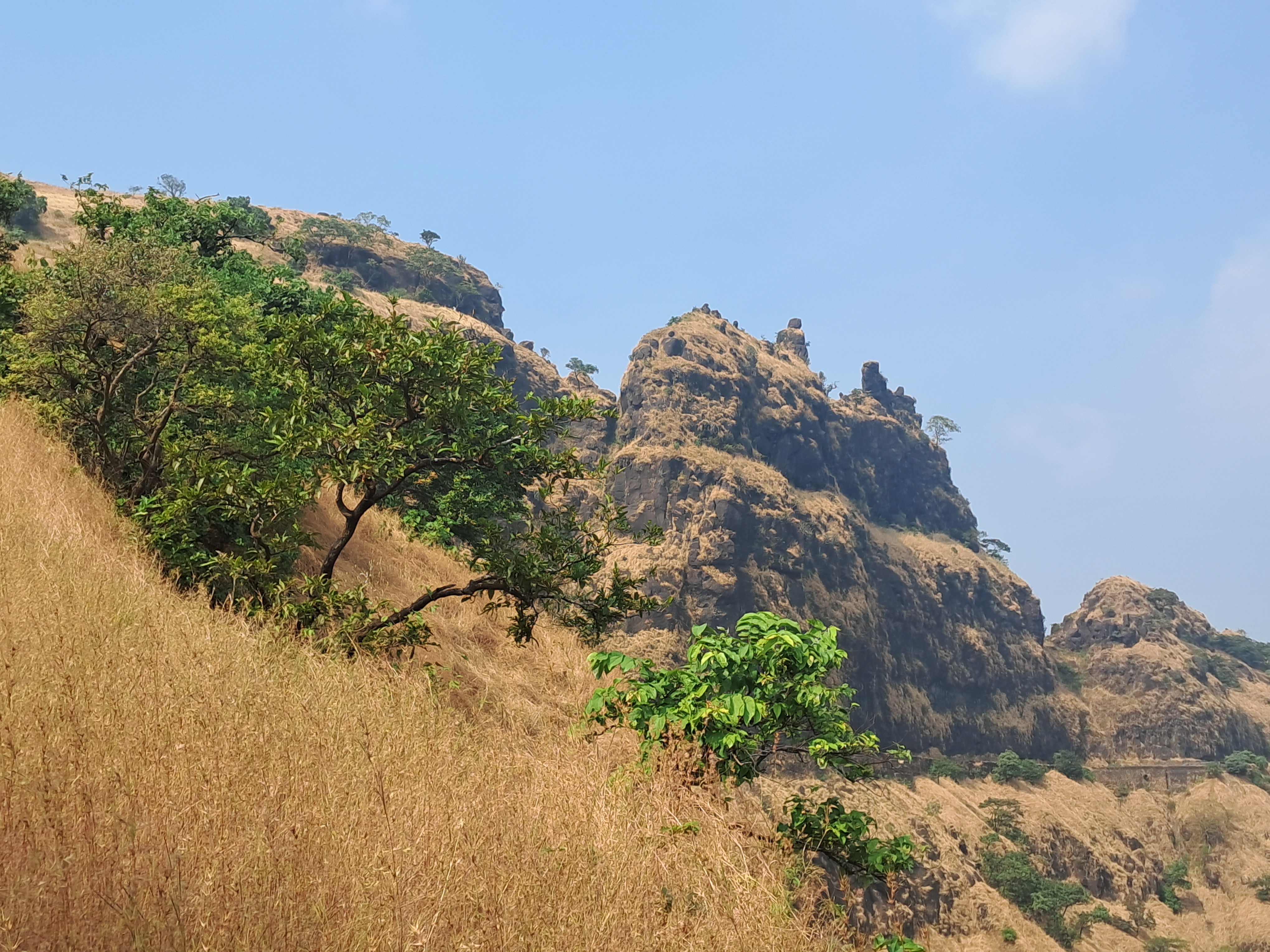
The grand scale of Deccan Volcanism is manifest so clearly in the lava flows traceable over hundreds of meters despite the afternoon haze.

On a satellite image, X marks the view point looking south towards the big meander.

This is a beautiful area near Pune to spend a day out.