
Last week beginning Monday July 15th, I took a four day road trip to Konkan, India west coastal plains. We went first to the small village of Murud and then drove south via Dabhol to Tural highlands.
The phrase 'coastal plains' is something of a misnomer since between the high Western Ghats and the Arabian Sea there are hill ranges with altitudes reaching 50 m to 200 m ASL. Tural is a community living on one of these ranges. We stayed there in the family home of a friend.
The map below shows a portion of the Konkan region through which we traveled.

The region had come alive due to the monsoons, although that week we caught a small break in the rains. It did rain heavily in short bursts, but there were enough interludes to go for long walks and enjoy the sun too.
Some pictures of landscapes that we came across.
1) The coast near Murud. After a brutal summer, the feel of cool winds and sounds of monsoon waves crashing on the shore was very refreshing.

2) Lonely stretch of a shimmering beach near Murud.

3) Loading our car on to the ferry at Dabhol.

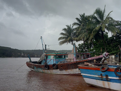
4) Colourful fishing boats at Dabhol jetty.
5) Continental erosion writ in mud! River Vashishti meets the Arabian Sea.

6) Rice fields in a quiet community in Tural highlands.

7) Tural highlands is capped by a flat surface.

8) This plateau cap is made up of iron rich laterite. It formed during late Miocene times (~10 million years ago) by prolonged chemical weathering of the underlying basalt rock and pediment (layer of weathered rock debris) . The picture shows the hard laterite surface, which would have been a low lying peneplain in late Miocene times.

9) Subsequent to lateritization, the western margin (Konkan coastal region) underwent some uplift, resulting in the formation of a plateau or 'table land' as it is commonly called. As the land rose, invigorated streams cut into the laterite surface forming deeply entrenched channels. The picture below shows a close up of the laterite plateau dissected by a dendritic stream network (blue arrows).

10) The evolution of the Konkan coastal region from a low lying undulating surface undergoing lateritization, to an uplifted and dissected plateau is depicted in the schematic below.

Source: Evolution of Laterite in Goa: Mike Widdowson 2009
11) The laterite is a commonly used building material in this region. Small quarries pockmark these highlands. The picture shows large bricks of laterite. The plateau cap is hard laterite that can't be cut into regular brick shaped pieces. Below this crust though is a softer iron rich soil. This semi indurated material is cut into brick shapes and left to dry. It hardens upon dehydration into a usable stone.

12) We took long walks in cool lush forest patches.

13) Deep in the forest we visited my friend's family temple, a hidden jewel with a spring fed bath. These temples act like a social glue, bringing families and communities together on religious and other occasions.

14) On the way back via Kumbharli Ghat we caught sight of the majestic Western Ghat Escarpment.

until next time!
The phrase 'coastal plains' is something of a misnomer since between the high Western Ghats and the Arabian Sea there are hill ranges with altitudes reaching 50 m to 200 m ASL. Tural is a community living on one of these ranges. We stayed there in the family home of a friend.
The map below shows a portion of the Konkan region through which we traveled.

The region had come alive due to the monsoons, although that week we caught a small break in the rains. It did rain heavily in short bursts, but there were enough interludes to go for long walks and enjoy the sun too.
Some pictures of landscapes that we came across.
1) The coast near Murud. After a brutal summer, the feel of cool winds and sounds of monsoon waves crashing on the shore was very refreshing.

2) Lonely stretch of a shimmering beach near Murud.

3) Loading our car on to the ferry at Dabhol.

4) Colourful fishing boats at Dabhol jetty.

5) Continental erosion writ in mud! River Vashishti meets the Arabian Sea.

6) Rice fields in a quiet community in Tural highlands.

7) Tural highlands is capped by a flat surface.

8) This plateau cap is made up of iron rich laterite. It formed during late Miocene times (~10 million years ago) by prolonged chemical weathering of the underlying basalt rock and pediment (layer of weathered rock debris) . The picture shows the hard laterite surface, which would have been a low lying peneplain in late Miocene times.

9) Subsequent to lateritization, the western margin (Konkan coastal region) underwent some uplift, resulting in the formation of a plateau or 'table land' as it is commonly called. As the land rose, invigorated streams cut into the laterite surface forming deeply entrenched channels. The picture below shows a close up of the laterite plateau dissected by a dendritic stream network (blue arrows).

10) The evolution of the Konkan coastal region from a low lying undulating surface undergoing lateritization, to an uplifted and dissected plateau is depicted in the schematic below.

Source: Evolution of Laterite in Goa: Mike Widdowson 2009
11) The laterite is a commonly used building material in this region. Small quarries pockmark these highlands. The picture shows large bricks of laterite. The plateau cap is hard laterite that can't be cut into regular brick shaped pieces. Below this crust though is a softer iron rich soil. This semi indurated material is cut into brick shapes and left to dry. It hardens upon dehydration into a usable stone.

12) We took long walks in cool lush forest patches.

13) Deep in the forest we visited my friend's family temple, a hidden jewel with a spring fed bath. These temples act like a social glue, bringing families and communities together on religious and other occasions.

14) On the way back via Kumbharli Ghat we caught sight of the majestic Western Ghat Escarpment.

until next time!
Great. ..very nicely composed and interesting read.
ReplyDeleteSuperb
ReplyDeletethank you to both Unknowns :)
ReplyDeleteSo nicely and informatively put.
ReplyDeletezenrainman.. thank you.
Delete