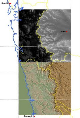
The ASTER instrument has a steroscopic imaging capability in the near-infrared band. The elevation data is extracted from this stereo-data by auto-stereocorrelation of nadir (directly below ortho view)) and along-track oblique view of the ASTER sensors.
The data is partitioned into 1 deg by 1 deg tiles. So instead of downloading just one massive file you can download data in small chunks of about 8 Mb -12 Mb size. The download is a zip file. That's really convenient for users with slowish connections. The DEM upon extract is about 24 Mb. The download process requires a little patience. It has plenty of little intermediate steps you have to complete before the final order form is submitted. At the end of the process you will be emailed a ftp URL. You can pull your selected data set from that ftp folder. Do study the download tutorial before proceeding.
I got to know of it a few weeks back from a GIS forum I follow. Yesterday night I finally decided to test the download process. Within an hour I had registered an account , made my selection and downloaded elevation data for the region around Pune, India. See the image below. I imported the DEM in Manifold GIS and created a quick display. I have shown 2 tiles, only part of the data I downloaded. The upper tile is shown in a gray palette and the lower in a standard altitude palette. I have overlain a 0.5 deg graticule grid for reference.

Free data is always good news. Users though have to be careful when applying ASTER data for their various needs. ASTER is a relative DEM which means that the elevation data has been constructed entirely using the stereo-images with no corrections applied using ground control points. The positional accuracy and the feature integrity is determined by the knowledge of sensor parameters and shape of the geoid. Accuracy assessment of the ASTER product by comparing it with other DEM and ground control points suggests overall horizontal and vertical accuracy of about 20 m but may be worse locally. Topographic artifacts and inaccuracies in feature geometry also exist. Also although the elevations are posted at 30 m interval the details of topographic features that can be resolved appears to be about 100 m or so.
You can improve on ASTER data by reconstructing the DEM by inputting additional elevation information from ground control points in a competent raster processing software. But the raw data will have inaccuracies and so is not a good bet for any detailed work that needs highly accurate terrain information. Good enough to use as a backdrop and for reconnaissance and preliminary research purposes.
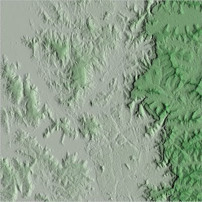
The image below is a close up of the West India coastal plains leading up eastwards to the western ghat escarpment (the sharp contrast between the light green and the dark green) and part of the plateau.

This is a welcome addition to the list of spatial data for India. A 30 arc second or 1 km resolution DEM is available for download free of charge from the USGS. You can also order elevation data for India from the Environment Information Centre, a Ministry of Env. and Forest data warehouse. This terrain model is extracted from source topographic maps of 1:50,000 scale and will have more positional accuracy and feature integrity than the raw ASTER output although it will be likely of coarser resolution. You will have to pay for this data set; about Rs 12,000 ($ 250/-) for every 100 sq km. A 30 m resolution data set (100 m in practice) improves on these older data sets in terms of resolution but not necessarily in terms of the accuracy.
NASA has indicated that this is the first release and improvements to this data set will follow in the future.
You can download data from this NASA data distribution site. There is a mirror site in Japan too.

I am also trying to download the data, aster image for altitude but not able to.. from SRTM can you help easy way to do it
ReplyDeletePTji- I did this a long time ago. what exactly is the problem you are encountering?
ReplyDelete