On December 16 and 17, I took part in an excursion to the village of Korlai. This place is about 150 km west of Pune. The trip was organized by Deep Dive India, a venture started by my cousin Shirish Kher. The idea is to offer participants an immersive experience into one or two specialized fields. On offer for this trip was geology and archaeology. I was the designated geology expert. The accompanying archaeologist was Sachin Joshi, a researcher from Deccan College Pune.
It was a lot of fun!
The group was mostly made up of working professionals with an interest in nature. Many of them came to know of this trip from my Twitter feed. We drove westwards along the Deccan Plateau. Then, we descended the Western Ghat escarpment along Tamhini Ghat. On this section, we made several stops to survey the landforms and to examine lava flows. I also gave the group an introduction to Deccan Volcanism. After crossing the coastal plain we ended up at the village of Korlai, where there was more geology on offer.
We stayed in a home stay in the village of Chaul, a few kilometers away from Korlai.
The next day, Sachin Joshi gave us a fascinating walk-through the Portuguese forts at Korlai and Revdanda. These two villages are on opposite banks of the Kundalika estuary. It is quite a beautiful location. The forts were established by the Portuguese in the 1520's, a couple of decades after Vasco da Gama rounded the Cape of Good Hope and established trading contacts with rulers and merchants of the Indian west coast.
The satellite image below shows the backwaters of Mulshi and Varasgaon dams on the edge of the plateau, Tamhini Ghat, the coastal plain and the locations of Korlai and Revdanda villages. The sinuous N-S trending white dotted line seen along the Tamhini Ghat just west of the backwaters is the Western Ghat escarpment.
..and here are more pictures from our trip.
I gave a brief preview of the trip and explained the physiography of our traverse which took us along the Deccan Plateau, down the escarpment and to the coast along a broad coastal plain.
Along the way at Tamhini Ghat, I stopped to point out a lava flow contact. You can see pipe vesicles at the base of the upper flow.
In Tamhini Ghat, unrolling a satellite imagery, I explained the landforms and structure of the Western Ghat escarpment to geology enthusiasts young and younger!
At Korlai coast the group is looking down at a dike.
I demonstrated the use of a Brunton compass at this dike.
And here is a view of some of the many dikes intruding the basalts along the west coast.
The rampart and walls of Korlai fort along the rocky coast. You can see a cannon protruding through an opening in the wall.
The group standing on the surface of a lava flow showing columnar jointing. You can make out the polygonal shape of basalt blocks.
Korlai village fishing fleet moored in a back bay with the open Arabian Sea to the right. View from top of Korlai fort.
A beautiful view of Revdanda Fort, built on a sand bar, with waves crashing on to the walls and ramparts.
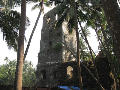
A watchtower in Revdanda Fort
An entrance with icons of a saint and official markings carved on stone.
Through a broken wall of Revdanda Fort, a view of the Kunadalika estuary. Korlai Fort is on the stretch of land seen on the opposite side of the river.
The group enjoying themselves, exploring the fractured basalts of the west coast.
A picturesque home in Revdanda village.
This was the first time I had taken a group out on an organized trip like this. I was a bit nervous to begin with. But the atmosphere was informal and the participants enthusiastic and curious. That led to many long and enjoyable discussions on geology and archaeology.
We will be doing a repeat trip along the same route in late January... more pics then.


