
Mid to late 1600's Maharashtra was a time of war between the local Marathas led by Shivaji and the Sultanate of Bijapur and later with the Mughals. On many steep basalt escarpments were forts that the Marathas controlled and used as strategic vantage points for launching guerrilla attacks on the enemy.
There are many important forts near Pune. Two are seen in the interactive Google imagery below.
View Larger Map
Rajgad was the home and capital of Shivaji for quite some time. A ridge which you can trace west of Rajgad meets Torna fort which was the first fort captured by Shivaji as he launched his resistance against the Bijapur Sultanate. And north north east of Rajgad is Sinhagad, site of one of the most famous night battles of 1600's Maharashtra. To give you a geographic mooring, north east of Sinhagad is the city of Pune.
You can zoom in to locate the plateaus on which the forts are built. The Deccan volcanic pile is made up of lava flows of different physical properties. Some flows are softer and weather into gentler slopes. They may be overlain by harder compact flows that form escarpments and mesas. The forts were built on top of thick compact basalt flows.
I went to Rajgad last Saturday for a one day trek. It is about a two hour climb which offers some great views of the valleys and surrounding countryside.
I'm facing south, looking towards the imposing Rajgad, altitude 4324 feet ASL.

On route a classic view of rural India.

Getting closer; looking onwards from a grassy ridge.

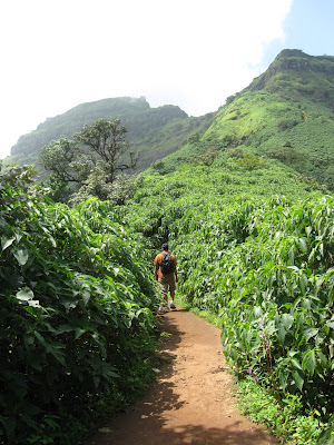
Mountain path with the forts ramparts visible through the trees.

The steep climb begins. The last 200 feet or so is an abrupt change in slope as the escarpment starts.
The topmost compact basalt and a rampart.

That's me trying negotiating the final few steps.

Inside!

Perched aquifers form the water supply of the fort. A perched aquifer is a local aquifer which is underlain by a confining impermeable layer and occurs isolated above the regional water table usually on a mountain top. The regional water table is the groundwater table in the surrounding plains and valleys. Along the slopes of the mountains the aquifer will discharge groundwater as springs.

A spectacular view of the escarpments and the topmost ramparts.

Countryside is still lush after the monsoons. Springs on the mountain slopes usually begin drying out by February to March, some even earlier. So, water management in the valley in the form of small surface reservoirs (in the center) and groundwater recharging structures is really important to sustain agriculture and livelihoods until the rains come back in June.

Until next time...
There are many important forts near Pune. Two are seen in the interactive Google imagery below.
View Larger Map
Rajgad was the home and capital of Shivaji for quite some time. A ridge which you can trace west of Rajgad meets Torna fort which was the first fort captured by Shivaji as he launched his resistance against the Bijapur Sultanate. And north north east of Rajgad is Sinhagad, site of one of the most famous night battles of 1600's Maharashtra. To give you a geographic mooring, north east of Sinhagad is the city of Pune.
You can zoom in to locate the plateaus on which the forts are built. The Deccan volcanic pile is made up of lava flows of different physical properties. Some flows are softer and weather into gentler slopes. They may be overlain by harder compact flows that form escarpments and mesas. The forts were built on top of thick compact basalt flows.
I went to Rajgad last Saturday for a one day trek. It is about a two hour climb which offers some great views of the valleys and surrounding countryside.
I'm facing south, looking towards the imposing Rajgad, altitude 4324 feet ASL.

On route a classic view of rural India.

Getting closer; looking onwards from a grassy ridge.

Mountain path with the forts ramparts visible through the trees.

The steep climb begins. The last 200 feet or so is an abrupt change in slope as the escarpment starts.

The topmost compact basalt and a rampart.

That's me trying negotiating the final few steps.

Inside!

Perched aquifers form the water supply of the fort. A perched aquifer is a local aquifer which is underlain by a confining impermeable layer and occurs isolated above the regional water table usually on a mountain top. The regional water table is the groundwater table in the surrounding plains and valleys. Along the slopes of the mountains the aquifer will discharge groundwater as springs.

A spectacular view of the escarpments and the topmost ramparts.

Countryside is still lush after the monsoons. Springs on the mountain slopes usually begin drying out by February to March, some even earlier. So, water management in the valley in the form of small surface reservoirs (in the center) and groundwater recharging structures is really important to sustain agriculture and livelihoods until the rains come back in June.

Until next time...
Great photos!
ReplyDeleteGreat hike! Thanks for sharing. Any tigers lurking in that lush undergrowth?
ReplyDelete--Howard
thanks Hollis..it is a beautiful place.. Anon- no tigers :)
ReplyDelete